Are you ready? Being prepared is key to weathering Calvin and other storms
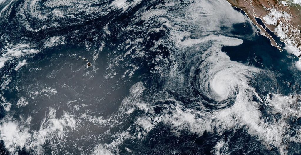
Preparing for a hurricane or tropical storm in Hawai‘i — including Calvin that is headed toward the Big Island — isn’t the same as on the mainland.
“We can’t drive out of the hurricane zone. We are also more vulnerable to being cutoff and isolated and have to be ready to support ourselves and our neighbors,” the National Weather Service forecast office in Honolulu says on its 2023 Hurricane Preparedness Week webpage.

The destructive winds, heavy rains, damaging surf, inland and coastal flooding, lightning and even tornadoes that accompanies powerful storms can threaten lives and cause significant damage to homes, businesses and public infrastructure.
“It only takes one storm to affect your life, your family and your community,” said Gov. Josh Green’s proclamation for Hurricane Preparedness Week in Hawai‘i.
As Hurricane Calvin approaches the Central Pacific, continuing on a westward trek that looks to bring the storm — or its remnants — to the Hawaiian Islands, possibly as early as Tuesday, it’s time to think about what you need to do to be ready.
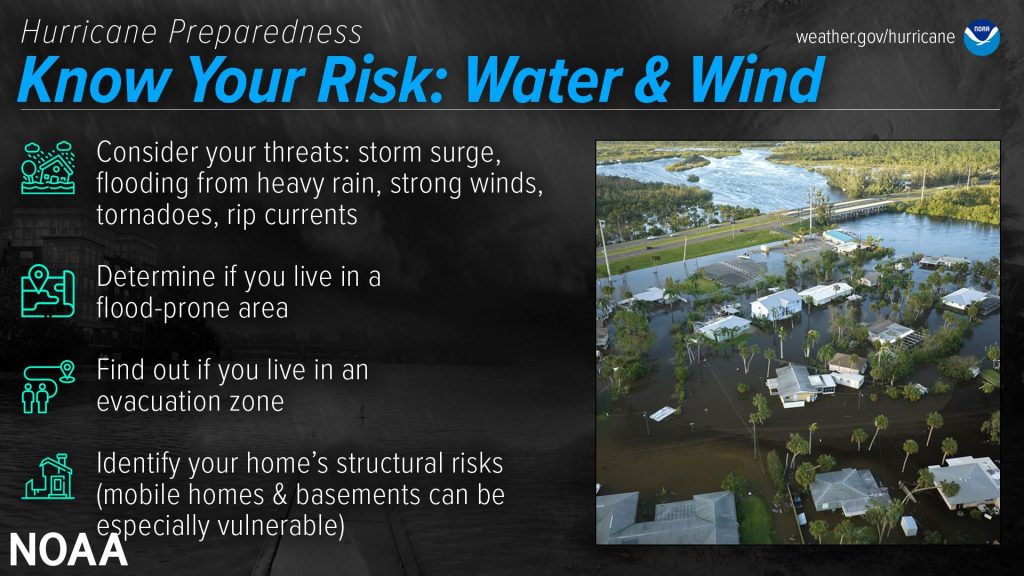
One of the first steps is to know your risk. Significant impacts can happen no matter a tropical cyclone’s strength.
- Find out what kinds of wind and water hazards could happen where you live. The primary hazards from tropical cyclones, which include hurricanes, tropical storms and tropical depressions, are storm surge flooding, inland flooding from heavy rainfall, destructive winds, high surf and rip currents.
- While hurricanes pose the greatest threat, tropical storms and tropical depressions can also be devastating. Impacts from wind and water can be felt hundreds of miles inland, so it’s important to know if you live in an area prone to flooding and if you live in an evacuation zone. You should also identify your home’s structural weaknesses.
Hurricane season in Hawai‘i and the Central Pacific runs from June 1 through Nov. 30, and while it’s best to avoid having to rush, much of the advice aimed at pre-season preparations still applies prior to a storm striking.
Just don’t wait until it’s too late.
- Develop an evacuation plan. If you already have one, update it. Plan several routes and be sure to account for any pets. If you don’t have a vehicle, check to see what public or other transportation services are available.
- You should also create a communication plan and share it with your household. The plan should include meeting places in and out of town just in case you are separated. Also gather emergency contacts, including utilities and other critical services.
- Get your disaster supplies before the shelves at stores are empty. The rule of thumb is to have enough non-perishable food, water and medicine to last each person in your household a minimum of three days; if possible, have more than three days worth of water.
- It also is a good idea, when and as soon as you can, to get an insurance checkup and document your possessions, as well as strengthening your home so it has the best chance to withstand impacts from a tropical cyclone.
When a storm is expected to strike, don’t hesitate.
- Prep your home by boarding up windows, securing loose outdoor items and all exterior doors and moving your vehicle to a safe place.
- If you are evacuating, unplug all electronics and appliances, and if instructed, shut off the water, gas and electricity before leaving. Find out what shelter spaces are available, not forgetting about your pets; some public shelters only allow service animals. Multiple options are best, but if you have to shelter at home, know the safest places inside.
- Also be sure to have a go bag ready with basic survival needs, medicine, phone chargers and hygiene products, with enough for at least three days. Make sure to fill up or charge your vehicle, too. The go bag should also include important personal and property paperwork, including your written communication plan.
- Help your neighbors, especially kūpuna and other vulnerable people, before and after a storm, even if it is something as simple as sharing the latest forecast information with them. And if evacuation orders are issued, follow them and help others to do the same when you can.
Once a storm strikes, stay in your safe place, away from water and wind. Even if you’re far from the most damaging winds, remember that inland flooding can happen hundreds of miles from the coast.
- Never drive through flooded areas — a car can be swept away in just 12 inches of water, plus you won’t be able to tell if the road collapsed while it’s hidden by water.
- If you are at risk from storm surge or flooding, get to higher ground. If your are sheltering at home and the highest floor of your house becomes flooded and dangerous, get on the roof and call 9-1-1.
- When it comes to wind, the best way to protect yourself is to put as many walls as possible between you and the outside; an interior room without windows is the safest option.
“Remain vigilant, stay up to date with the latest forecasts and alerts and continue to listen to local officials,” the National Oceanic and Atmospheric Administration says.
You should also have an understanding of forecast information. The National Weather Service and National Hurricane Center have forecast products that can tell you a lot about what a storm is expected to do and produce, including its path, rainfall amounts, wind speeds and more. A lot of information is available days ahead of a storm.
It’s important to know the different watches, warnings and alerts issued for storms. More important, however, is knowing there are potential impacts regardless of the storm’s size or category. The scale of a storm only reflects the strongest winds at its center, not about the possibility for life-threatening flooding from storm surge or heavy rain.
Impacts from a storm can be felt far away from its core. Even if winds and rain have weakened and a storm is downgraded, hazards can still continue.
Caution is still needed after the storm has moved away. Dangers can remain; nearly half of hurricane fatalities happen after the storm.
- Stay away from flooded areas and downed powerlines.
- Be careful near damaged buildings and walk carefully outside to check for loose powerlines, gas leaks and structural damage, including dangerous debris.
- If you evacuated, do not return home until officials declare it safe, and do not use generators inside — carbon monoxide poisoning is one of the leading causes of death in areas experiencing power outages.
- Be sure to clean up safely, too, by staying hydrated; wearing light, loose-fitting clothes; and doing the work during cooler times of the day, if possible.
- Also, again, make sure to check on your neighbors.
The outlook for the 2023 Central Pacific hurricane season shows a 50% chance of above normal tropcial cyclone activity, with four to seven storms predicted. Now is not the time to be lured into letting your guard down.
“Take action today to be better prepared for when the worst happens,” the National Oceanic and Atmospheric Administration says. “Even if you are already well-prepared and knowledgeable, there may be additional things you could do or learn to be even more prepared.”
Sponsored Content
Comments


