

February 01, 2019 Surf Forecast
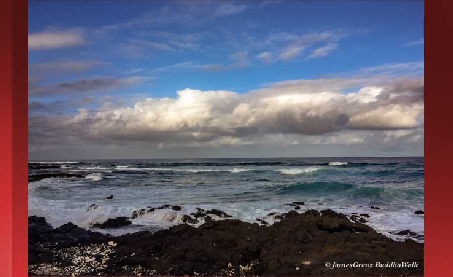
Photo: James Grenz
Swell Summary
Outlook through Thursday February 07: The current northeast swell will continue to keep surf elevated along east facing shores through Friday night before gradually lowering over the weekend. Surf heights may once again pick up along east facing shores toward the middle of next week. The current advisory level west northwest swell will lower gradually Friday and Friday night. Another moderate size west northwest swell is expected to fill on Saturday, peak late Saturday and Saturday night, then lower gradually on Sunday. Surf heights may reach advisory levels along north and west facing shorelines. A slightly smaller west northwest swell is on tap for Monday and Tuesday with a slightly larger west northwest swell expected Tuesday night and Wednesday. No other significant swells are expected.
Surf heights are forecast heights of the face, or front, of waves. The surf forecast is based on the significant wave height, the average height of the one third largest waves, at the locations of the largest breakers. Some waves may be more than twice as high as the significant wave height. Expect to encounter rip currents in or near any surf zone.
North East
am ![]()
![]() pm
pm ![]()
![]()
Surf: Head high mix of N medium period swell and NW long period swell
Conditions: Light sideshore texture with SSE winds 5-10mph in the morning shifting ESE for the afternoon.
North West
am ![]()
![]() pm
pm ![]()
![]()
Surf: Waist high WNW ground swell for the morning with occasional chest high sets. This drops in the afternoon with occasional stomach high sets.
Conditions: Semi glassy in the morning with NE winds less than 5mph. Semi choppy conditions for the afternoon with the winds shifting WSW 5-10mph.
West
am ![]()
![]() pm
pm ![]()
![]()
Surf: Chest to shoulder high WNW ground swell for the morning. This fades in the afternoon with sets up to shoulder high.
Conditions: Glassy in the morning with NNE winds less than 5mph. Bumpy/semi bumpy conditions for the afternoon with the winds shifting WNW 5-10mph.
South East
am ![]()
![]() pm
pm ![]()
![]()
Surf: Waist to chest high E medium period swell.
Conditions: Semi clean/textured with N winds 10-15mph.

Image: NOAA

Image: NOAA

Image: NOAA
Image: NOAA

Image: NOAA

Image: NOAA
**Click directly on the images below to make them larger. Charts include: Hawaii County projected winds, tides, swell direction & period and expected wave heights.**
Data Courtesy of NOAA.gov and SwellInfo.com
Sponsored Content


