


PHOTOS: Kīlauea Volcano’s Summit
The U.S. Geological Survey released these photos of the summit of Kīlauea on Tuesday, Oct. 30, 2018.
This Aug. 11, 2018, aerial photomosaic of Kīlauea Volcano’s south caldera shows how the summit was changed by the collapse events that occurred between the end of May and Aug. 2.
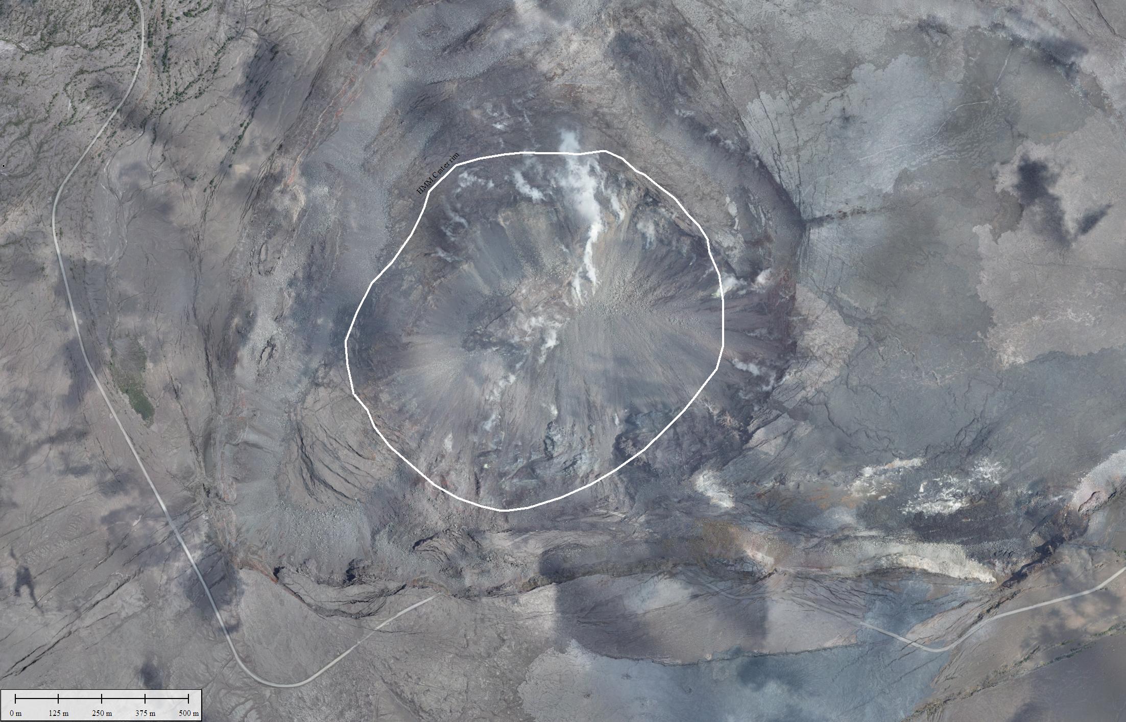
Click to enlarge. PC: USGS
The bright white line circles the outline of Halema‘uma‘u as it was before the onset of the 2018 collapses. Closer views of the fuming spots within the collapsed area are shown in the two photos posted below. Note in the lower third of this image the section of Hawai‘i Volcanoes National Park’s Crater Rim Drive (light gray line) that dropped into the crater during the collapse events.
Kīlauea Volcano’s summit, as viewed from the southwest, shows the collapsed area of Halema‘uma‘u and the adjacent caldera floor.
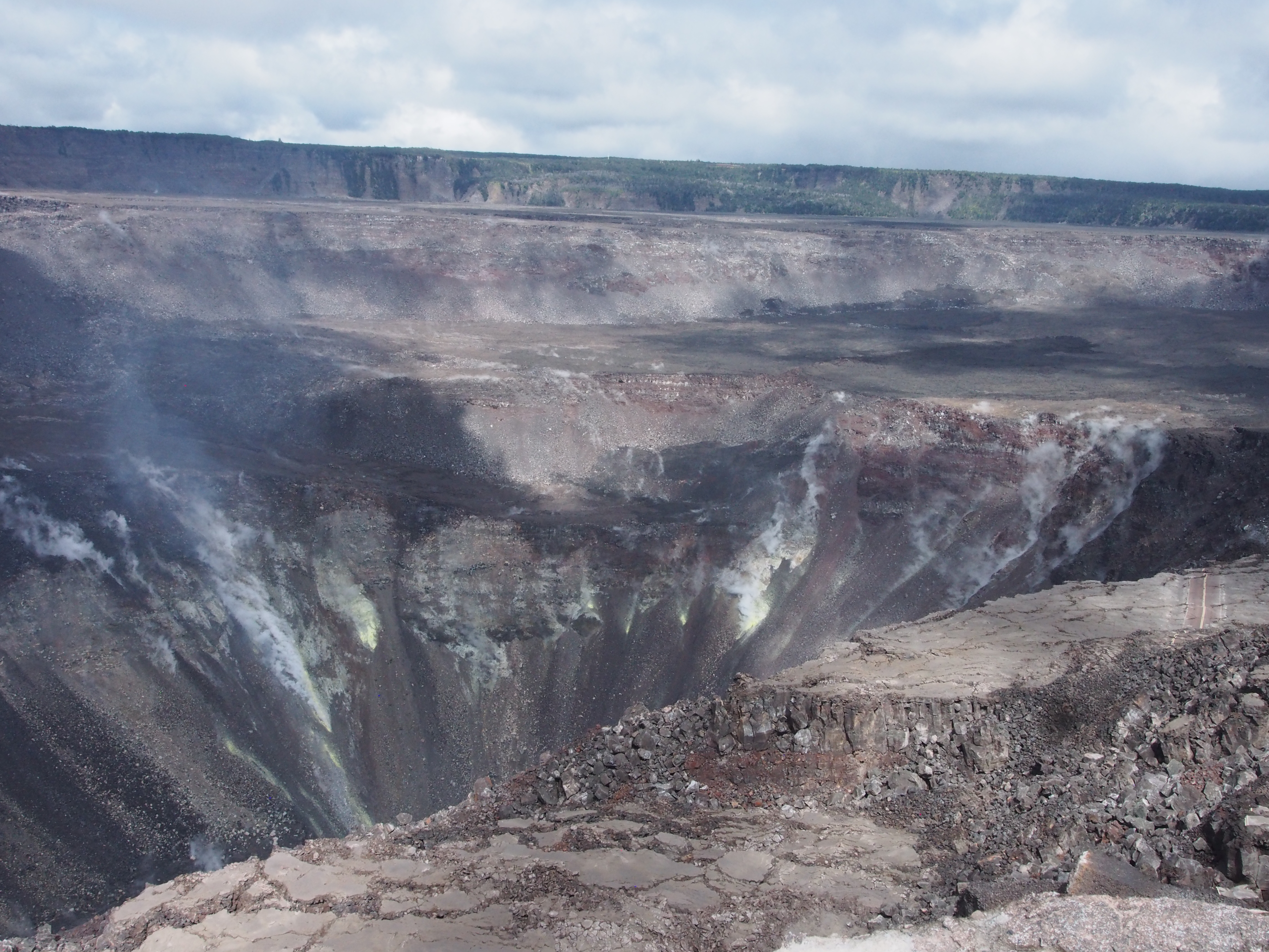
Click to enlarge. PC: USGS
A section of Crater Rim Drive preserved on a down-dropped block is visible at the far right. Volcanic gases rising from magma stored beneath the summit continue to escape to the surface, as they have for as long as Kīlauea has existed, resulting in deposits of sulfur on the crater walls.
The emission of volcanic gases, including sulfur dioxide and hydrogen sulfide, is not unusual at the summit of Kīlauea.
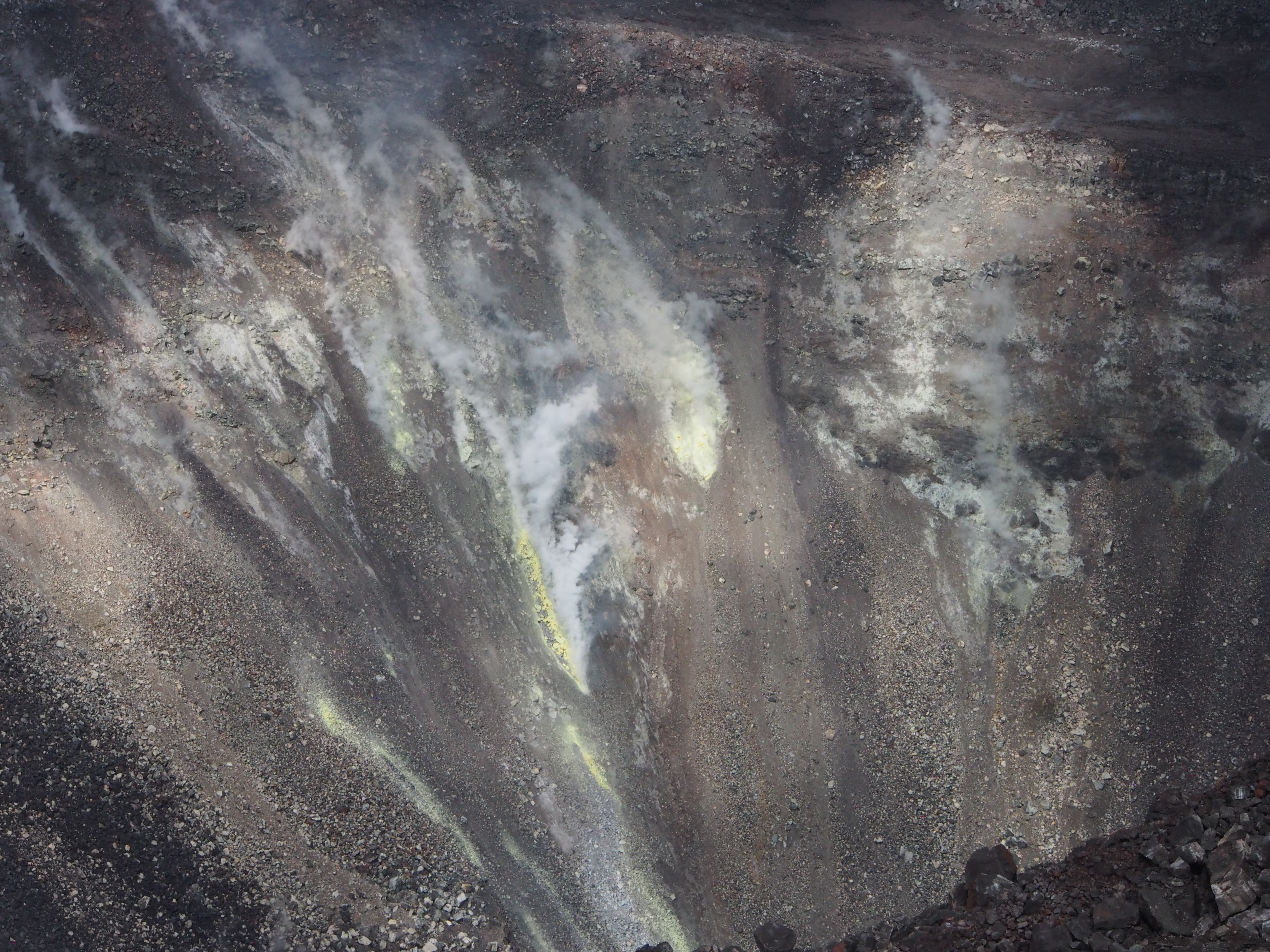
Even with low emissions, enough gas reaches the surface to produce yellow deposits of native sulfur on the crater walls, as seen here. PC: USGS
However, sulfur dioxide gas emission rates are now lower than they have been since before 1983, with about 50 tonnes/day measured at the summit of the volcano on the day of this photo Oct. 24. Even with low emissions, enough gas reaches the surface to produce yellow deposits of native sulfur on the crater walls, as seen here.
Sponsored Content


