

2 PM: Tropical Storm Olivia Moves Closer to Islands
https://www.facebook.com/GovernorDavidIge/videos/2221304594821361/
VIDEO: A Live update on Hurricane Olivia from the State Capitol is scheduled for 1 p.m.
Participants: Gov, David Ige, Hawai‘i Emergency Management Agency (HIEMA), Federal Emergency Management Agency (FEMA), Honolulu Mayor Kirk Caldwell

LOCAL AREA FORECASTS: Click here for a dropdown menu of your local area forecast.
Sept. 10, 2018, 2 PM: Tropical Storm Olivia Moves Closer to Islands
Olivia has been downgraded to a Tropical Storm with maximum sustained winds near 70 mph, with higher gusts, as it continues to move toward the Hawaiian Islands.
At 2 p.m., the center of Hurricane Olivia was located near latitude 21.9 north, longitude 149.1 west, about 415 miles ENE of Hilo.
Olivia is moving toward the west near 9 mph. A continued west to WSW motion is expected for the next few days.
On the forecast track, the center of Olivia will be moving over the main Hawaiian Islands Tuesday night into Wednesday.
Gradual weakening is expected as Olivia continues to approach the main Hawaiian Islands.
Hurricane-force winds extend outward up to 15 miles from the center and tropical-storm-force winds extend outward up to 105 miles.
HAZARDS AFFECTING LAND
WIND: Tropical storm conditions are expected somewhere within the warning area starting late Tuesday. Tropical storm conditions are possible within the watch area starting late Tuesday night or early
Wednesday morning.
RAINFALL: Olivia is expected to produce total rainfall accumulations of 10 to 15 inches. Isolated maximum amounts of 20 inches are possible, especially over windward sections of Maui County and the
Big Island. This rainfall may produce life-threatening flash flooding.
SURF: Large swells generated by Olivia will spread from east to west across the Hawaiian Islands early this week. This will cause surf to build along exposed east facing shorelines as Olivia approaches. This surf may become damaging across parts of the state.
11 AM: Hurricane Olivia Continues Westward Track to Hawai‘i
https://www.facebook.com/BigIslandNow/videos/243800799811551/
The National Weather Service Central Pacific Hurricane Center issued an 11 p.m. on Sept. 10, 2018, update for Hurricane Olivia.
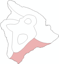
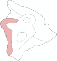
A Tropical Storm Warning is in effect for the Big Island and Maui County.
A Tropical Storm Watch is in effect for O‘ahu.
Category 1 Hurricane Olivia is about 430 miles ENE of Hilo.
The Big Island and Maui will be the first to experience impacts from Olivia.
Hurricane Olivia is expected to bring strong winds, heavy rainfall, and high surf to parts of the state this week. Olivia is forecast to close in on the main Hawaiian Islands Tuesday and move over portions
of the island chain Tuesday night and Wednesday.
Olivia is expected to move over the Hawaiian Islands as a Tropical Storm. However, Hawai‘i is in danger of experiencing high winds, heavy rains, high surf, storm surges and flooding that threaten to harm communities and cause extensive damage to public and private property across the state.
Forecasters warn that residents and visitors should be prepared for changes in future forecasts.
Olivia is forecast to be a weaker storm than Lane, but the impacts could be significantly worse.
Damaging tropical storm-force winds may begin as early as Tuesday afternoon across the Big Island and Maui. Additionally, hurricane-force wind gusts are possible as Olivia moves across the state Tuesday night and Wednesday.
Forecasters said It is important to remember that the mountainous terrain of Hawai‘i can produce localized areas of highly enhanced winds, even well away from the tropical cyclone center.


The chance for flooding rainfall will increase rapidly late Tuesday and will remain a significant threat through at least Wednesday. Storm total rainfall amounts are expected to be around 10 to 15 inches, with isolated areas up to 20 inches. Much of this will be focused on windward areas; however, flooding is still a significant threat for all areas.
Swells and surf generated by Hurricane Olivia will continue to slowly build through Tuesday, and reach damaging levels on some east-facing shores Tuesday and Wednesday. Surf heights along east-facing shores are expected to reach up to 20 feet on the Big Island and Maui, and 10 to 15 feet on other islands. This is expected to result in significant beach erosion and overwash onto vulnerable coastal roadways, particularly during high tides.
BELOW: HIGHLIGHTS FROM THE 11 AM NWS LOCAL AREA REPORT

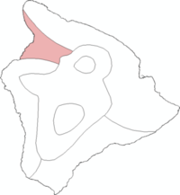
Big Island North and East
Peak Wind Forecast: 20–30 mph with gusts to 45 mph
Peak Storm Surge Inundation: The potential for up to 2 feet above ground somewhere within surge prone areas
Peak Rainfall Amounts: Additional 3–6 inches, with locally higher amounts
South Big Island
Peak Wind Forecast: 10–20 mph with gusts to 30 mph
No storm surge inundation forecast
Peak Rainfall Amounts: Additional 1-3 inches, with locally higher amounts
Kona
Peak Wind Forecast: 20-30 mph with gusts to 40 mph
No storm surge inundation forecast
Peak Rainfall Amounts: Additional around 1 inch
Kohala
Peak Wind Forecast: 20-30 mph with gusts to 45 mph
No storm surge inundation forecast
Peak Rainfall Amounts: Additional 1-3 inches, with locally higher amounts
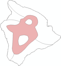
Interior
Peak Wind Forecast: 20-30 mph with gusts to 45 mph
Peak Rainfall Amounts: Additional 1-3 inches, with locally higher amounts
POTENTIAL IMPACTS OVERVIEW
WIND: Protect against dangerous wind having possible significant impacts across O‘ahu, the islands of Maui County and the Big Island. Potential impacts in this area include:
- Some damage to roofing and siding materials, along with damage to porches, awnings, carports, and sheds. A few buildings experiencing window, door, and garage door failures. Mobile
homes damaged, especially if unanchored. Unsecured lightweight objects become dangerous projectiles. - Several large trees snapped or uprooted, but with greater numbers in places where trees are shallow rooted. Several fences and roadway signs blown over.
- Some roads impassable from large debris, and more within urban or heavily wooded places. A few bridges, causeways, and access routes impassable.
- Scattered power and communications outages, but more prevalent in areas with above ground lines.
- Also, protect against hazardous wind having possible limited impacts across the remainder of the state.
FLOODING RAIN: Protect against life-threatening rainfall flooding having possible devastating impacts across Molokai, Maui and the Big Island. Potential impacts include:
- Extreme rainfall flooding may prompt numerous evacuations and rescues.
- Rivers and tributaries may overwhelmingly overflow their banks in many places with deep moving water. Small streams, creeks, canals, arroyos, and ditches may become raging rivers. In mountain areas, deadly runoff may rage down valleys while increasing susceptibility to rockslides and mudslides. Flood control systems and barriers may become stressed.
- Flood waters can enter numerous structures within multiple communities, some structures becoming uninhabitable or washed away. Numerous places where flood waters may cover escape routes. Streets and parking lots become rivers of raging water with underpasses submerged. Driving conditions become very dangerous. Numerous road and bridge closures with some weakened or washed out.
- Protect against life-threatening rainfall flooding having possible limited to extensive impacts across the rest of the state.
SURGE: Protect against locally hazardous surge having possible limited
impacts across east facing coastlines of Oahu, the islands of Maui
County, and the Big Island. Potential impacts in this area include:
- Localized inundation with storm surge flooding mainly along immediate shorelines and in low-lying spots or in areas farther inland near where higher surge waters move ashore.
- Sections of near-shore roads and parking lots become overspread with surge water. Driving conditions dangerous in places where surge water covers the road.
- Moderate beach erosion. Heavy surf also breaching dunes, mainly in usually vulnerable locations. Strong rip currents.
- Minor to locally moderate damage to marinas, docks, boardwalks and piers. A few small craft broken away from moorings.
- Elsewhere across the Hawaiian islands, little to no impact is anticipated.
PRECAUTIONARY/PREPAREDNESS ACTIONS
EVACUATIONS
Listen to local official for recommended preparedness actions, including possible evacuation. If ordered to evacuate, do so immediately.
OTHER PREPAREDNESS INFORMATION
Now is the time to complete all preparations to protect life and property in accordance with your emergency plan. Ensure you are in a safe location before the onset of strong winds or possible flooding.
Failure to adequately shelter may result in serious injury or loss of life. Always heed the advice of local officials and comply with any orders that are issued. Remember, during the storm 9 1 1 Emergency Services may not be able to immediately respond if conditions are unsafe. This should be a big factor in your decision making.
Keep cell phones well charged. Cell phone chargers for automobiles can be helpful, but be aware of your risk for deadly carbon monoxide poisoning if your car is left idling in a garage or other poorly ventilated area.
It is important to remain calm, informed, and focused during an emergency. Be patient and helpful with those you encounter.
If you are a visitor, be sure to know the name of the city or town in which you are staying and the name of the county in which it resides. Listen for these locations in local news updates. Pay attention for instructions from local authorities.
Rapidly rising flood waters are deadly. If you are in a flood-prone area, consider moving to higher ground. Never drive through a flooded roadway. Remember, turn around, don’t drown!
If in a place that is vulnerable to high wind, such as near large trees, a manufactured home, upper floors of a high-rise building, or on a boat, consider moving to a safer shelter before the onset of strong winds or flooding.
Closely monitor weather.gov, NOAA Weather radio or local news outlets for official storm information. Be ready to adapt to possible changes to the forecast. Ensure you have multiple ways to receive weather warnings.
ADDITIONAL SOURCES OF INFORMATION
- For information on appropriate preparations see ready.gov
- For information on creating an emergency plan see getagameplan.org
- For additional disaster preparedness information see redcross.org
Sponsored Content


