

News 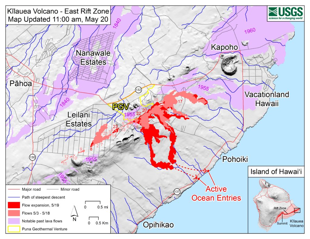
Map Shows Where Ocean Lava Entries Are
A
A
A
The U.S. Geological Survey (USGS) released this map of the East Rift Zone as of 11 a.m., Sunday, May 20, 2018. Shaded purple areas indicate lava flows erupted in 1840, 1955, 1960 and 2014-2015.
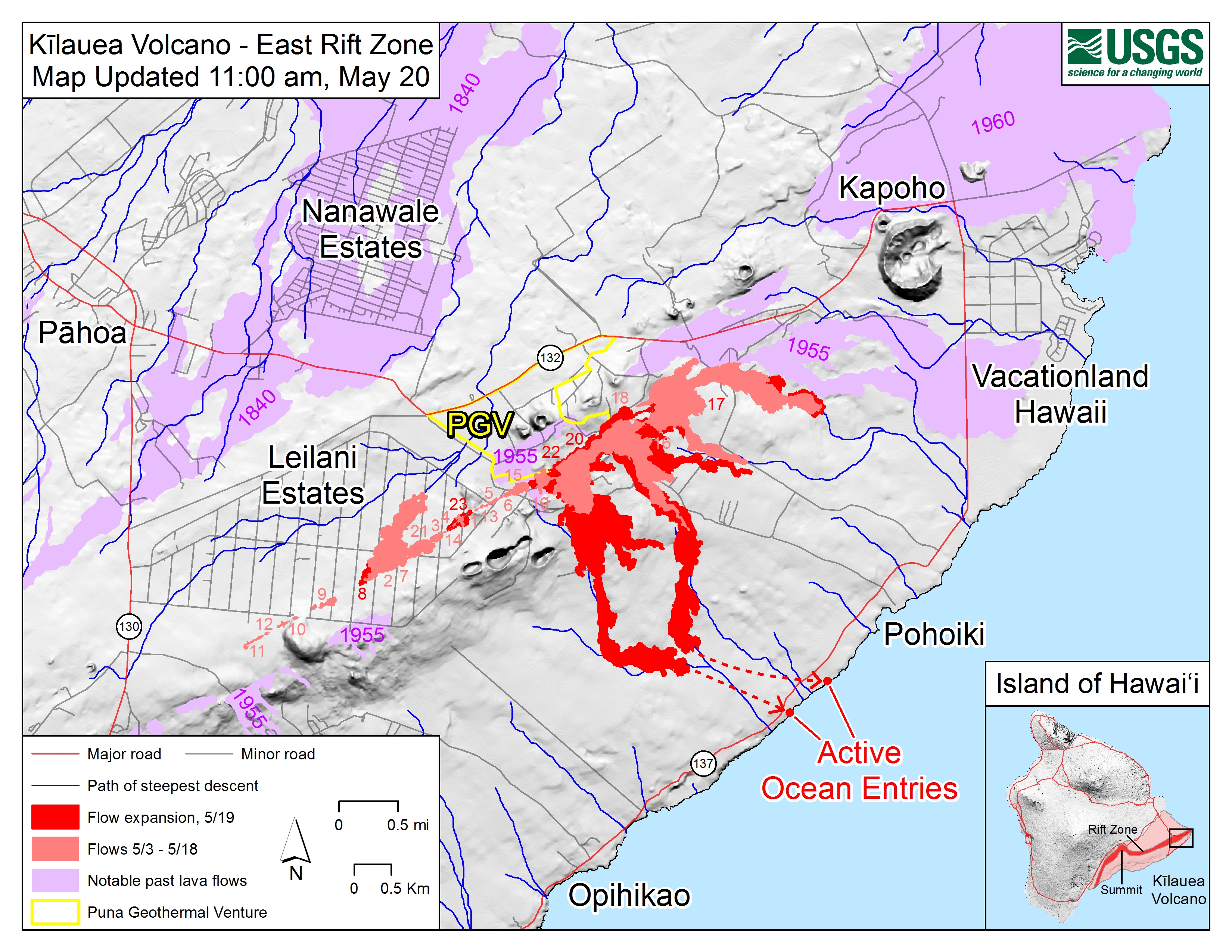
Site of active ocean entry is shown with dots. Click to enlarge. (USGS Map)
ADVERTISEMENT
Sponsored Content


Subscribe to our Newsletter
Stay in-the-know with daily or weeklyheadlines delivered straight to your inbox.
Comments
This comments section is a public community forum for the purpose of free expression. Although Big Island Now encourages respectful communication only, some content may be considered offensive. Please view at your own discretion. View Comments
