

WNW Swell Fills in Today for Big Island

Image: James Grenz
Alerts (as of 1:00 a.m.)
High Surf Advisory: North and east shores of the Big Island through 6 p.m. Saturday.
Special Weather Statement: A strong front approaches the Aloha State from the northwest this weekend. Southwest winds will increase ahead of this front Sunday and Sunday night. Kona winds such as these can cause localized problems on the typical windward side of each island, as they blow downslope from the mountains and accelerate. A narrow band of gusty heavy showers, and possibly a few embedded thundershowers, is expected to accompany the front as it passes through. Our forecast has the front reaching Kauai late Sunday night, Oahu Monday morning, Maui County Monday afternoon, and the Big Island Monday night. The front appears as though it will be moving fast enough to prevent widespread significant flooding problems, but the rain may be briefly heavy enough to cause localized ponding or minor flooding.
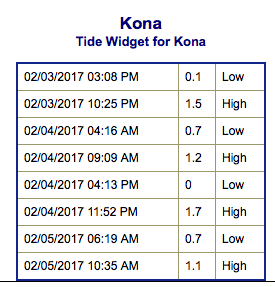
**Click directly on the images below to make them larger. Charts include: Big Island projected winds, tides, swell direction & period and expected wave heights.**
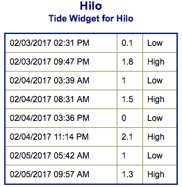 Big Island Surf Forecast
Hilo side: Wave heights are forecast to be head high to overhead today at good exposures along the northeast coast with a downward trend through the day. North Kohala will be a bit smaller but still fun.
Kona side: Wave heights are expected to be waist/chest high today with the best breaks getting up to shoulder/head high by the afternoon.
South: Wave heights are expected to be waist/chest high today with the best breaks getting up to shoulder/head high by the afternoon.
 A west-northwest swell is forecast to build Saturday before slowly easing Sunday. Another round of surf is expected to fill in Monday, peak Tuesday and ease Wednesday with a smaller northwest on tap for the 11th.
Nothing significant expected out of the South Pacific any time soon.
Keep in mind, surf heights are measured on the face of the wave from trough to crest. Heights vary from beach to beach, and at the same beach, from break to break.
**Click here for your detailed Big Island weather report.**
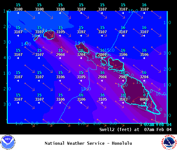
Image: NOAA
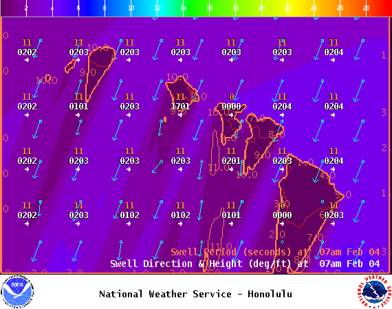
Image: NOAA
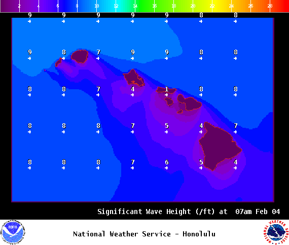
Image: NOAA
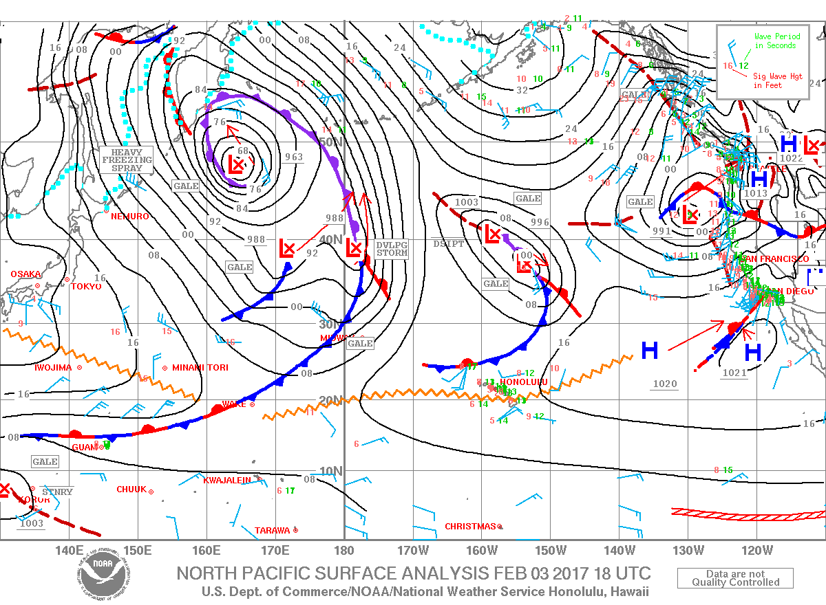
Image: NOAA

Image: NOAA
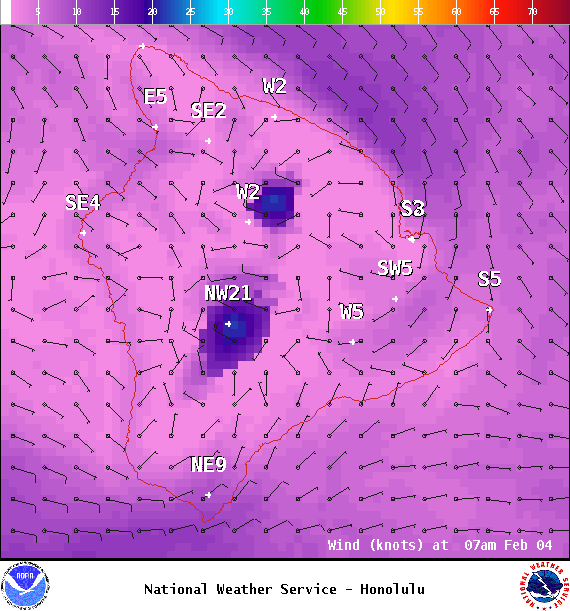
Image: NOAA
Sponsored Content


