

NNE Swell Easing, New NNE Expected Soon
 Alerts (as of 1:00 a.m.)
There are no marine alerts posted at this time.
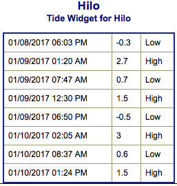
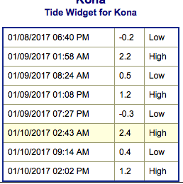
**Click directly on the images below to make them larger. Charts include: Big Island projected winds, tides, swell direction & period and expected wave heights.**
 Big Island Surf Forecast
Hilo side: Wave heights are forecast to be shoulder/head high today for the best breaks with sets getting overhead.
Kona side: Wave heights are expected to be pretty flat maybe up to ankle/knee high today. Wrap from the northwest swell is also mixing in today.
South: Wave heights are expected to be ankle/knee high today.
 North-northeast swell keeps wave heights elevated for those exposures. Slightly longer pulse of north-northeast expected to build Tuesday, peak Tuesday night and Wednesday morning.
Another small south-southwest swell is expected to build on the 10th for the 11th through the 13th. No significant swells forecast after that time.
Keep in mind, surf heights are measured on the face of the wave from trough to crest. Heights vary from beach to beach, and at the same beach, from break to break.
**Click here for your detailed Big Island weather report.**
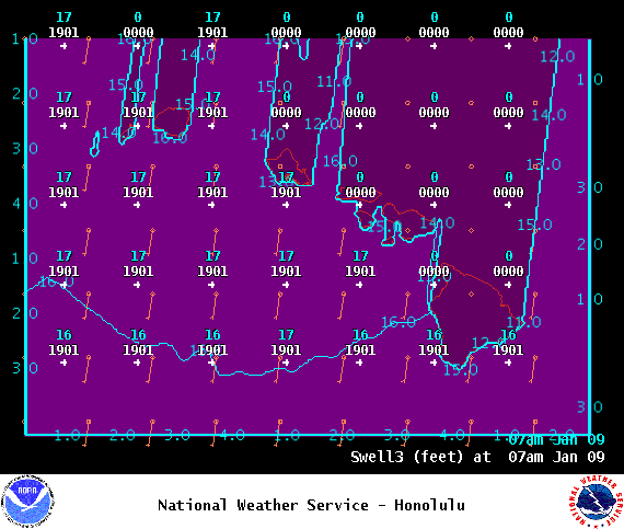
Image: NOAA
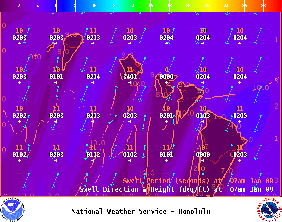
Image: NOAA
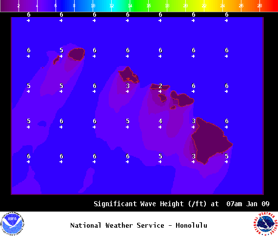
Image: NOAA
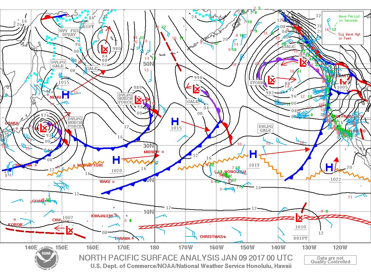
Image: NOAA
Image: NOAA
Image: NOAA
Sponsored Content


