

NNW, Trade Swell Easing, New WNW Soon

Image: James Grenz
Alerts (as of 1:00 a.m.)
A Small Craft Advisory is posted for leeward and southern waters as well as the Alenuihaha Channel through 6 p.m.
High Surf Advisory in effect for east shores of the Big Island through Monday at 6 a.m.
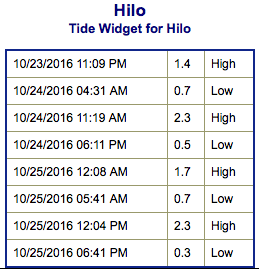
**Click directly on the images below to make them larger. Charts include: Big Island projected winds, tides, swell direction & period and expected wave heights.**
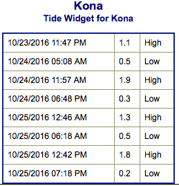 Big Island Surf Forecast
Hilo side: Wave heights are forecast from waist/chest/shoulder high today.
Kona side: Wave heights are expected to be knee/thigh high today. Some spots could get up to waist high.
South: Wave heights are expected to be waist/shoulder high for spots catching the trade swell. Otherwise, waist high or less out of the south.
 Some north-northwest energy will show today before easing into the middle of the week. West-northwest swell energy expected to build Tuesday into Wednesday. The Big Island is largely blocked however swell will filter into some spots up to about waist/chest/shoulder high during the peak on Wednesday.
East-northeast trade swell will bring waist/shoulder high waves to exposed spots.
Nothing significant is expected out of the SPAC with minimal leftovers expected this week.
Keep in mind, surf heights are measured on the face of the wave from trough to crest. Heights vary from beach to beach, and at the same beach, from break to break.
**Click here for your detailed Big Island weather report.**
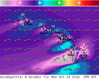
Image: NOAA
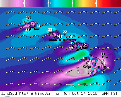
Image: NOAA
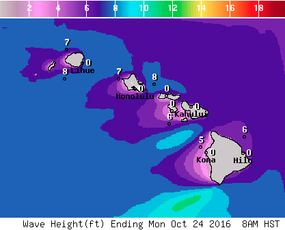
Image: NOAA
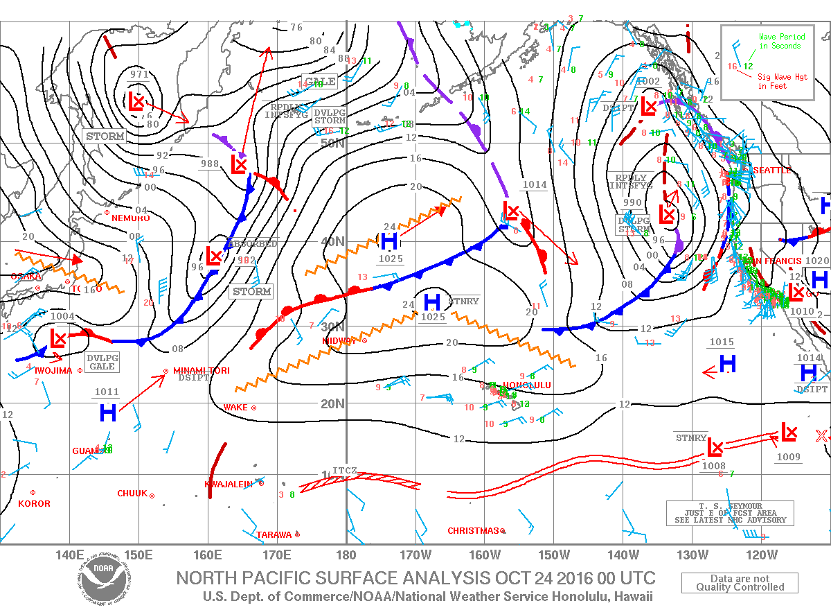
Image: NOAA
Sponsored Content


