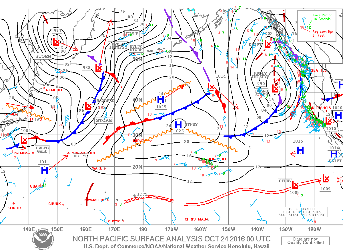
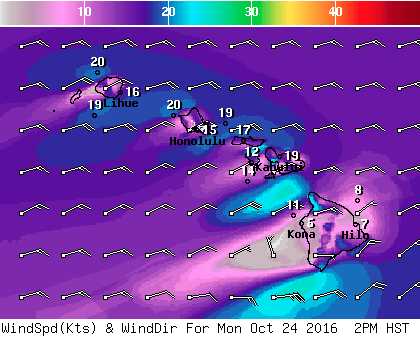
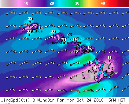
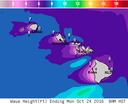
**Click directly on the images below to make them larger. Charts include: Big Island high/low forecasted temperatures, projected winds, chance of cloud cover, projected localized weather conditions, vog/SO2 forecast and expected wave heights.**
+
SWIPE LEFT OR RIGHT
Looking Ahead
Moderate to locally breezy trade winds should stay in place through the middle of the work week. Winds are expected to strengthen late in the week and next weekend. Bands of enhanced moisture will occasionally move through the area, increasing shower activity particularly over windward and mauka spots.
ARTICLE CONTINUES BELOW AD
Today
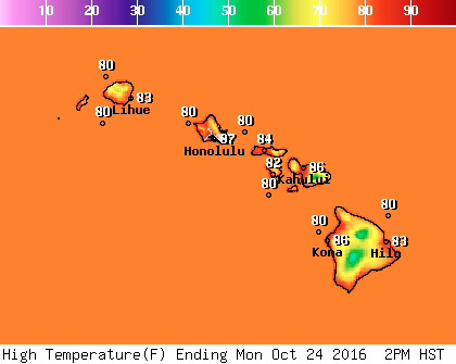
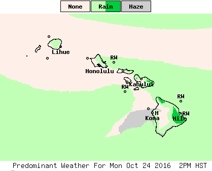
Mostly cloudy with showers likely for windward and mauka areas. Hazy skies for the Kona side. Sunny in the morning with scattered showers as cloud cover builds in the afternoon. High temperatures from 81° to 86°. Winds will be east from 15 to 25 mph.
UV index at 8 (“very high” exposure level)
ARTICLE CONTINUES BELOW AD
Tonight
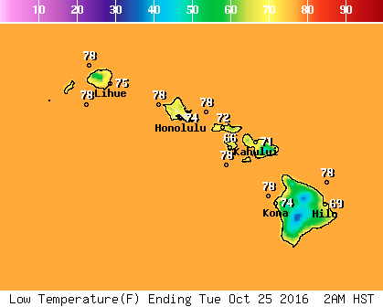
Winds will be northeast around 15 to 20 mph. Mostly cloudy with scattered windward showers. Kona side should be clearing as the night goes on. Low temperatures from 69° to 74°.
This comments section is a public community forum for the purpose of free expression. Although Big Island Now encourages respectful communication only, some content may be considered offensive. Please view at your own discretion. View Comments