

VIDEO: Lava Continues Trek Toward Ocean
The Hawaiian Volcano Observatory reports today that eruptions continue at Kīlauea Volcano’s summit and East Rift Zone.
The 61G lava flow, as it’s called, remains active, extending southeast of Puʻu ʻŌʻō towards the coastal plain on Kīlauea’s south flank.
It poses no threat to nearby communities.
On Monday evening, the flow tip was inactive but breakouts were active within a few hundred yards upslope.
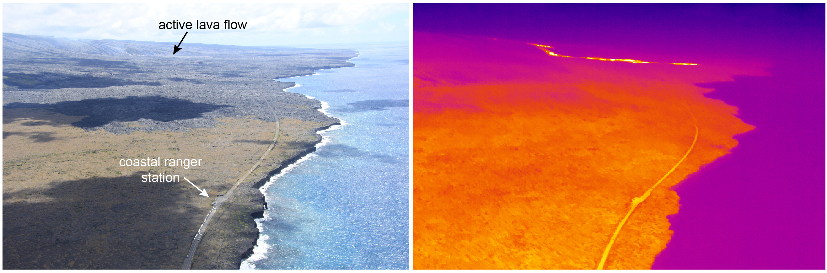
Aerial view of the Hawai’i Volcanoes National Park Coastal Ranger Station at the end of Chain of Craters Road with the active lava flow (61G) in the distance. Correlative thermal image highlighting the hot, active flow at the top portion of the photo (right). HVO images.
A satellite image from Saturday, July 17, indicates the lava flow front was approximately 680 m (.4 miles) from the coastal emergency road and 820 m (.5 miles) from the ocean.
Areas of incandescence remain visible in overnight webcam views of the active lava flow field, marking lava tube skylights and areas of active lava on the pali and along the flow as it extends towards the coast.
Tiltmeters at the summit of Kīlauea recorded a slight inflationary tilt over the past day.
The lava lake at Halema‘uma‘u Crater continues to circulate, intermittently spatter and emit a vigorous plume of volcanic gas. On Monday morning, the lava lake at Halemaʻumaʻu was 25.5 meters (84 feet) below its floor.
Based on analysis of web camera images, the level has changed little overnight.
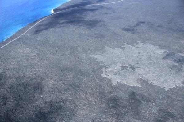
The flow front remains active on the coastal plain, but has only moved about 60 m (~200 ft) closer to the ocean in the past three days. As of midday on July 15, the slow-moving pahoehoe is roughly 870 m (~0.5 mi) from the ocean. Activity upslope continues to widen the flow margins. The light gray surface in this image is the new pahoehoe of the 61G flow. HVO image
HVO seismometers continue to record typical fluctuations in seismic tremor in response to changes in the vigor of lava lake circulation and spattering.
Sulfur dioxide emissions from the summit vent over the past week during good trade wind conditions ranged from 3,700 to 7,300 metric tons/day.
HVO webcams show several persistent incandescent vents on the floor of Puʻu ʻŌʻō crater. There were no significant changes in seismicity or tilt over the past 24 hours. The sulfur dioxide emission rate from all East Rift Zone vents on July 15 was about 270 metric tons per day.
Sponsored Content


