

Sunny Skies Today, Front for Weekend
 Alerts (as of 1:00 a.m.)
Special Weather Statement – A fast-moving cold front is expected to sweep across the islands this weekend. Late Saturday the front will reach Kauai then progress down the island chain by Sunday morning bringing periods of showers. Very cool, dry and gusty north winds are expected in the wake of the front. Take precautions if you live downwind of high terrain and secure any loose outdoor objects.
**Click directly on the images below to make them larger. Charts include: Big Island high/low forecasted temperatures, projected winds, chance of cloud cover, projected localized weather conditions, vog/SO2 forecast and expected wave heights.**
Looking Ahead
Gentle to moderate trades will continue through Friday, leading to a land and sea breeze weather pattern for most leeward areas. Stable conditions and a relatively dry weather pattern will limit any rainfall. A strong cold front will sweep down the island chain late in the day Saturday and Saturday night, accompanied by showers and strong and gusty northerly winds through Sunday. Winds will lighten up and a cool and dry airmass will prevail over the islands early next week.
Today
Today we expect partly sunny skies with isolated showers in the afternoon for the Kona side. Windward and mauka areas will get isolated showers. Winds are out of the east and southeast up to 15 mph. High temperatures from 78° to 84°.
UV index at 8 (“very high” exposure level)
Tonight
East to southeast winds are expected up to 15 mph tonight. Low temperatures from 65° to 70°. Clearing is expected as the land breeze takes over.
Our Big Island Now Weather homepage always includes daily: Sunrise | Sunset | Moonrise | Moonset | Moon Phase | Live Weather Cams | 5-day Forecast | Current Temperature & Conditions
**Click here for your detailed Big Island surf report.**

Image: NOAA / NWS

Image: NOAA / NWS
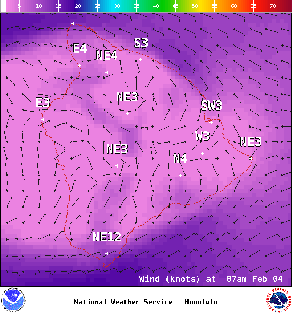
Image: NOAA / NWS
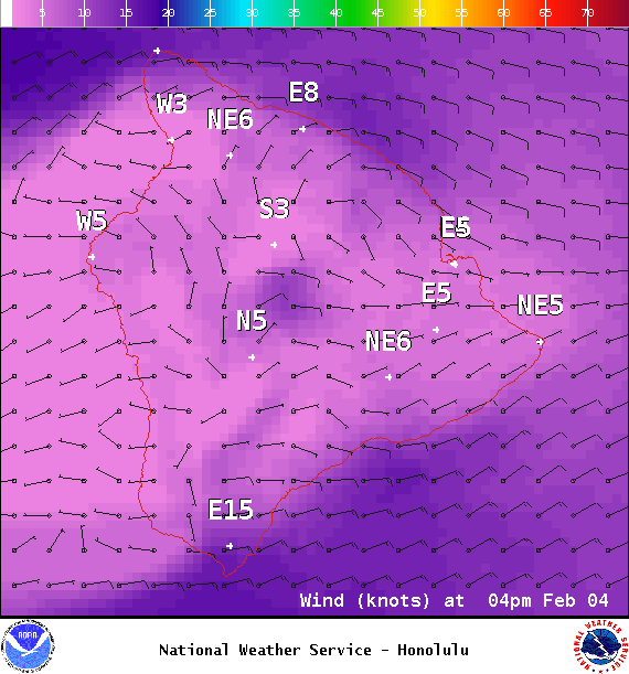
Image: NOAA / NWS

Image: NOAA / NWS

Image: NOAA / NWS
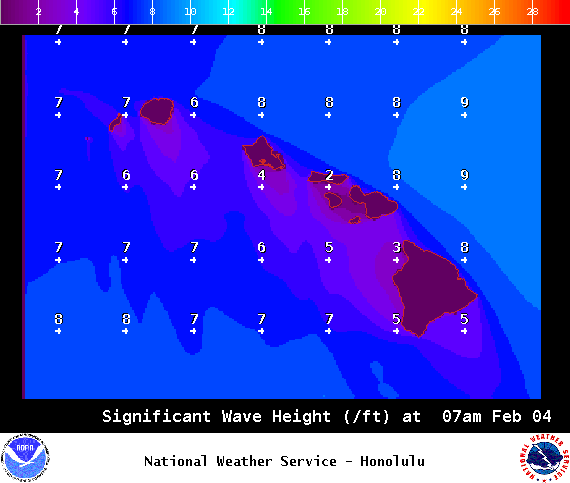
Image: NOAA / NWS
Sponsored Content


