

Public Hearing on Proposed Changes to Forest Reserve Lands
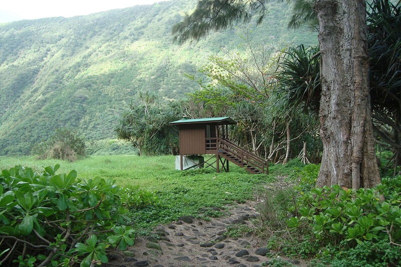
Waimanu campsite. Department of Land and Natural Resources image.
On Friday, Feb. 12, the Department of Land and Natural Resources, Division of Forestry and Wildlife will hold a public hearing on proposed changes to government forest reserve lands on the Big Island.
The meeting will provide the public the opportunity to present comments on the proposed changes.
The hearing will start at 5:30 p.m. at the Kuhio Hale, Department of Hawaiian Home Lands West Hawai‘i district office, located at 64-756 Mamalahoa Highway.
The proposed changes are as follows:
Withdrawal of Tax Map Key (3) 4-6-011:040, comprising approximately 238 acres from Hāmākua Forest Reserve, Hāmākua, Hawaiʻi.
- The area proposed for withdrawal from Hāmākua Forest Reserve was developed into an educational and recreational site, Camp Honokaia, by the Boy Scouts of America (BSA) under a long term lease.
- In 2004, the parcel was the subject of a land exchange between the State of Hawai‘i and the BSA involving private land in Waikele, O‘ahu, for public lands located on the islands of O‘ahu, Kaua‘i, and Hawai‘i.
- Given that the land exchange between the BSA and the State of Hawai‘i has been completed, the Division seeks to formally withdraw TMK (3) 4-6-011:040, which is no longer State land, from the Hāmākua Forest Reserve.
Addition of Tax Map Keys: (3) 4-3-010:009 and (3) 4-4-015:002 comprising approximately 6,887 acres to Mauna Kea Forest Reserve, Hāmākua, Hawaiʻi.
- The areas proposed for addition to Mauna Kea Forest Reserve were originally encumbered by leases issued by DLNR to multiple private entities for pasture purposes.
- In 2001, DLNR issued a non-exclusive easement to the Department of Transportation for the area in question to mitigate for impacts to Palila Critical Habitat (PCH) by the Saddle Road Improvement Project.
- Beginning in 2004, and continuing presently, the Division of Forestry and Wildlife has conducted a forest restoration program on the proposed addition for the purpose of providing long-term habitat for Palila at considerable effort and with significant progress.
- To address concerns raised by the United States Fish and Wildlife Service, as documented in their revised 2009 Biological Opinion, and to retain the progress made in terms of Palila habitat restoration, DOFAW requested that the mitigation areas be formally withdrawn from the pasture leases and set aside for addition to Mauna Kea Forest Reserve.
The Board of Land and Natural Resources approved this action at its meetings in 2009, 2010, and 2015.
Addition of Tax Map Key (3) 7-5-001:022 comprising approximately 17 acres to Honua‘ula Forest Reserve, North Kona, Hawaiʻi.
- The area being proposed for addition to Honua‘ula Forest Reserve was previously encumbered by a revocable permit issued by DLNR Land Division for pasture purposes to a private individual.
- The permit was terminated by the Board of Land and Natural resources on December 09, 2012. Upon the cancellation of the permit, DOFAW expressed interest in taking over management of this land because the transfer of this parcel could provide a potential access corridor to the forest reserve.
Addition of Tax Map Key (3) 3-9-001: portions of 013 and (3) 3-9-001:018, comprising approximately 40 acres to the Humuʻula Section of the Hilo Forest Reserve, North Hilo, Hawaiʻi.
- The proposed addition to Hilo Forest Reserve is currently set-aside to DOFAW “for potential demonstration forest projects.” However, there is no formal land designation category called “demonstration forest” in the Department’s land use designation system.
- As such, DOFAW proposes to add the subject lands to the currently existing Hilo Forest Reserve. This action would merely change the designation of the area from a “demonstration forest” to “Forest Reserve,” placing the area under the guidance of statutes and rules associated with the Forest Reserve System.
- DOFAW currently has management jurisdiction of these lands, and would retain jurisdiction with their transfer to the Forest Reserve System. Management objectives for the area would not change.
Addition of Tax Map Keys (3) 4-9-001: portion of 007, (3) 4-9-013: portion of 001, (3) 4-9-014:001, 003, 004, 005, 008, 009, 010, 011, 013, 014, 017, 020, 021, and 022, comprising approximately 3,431 acres to the Waimanu section of the Kohala Forest Reserve, Hāmākua, Hawaiʻi.
- A National Estuarine Research Reserve (NERR) was established at Waimanu Valley on the Kohala Coast of the island of Hawai‘i in 1978.
- The National Estuarine Research Reserve System is a partnership between the National Oceanic and Atmospheric Administration (NOAA) and coastal states for long-term research, water quality monitoring, education, and coastal stewardship. Public lands were withdrawn from the Kohala Forest Reserve, and the State of Hawai’i acquired 13 additional privately owned parcels of land in Waimanu Valley for inclusion into the NERR.
- However in 1996, Waimanu Valley was officially withdrawn from the NERR System. As such, DOFAW now proposes to add the subject lands back into Kohala Forest Reserve.
- This action would merely change the designation of the area from a “National Estuarine Research Reserve” to “Forest Reserve,” placing the area under the guidance of statutes and rules associated with the Forest Reserve System.
Forest reserve area maps can be found on the DLNR website.
Those interested in sharing comments should attend the public hearing to present relevant information and individual opinion for the DLNR to consider.
Anyone unable to attend can present comments by mail written testimony postmarked no later than Feb. 26 to the Forestry Program Manager, Division of Forestry and Wildlife, 1151 Punchbowl Street, #325, Honolulu, HI 96813.
The DLNR will compile the input from the public hearing and other testimonies received through February 26, and DOFAW will present a summary of public testimony, staff analyses and recommendations for further actions to the Board of Land and Natural Resources.
Based on the testimony, BLNR will decide on whether to proceed with or charge their previous recommendation for the proposed changes to the Forest Reserve System.
If the Board chooses to proceed with the recommendations, DLNR will send the items to Governor David Ige for final approval via Executive Order.
The lands, if approved, would be formally added to Government Forest Reserve status and the DOFAW Forestry Program would assume primary responsibility for the management and stewardship of the subject lands.
Sponsored Content


