

NW Fading Today, New WNW Sunday

Image: James Grenz
Alerts (as of 1:00 a.m.)
A Small Craft Advisory is posted through 6:00 a.m. Friday for the Alenuihaha channel and windward Big Island waters.
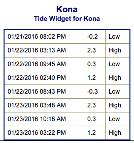
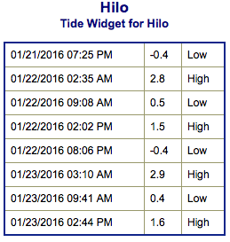
**Click directly on the images below to make them larger. Charts include: Big Island projected winds, tides, swell direction & period and expected wave heights.**
 Big Island Surf Forecast
Hilo side: Wave heights for spots exposed to the wrap are expected to be head high to overhead at the best breaks on the sets and easing through the day. Trade swell is waist/chest high.
Kona side: Wave heights are expected to be up to waist/head high on the sets for the best spots with northwestern exposure and tapering off through the day. Out of the south-southwest knee to waist high waves.
South: Out of the southwest knee/waist high today. Trade swell brings waist/chest high waves. Some spots around South Point may get wrap out of the northwest up to waist/head high on the sets in the morning.
 Our current northwest swell is expected to taper off and shift more out of the north today. A second large west-northwest swell is likely Sunday through Monday, resulting in warning-level surf along north and west facing shores, including west facing shores of the Big Island.
Trade swell is expected to remain pretty small at waist/chest high or less.
Our current south-southwest swell is expected to begin fading Friday. A new south-southwest is due to fill in Saturday around knee / chest high.
Keep in mind, surf heights are measured on the face of the wave from trough to crest. Heights vary from beach to beach, and at the same beach, from break to break.
**Click here for your detailed Big Island weather report.**
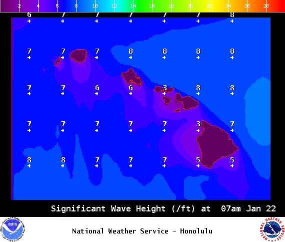
Image: NOAA / NWS
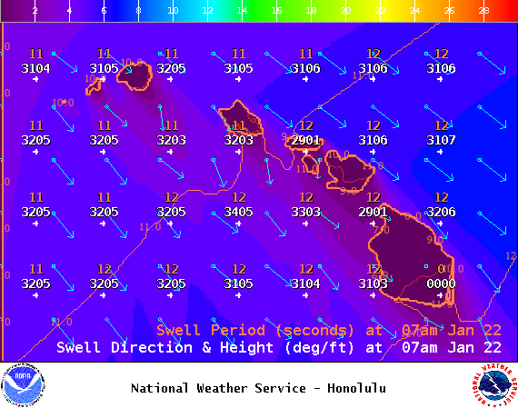
Image: NOAA / NWS
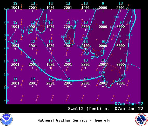
Image: NOAA / NWS
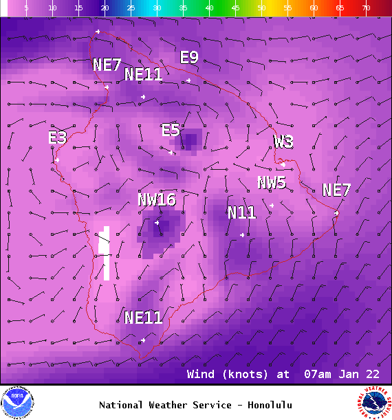
Image: NOAA / NWS
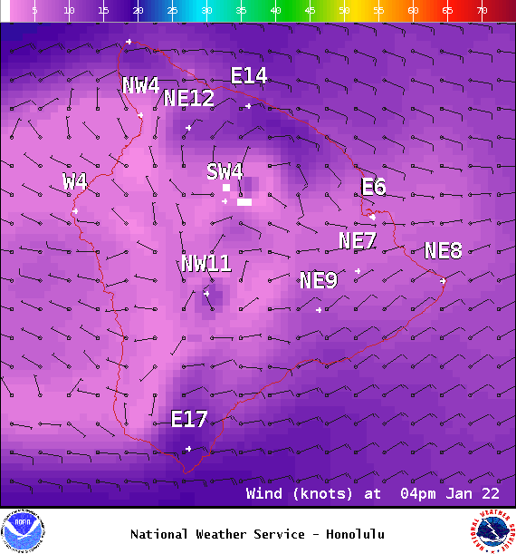
Image: NOAA / NWS
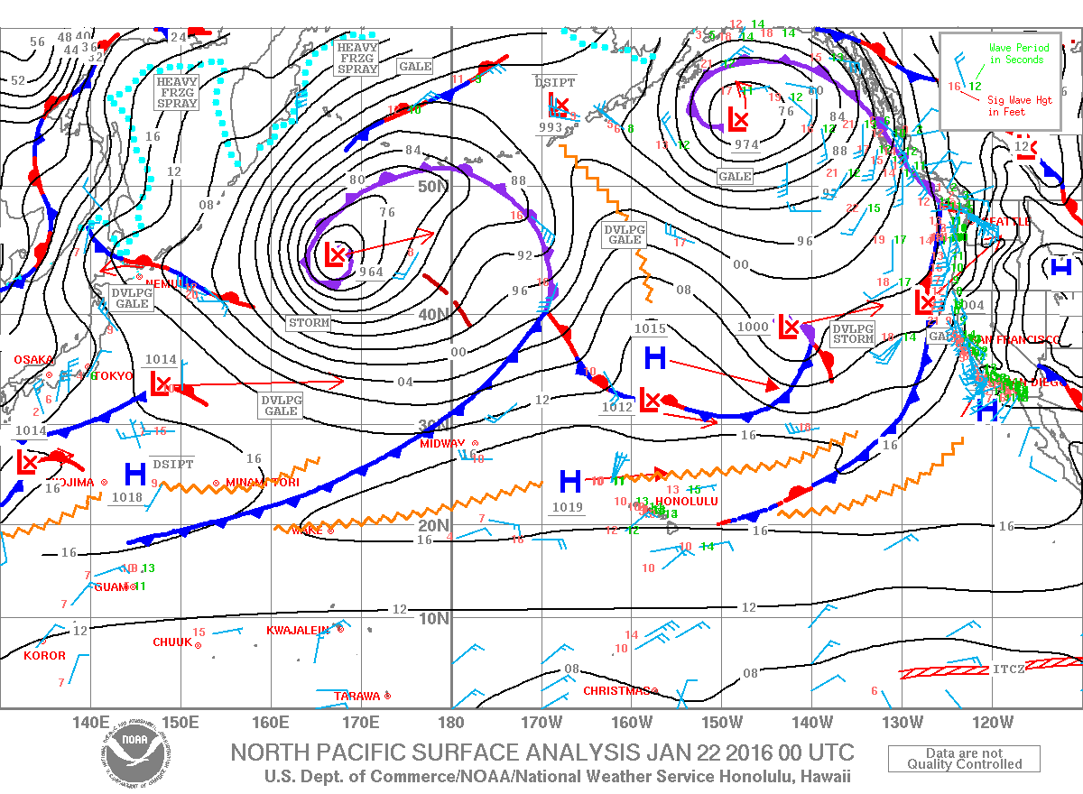
Image: NOAA / NWS
Sponsored Content


