

Hilda Swell Lingers Through end of Work Week
Alerts
A Flash Flood Watch has been issued for the Big Island. This watch goes into effect at 6:00 a.m. on Thursday through 6:00 a.m. Saturday. Abundant moisture from weakening Hilda is expected to produce the potential for excessive runoff, rock/mudslides and fast-moving water that could create life-threatening situations. Storm total rainfall amounts of 4 to 8 inches are possible with upslope areas getting up to a foot of rain.
A High Surf Advisory is posted for the Big Island as swell generated by Hilda continues to affect easterly exposures. The advisory is posted through 6:00 p.m. Thursday. Wave heights of 8 to 12 feet are expected. Expect strong breaking waves, shore break and strong longshore and rip currents making swimming difficult and dangerous.
A Tropical Storm Watch is posted for the waters to the south and west of the Big Island until further notice.
A Small Craft Advisory is posted for the rest of the Big Island coastal waters through 6:00 p.m. Friday for winds up to 30 knots and rough seas up to 10 feet. Inexperienced mariners should avoid navigating in these conditions.
**Click directly on the images below to make them larger. Charts include: Big Island projected winds, tides, swell direction & period and expected wave heights.**
 Big Island Surf Forecast
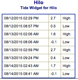
Hilo side: Wave heights are expected to be overhead to occasionally well overhead today for exposures open to Hilda swell.
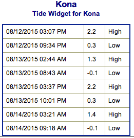
Kona side: Wave heights ankle/knee/thigh high are expected for the best breaks open to the SW swell.
South: Hilda swell could get into the well overhead to double overhead range for spots open to the ESE. Messy conditions are expected.
 Hilda has generated a ESE/E swell for the islands. The swell is expected to continue through the end of the work week.
A very small southwest swell is lingering. No significant swells are on the horizon out of the SPAC. Small south-southeast swells are expected the second half of the week but a bigger swell is possible late next week if a storm near New Zealand develops as expected.
Keep in mind, surf heights are measured on the face of the wave from trough to crest. Heights vary from beach to beach, and at the same beach, from break to break.
**Click here for your detailed Big Island weather report.**
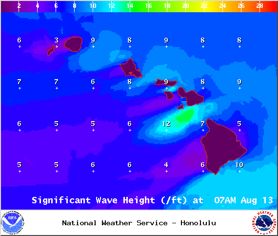
Image: NOAA /NWS
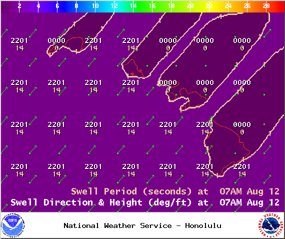
Image: NOAA /NWS
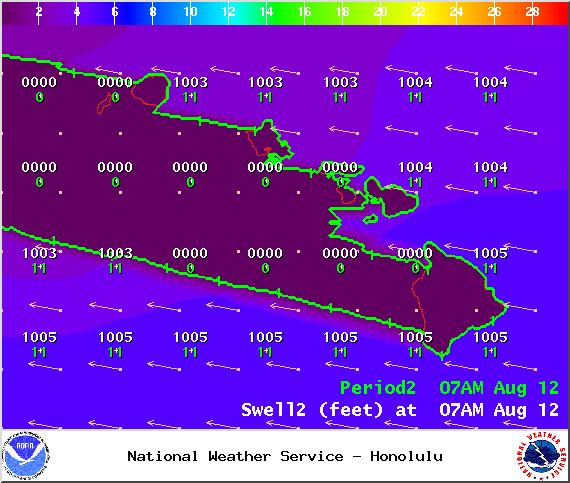
Image: NOAA /NWS

Image: NOAA /NWS
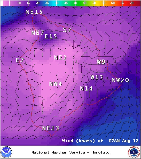
Image: NOAA /NWS
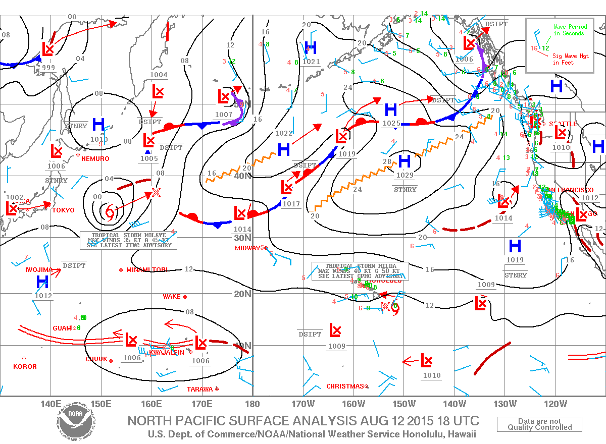
Image: NOAA /NWS
Sponsored Content


