

Kilauea Summit Update – 8/5/15
A lull in activity at Kilauea’s summit continues for a third day. Hawaiian Volcano Observatory reports that tiltmeters at the summit have not recorded any significant change in the past day, a similar report to the previous two days.
The lava lake within the Overlook crater was about 158 feet below the rim on Wednesday morning\ and remains active.
In addition to the summit, no obvious changes have been seen at the Puʻu ʻŌʻō crater. HVO reports that persistent incandescent, outgassing crater vents remain within the crater, and now includes a small lava pond in a collapsed pit. The pit that collapsed is about 130-165 feet across and about 70 feet deep.
Seismicity at Puʻu ʻŌʻō remains low.
Observation of the June 27, 2014 lava flow continues through webcame images. Overnight, HVO reports the images showed continued activity. The flow remains active and has scattered surface flows in three areas to the northeast and east of Puʻu ʻŌʻō.
HVO mapped the June 27 lava flow Tuesday and observed that flows are within 5 miles of Puʻu ʻŌʻō.
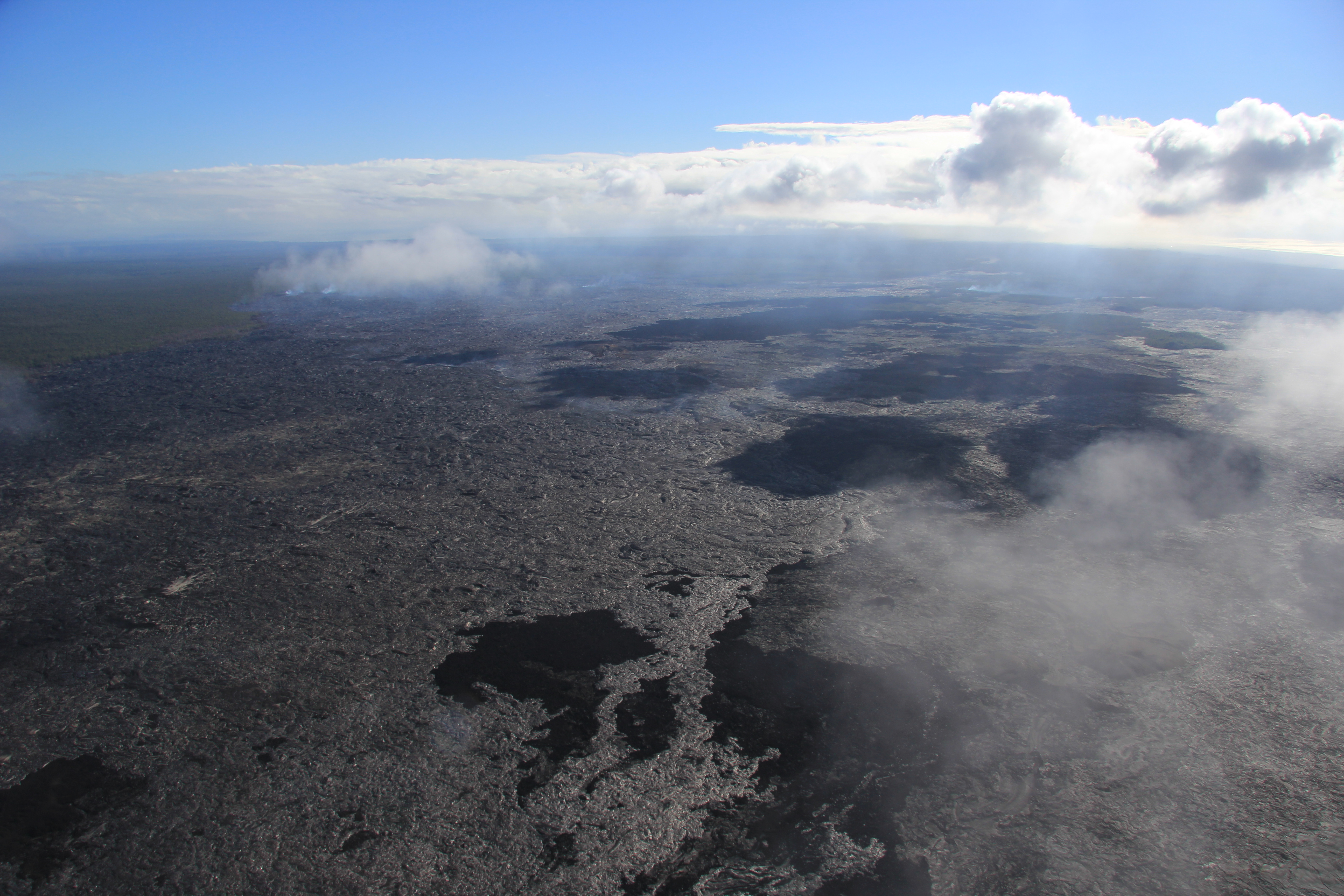
Lava flows are scattered across a broad area extending from about 3 to 8 km (2–5 mi) northeast of Puʻu ʻŌʻō. The active flows start just above the horizontal mid-line of the photo, but cannot be picked out easily within the broader inactive flow field due to their distance away in this photo. USGS/HVO photo.
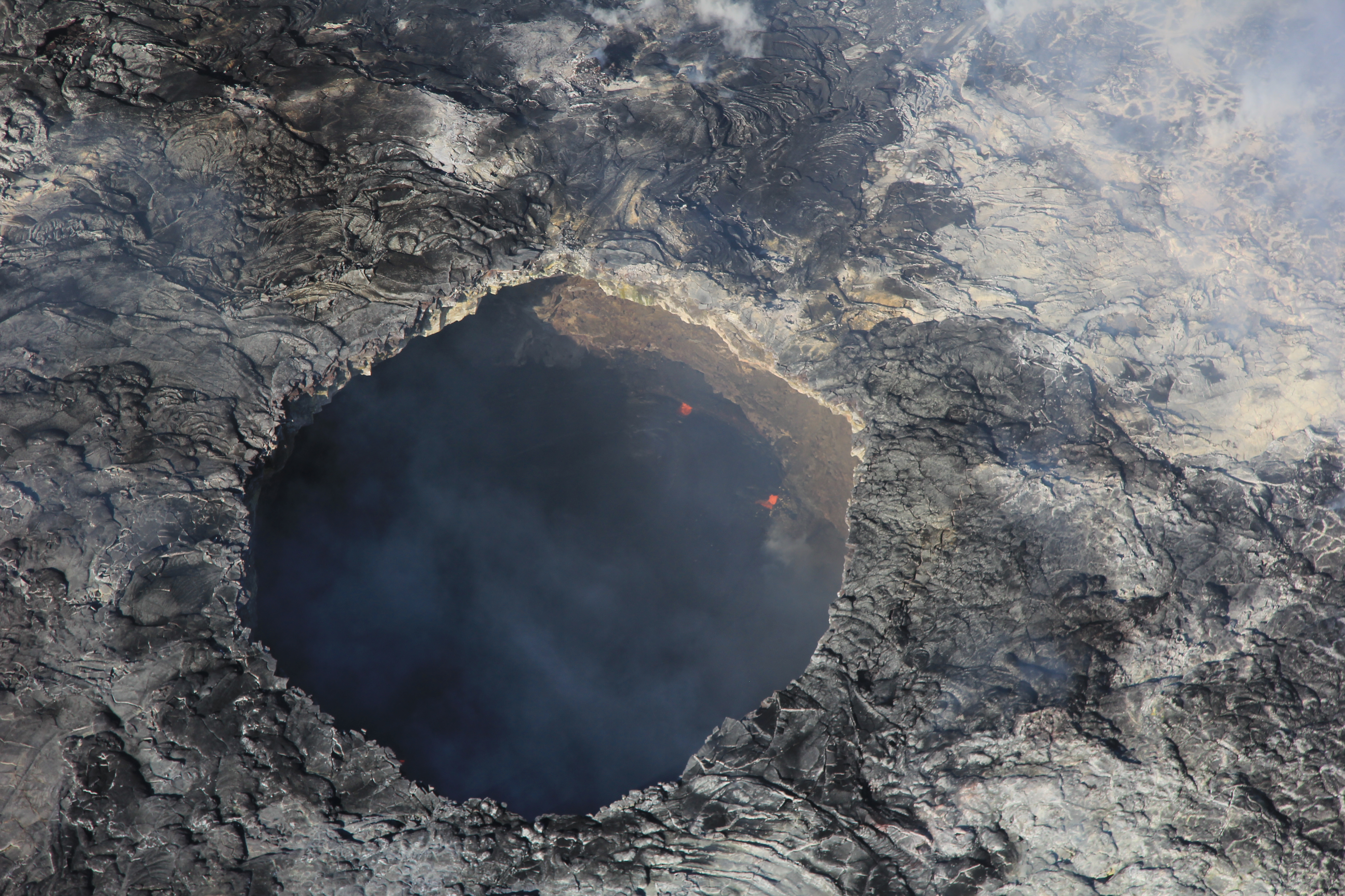
Aug. 4: The pit west of the Puʻu ʻŌʻō crater, shown here, is overhung on most sides and may continue to widen with time. The lava pond inside is relatively placid, appearing as a black surface, usually with a few tiny spattering areas along the edge. USGS/HVO photo.
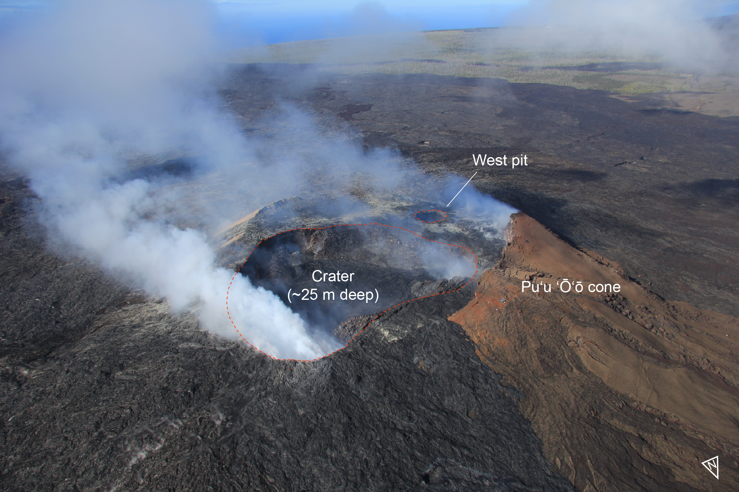
Aug. 4: High aerial view of Puʻu ʻŌʻō, looking south-southwest. The current crater at Puʻu ʻŌʻō is about 280 m (~920 ft) long and 230 m (~755 ft) wide, with a depth of about 25 m (~82 ft). To the west of the crater is another pit 49 m (~161 ft) across that contains a small lava pond. USGS/HVO photo.
Sponsored Content


