East Hawaii News

Kilauea Summit Activity Increases

Play
Listen to this Article
1 minute
Loading Audio... Article will play after ad...
Playing in :00
A
A
A

Hawaiian Volcano Observatory reported Friday that Kilauea Volcano’s summit continues to inflate.

Scientists at HVO say that as a result of the inflation, which has been occurring since about 2:30 p.m. Tuesday, the lava lake in the crater has risen to its highest level since March 2008, when the current summit eruption started.

A total of 4.5 microradians have been reported since the inflation began on Tuesday.

On Thursday afternoon, the lave lake was measured to be about 20 meters below the rim of the Overlook crater. That number is likely to have risen an additional few meters overnight and into Friday, according to HVO.

ARTICLE CONTINUES BELOW AD

The lave lake came into view from the Jagger Museum overlook on Thursday and continued to be visible Friday morning.

At 5:30 a.m. on Friday, the level of lava in the crater caused a small collapse from the overhanging west wall and rim of the Overlook. According to HVO officials, this caused a small explosive event that threw lava spatter onto the Halema’uma’u crater floor.

Seismic activity beneath Kilauea’s summit and upper Rift Zone remains increased.

ARTICLE CONTINUES BELOW AD

In addition to the tiltmeter changes at Kilauea’s summit, the tiltmeter on the north flank of Puʻu ʻŌʻō has recorded a change in ground tilt. HVO says the weak inflation is possibility a slight response to what is happening at the summit.

HVO made note that throughout the day on Thursday, lava flows sporadically erupted from vents at the south and southeast edges of the Puʻu ʻŌʻō  crater. These flows are small in size and were confined to the crater.

Sulfur dioxide emission rates from all East Rift Zone vents were about 850 tonnes/day when they were last measured on April 21.
    +
    SWIPE LEFT OR RIGHT
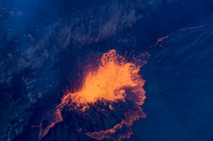
The lava level was high enough at the lava lake on the evening of April 23 that bits of spatter were reaching the rim of the Overlook crater. USGS/HVO photo.
The lava level was high enough at the lava lake on the evening of April 23 that bits of spatter were reaching the rim of the Overlook crater. USGS/HVO photo.

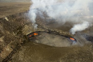
The Overlook crater lava lake, within Halemaʻumaʻu Crater at Kīlauea's summit, has been rising over the past few days, and today reached the highest point yet measured for the current summit eruption. The lava lake this afternoon was 20 meters (66 feet) below the Overlook crater rim. USGS/HVO photo.
The Overlook crater lava lake, within Halemaʻumaʻu Crater at Kīlauea’s summit, has been rising over the past few days, and today reached the highest point yet measured for the current summit eruption. The lava lake this afternoon was 20 meters (66 feet) below the Overlook crater rim. USGS/HVO photo.

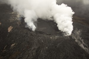
Over the past week small flows have filled the bottom of Puʻu ʻŌʻō Crater. These flows originated from vents in the south portion of the crater, and one of the flows can be seen near the center of the photograph. USGS/HVO photo.
Over the past week, small flows have filled the bottom of Puʻu ʻŌʻō Crater. These flows originated from vents in the south portion of the crater, and one of the flows can be seen near the center of the photograph. USGS/HVO photo.

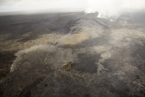
Breakouts on the June 27 lava flow remain active northeast of Puʻu ʻŌʻō. A new, small, breakout appeared recently from the tube adjacent to Puʻu Kahaualeʻa, the small forested cone near the center of the photograph. The new breakout is the light-colored curved flow in the left portion of the photograph. Puʻu ʻŌʻō is in the upper right portion of the photo. USGS/HVO photo.
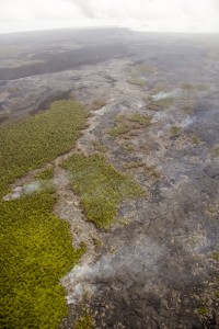
Breakouts on the June 27 lava flow remain active northeast of Puʻu ʻŌʻō. A new, small, breakout appeared recently from the tube adjacent to Puʻu Kahaualeʻa, the small forested cone near the center of the photograph. The new breakout is the light-colored curved flow in the left portion of the photograph. Puʻu ʻŌʻō is in the upper right portion of the photo. USGS/HVO photo.

The farthest active breakout on the June 27th flow reached about 8 km (5 miles) northeast of the vent on Puʻu ʻŌʻō. The tip of this breakout was narrow and burning forest. Puʻu ʻŌʻō is at the top of the photograph.

The farthest active breakout on the June 27th flow reached about 8 km (5 miles) northeast of the vent on Puʻu ʻŌʻō. The tip of this breakout was narrow and burning forest. Puʻu ʻŌʻō is at the top of the photograph. USGS/HVO photo
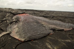
A small breakout from an inflated portion of the June 27 flow. Large gas bubbles reach the surface near the source of the breakout, and are then carried and deformed as the surface advances and cools. USGS/HVO photo.
A small breakout from an inflated portion of the June 27 flow. Large gas bubbles reach the surface near the source of the breakout, and are then carried and deformed as the surface advances and cools. USGS/HVO photo.

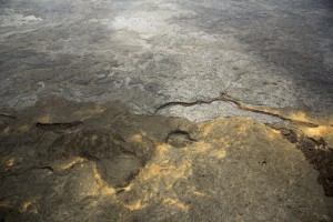
The June 27 flow covers much of the top of the photograph, and recent expansion of the flow margins has sent lava cascading into one of the ponds on the 2007 perched lava channel. This 2007 lava fills the bottom of the photograph, and is covered with yellow alteration. USGS/HVO photo.
The June 27 flow covers much of the top of the photograph, and recent expansion of the flow margins has sent lava cascading into one of the ponds on the 2007 perched lava channel. This 2007 lava fills the bottom of the photograph, and is covered with yellow alteration. USGS/HVO photo.

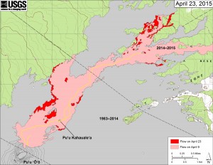
his map shows recent changes to Kīlauea’s active East Rift Zone lava flow field. The area of the flow on April 9 is shown in pink, while widening and advancement of the flow as of April 23 is shown in red. Puʻu ʻŌʻō lava flows erupted prior to June 27, 2014, are shown in gray. USGS/HVO map.
his map shows recent changes to Kīlauea’s active East Rift Zone lava flow field. The area of the flow on April 9 is shown in pink, while widening and advancement of the flow as of April 23 is shown in red. Puʻu ʻŌʻō lava flows erupted prior to June 27, 2014, are shown in gray. USGS/HVO map.

ARTICLE CONTINUES BELOW AD


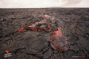
This photo, taken on April 24, shows a vigorous breakout in the middle of the flow field, creates a shelly pahoehoe surface, probably the scariest surface to walk over, as it is very thin and brittle. Photo credit: Extreme Exposure Media/Paradise Helicopters.
This photo, taken on April 24, shows a vigorous breakout in the middle of the flow field, creates a shelly pahoehoe surface, probably the scariest surface to walk over, as it is very thin and brittle. Photo credit: Extreme Exposure Media/Paradise Helicopters.

April 23, Pu‘u ‘O‘o overflight. Photo credit: Extreme Exposure Media/Paradise Helicopters.

April 23, Pu‘u ‘O‘o overflight. Photo credit: Extreme Exposure Media/Paradise Helicopters.

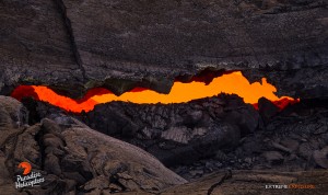
A long, thin skylight gives a peek at the raging river of lava feeding the flow, taken April 24. Photo credit: Extreme Exposure Media/Paradise Helicopters.
A long, thin skylight gives a peek at the raging river of lava feeding the flow, taken April 24. Photo credit: Extreme Exposure Media/Paradise Helicopters.

April 23, Pu‘u ‘O‘o overflight. Photo credit: Extreme Exposure Media/Paradise Helicopters.

April 23, Pu‘u ‘O‘o overflight. Photo credit: Extreme Exposure Media/Paradise Helicopters.

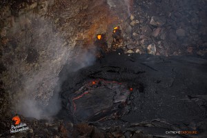
This photo, taken April 24, shows a little pit of lava is again visible against Pu‘u ‘O‘o's southeast wall. Photo credit: Extreme Exposure Media/Paradise Helicopters.

This photo, taken April 24, shows a little pit of lava is again visible against Pu‘u ‘O‘o’s southeast wall. Photo credit: Extreme Exposure Media/Paradise Helicopters.
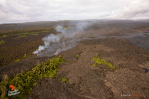
This photo, taken April 24, shows  a new branch of lava breaks off from the main flow to the east. Pu‘u ‘O‘o sits in the upper right of the frame. Photo credit: Extreme Exposure Media/Paradise Helicopters.

This photo, taken April 24, shows a new branch of lava breaks off from the main flow to the east. Pu‘u ‘O‘o sits in the upper right of the frame. Photo credit: Extreme Exposure Media/Paradise Helicopters.

April 23, Pu‘u ‘O‘o overflight. Photo credit: Extreme Exposure Media/Paradise Helicopters.

April 23 Pu‘u ‘O‘o overflight. Photo credit: Extreme Exposure Media/Paradise Helicopters.

April 23, Pu‘u ‘O‘o overflight. Photo credit: Extreme Exposure Media/Paradise Helicopters.
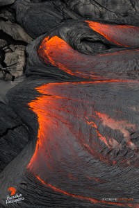
April 23 Pu‘u ‘O‘o overflight. Photo credit: Extreme Exposure Media/Paradise Helicopters.
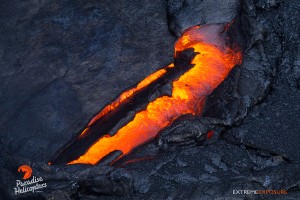
April 23, Pu‘u ‘O‘o overflight. Photo credit: Extreme Exposure Media/Paradise Helicopters.
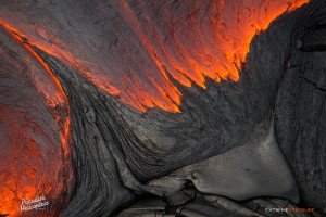
April 23 Pu‘u ‘O‘o overflight. Photo credit: Extreme Exposure Media/Paradise Helicopters.
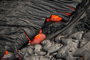
This photo, taken April 23, shows a fresh flow creeps over kupukupu ferns on an old flow. Photo credit: Extreme Exposure Media/Paradise Helicopters.
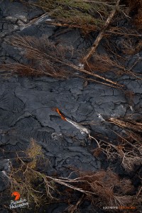
This photo, taken April 23, shows a fresh flow creeps over kupukupu ferns on an old flow. Photo credit: Extreme Exposure Media/Paradise Helicopters.
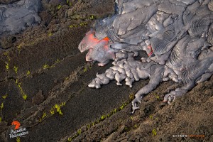
April 23, Pu‘u ‘O‘o overflight. Photo credit: Extreme Exposure Media/Paradise Helicopters.
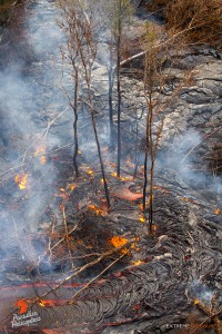
April 23 Pu‘u ‘O‘o overflight. Photo credit: Extreme Exposure Media/Paradise Helicopters.

Sponsored Content

Subscribe to our Newsletter

Stay in-the-know with daily or weekly
headlines delivered straight to your inbox.
Cancel
×

Comments

This comments section is a public community forum for the purpose of free expression. Although Big Island Now encourages respectful communication only, some content may be considered offensive. Please view at your own discretion. View Comments