HVO Update on Upslope June 27 Breakouts
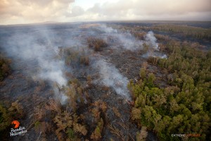
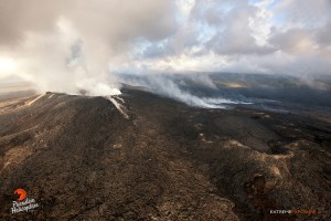
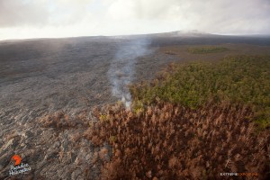
Despite the lack of activity in the downslope portions of the June 27 lava flow, activity continues to remain upslope near Puʻu ʻŌʻō. Over the past week, Hawaiian Volcano Observatory has recorded that one of the three breakouts being watched in recent weeks has shown an increase in activity.
HVO noted on Monday that the Feb. 21 breakout on the northern flank of Puʻu ʻŌʻō, the March 9 breakout which originated at Pu’u Kahauale’a and extends 1.2 miles to the north, and another forked breakout that is located about 3-4 miles northeast of Puʻu ʻŌʻō, continues to remain active. Officials say it’s the third, forked breakout that has shown an increase in activity.
On March 27, Hawai’i County Civil Defense discontinued its daily overflight assessments and updates following HVO’s decision to downgrade the lava alert level from a Warning to a Watch on March 25. The decision came after weeks of inactive downslope activity and concentrated activity miles upslope from the stalled flow fronts, nearest to the Puʻu ʻŌʻō vent. The decreased downslope activity severely lessened the threat to communities in the area.
Slight variations have been recorded by the tiltmeter on the north flank of Puʻu ʻŌʻō. HVO reports that the sulfur dioxide emission rate from all of the East Rift Zone vents as last measured on March 27 was about 400 tonnes per day.
On Sunday, HVO reported a summit lava lake level drop at the Kilauea summit at about 8 a.m. A few hours later, the level returned to its prior level. Also reported was a collapse of a small part of the north Overlook crater rim that fell into the lake on Sunday evening. The event caused a disruption in circulation for several minutes, according to officials.
Hawai’i County Civil Defense planned a community lava meeting last Thursday but it was canceled after the realization that partner agencies would need more time to discuss and come to final conclusions about situations pertaining to the lava flow threat and the federal reimbursement program.
Darryl Oliveira, Civil Defense Administrator, said that the meeting would be rescheduled for a future date.
This map overlays georegistered mosaics of thermal images collected during a helicopter overflight of the three areas of breakouts near Puʻu ʻŌʻō on April 3. The perimeter of the flow at the time the imagery was acquired is outlined in yellow. Temperature in the thermal mosaics is displayed as gray-scale values, with the brightest pixels indicating the hottest areas (white areas are active breakouts). USGS/HVO map.
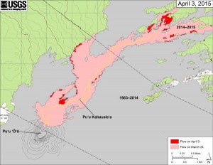
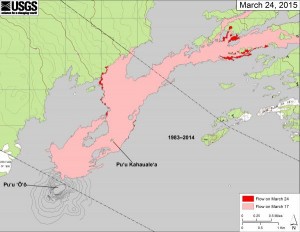
This map shows recent changes to Kīlauea’s active East Rift Zone lava flow field. The area of the flow on March 24 is shown in pink, while widening and advancement of the flow as of April 3 is shown in red. USGS/HVO map.
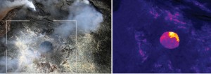
A closer look at the new pit in the western portion of Puʻu ʻŌʻō Crater on April 3. Views inside the crater with the naked eye were obscured by thick fume, but the thermal images (right) revealed two areas of ponded lava, separated by a pile of collapse rubble, deep within the pit. Measurements using the thermal camera images indicated that the lava pond surface was roughly 24 m (about 80 ft) below the rim of the pit. USGS/HVO photo.
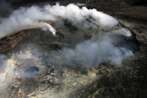
This photo, taken April 3, shows a new collapse pit that formed in the western portion of Puʻu ʻŌʻō Crater since March 27. This circular pit can be seen in the lower left portion of the photograph, and measures about 27 m (roughly 90 ft) in diameter. Numerous hot cracks were also observed in this general area during previous visits on foot. USGS/HVO photo.
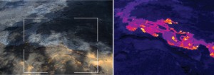
The breakout north of Kahaualeʻa has one lobe that has traveled along the west side of the perched lava channel that was active in late 2007. This breakout consists of blue glassy pāhoehoe, which is easily visible in the photograph on the left. The white box shows the rough extent of the thermal image on the right. Active (flowing) portions of the breakout are shown by yellow and white colors, while the red and purple areas show hot, but solidified, portions of the surface crust. USGS/HVO photo.
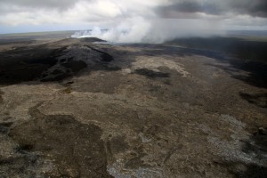
A closer look at the lava flow field near Puʻu ʻŌʻō. Puʻu ʻŌʻō is in the upper left portion of the photograph taken April 3. USGS/HVO photo.


