

Advisory Level Swell Continues
Alerts
A High Surf Advisory is in effect for the Kona side of the island through 6:00 a.m. Thursday. The National Weather Service is calling for wave heights of 6 to 10 feet. Expect strong breaking waves, shore break and strong longshore and rip currents making swimming difficult and dangerous.
A Small Craft Advisory is posted for the Alenuihaha channel and leeward / south waters of the Big Island through 6:00 p.m. Wednesday.
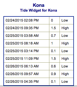
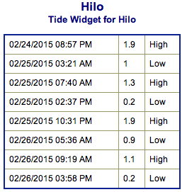
**Click directly on the images below to make them larger. Charts include: Big Island projected winds, tides, swell direction & period and expected wave heights.**
 Big Island Surf Forecast
Hilo side: Wave heights from waist to head high are expected, getting bigger later in the day.
Kona side: Wave heights from waist to shoulder high early on with larger waves in the afternoon and evening.
South: Wave heights of knee to chest high are expected from the south-southwest swell. Spots catching the Kona will get waist to shoulder high waves or bigger in the afternoon.
 A shadowed west-northwest is expected to build and peak on Wednesday afternoon possibly up to overhead at the best breaks on the sets. Swell holds through Thursday morning before fading out. Short-period northwest shifting swell brings a reinforcement Friday.
Possible storm development off of Japan may bring a swell for first few days of March. Will keep an eye on it.
A new south swell continues to build with knee to chest high waves in the forecast. Swell is expected to peak on Wednesday.
Keep in mind, surf heights are measured on the face of the wave from trough to crest. Heights vary from beach to beach, and at the same beach, from break to break.
**Click here for your detailed Big Island weather report.**
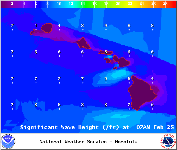
Image: NOAA / NWS
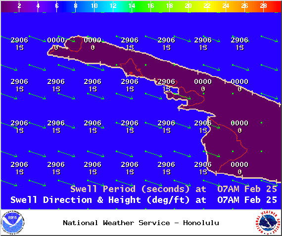
Image: NOAA / NWS
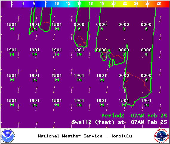
Image: NOAA / NWS
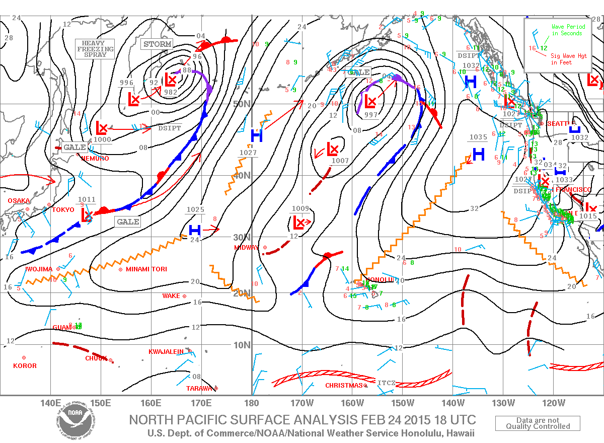
Image: NOAA / NWS
Image: NOAA / NWS

Image: NOAA / NWS
Sponsored Content


