

June 27 Lava Flow Update – 1/29/15
Lack of advancement continues for all of the main breakouts of the June 27 lava flow.
Hawai’i County Civil Defense said Thursday morning following its overflight assessment that the north margin breakout continues to remain stalled, as it has nearly the entire week. The flow is active and is showing signs of widening just above the flow front.
On Wednesday during a media briefing, Civil Defense Administrator Darryl Oliveira told reporters that activity at the front of the north margin breakout was minimal and the lava was already crusted over black. He also made mention of lava seen through the crack system and along the surface just yards above the stalled front.
At the current time, the distal north margin breakout remains 0.36 miles from Highway 130, just west of the Pahoa Police and Fire stations.
Also observed during the overflight assessment was the original flow front and the south margin breakout that both remain stalled.
Various other activity is continuing upslope, according to officials, including a number of breakouts along both margins of the flow and within the flow pad. The two breakouts located about 1-1.5 miles upslope from the original stalled flow front have shown little activity and no signs of advancement.
Civil Defense, along with Hawaiian Volcano Observatory, will continue to keep a watchful eye on activity, as well as keep the public informed of any changes or threat.
Light smoke conditions were reported Thursday morning as a light south wind was blowing smoke in a north northeast direction. As usual, these smoke conditions have the possibility of changing and those who are sensitive are advised to take precautionary measures.
There is currently no brush fire activity as fire conditions continue to be closely monitored.
The Public Lava Viewing area at the Pahoa Transfer Station will be closed Thursday, in order to conduct the last day of the school educational program that allows area students to view the site during class excursions. Officials will reopen the area Friday and Saturday before closing it indefinitely. While closed, the area will be restored to its original use as a solid waste collection site.
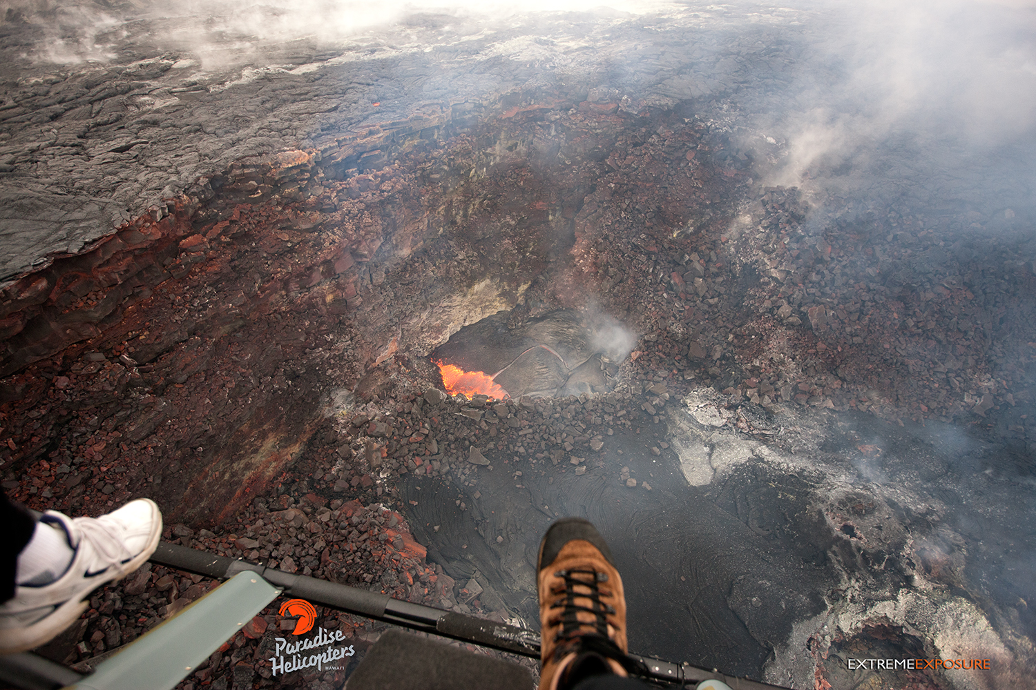
In this photo, taken on Jan. 28, you can see some slight action in Pu‘u ‘O‘o as a little lava pond is visible against the southeastern wall of the crater. Photo credit: Extreme Exposure /Paradise Helicopters.
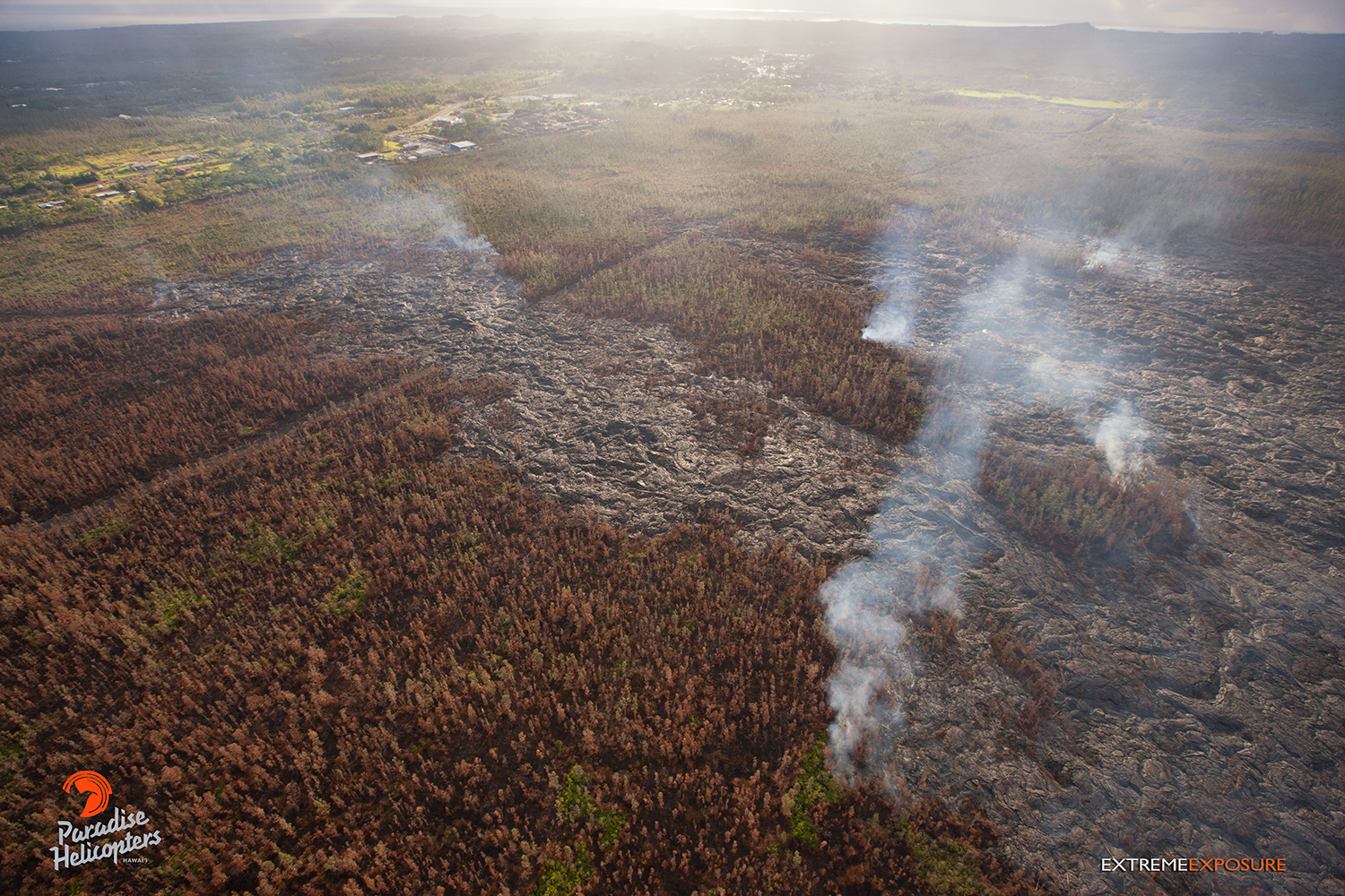
In this overview photo, taken on Jan. 28, you can see the distal tip of the June 27 lava flow. Photo credit: Extreme Exposure/Paradise Helicopters.
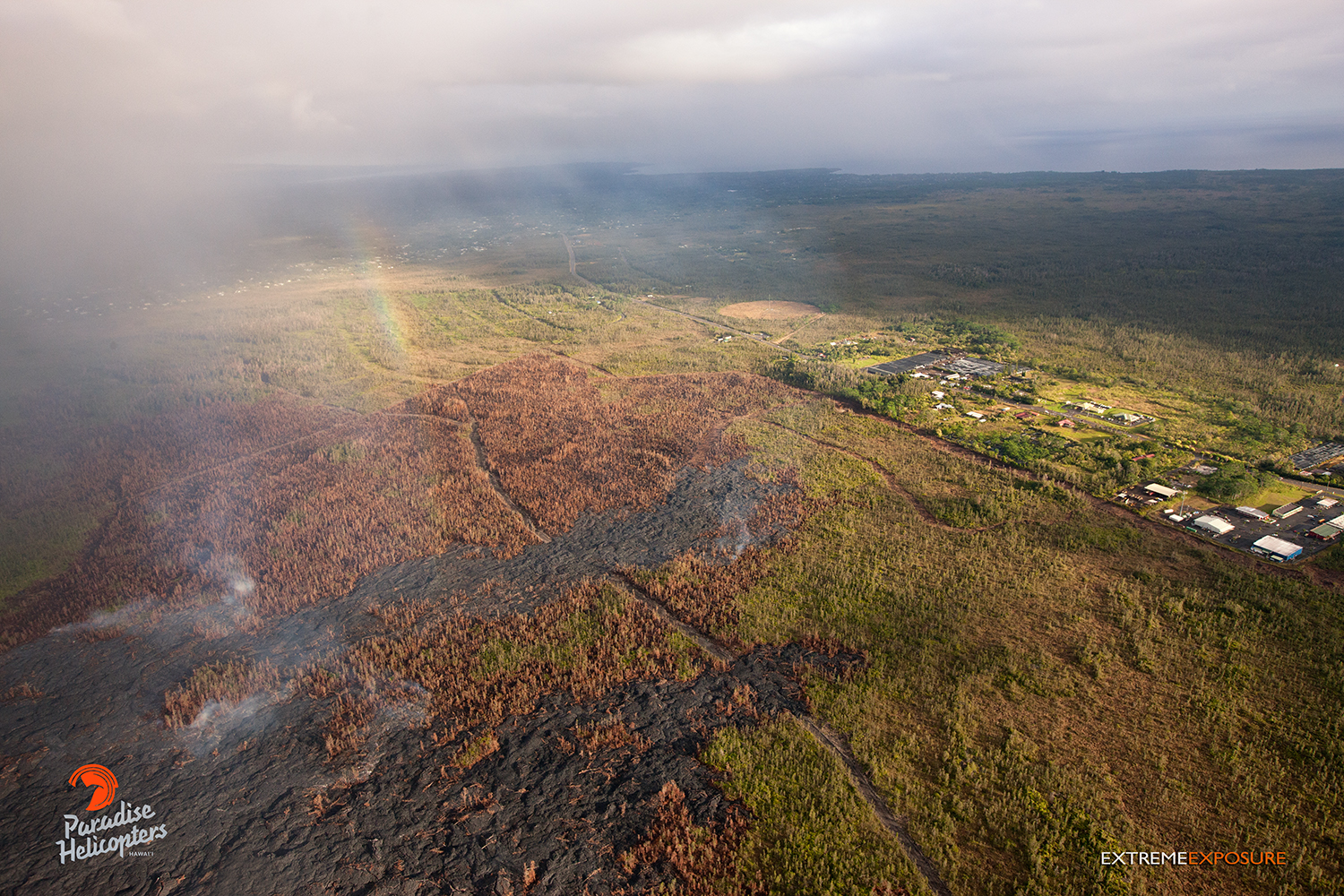
This overflight photo, taken on Jan. 28, captured a rainbow above the lava bed. Photo credit: Extreme Exposure Media/Paradise Helicopters.
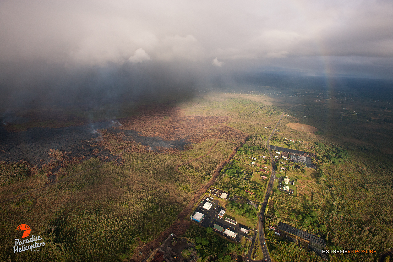
This overflight photo, taken on Jan. 28, shows the distal portion of the flow’s vicinity to Highway 130. Photo credit: Extreme Exposure Media/Paradise Helicopters.
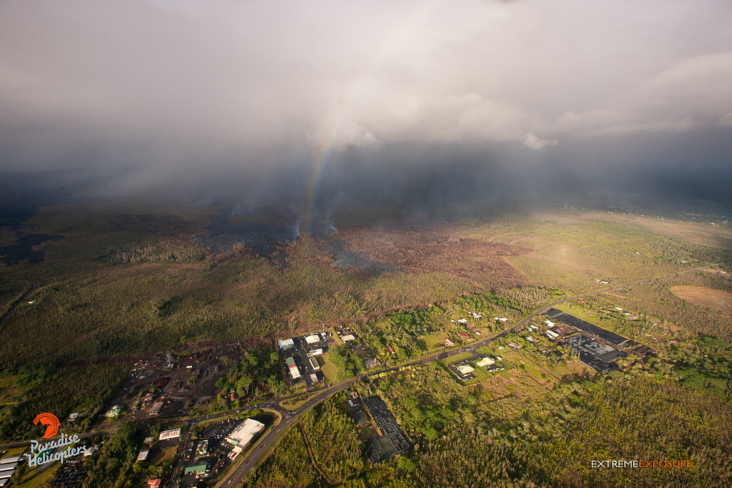
A rainbow shines above the distal portion of the June 27 lava flow in this overflight photo, taken on Jan. 28. Photo credit: Extreme Media Exposure/Paradise Helicopters.
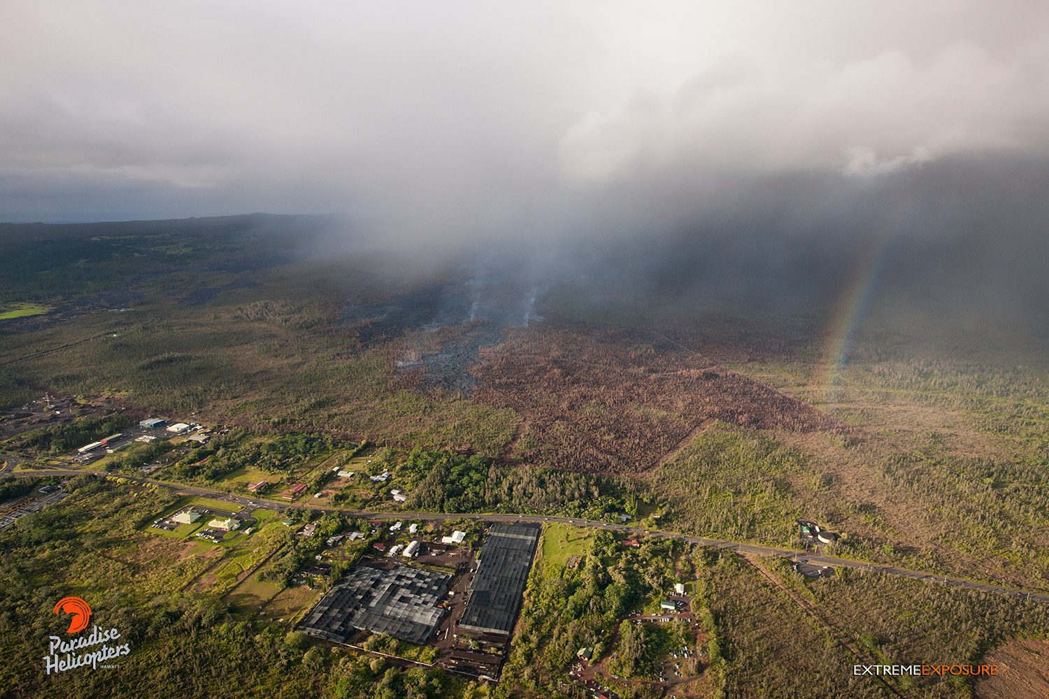
This photo shows the June 27 lava flow’s proximity to Highway 130 from a different perspective. Photo credit: Extreme Media Exposure/Paradise Helicopters.
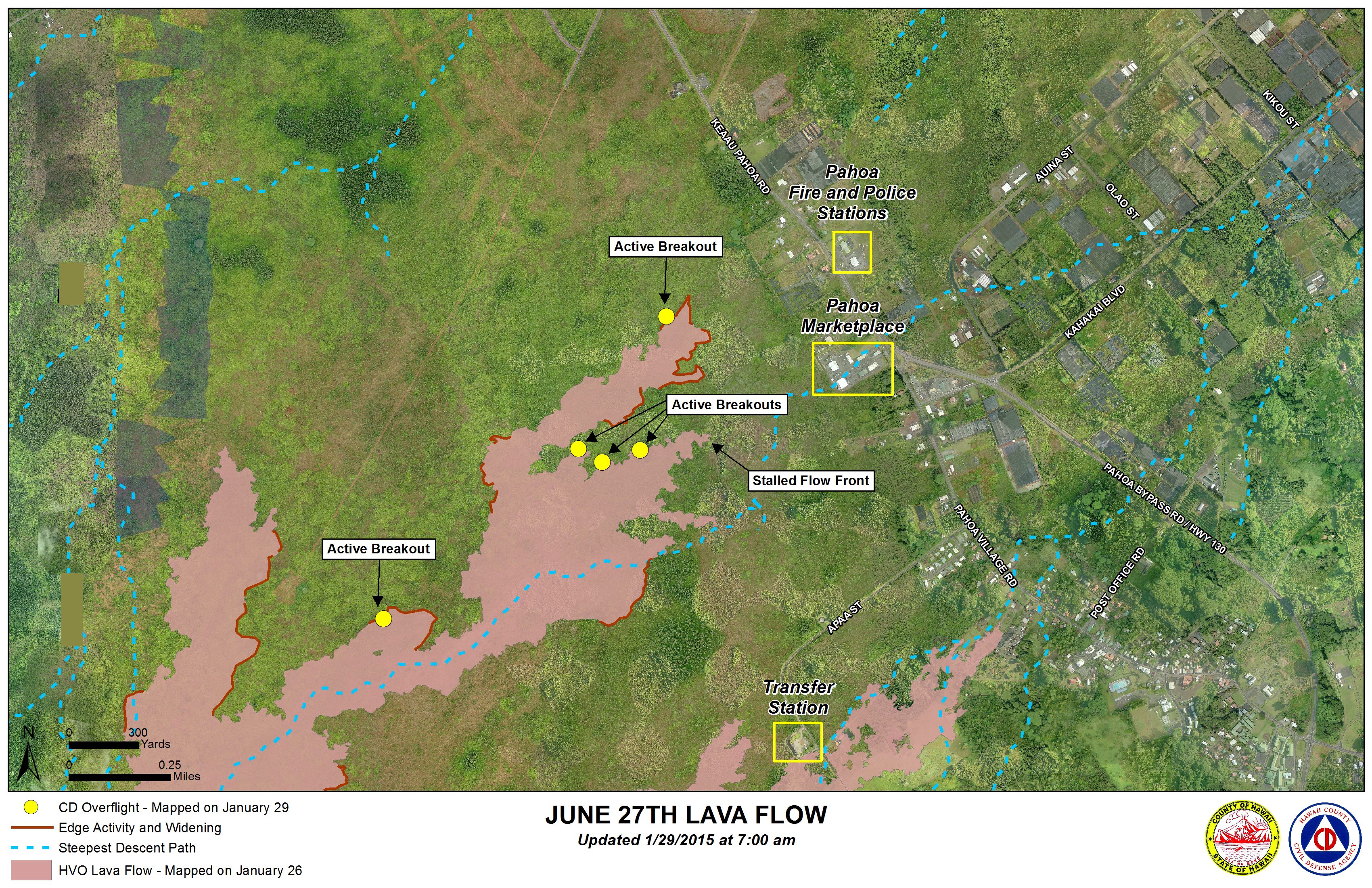
Hawai’i County Civil Defense lava flow map, as of Jan. 29 at 7 a.m. Civil Defense photo.
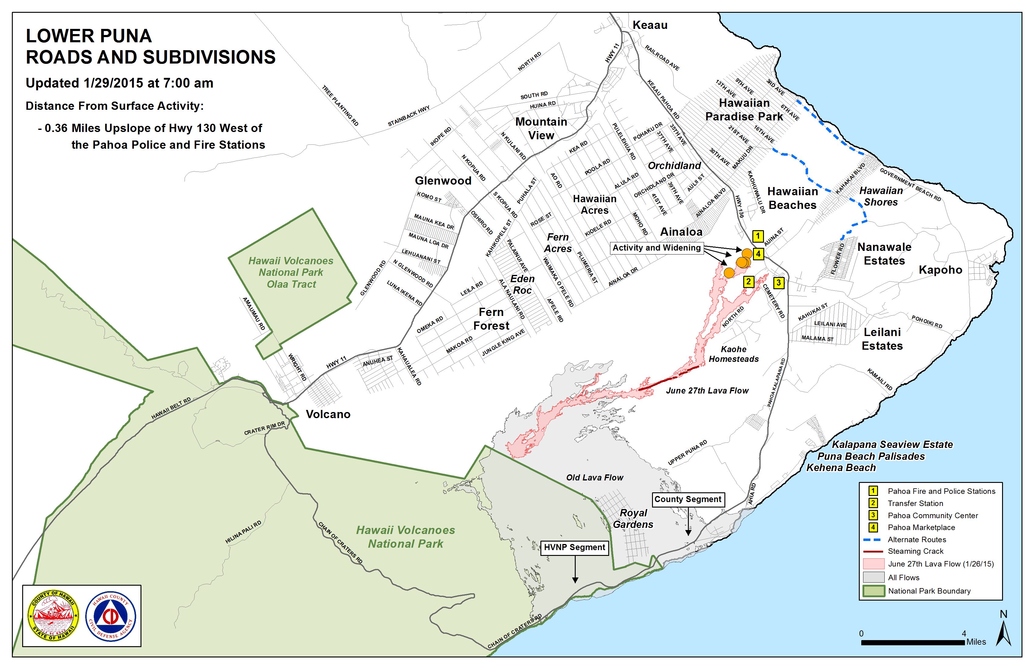
Hawai’i County Civil Defense lava flow map, as of Jan. 29 at 7 a.m. Civil Defense photo.
Sponsored Content


