

June 27 Lava Flow Update – 1/28/15
The north margin breakout continues to remain stalled for the second day, following its 50 yard advancement between Sunday and Monday mornings.
On Wednesday morning, Hawai’i County Civil Defense reported that the breakout along the north margin of the flow has not made any advancement since Monday morning. The flow, however, continues to remain active and is showing signs of widening behind its front.
At the current time, the flow remains about 0.36 miles from Highway 130 near the Pahoa Police and Fire stations.
In addition to the north margin breakout, the original flow front that was headed towards the Pahoa MarketPlace continues to remain stalled, along with the south margin breakout that was active during the same time.
The two breakouts along the north margin, 1-1.5 miles upslope from the original flow front, were observed as having little activity and no signs of advancement on Wednesday morning.
Civil Defense made note that additional breakouts continue along both margins of the flow as well as within the flow pad.
None of the lava activity is posing a current threat to communities in the area, according to officials, and Civil Defense, along with Hawaiian Volcano Observatory personnel, will continue to monitor activity and keep the public informed.
Light smoke conditions were observed on Wednesday morning during Civil Defense’s morning overflight assessment as a light variable wind was blowing smoke in a west-southwest direction. As usual, these conditions have the possibility of changing as officials advise those who are sensitive or have respiratory issues to take necessary precautions.
There is currently no brush fire activity as fire conditions continue to be monitored closely.
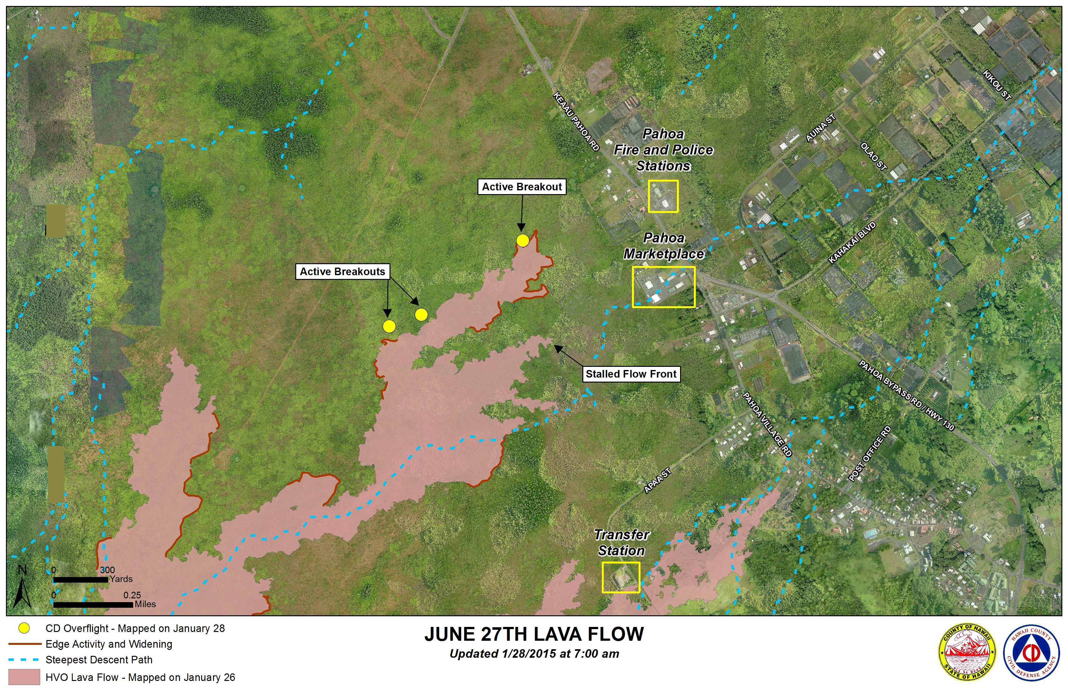
Hawai’i County Civil Defense lava flow map, as of Jan. 28 at 7 a.m. Civil Defense photo.
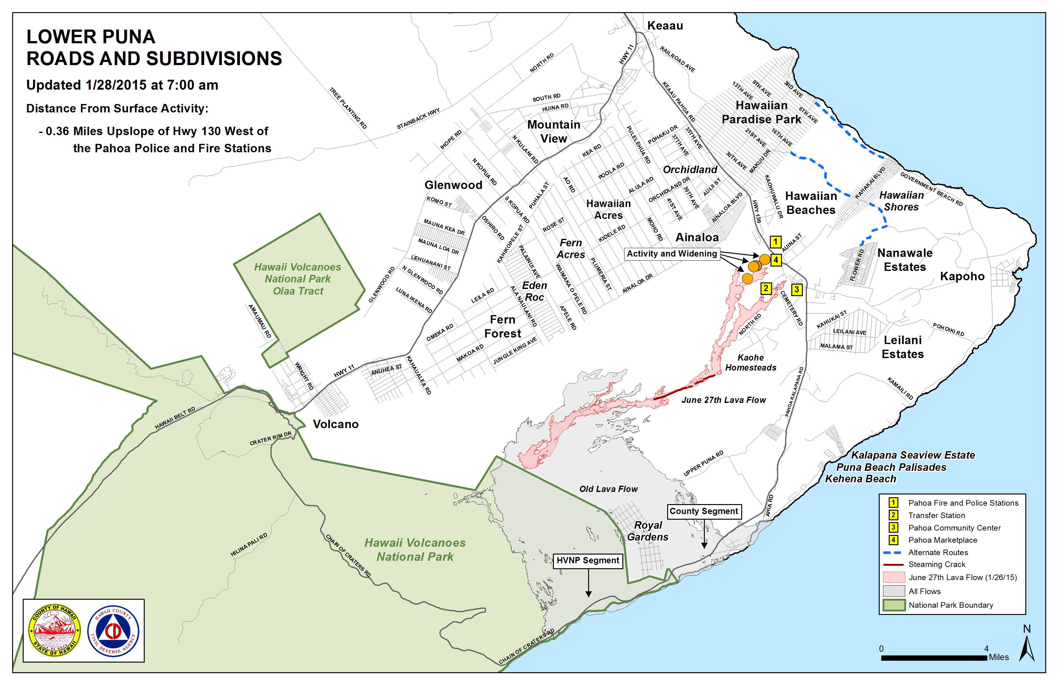
Hawai’i County Civil Defense lava flow map, as of Jan. 28 at 7 a.m. Civil Defense photo.
Sponsored Content


