

June 27 Lava Flow Update – 1/27/15
Hawai’i County Civil Defense reported Tuesday morning following its daily overflight assessment that after 50 yards of movement between Sunday and Monday mornings, the north margin breakout has stalled again.
No advancement was observed at the tip of this portion of the lava flow, however, it continues to widen. At the current time, the leading edge of this breakout is about 0.36 from Highway 130.
Officials also said there was no observation of any changes with the original flow front, as it, along with the south margin breakout, continue to remain stalled.
The two breakouts 1-1.5 miles upslope from the original flow front, along the north margin of the flow, also showed little activity and no signs of advancement.
Also being closely monitored are a number of breakouts along both the south and north margin of the flow, as well as along the flow pad. None of the activity in this area is posing a current threat to communities.
Civil Defense, along with Hawaiian Volcano Observatory personnel, will continue to monitor and access the situation and keep the public informed.
Light to moderate smoke conditions were reported Tuesday morning as a light northeast wind was blowing smoke in a southwest direction. As usual, these conditions have the possibility of increasing and individuals who are sensitive are advised to take necessary precautions.
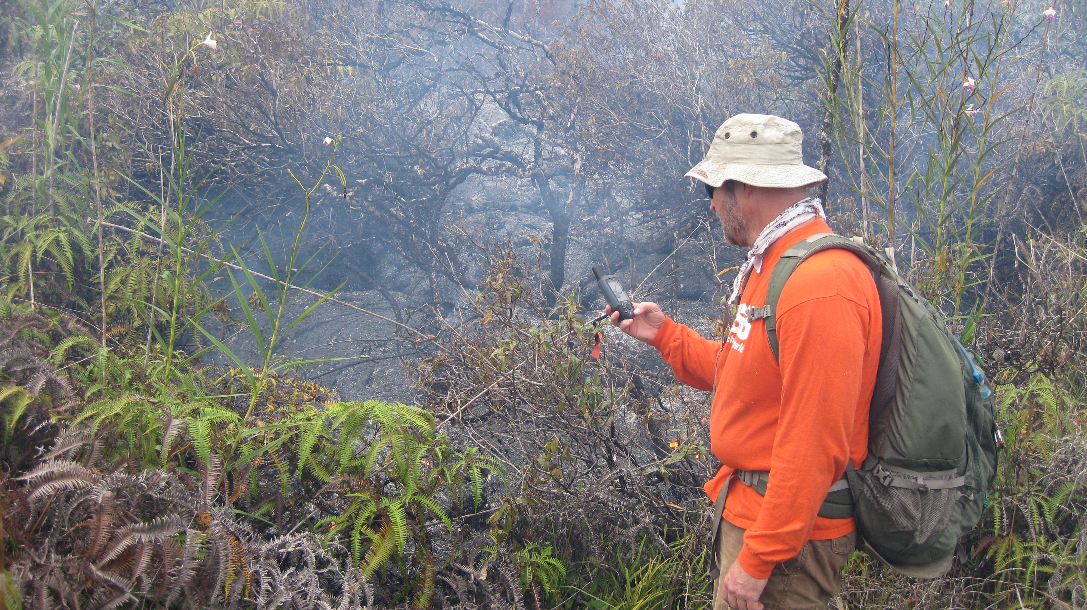
This photo, taken on Jan. 26, shows a HVO geologist taking a GPS waypoint of the leading edge of the June 27 flow, which consisted of a narrow, sluggish breakout during the afternoon. HVO photo.
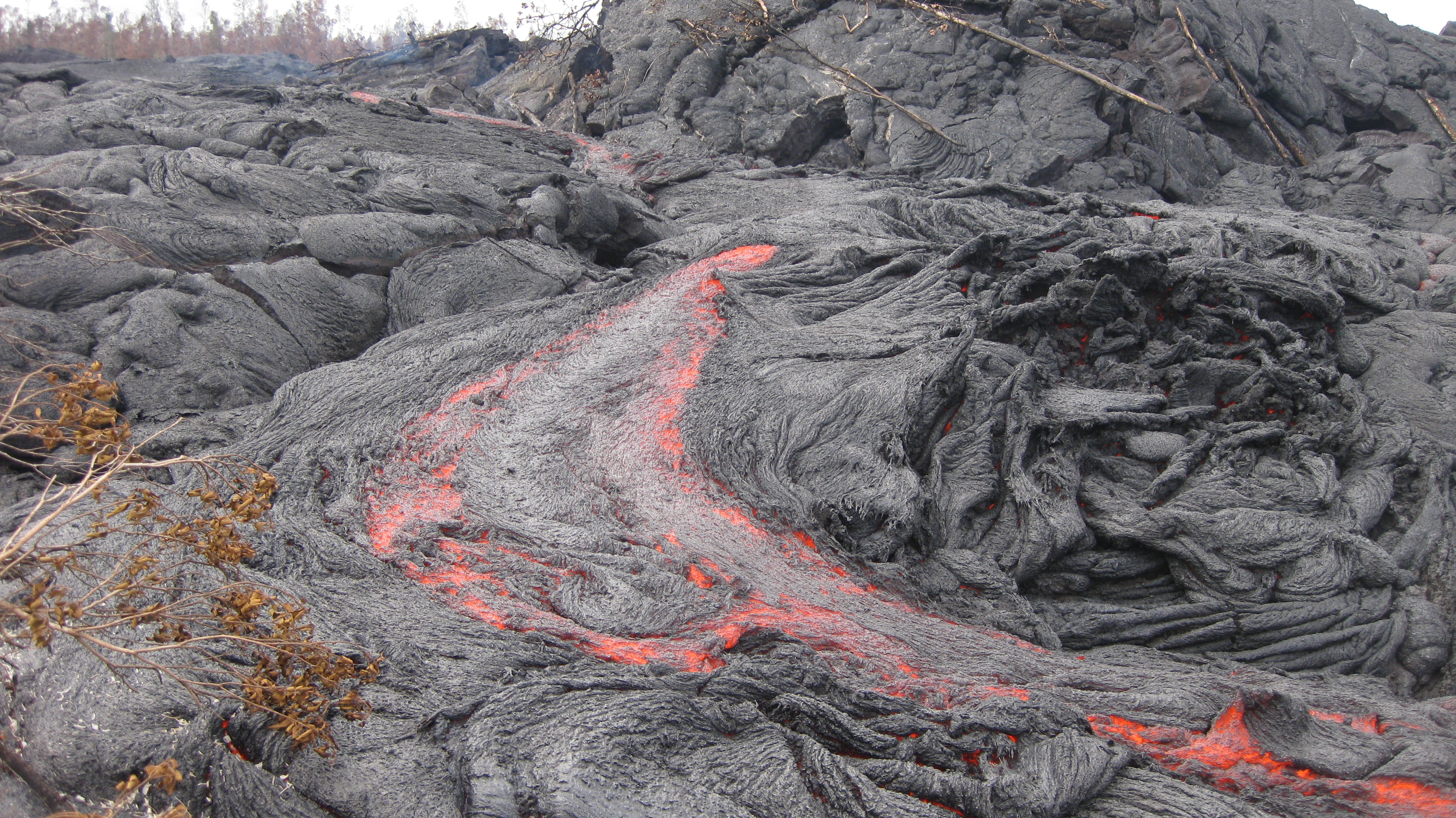
This photo, taken on Jan. 26, features one of many small breakouts on the surface of the June 27 flow immediately upslope of the leading edge. Many inflation features are present on the flow, including the tumulus in the upper right. HVO photo.
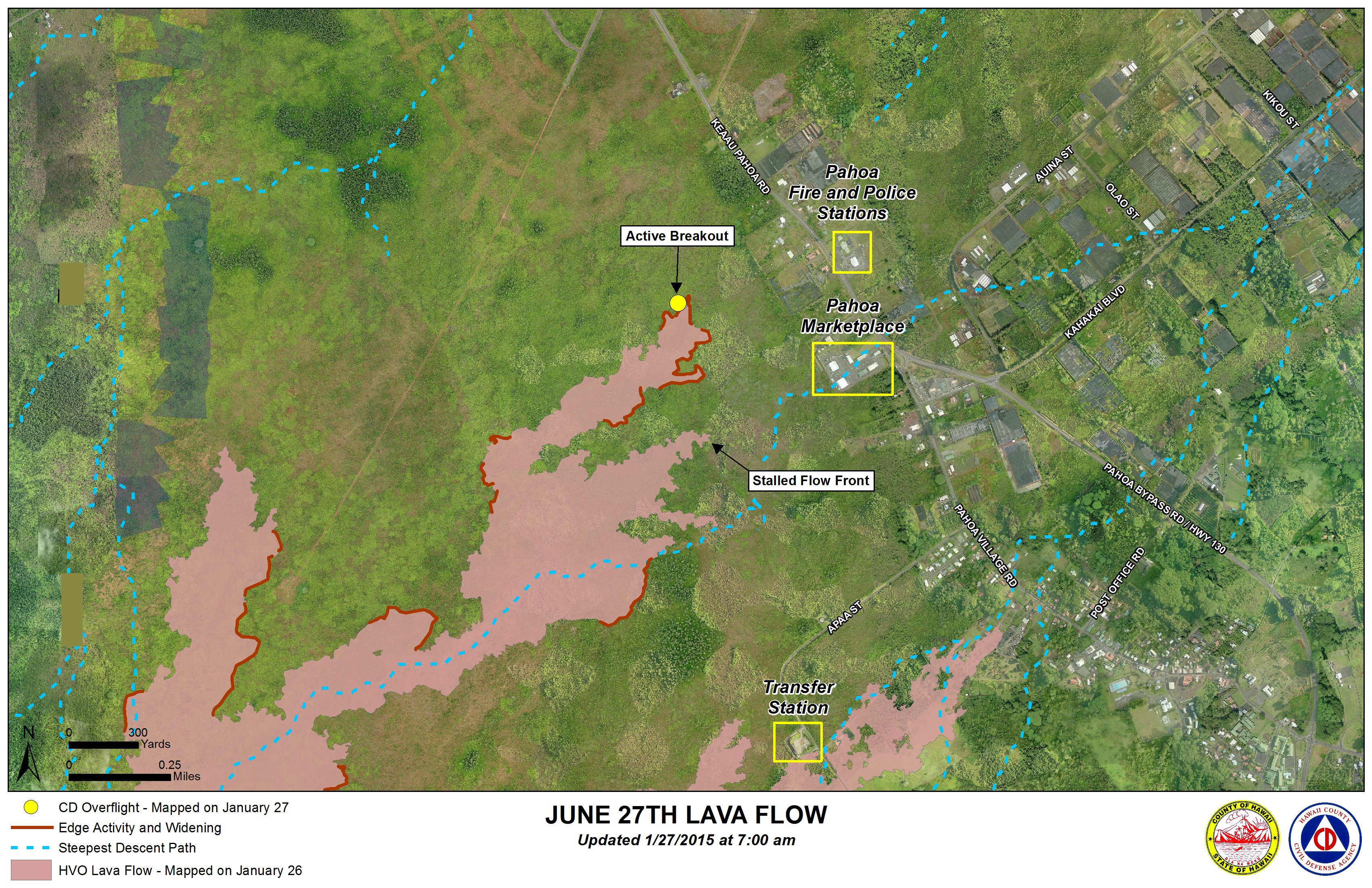
Hawai’i County Civil Defense lava flow map, as of Jan. 27 at 7 a.m. Civil Defense photo.
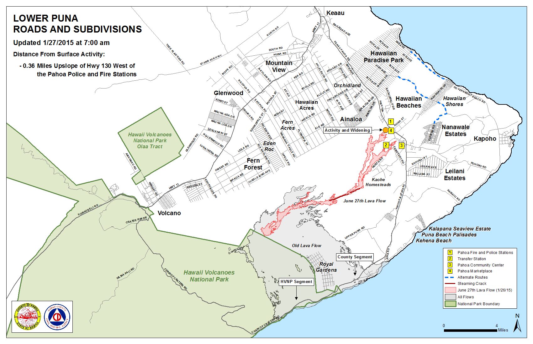
Hawai’i County Civil Defense lava flow map, as of Jan. 27 at 7 a.m. Civil Defense photo.
Sponsored Content


