

June 27 Lava Flow Update – 1/26/15
After being nearly stalled for four days, the north margin breakout of the June 27 lava flow is advancing again. Hawai’i County Civil Defense says the flow has advanced about 50 yards since Sunday morning in a northeast direction.
During Civil Defense’s Monday morning overflight assessment, sluggish advancement was observed at the active distal portion of the north margin breakout. Officials reported that the leading edge of the flow from is about 0.36 miles from Highway 130, just west of the Pahoa Police and Fire stations.
Other areas of the flow, including the original flow from and the south margin breakout, remain stalled.
Additional breakouts, like the two located about 1-1.5 miles upslope from the original flow front along the north margin, were observed by Civil Defense Monday as showing little activity and no signs of advancement.
Both the north and south margins of the flow were observed as having numerous breakout along them, however, officials say that none of the activity is posing an immediate threat to communities in the area.
Civil Defense, along with Hawaiian Volcano Observatory, will continue to maintain close observation and keep the public informed.
Light to moderate smoke conditions were reported Monday morning as a light northeast wind was blowing smoke in a southwest direction. As usual, these conditions have the possibility of increasing and individuals who are sensitive are advised to take necessary precautions.
At the current time, there is no brush fire activity as rain in the area continues.
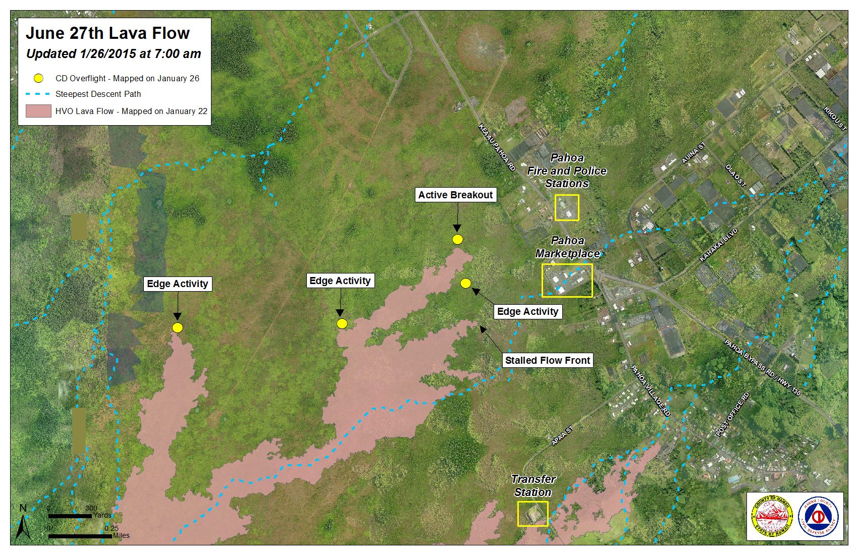
Hawai’i County Civil Defense lava flow map, as of Jan. 26 at 7 a.m. Civil Defense photo.
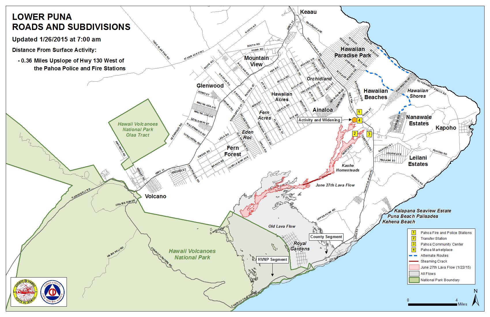
Hawai’i County Civil Defense lava flow map, as of Jan. 26 at 7 a.m. Civil Defense photo.
Sponsored Content


