

June 27 Lava Flow Update – 1/25/15
Another day begins as the June 27 lava flow’s north margin breakout that was actively advancing in past weeks remains at a standstill.
Following Hawai’i County Civil Defense’s Sunday assessment, it was noted that the breakout is active and widening but has not made forward advancement in the past four days. The front of the breakout remains 0.4 miles from Highway 130, just north of the Pahoa Police and Fire stations.
According to Civil Defense, the original flow front and south margin breakout that was active a handful of weeks ago continues to remain stalled.
Breakouts along the north margin, about 1-1.5 miles upslope from the stalled original flow front, showed minimal activity and no signs of advancement during Civil Defense’s morning overflight.
Additional breakouts along both margins of the flow and within the flow pad are being monitored by officials.
No lava activity is currently posing any threat to communities in the area. Close observations continue to be made by Civil Defense and Hawaiian Volcano Observatory personnel and the public will continue to keep informed.
Fires that occurred during the past two weeks as a result of the lava flow have been contained within fire break perimeters, according to officials. Additionally, Hawai’i County Fire Department personnel and equipment continue to remain on scene as monitoring continues. Fire breaks in the area remain secure and there is no current threat of fire to residents or properties in the area.
Light to moderate smoke conditions were reported by Civil Defense Sunday morning, as a light northwest wind was blowing smoke in a southeast direction.
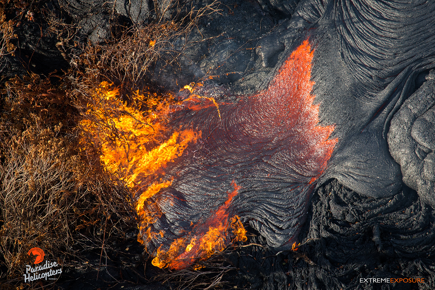
In this photo, taken on Jan. 23, a toe of lava breaks out and burns scrub brush in an area above Highhway 130. Photo credit: Extreme Exposure Media/Paradise Helicopters
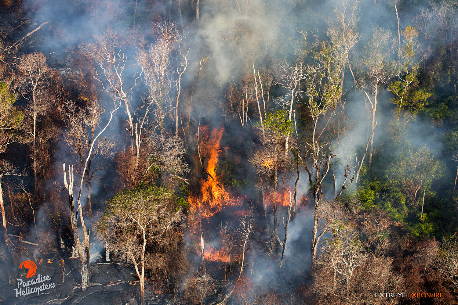
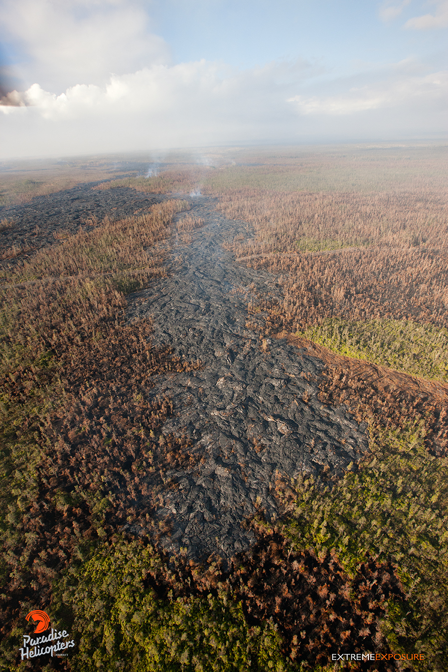
When this photo was taken on Jan. 23, the flow field continued to expand, as little breakouts along the perimeter crept into the forest near the old geothermal pad, 4 miles above Pahoa. Photo credit: Extreme Exposure Media/Paradise Helicopters.
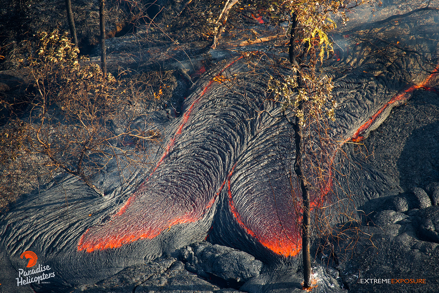
A large breakout toppled trees in an area between the lobe that has been moving toward the Pahoa Marketplace and the police/fire stations when this photo was taken on Jan. 23. Photo credit: Extreme Exposure Media/Paradise Helicopters.
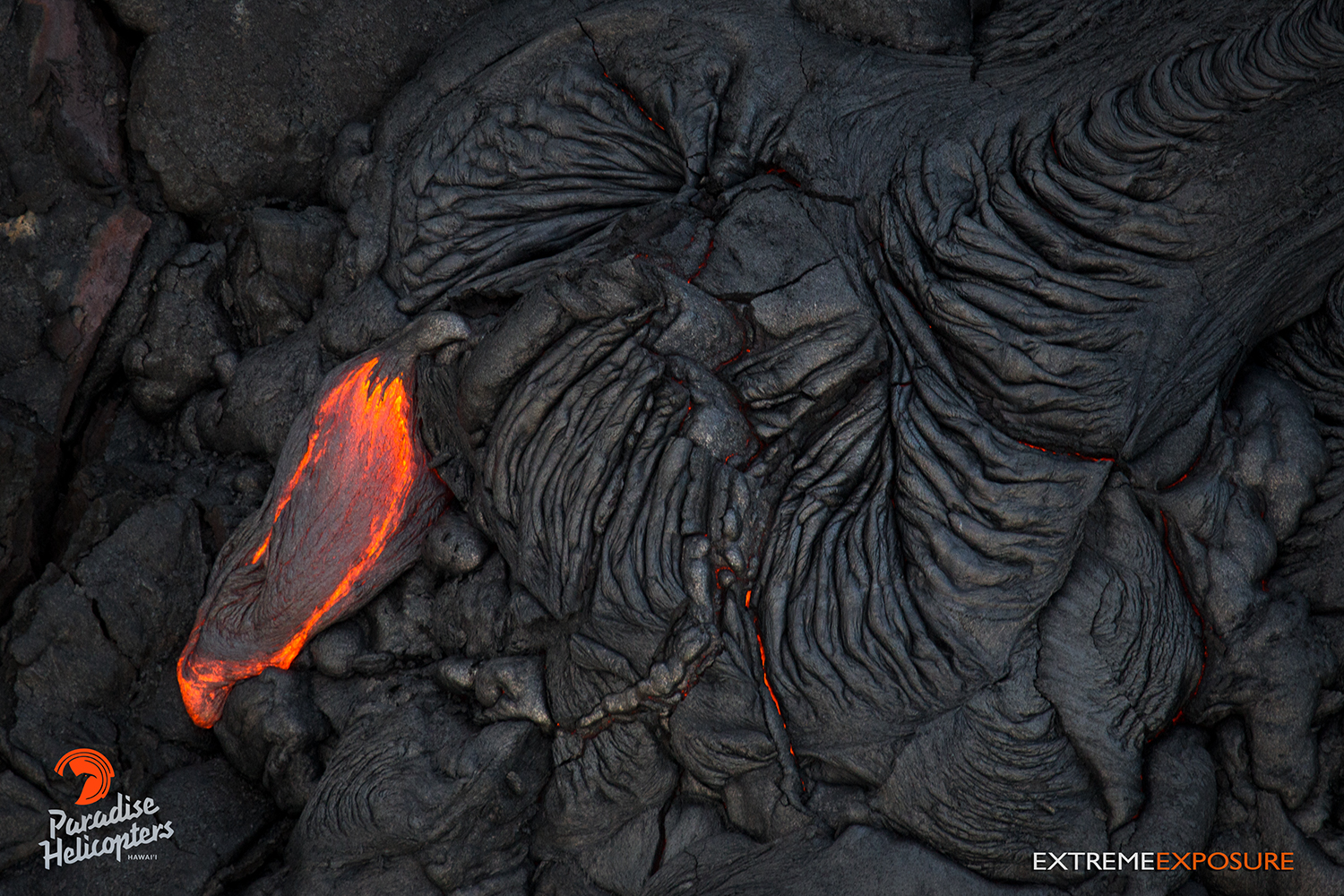
This photo, taken on Jan. 23, shows a little breakout near the perched channel, roughly 4 miles downslope of Pu‘u ‘O‘o crater. Photo credit: Extreme Exposure Media/Paradise Helicopters.
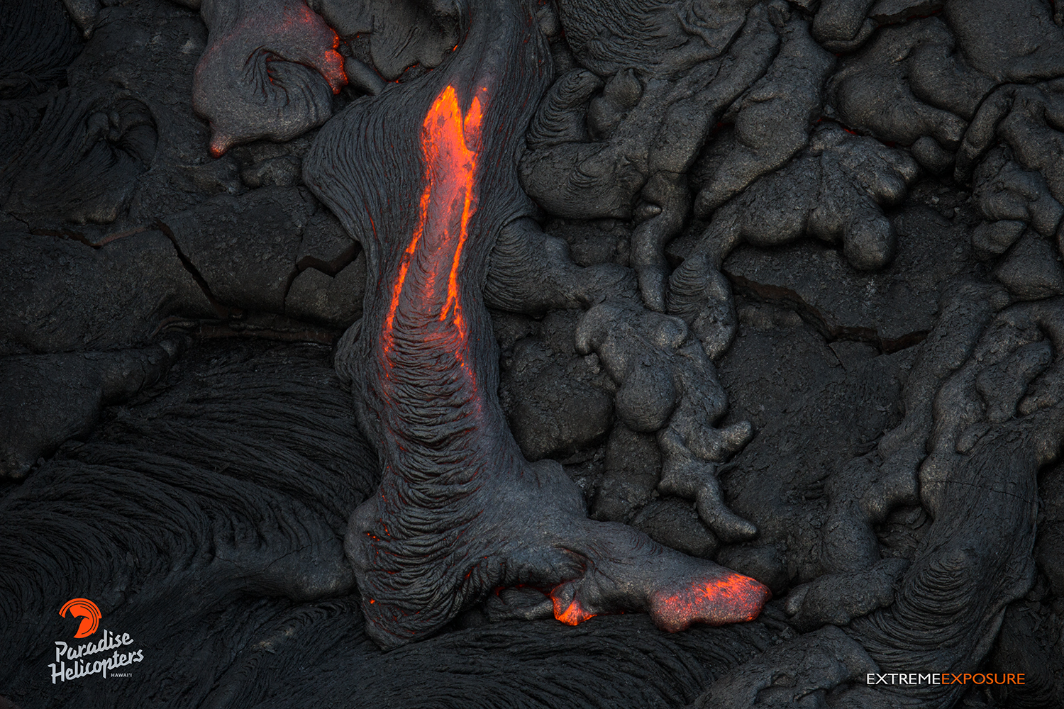
This photo, taken on Jan. 23, shows another little breakout in the flow field near the perched channel below Pu‘u ‘O‘o. Photo credit: Extreme Exposure Media/Paradise Helicopters.
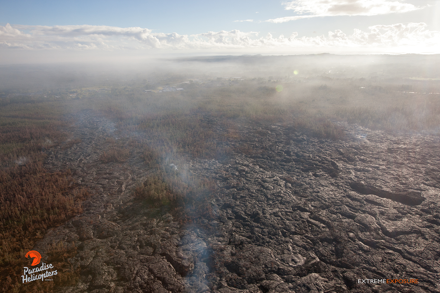
This photo, taken on Jan. 23, shows lava continuing to advance toward Highway 130. Photo credit: Extreme Exposure Media/Paradise Helicopters.
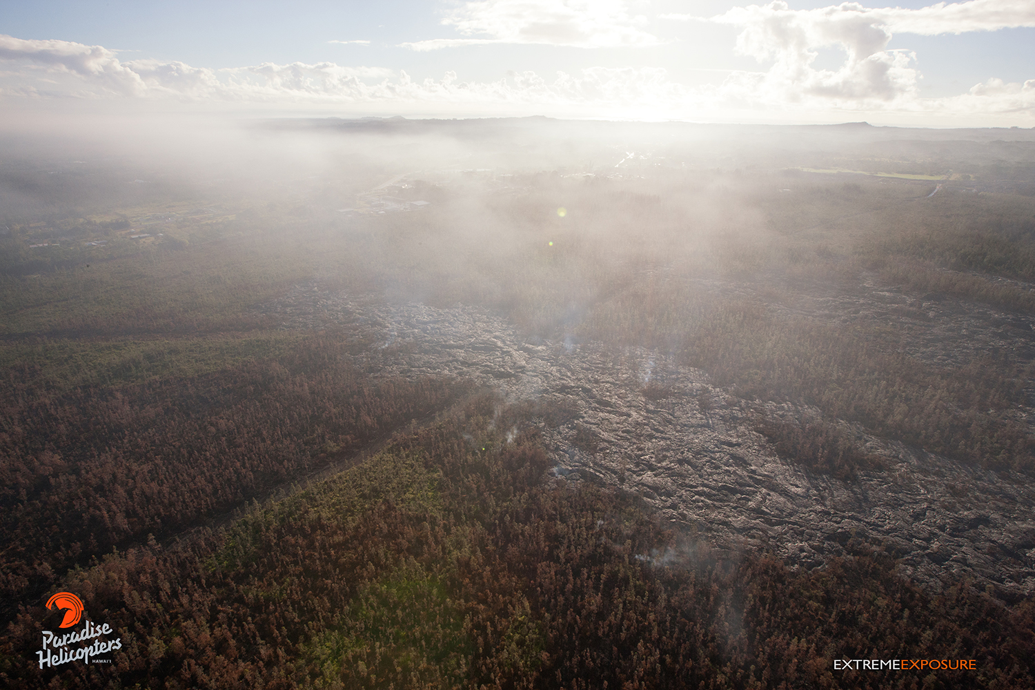
This photo, taken on Jan. 23, shows lava continuing to advance toward Highway 130. Photo credit: Extreme Exposure Media/Paradise Helicopters.
This photo, taken on Jan. 23, shows lava continuing to advance toward Highway 130. Photo credit: Extreme Exposure Media/Paradise Helicopters.
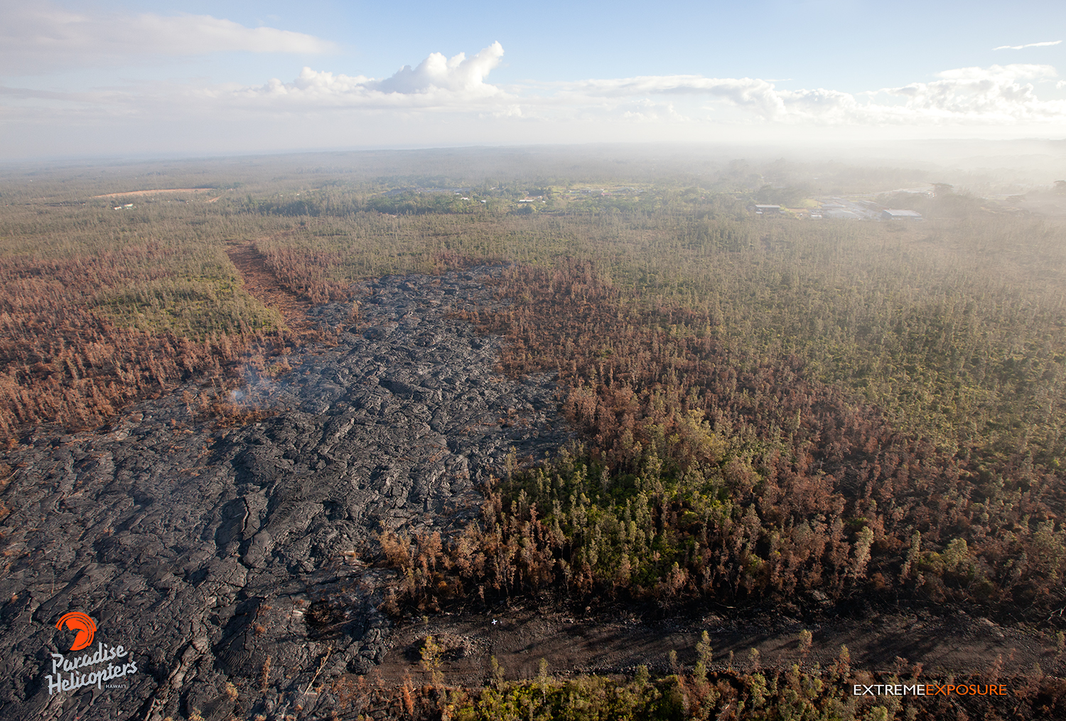
This photo, taken on Jan. 23, shows lava continuing to advance toward Highway 130. Photo credit: Extreme Exposure Media/Paradise Helicopters.
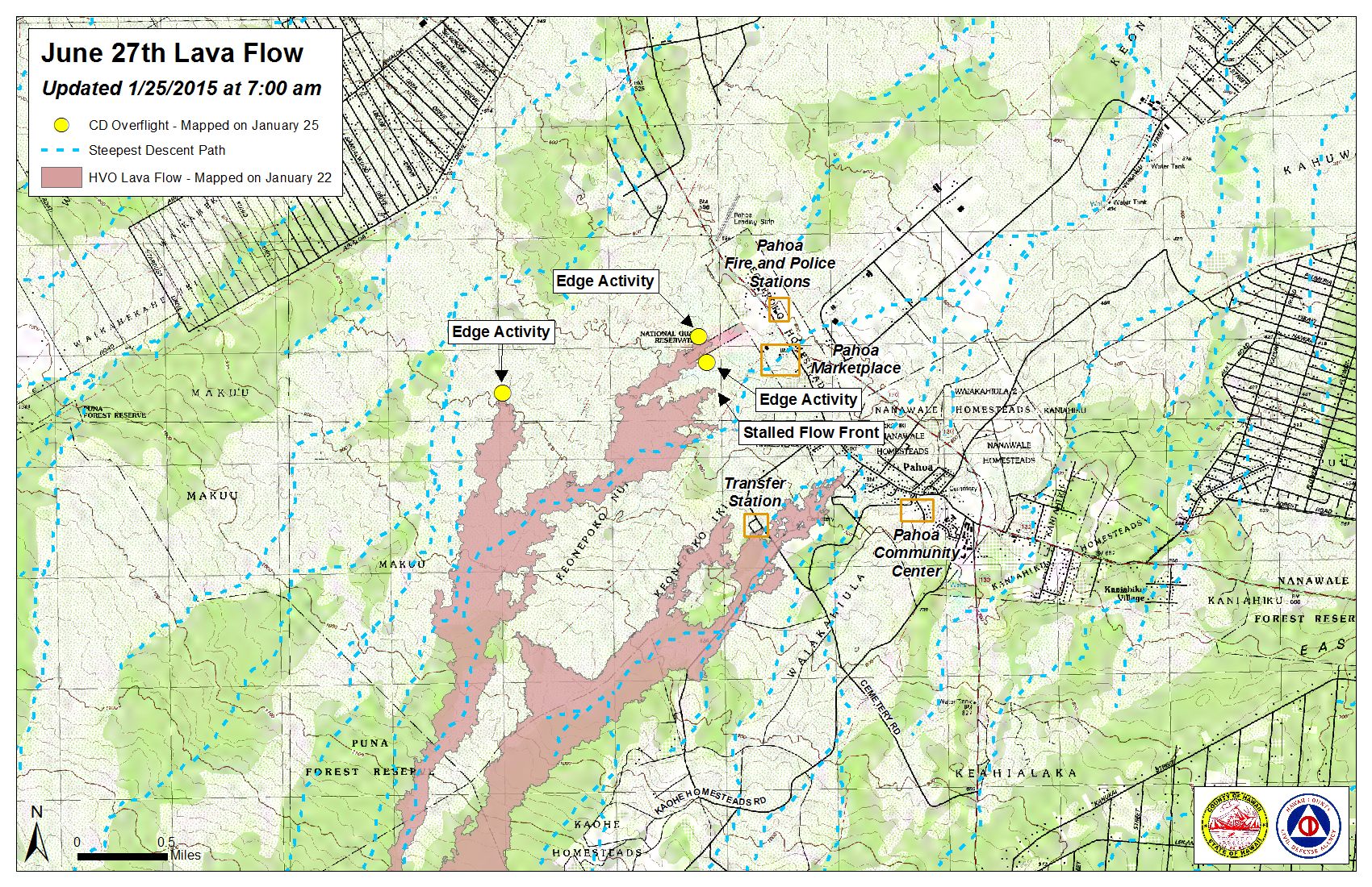
Hawai’i County Civil Defense lava flow map, as of Jan. 25 at 7 a.m. Civil Defense photo.
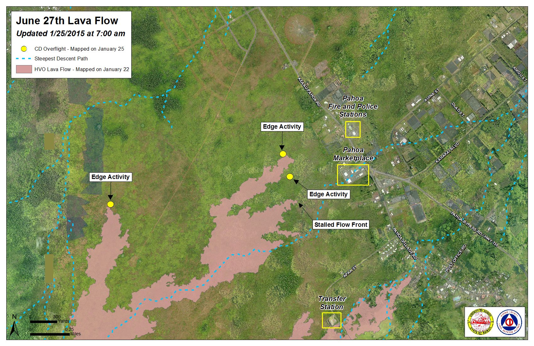
Hawai’i County Civil Defense lava flow map, as of Jan. 25 at 7 a.m. Civil Defense photo.
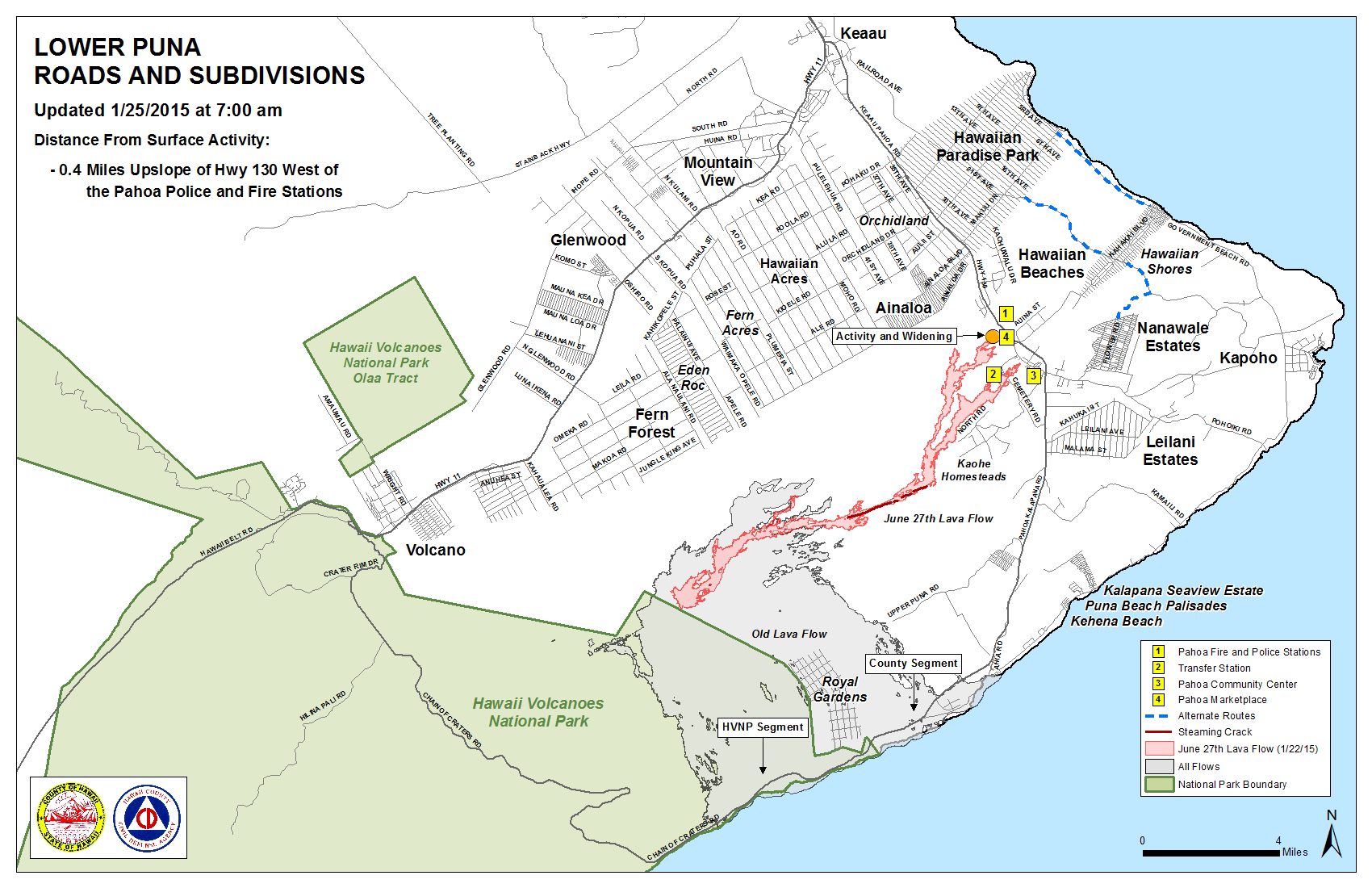
Hawai’i County Civil Defense lava flow map, as of Jan. 25 at 7 a.m. Civil Defense photo.
Sponsored Content


