

June 27 Lava Flow Update – 1/23/15
For the third day in a row, the distal tip of the June 27 lava flow remains stalled.
Hawai’i County Civil Defense Administrator Darryl Oliveira said that the flow edge remains active and continues to widen above the tip but has shown very little activity since Wednesday.
The last recorded movement of this portion of the flow was between Tuesday and Wednesday mornings, when the flow advanced 15 yards. At the current time, the flow remains 0.4 miles from the Highway 130 area just west, of the Pahoa Police and Fire Stations.
In addition to the stalled portion of the recently advancing flow, Civil Defense reported that the original leading flow front that was heading towards the Pahoa Marketplace continues to remain stalled, as does the south margin breakout that was active during the same time.
Civil Defense made note that the breakouts 1-1.5 miles upslope from the stalled original flow front along the north margin of the flow are showing slight activity but are sluggish without forward advancing movement.
Numerous additional breakouts were observed by Civil Defense during its Friday morning overflight, both along the north and south margins of the flow and within the flow pad.
None of the activity is posing a threat at the current time to communities in the area, according to Civil Defense, who says that they, along with Hawaiian Volcano Observatory, will continue to keep a watchful eye on activity and keep the public informed.
Fire personnel with the Hawai’i County Fire Department remain on the ground monitoring fire conditions in the area. All brush fires that have occurred in the area have been contained within the fire break perimeters and any burning is limited to hot spots and flare ups. Officials say there is no fire threat to residents or properties in the areas.
Light to moderate smoke conditions were reported Friday morning as a light south wind was blowing smoke in a northeast direction. As usual, these conditions have the possibility of change and those who are sensitive or have a history of respiratory issues should take precaution and remain indoors.
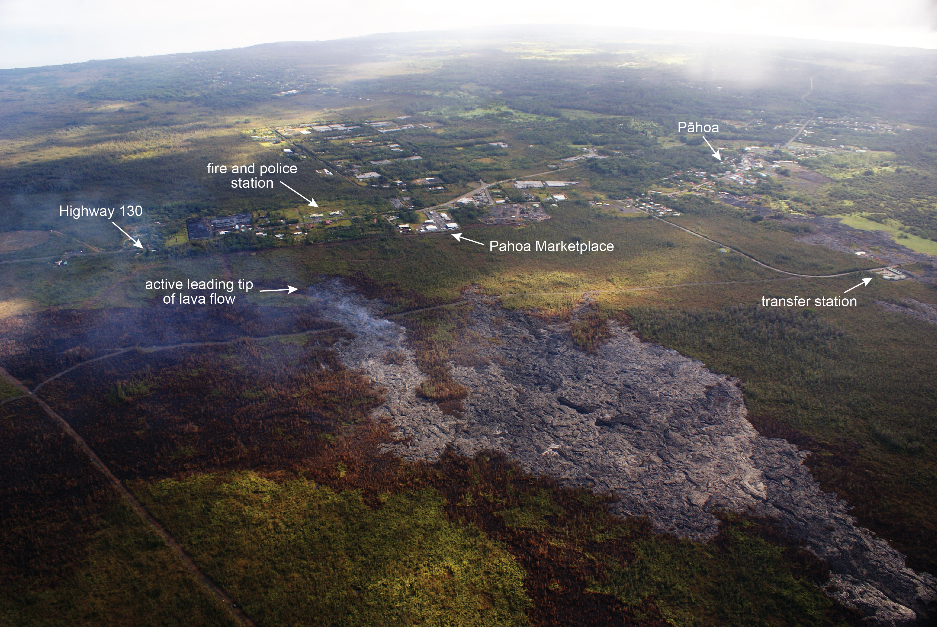
This HVO photo, taken Jan. 22, shows the active June 27 flow leading tip, with breakouts scattered in the distal portion of the flow. HVO photo.
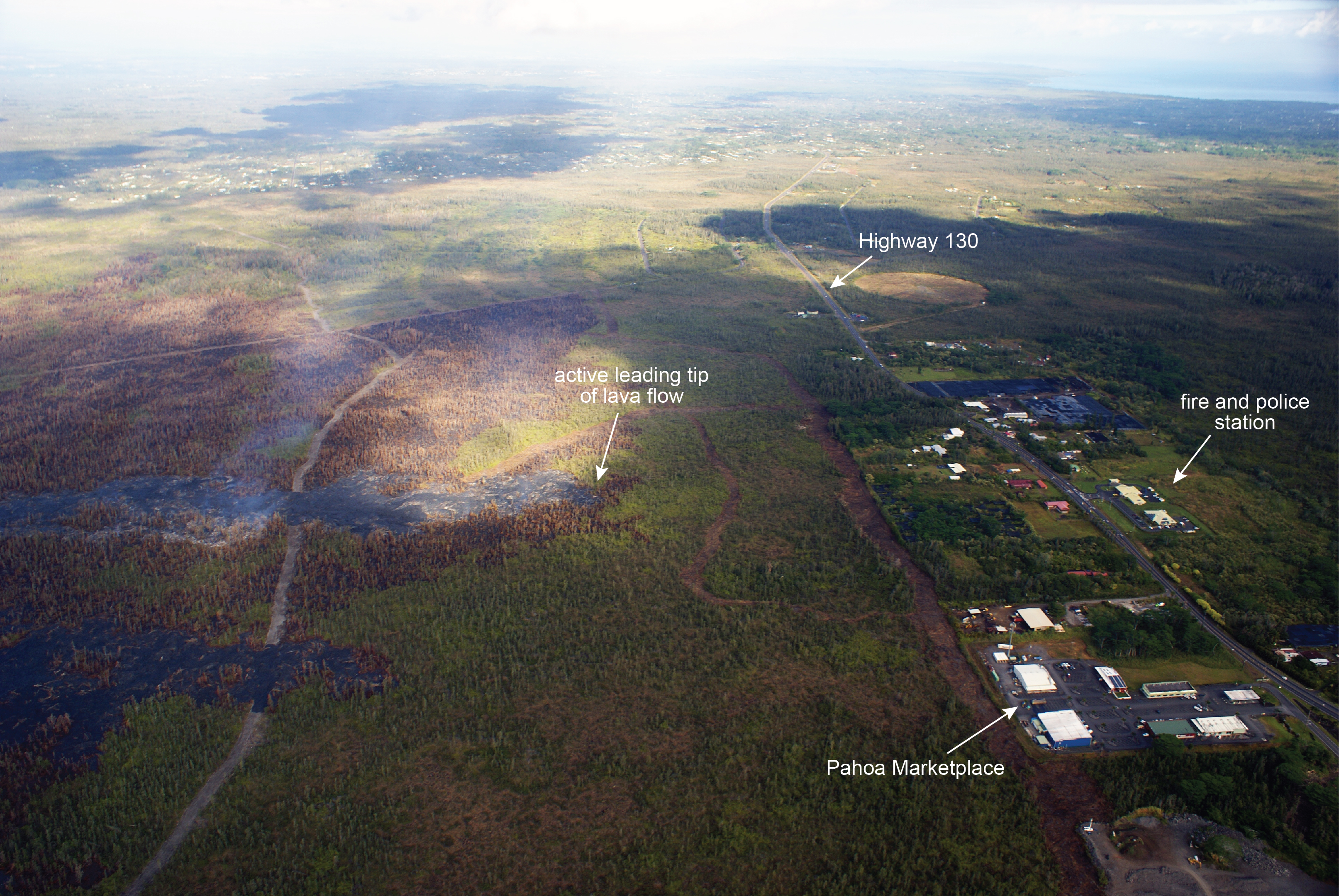
This photo looks north, and shows the position of the leading tip of the flow relative to Highway 130 on Jan. 22. The brown swaths cut through the forest are fire breaks, and the large brown area at the left side of the image is a recent burn scar. HVO photo.
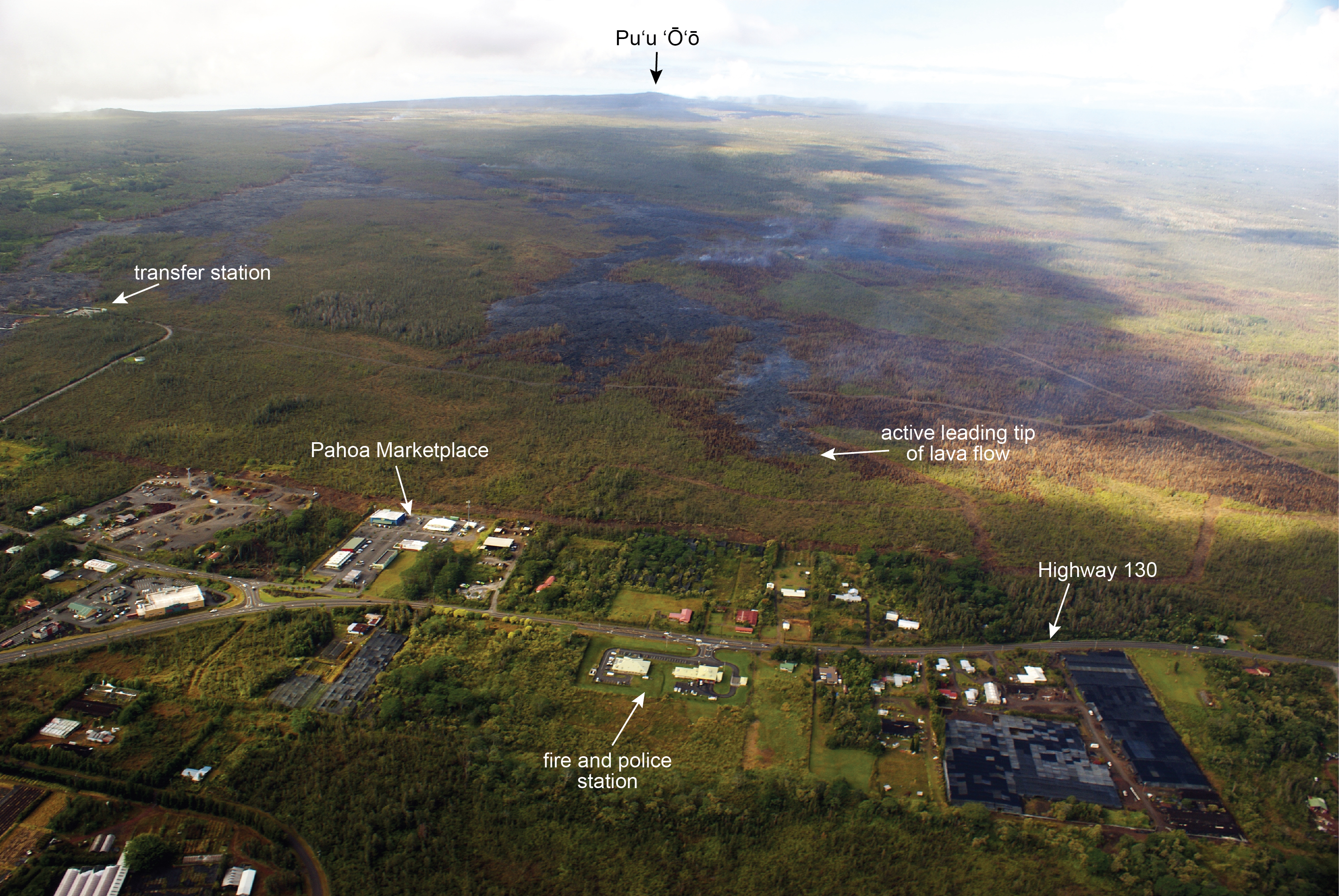
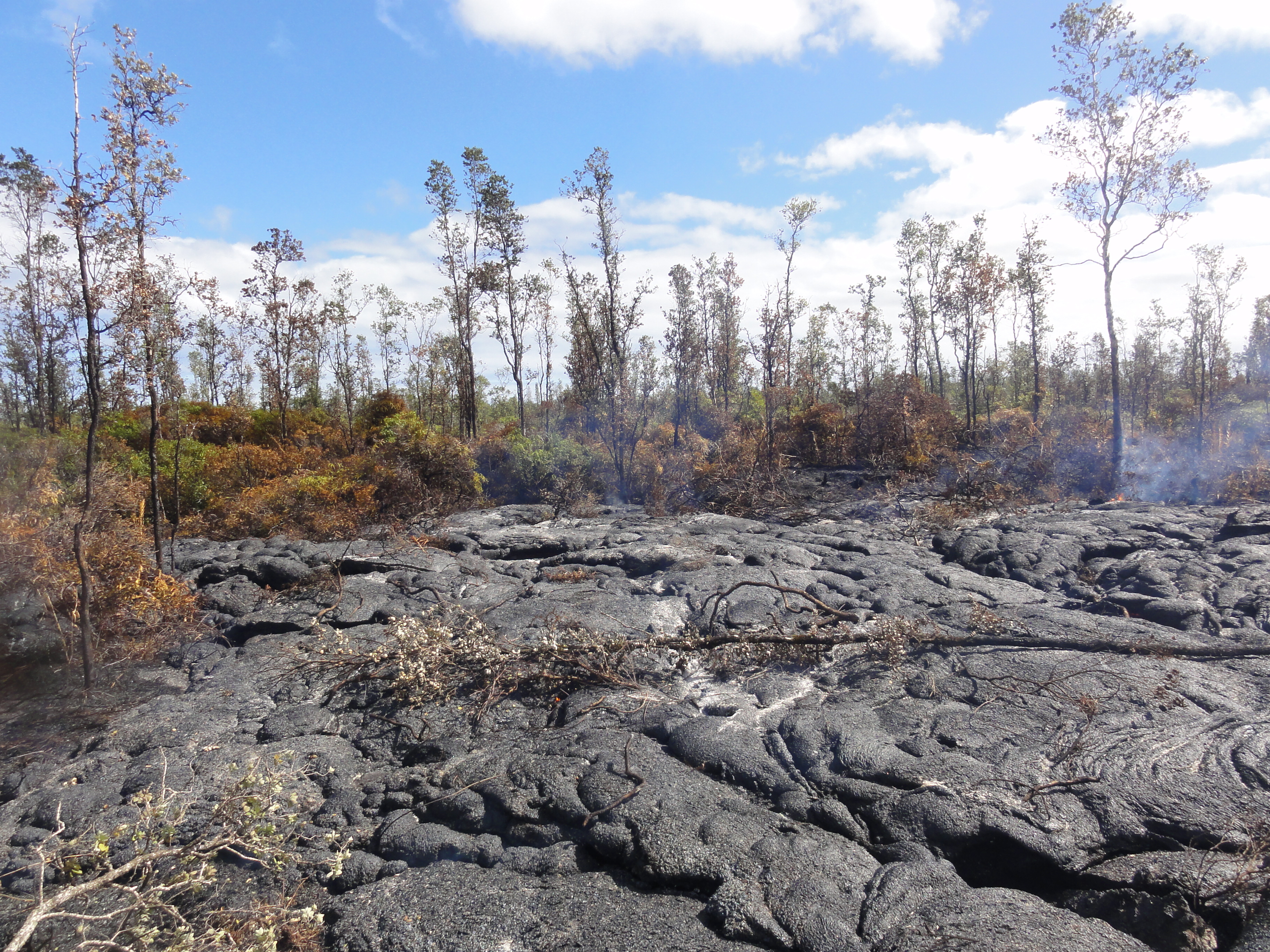
This photo taken, on Jan. 22, looks upslope at the leading tip of the flow. HVO photo.
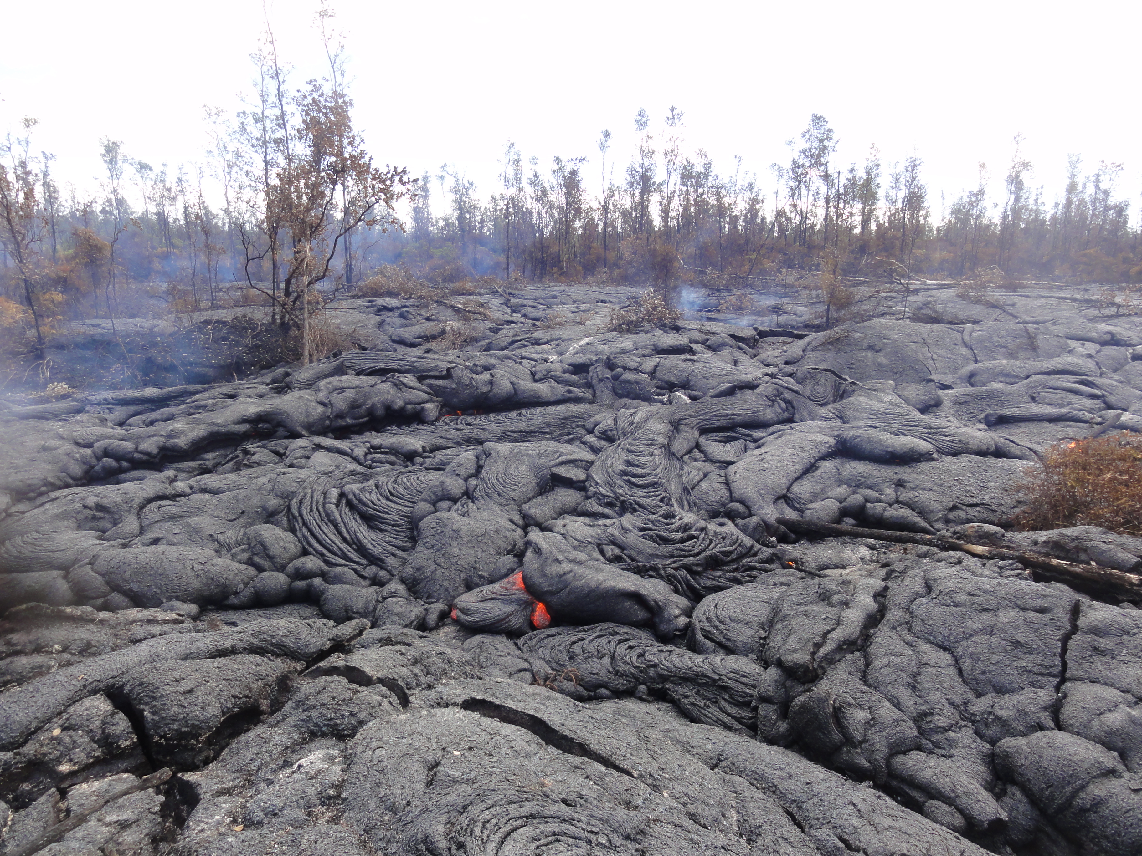
This photo, taken on Jan. 21, shows a ground look at an active portion of the June 27 lava flow. HVO photo.
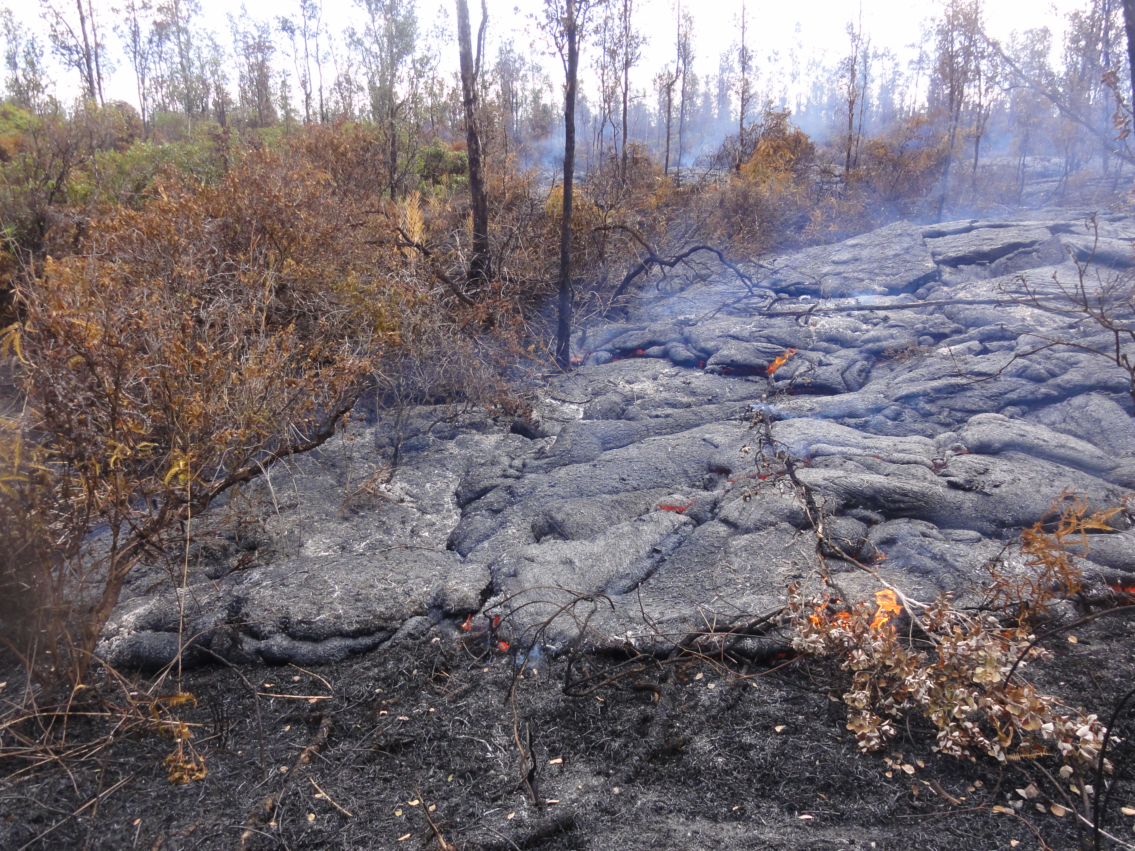
One of the small active breakouts along the distal tip of the flow is seen in this photo, taken on Jan. 21. HVO photo.
This photo, taken on Jan. 21, shows a downslope view at the leading tip of the flow, which is surrounded by burned vegetation. HVO photo.
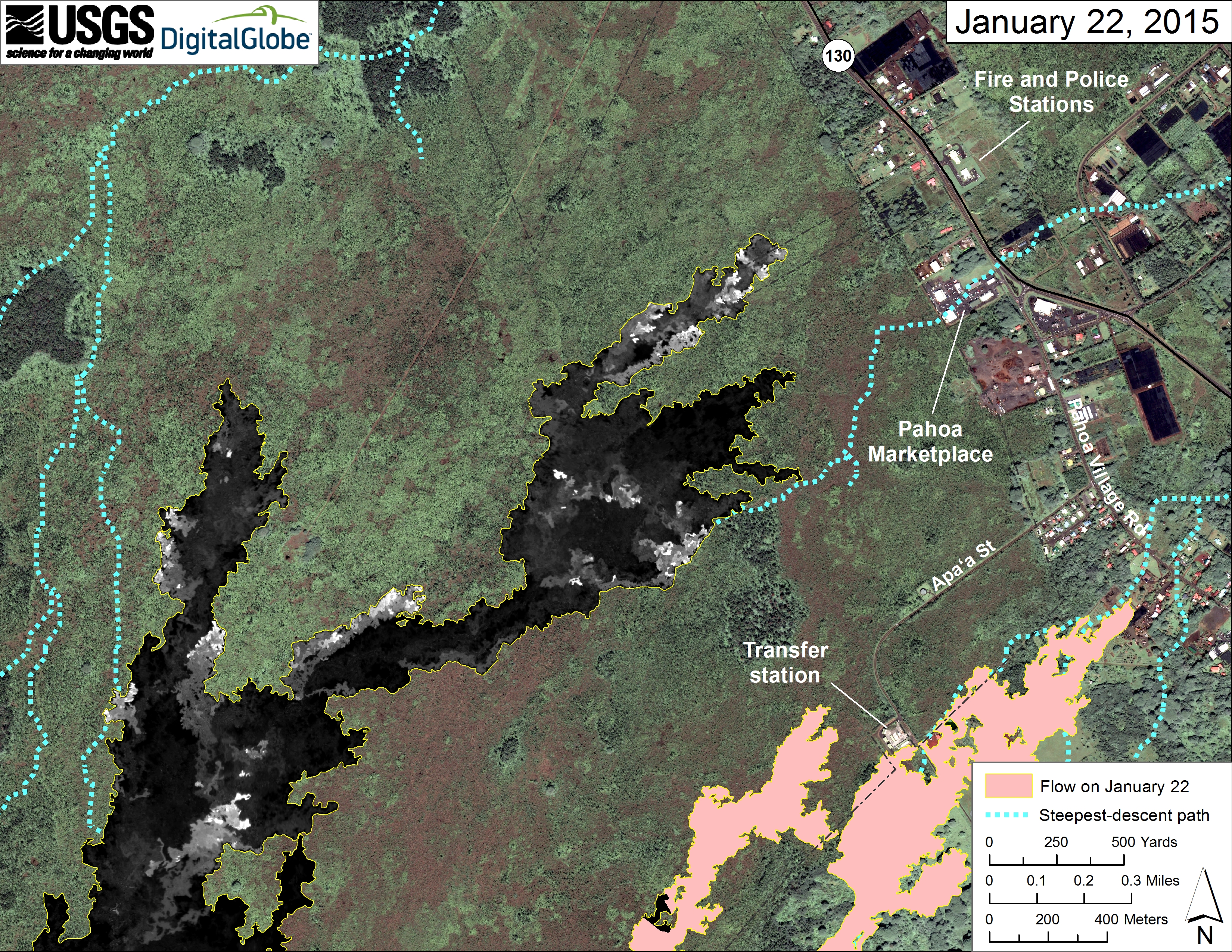
This map overlays a georegistered mosaic of thermal images collected during a helicopter overflight of the distal part of Kīlauea’s active East Rift Zone lava flow on Jan. 22 at about 9:15 AM. The base image is a satellite image acquired in March 2014. The perimeter of the flow at that time is outlined in yellow. Temperature in the thermal image is displayed as gray-scale values, with the brightest pixels indicating the hottest areas (white shows active breakouts). The blue lines show steepest-descent paths calculated from a 1983 digital elevation mode. HVO image.
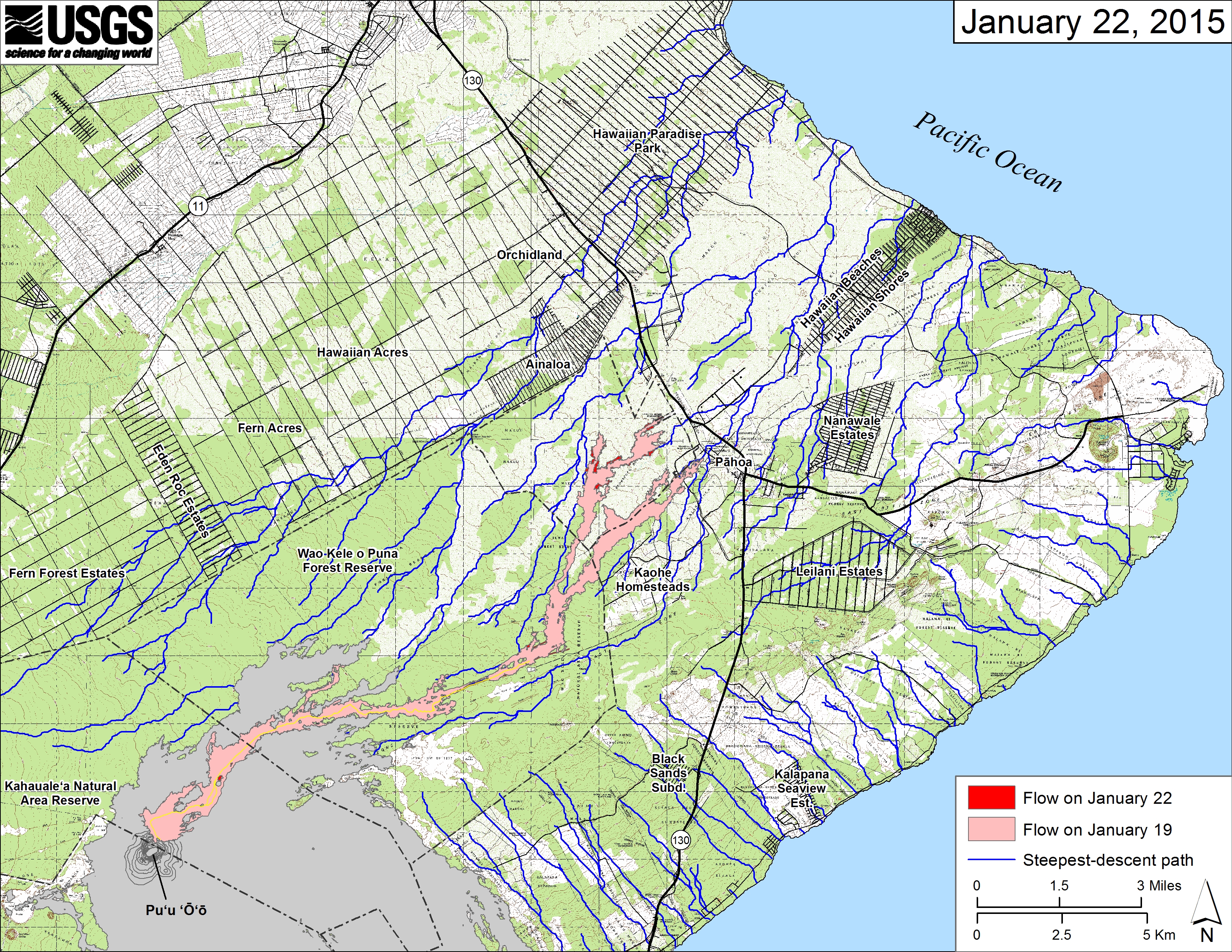
This large-scale map shows the distal part of Kīlauea’s active East Rift Zone lava flow in relation to nearby Puna communities. The area of the flow on Jan. 19 is shown in pink, while widening and advancement of the flow as of Jan. 22 is shown in red. The blue lines show steepest-descent paths calculated from a 1983 digital elevation model. HVO image.
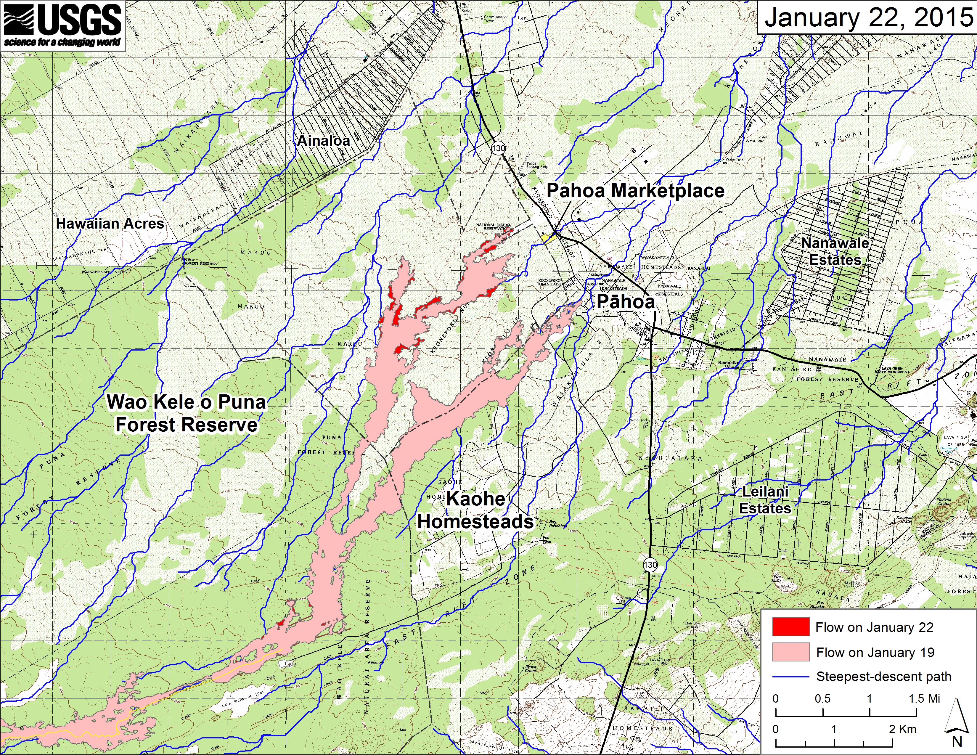
This small-scale map shows Kīlauea’s active East Rift Zone lava flow in relation to lower Puna. The area of the flow on Jan. 19 is shown in pink, while widening and advancement of the flow as of Jan. 22 is shown in red. The blue lines show steepest-descent paths calculated from a 1983 digital elevation mode. HVO image.
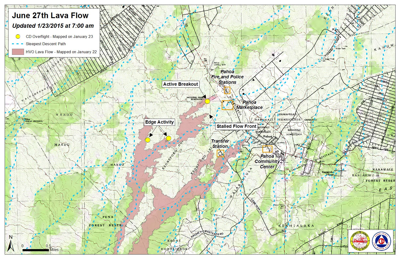
Hawai’i County Civil Defense lava flow map, as of Jan. 23 at 7 a.m. Civil Defense photo.
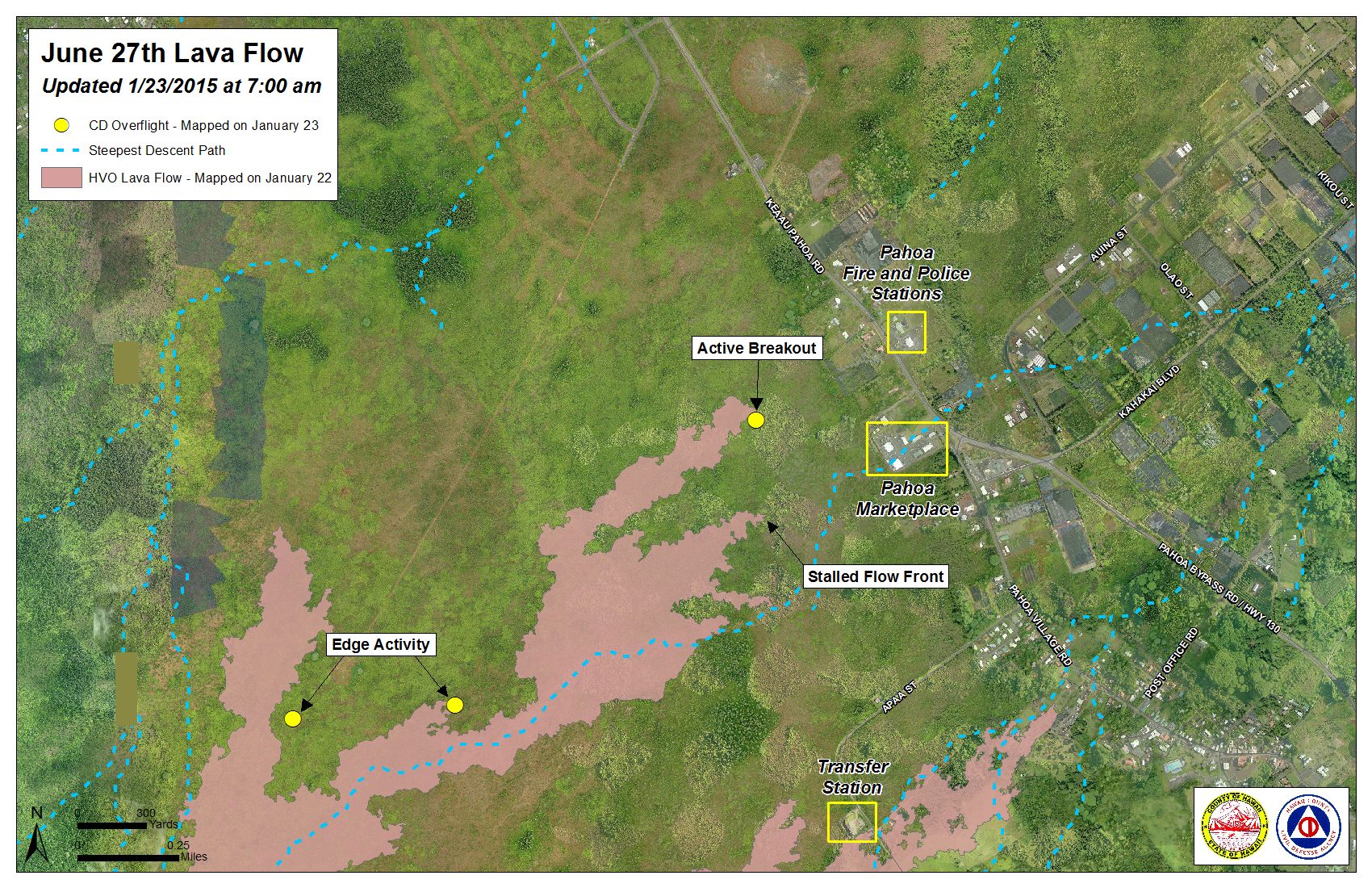
Hawai’i County Civil Defense lava flow map, as of Jan. 23 at 7 a.m. Civil Defense photo.
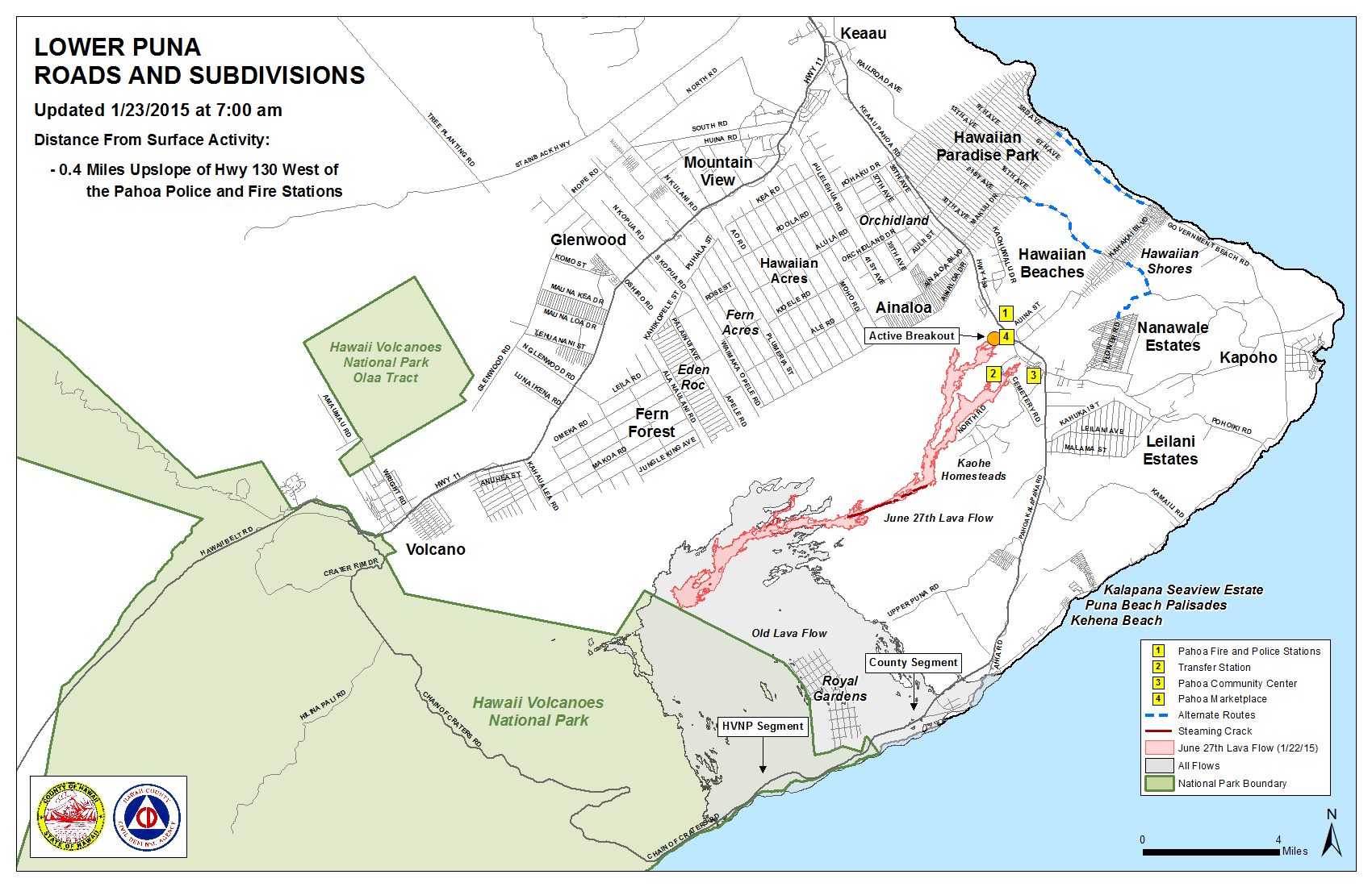
Hawai’i County Civil Defense lava flow map, as of Jan. 23 at 7 a.m. Civil Defense photo.
Sponsored Content


