

June 27 Lava Flow Update – 1/17/15
Hawai’i County Civil Defense was in the air early Saturday morning for an overflight assessment of the June 27 lava flow.
The flow, whose front continues to remain stalled, has an active portion that has advanced in spurts over the past week. Stemming from a breakout about 765 yards upslope from the stalled flow front along the north margin of the flow, a lobe of lava took off Tuesday, advancing a total of about 550 yards since. About 120 yards of the advancement has occurred since Friday.
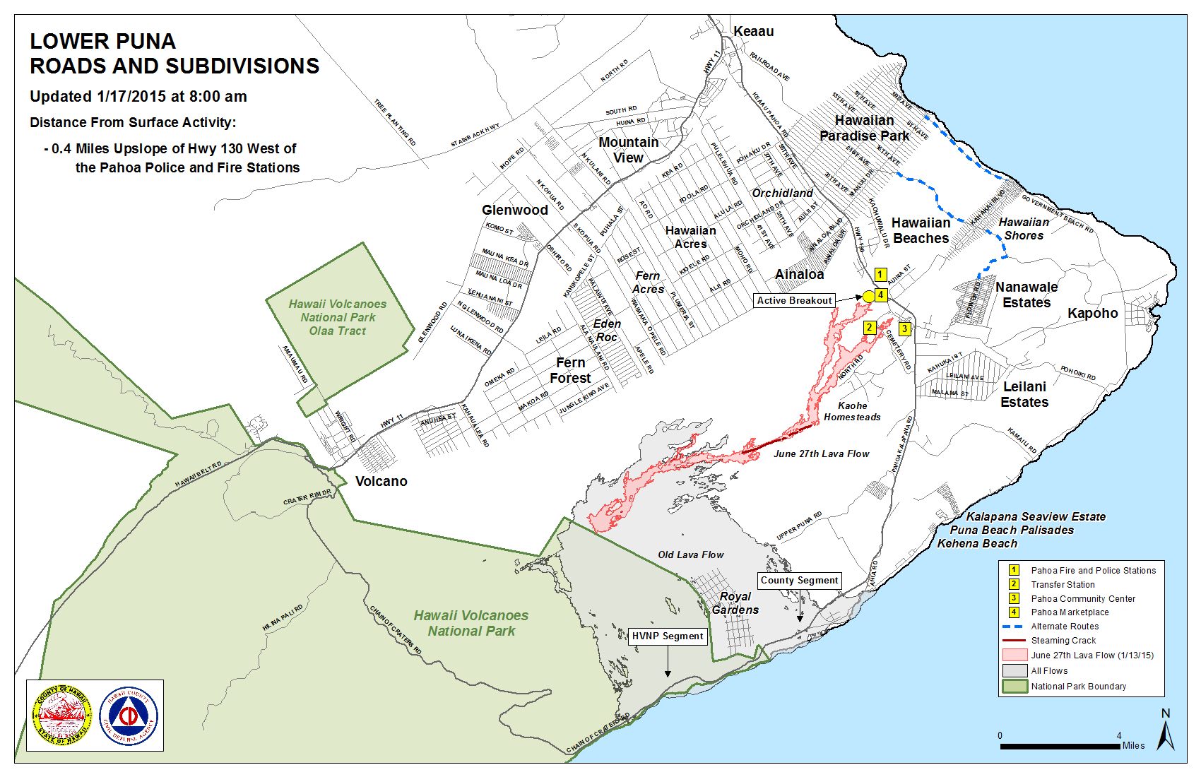
Civil Defense says that the active leading edge of that portion of the flow is about 0.4 miles from the area of Highway 130 to the west of the Pahoa Police and Fire Stations.
Additional breakouts along the north margin 1-1.5 miles upslope of the stalled flow front that were being watched closely over the past two weeks continue to remain active, according to officials. The two breakouts have shown very little advancement, moving sluggishly.
Close observations are being made of all flow activity in the area, as Civil Defense and Hawaiian Volcano Observatory maintain close contact about flow observations and data. Officials say that none of the lava activity is posing a current threat to residents or businesses in the area. The public will continue to be informed of activity.
Dry weather activity continues to allow the possibility of continuous brush fire activity in relation to the lava. Hawai’i Fire Department personnel and equipment remain on scene for monitoring and control purposes. Fires that have occurred over the past week have all been contained within the firebreak. Private contracted bulldozer companies have been aiding in the efforts to improve the fire break conditions. Civil Defense says that there is currently no fire threat to residents or properties in the area.
Continued heavy smoke and vog conditions were reported Saturday morning as the wind blows the smoke in a northeast direction over lower Puna and into Hilo. As usual, these smoke conditions have the possibility of increasing. Individuals who are sensitive or suffer from respiratory issues are advised to take necessary precautions and to remain indoors.
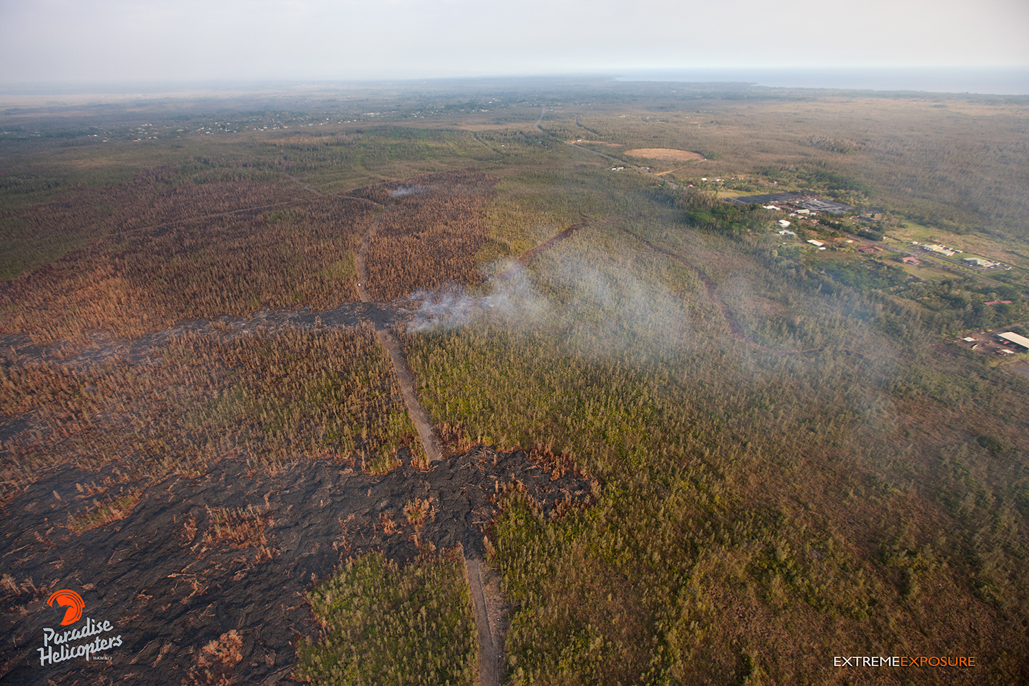
Taken on Jan. 16, this photo shows that the new active and advancing breakout has crossed the firebreak and was about the same distance from Hwy 130 as the stalled distal tip. Photo: Extreme Exposure Media/Paradise Helicopters.
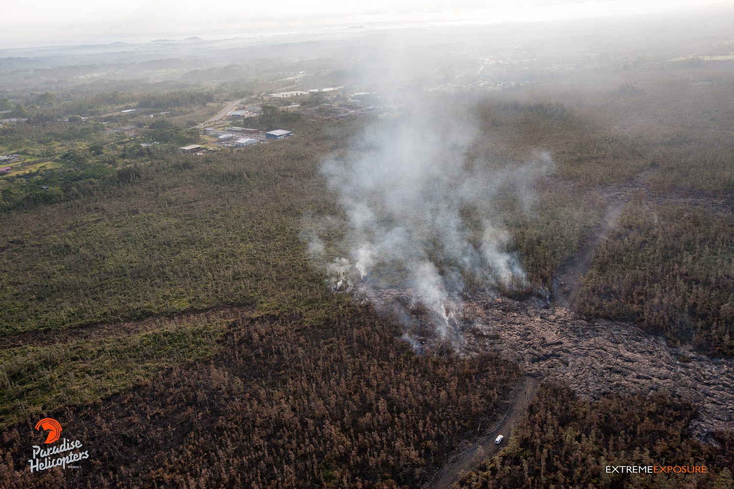
Taken on Jan. 16, this photo shows the most recent active and advancing portion of the flow. Photo: Extreme Exposure Media/Paradise Helicopters.
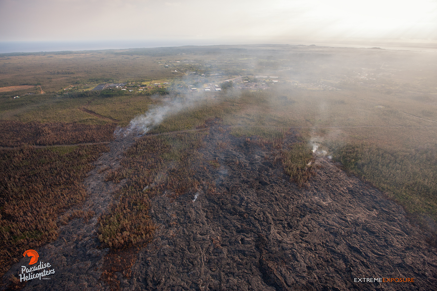
Taken on Jan. 16, this photo shows an aerial view of the active and advancing portion of the flow. Photo: Extreme Exposure Media/Paradise Helicopters.
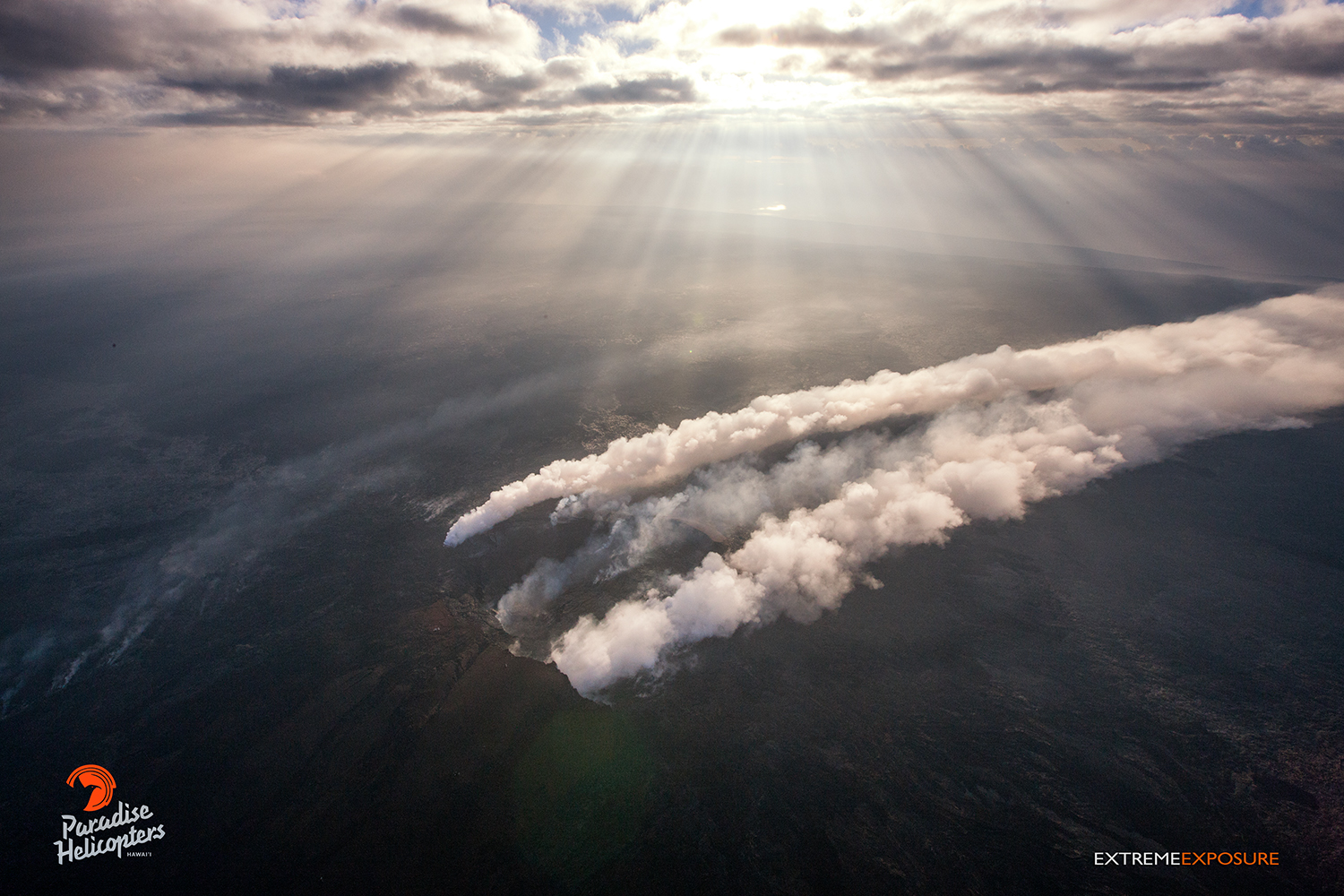
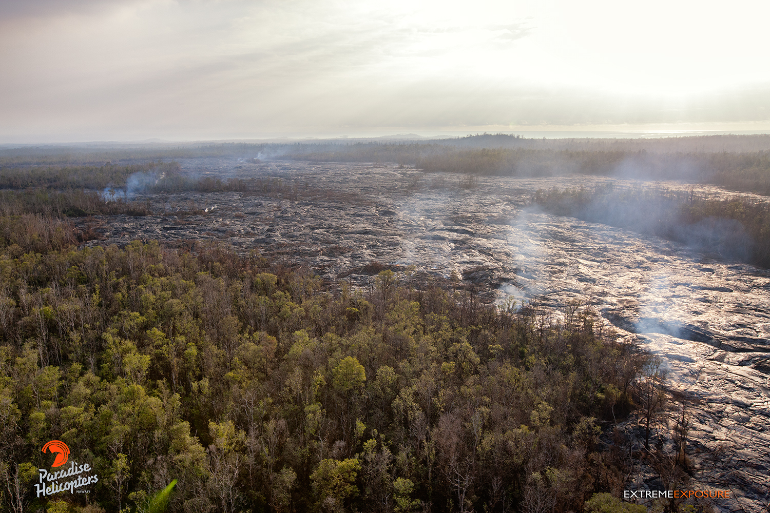
Taken on Jan. 16, this photo shows a Northerly wind blowing the plume rising out of Pu‘u ‘O‘o crater to the south, while the voggy and smokey air is illuminated by the crepuscular rays of sunshine. Photo: Extreme Exposure Media/Paradise Helicopters.
Taken on Jan. 16, this photo shows activity near the old geothermal pad that has decreased. Photo: Extreme Exposure Media/Paradise Helicopters.
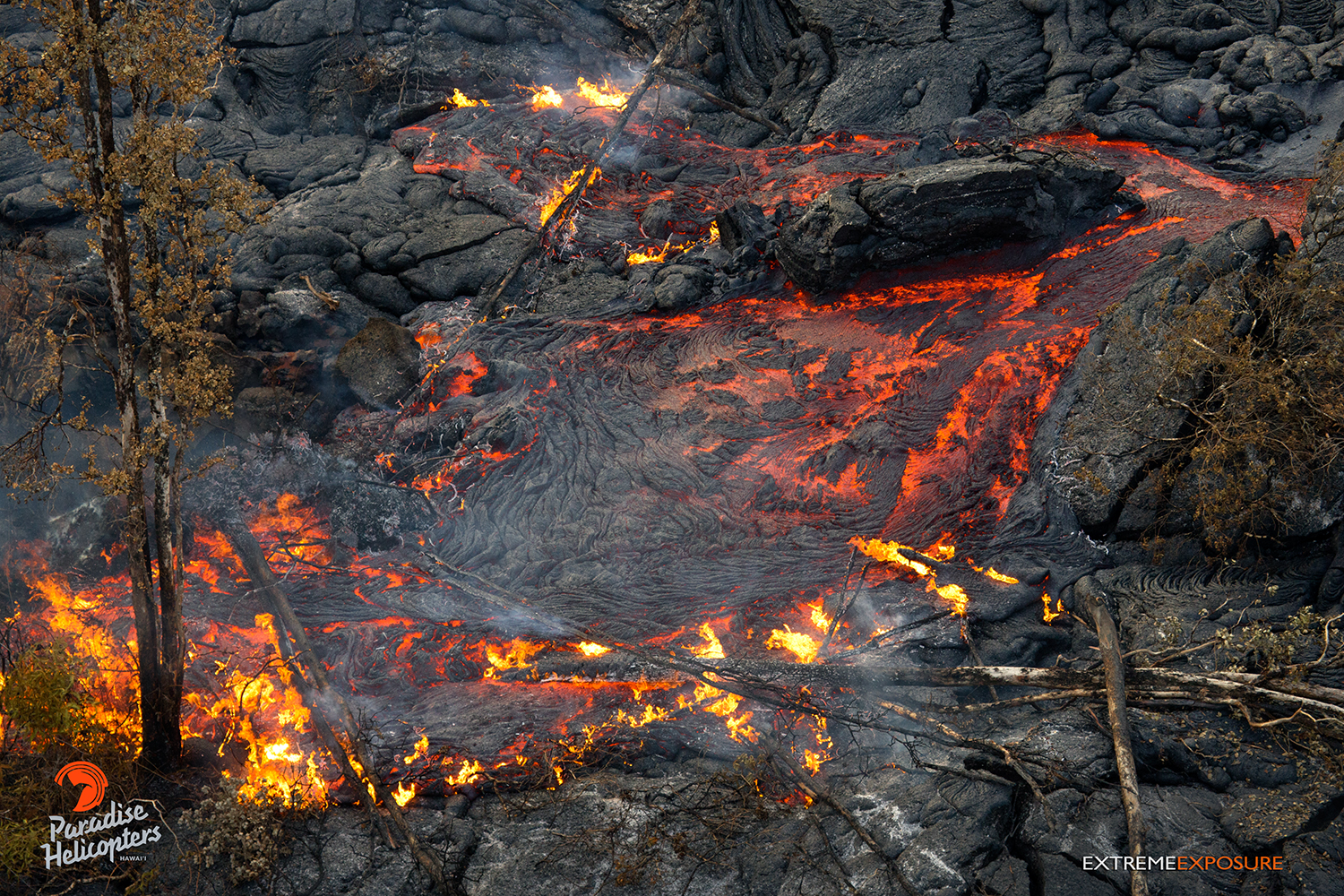
Taken on Jan. 16, this photo shows the cooled crust of a flow that broke open and released pressure from within. Photo: Extreme Exposure Media/Paradise Helicopters.
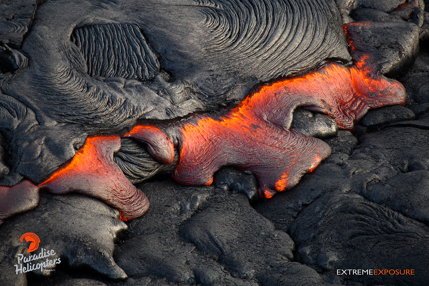
Taken on Jan. 16, this photo shows lava pouring from the fractured side of a tube. Photo: Extreme Exposure Media/Paradise Helicopters.
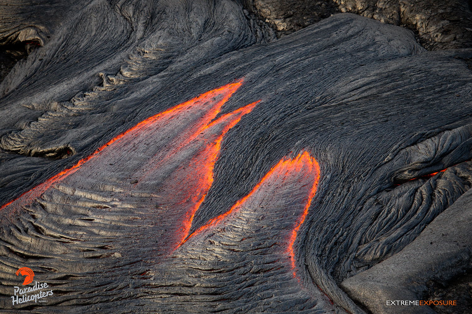
Taken on Jan. 16, this photo shows a narrowing river of lava streaming from the side of a tube near the perched channel. Photo: Extreme Exposure Media/Paradise Helicopters.
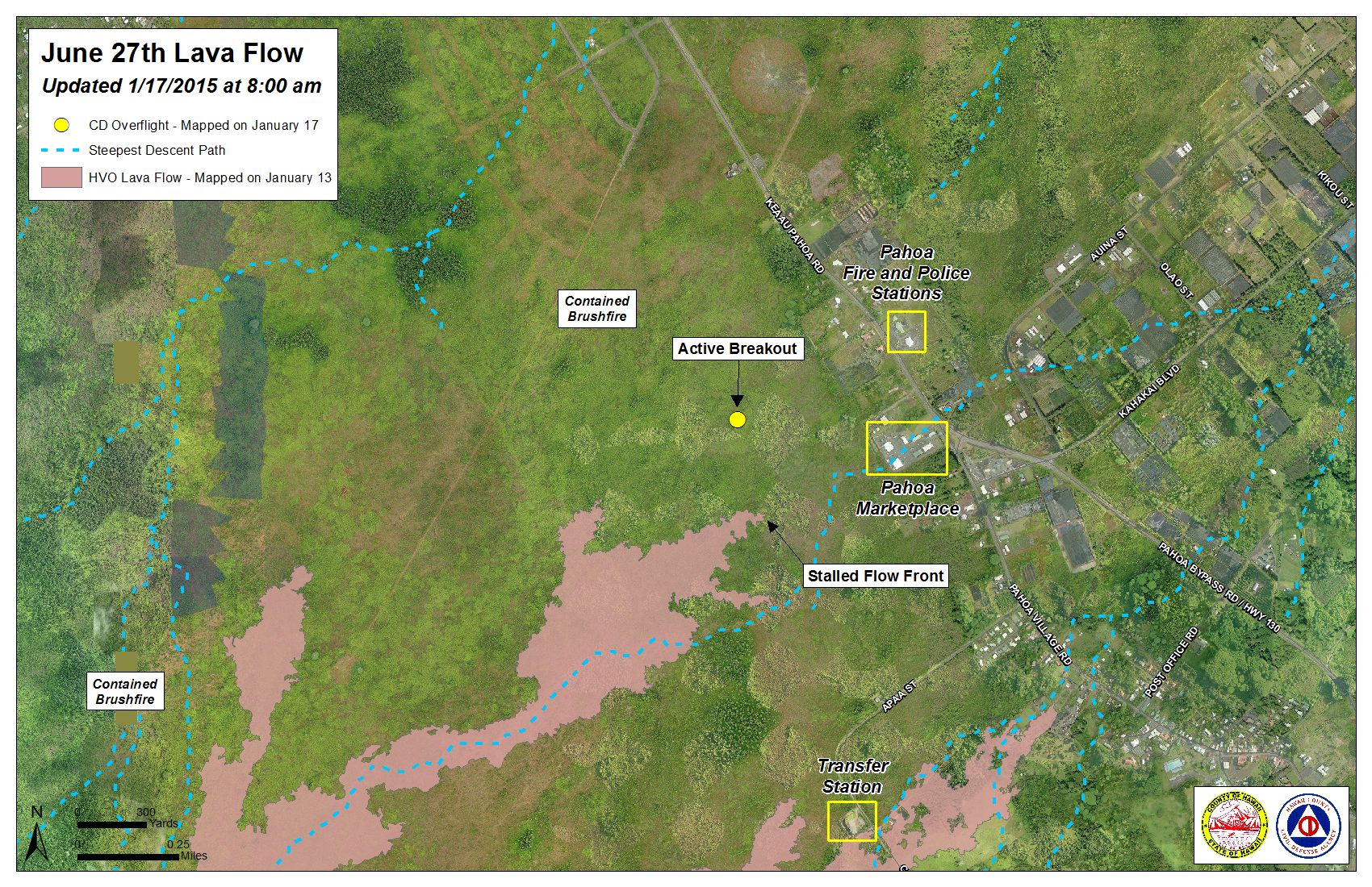
Hawai’i County Civil Defense lava flow map, as of Jan. 17 at 8 a.m. Civil Defense photo.
Hawai’i County Civil Defense lava flow map, as of Jan. 17 at 8 a.m. Civil Defense photo.
Sponsored Content


