

June 27 Lava Flow Update – 1/16/15
Hawai’i County Civil Defense’s Friday morning overflight assessment has been delayed, however, preliminary ground assessments have taken place.
According to Civil Defense, the original flow front and the south margin breakout both remain stalled.
The breakout along the north side of the flow continues to remain active and has advanced further downslope about 50 yards since Thursday. This flow area has also shown signs of widening and is currently located about 0.6 miles upslope from the Highway 130 area, just west of the Pahoa Police and Fire Stations.
In addition, the two breakouts 1-1.5 miles upslope from the stalled flow front on the north margin continue to remain active. Civil Defense says that more information will be determined following a more thorough assessment, planned for later Friday.
Civil Defense says that none of the activity currently poses a threat to residents or businesses in the area and they, along with Hawaiian Volcano Observatory, will continue to keep a close watch over the lava flow activity and keep the public informed of current activity and changes.
Fire activity has been active over the course of the week. Civil Defense says that due to ongoing dry weather conditions, brush fire activity is likely to continue as a result of the lava flow. The Hawai’i Fire Department is on scene monitoring fire conditions.
According to officials, the fires that began on Thursday have been contained within the fire break perimeters. Improvements are being made to fire break conditions. At the current time, there is no fire threat to residents or properties.
Continued heavy smoke and vog conditions fill the air in lower Puna through Hilo, as a southwest wind is blowing smoke in a northeast direction. These smoke conditions have the possibility of increasing. Officials advise individuals who are sensitive or have respiratory issues to take precautions as necessary and remain indoors.
This photo, taken on Jan. 14, shows the northern lobe advancing to the northeast. The leading edge touched off a brush fire that moved toward the Ainaloa Subdivision, steered by the light southeasterly winds. Photo: Extreme Exposure Media/Paradise Helicopters.
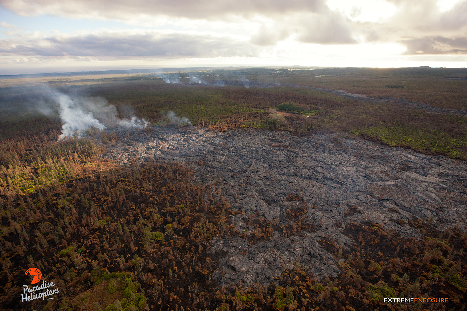
This photo, taken on Jan. 14, shows a branch from the flow that threatened the Pahoa Marketplace, that was active and slowly approaching the firebreak. The flow’s outer edges continue to expand as well. Photo: Extreme Exposure Media/Paradise Helicopters.
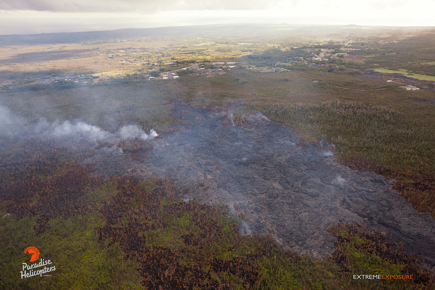
This photo, taken on Jan. 14, shows two branches that continued to advance toward Highway 130 on Wednesday. Brush fires spawned by these areas of activity spread toward the northwest due to the light southeasterly winds. Photo: Extreme Exposure Media/Paradise Helicopters.
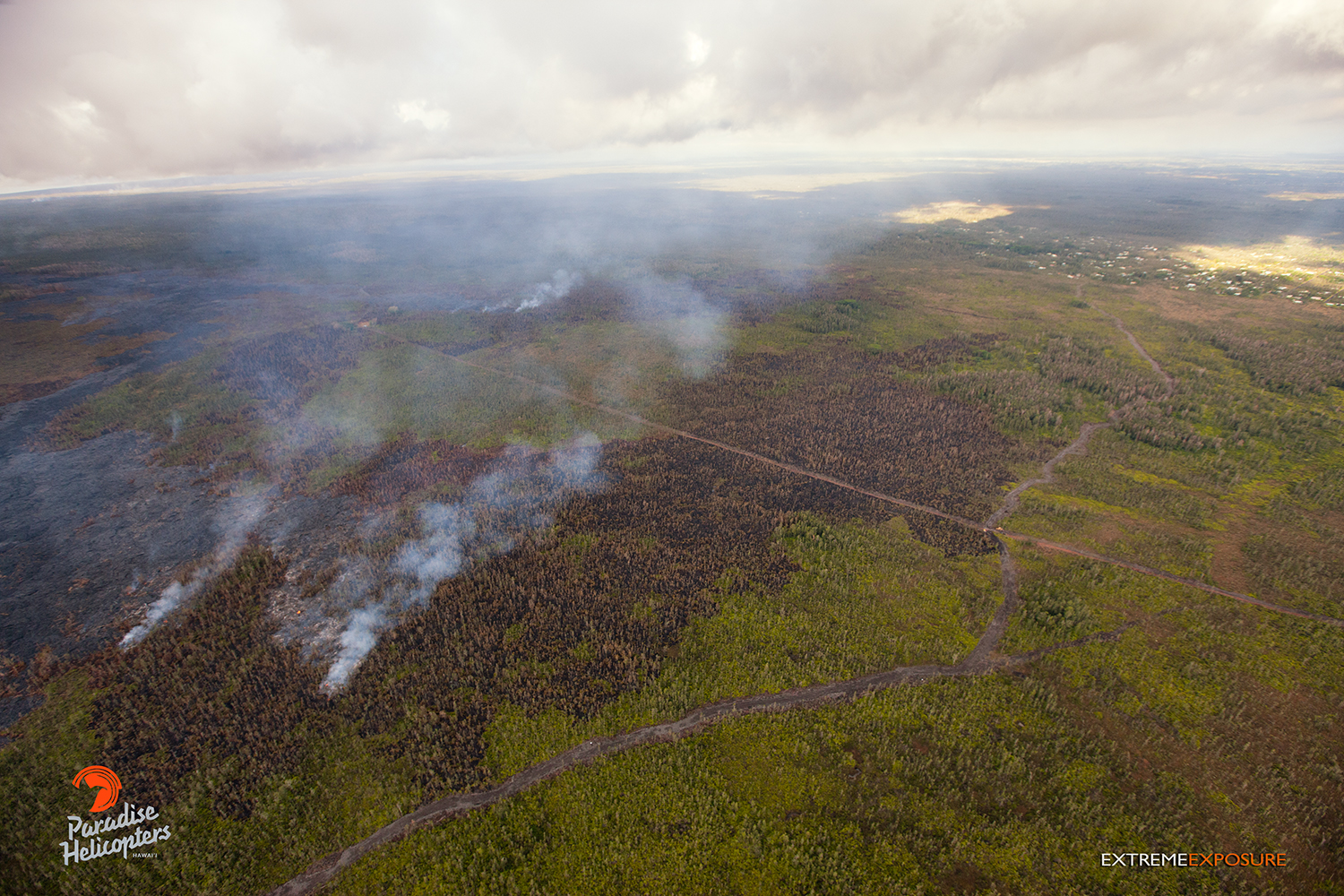
This photo, taken on Jan. 14, shows activity that continues near the old geothermal pad a few miles upslope of Pahoa. Photo: Extreme Exposure/Paradise Helicopters.

This photo, taken on Jan. 14, shows light and variable winds, coupled with an inversion layer, trapping vog and smoke close to the ground in the Hawaiian Paradise Park area. Photo: Extreme Exposure/Paradise Helicopters.
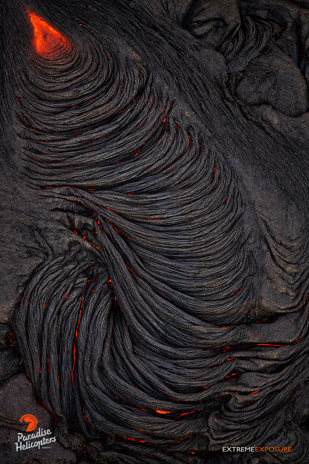
This photo, taken Jan. 14, shows a slowly cooling finger of pahoehoe creating ropey braids. Photo: Extreme Exposure Media/Paradise Helicopters.
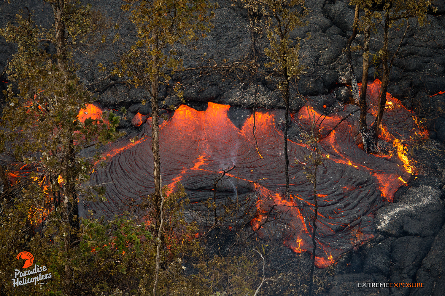
This photo, taken on Jan. 14, shows a breakout along the edge of the flow expanding the flow field above the Pahoa Marketplace. Photo: Extreme Exposure Media/Paradise Helicopters.
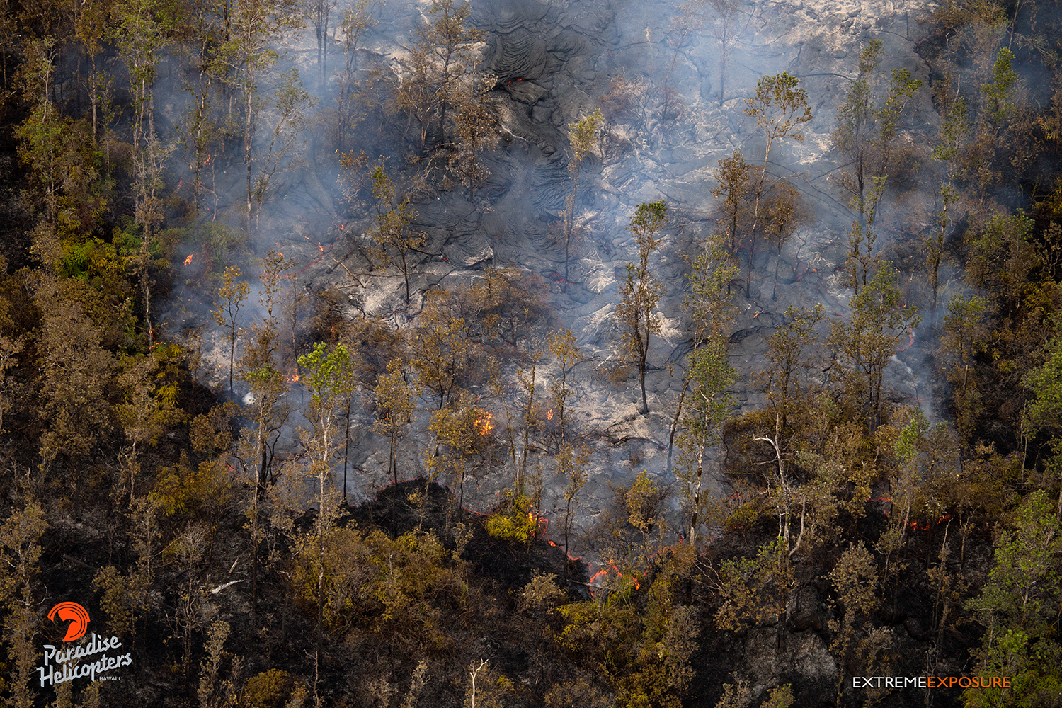
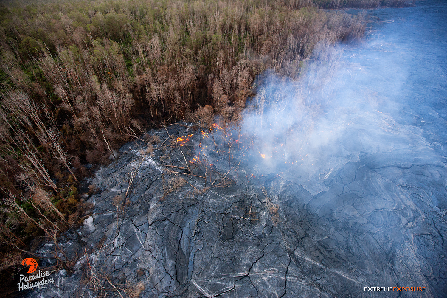
This photo, taken on Jan. 15, shows an active lobe as it moves through an area recently scorched by a brush fire it spawned. Photo: Extreme Media Exposure/Paradise Helicopters.
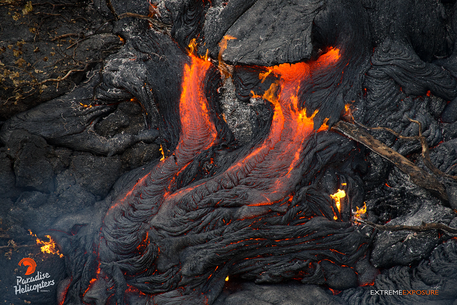
In this photo, taken on Jan. 14, an increase in back pressure causes a tube’s crust to break and releases molten lava, slowly expanding the flow field above the Pahoa Marketplace. Photo: Extreme Media Exposure/Paradise Helicopters.
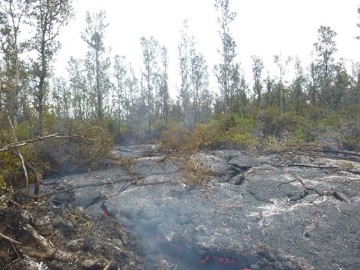
Hawai’i County Civil Defense lava flow image taken from the ground on Jan. 16. Civil Defense photo.
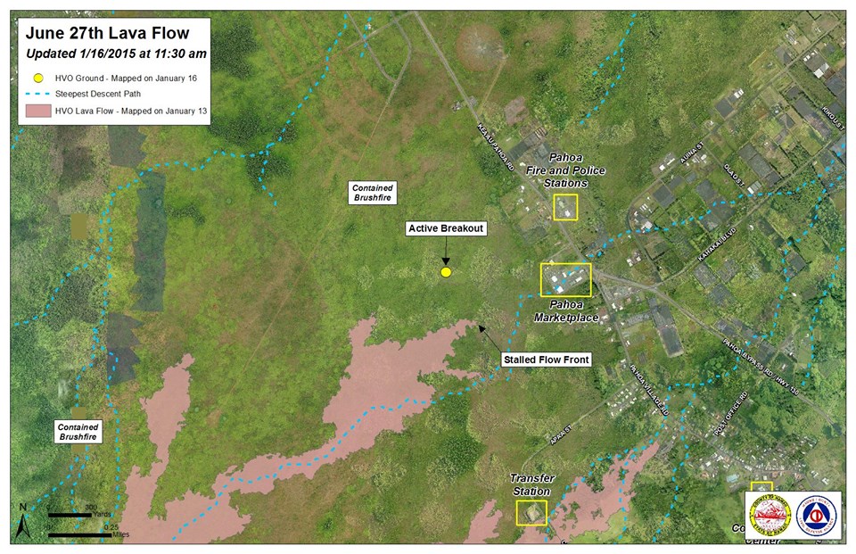
Hawai’i County Civil Defense lava flow map, as of Jan. 16 at 11:30 a.m. Civil Defense photo.
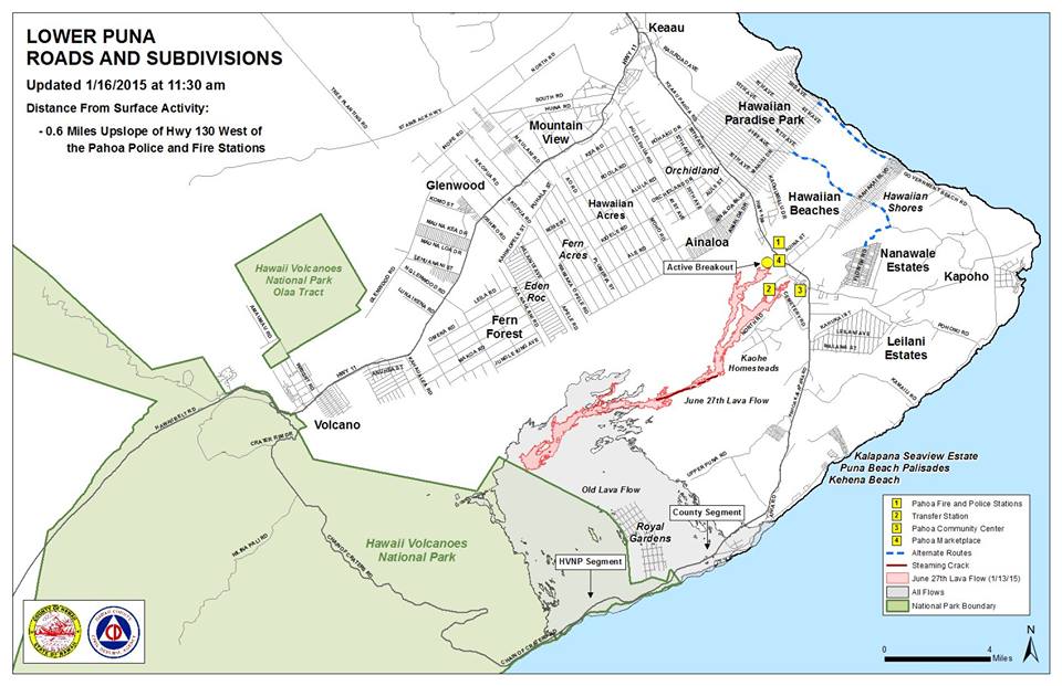
Hawai’i County Civil Defense lava flow map, as of Jan. 16 at 11:30 a.m. Civil Defense photo.
Sponsored Content


