

June 27 Lava Flow Update – 1/13/15
The two north margin breakouts of the June 27 lava flow continue to move slowly Tuesday, as Hawai’i County Civil Defense reported following its morning overflight assessment that the flow had only advanced 20 yards since Monday.
Located about 1-1.5 miles upslope from the stalled lava flow leading edge, the branches of active flow continue to move in a northeast direction.
For over a week, the flow front that threatened the Pahoa Marketplce has remained stalled 0.5 miles from the Highway 130 and Pahoa Village Road intersection with no activity along the edges of the flow front. In addition, the south margin breakout also continues to remain stalled.
Civil Defense noted surface activity Tuesday, including widening of the flow front about 300 yards upslope from the flow front. Civil Defense Administrator Darryl Oliveira told reporters during a media briefing Monday that the lava widening in this section has widened to about 500 yards, showing that although the narrow flow front is stalled, activity continues not too far behind.
Additional activity, including breakouts, continue along both the south and north margins of the flow in upslope areas. Civil Defense, along with Hawaiian Volcano Observatory personnel, will continue to maintain a watchful eye and monitor the area for changes.
For the second day in a row, heavy smoke and vog conditions were reported as a southwest wind was blowing smoke in a northeast direction, impacting areas of lower Puna through Hilo. These conditions, as usual, have the possibility of increasing and officials advise individuals who are sensitive or have respiratory issues to take necessary precautions and remain indoors.
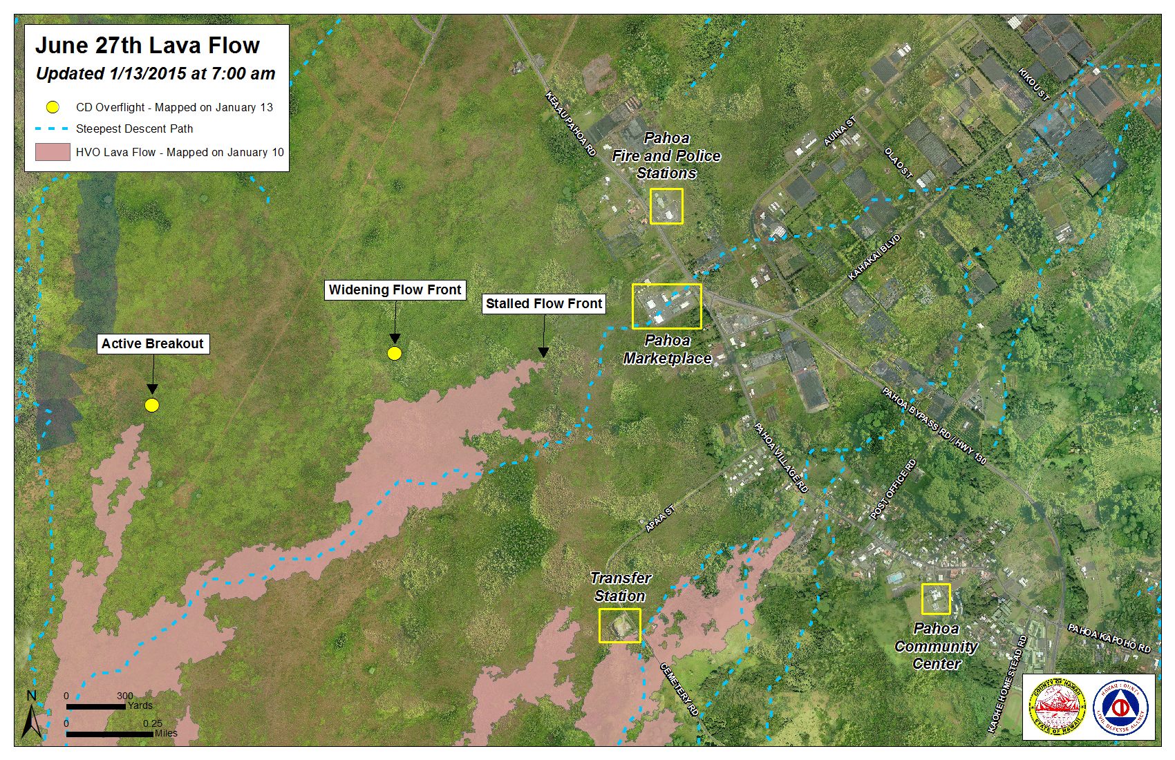
Hawai’i County Civil Defense lava flow map, as of Jan. 13 at 7 a.m. Civil Defense photo.
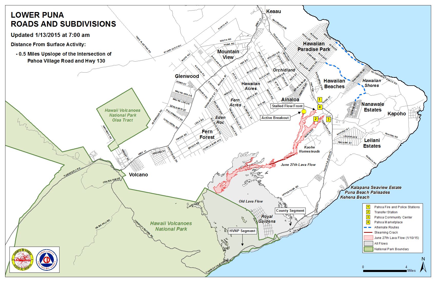
Hawai’i County Civil Defense lava flow map, as of Jan. 13 at 7 a.m. Civil Defense photo.
Sponsored Content


