

WEEKEND SURF: New NW Expected
Alerts
There are no ocean alerts posted at this time.
**Saturday and Sunday weather charts are below. Click directly on the images below to make them larger. Charts include: Big Island projected winds, tides, swell direction & period and expected wave heights.**
 Big Island Surf Forecast, Thursday, December 25
Hilo side: Surf heights are expected from thigh to about chest high at the best breaks along the Hamakua coast.
Kona side: Surf heights expected from ankle to about waist high, possibly bigger on the sets at the best breaks.
South: Surf is waist to chest high for exposures open to the trade swell. Flat to ankle high everywhere else.
 A new northwest is forecasted for Saturday into Sunday building to a few feet overhead to possibly double overhead at the best breaks open to the swell. A reinforcement is on tap for Monday with a larger swell expected midweek.
Super small trace amounts of swell expected out of the SPAC. Not much to get excited about.
Keep in mind, surf heights are measured on the face of the wave from trough to crest. Heights vary from beach to beach, and at the same beach, from break to break.
**Click here for your detailed Big Island weather report.**

Image: NOAA / NWS

Image: NOAA / NWS
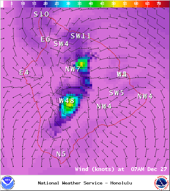
Image: NOAA / NWS
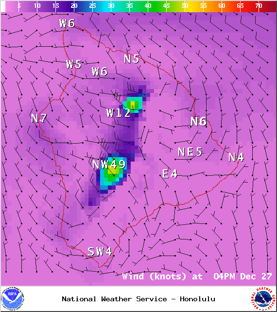
Image: NOAA / NWS

Image: NOAA / NWS

Image: NOAA / NWS

Image: NOAA / NWS
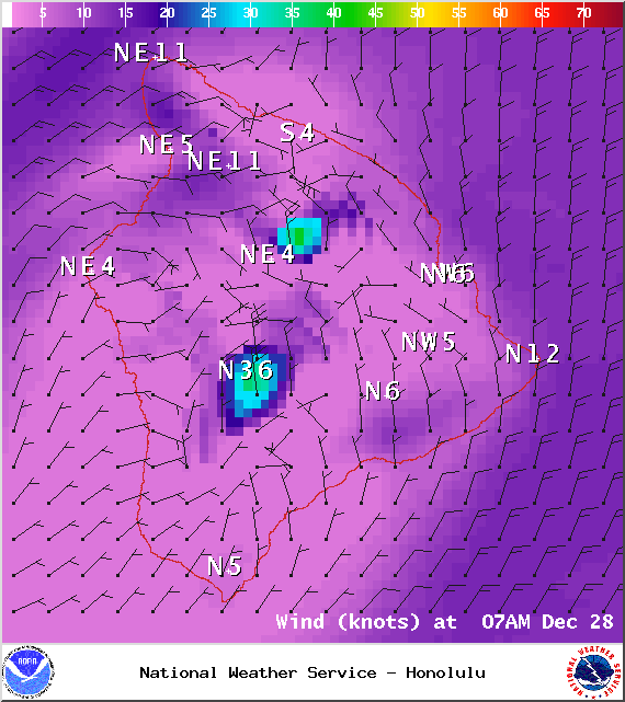
Image: NOAA / NWS
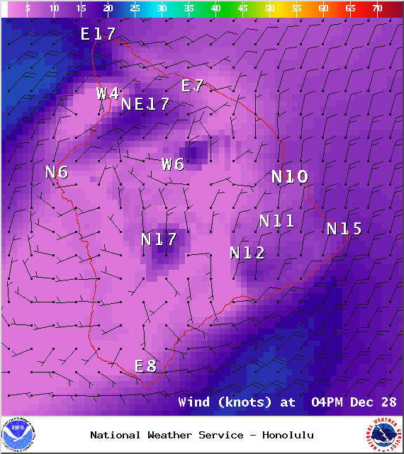
Image: NOAA / NWS
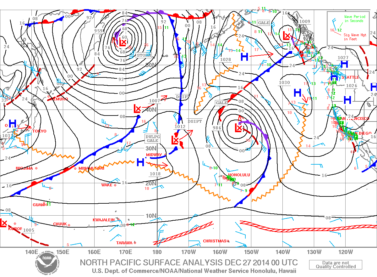
Image: NOAA / NWS
Sponsored Content


