East Hawaii News

June 27 Lava Flow Update – 12/23/14

Play
Listen to this Article
1 minute
Loading Audio... Article will play after ad...
Playing in :00
A
A
A

The June 27 lava flow front appears to have stalled.

Hawai’i County Civil Defense’s Tuesday morning overflight assessment shows that there has been no advancement in the leading flow front since 4:30 p.m. Monday.

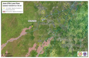
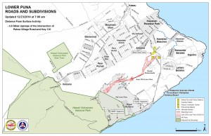
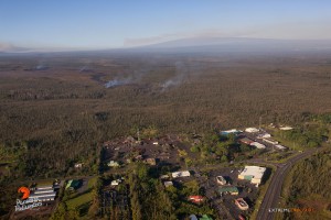
Currently, the leading edge of the flow is about 0.6 miles upslope from the Highway 130 and Pahoa Village Road intersection, in the vicinity of the Pahoa Marketplace.

Civil Defense reported that surface breakouts and activity along both margins were noted in upslope areas of the flow front but that the front itself has not advancement.

ARTICLE CONTINUES BELOW AD

There is no threat to area communities at this time and Civil Defense, along with Hawaiian Volcano Observatory personnel, will continue to maintain close observation of the activity.

Businesses in the Pahoa Marketplace continue to take steps to prepare for a possible evacuation, and motorists in the area are asked to drive with caution and be prepared for increased traffic.

Light smoke conditions were reported by Civil Defense Tuesday morning, as light variable winds were blowing smoke in a southsoutheast direction. As usual these smoke conditions have the possibility of increasing and those who are sensitive or who have respiratory issues are encouraged to take necessary precautions and stay indoors.

ARTICLE CONTINUES BELOW AD

Railroad Avenue, the alternate access road that opened on Saturday, Dec. 20, remains open. The opening of the road is to allow motorists to get familiarized with the road and traffic flow should the closure of Highway 130 be necessary.

There is no anticipated road closure of Highway 130 at this time and it currently remains open.
    +
    SWIPE LEFT OR RIGHT
Hawai'i County Civil Defense Lava Flow Map as of Tuesday, Dec. 23 at 7:00 a.m. Civil Defense photo.

Hawai’i County Civil Defense Lava Flow Map as of Tuesday, Dec. 23 at 7:00 a.m. Civil Defense photo.

Hawai'i County Civil Defense Lava Flow Map as of Tuesday, Dec. 23 at 7:00 a.m. Civil Defense photo.

Hawai’i County Civil Defense Lava Flow Map as of Tuesday, Dec. 23 at 7 a.m. Civil Defense photo.

Overflight view of the June 27 lava flow on Dec. 22. Photo credit: Extreme Exposure/ Paradise Helicopters.
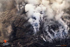
Overflight view of the June 27 lava flow on Dec. 22. Photo credit: Extreme Exposure/ Paradise Helicopters.
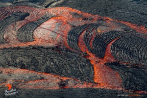
Overflight view of the June 27 lava flow on Dec. 22. Photo credit: Extreme Exposure/ Paradise Helicopters.
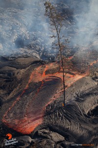
Overflight view of the June 27 lava flow on Dec. 22. Photo credit: Extreme Exposure/ Paradise Helicopters.
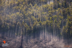
Overflight view of the June 27 lava flow on Dec. 22. Photo credit: Extreme Exposure/ Paradise Helicopters.
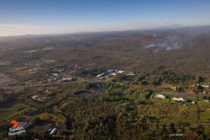
Overflight view of the June 27 lava flow on Dec. 22. Photo credit: Extreme Exposure/ Paradise Helicopters.
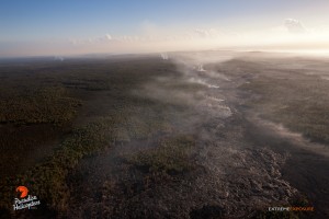
Overflight view of the June 27 lava flow on Dec. 22. Photo credit: Extreme Exposure/ Paradise Helicopters.
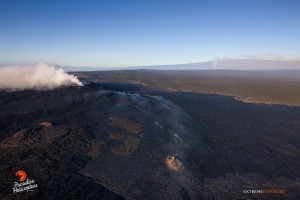
Overflight view of the June 27 lava flow on Dec. 22. Photo credit: Extreme Exposure/ Paradise Helicopters.
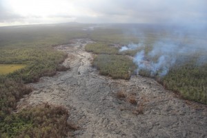
Overflight view of the June 27 lava flow on Dec. 22. Photo credit: Extreme Exposure/ Paradise Helicopters.

Overflight view of the June 27 lava flow on Dec. 22. Photo credit: Extreme Exposure/ Paradise Helicopters.

Overflight view of the June 27 lava flow on Dec. 22. Photo credit: Extreme Exposure/ Paradise Helicopters.

Overflight view of the June 27 lava flow on Dec. 22. Photo credit: Extreme Exposure/ Paradise Helicopters.

Overflight view of the June 27 lava flow on Dec. 22. Photo credit: Extreme Exposure/ Paradise Helicopters.

Overflight view of the June 27 lava flow on Dec. 22. Photo credit: Extreme Exposure/ Paradise Helicopters.

Overflight view of the June 27 lava flow on Dec. 22. Photo credit: Extreme Exposure/ Paradise Helicopters.

Overflight view of the June 27 lava flow on Dec. 22. Photo credit: Extreme Exposure/ Paradise Helicopters.

This photo taken Dec. 22, shows a west southwest view of breakouts from the lava tube near the True/Mid-Pacific geothermal well site that are active and slowing moving towards a forest to the north. HVO photo.

This photo taken Dec. 22, shows a west southwest view of breakouts from the lava tube near the True/Mid-Pacific geothermal well site that are active and slowing moving towards a forest to the north. HVO photo.

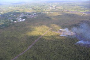
Kīlauea’s East Rift Zone lava flow remains active upslope from the Pahoa Marketplace area, visible at upper left, though activity has waned over the past week. The flow was very close to a firebreak road cut several months ago. The Pahoa Transfer Station is at upper right. The view is to the southeast. HVO photo.

The flow was very close to a firebreak road cut several months ago. The Pahoa Transfer Station is at upper right. The view is to the southeast. HVO photo.

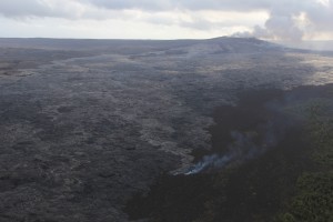
A breakout from the lava tube has also been active on the upper part of the flow field near Puʻu ʻŌʻō since December 5. The smoke is from a narrow finger of lava burning lichen on an older Puʻu ʻŌʻō lava flow. Puʻu ʻŌʻō is at upper right. The view is to the south-southwest. HVO photo.

A breakout from the lava tube has also been active on the upper part of the flow field near Puʻu ʻŌʻō since December 5. Puʻu ʻŌʻō is at upper right. The view is to the south-southwest. HVO photo.

Sponsored Content

Subscribe to our Newsletter

Stay in-the-know with daily or weekly
headlines delivered straight to your inbox.
Cancel
×

Comments

This comments section is a public community forum for the purpose of free expression. Although Big Island Now encourages respectful communication only, some content may be considered offensive. Please view at your own discretion. View Comments