June 27 Lava Flow Update- 12/20/14
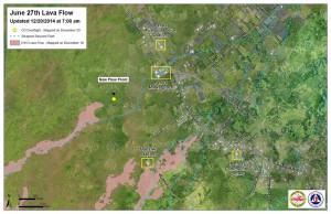
The June 27 lava flow continues its advancement towards the Pahoa Marketplace vicinity.
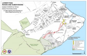
Hawai’i County Civil Defense’s Saturday morning assessment shows that the flow advanced about 160 yards since Friday at 6:30 a.m. It is currently about 0.7 miles upslope from the Highway 130 and Pahoa Village Road intersection.
Hawaiian Volcano Observatory ground crew reported Friday that the northern branch of the flow, which is the leading active flow front, began to narrow as it encountered relatively flat terrain. If the path of steepest decent continues to be followed by the flow front, the expected path will take it towards the Pahoa Marketplace.
The southern branch of the flow remains stalled, as first reported Friday. Several glowing cracks can been seen in the area but the only breakout is the one represented by the now stalled Southern branch.
There is no immediate threat to communities in the area, according to officials. However, residents and businesses will continue to be kept informed by Civil Defense and HVO personnel, who are keeping a watchful eye on activity.
HVO’s overflight Thursday has also shown that the breakouts from Dec. 5 remain active about 1.6 miles from Puʻu ʻŌʻō.
Businesses in the Pahoa Marketplace have begun to take steps to prepare for a possible evacuation. This includes the closure of many shops in the area.
Among the businesses that have closed their doors, according to Civil Defense Administrator Darryl Oliveira during a Friday media briefing, are Malama Market, Malama Gas N Go, Subway, ACE Hardware, Lex Brodies, satellite classrooms for HAAS Public Charter School, and Puna Pharmacy.
Oliveira also noted that some of the businesses have relocated or will operate businesses in combination with other locations. Those businesses include Eyeland Eyedoc, Puna Community Medical Center, Aloha Coast Realty, CU Hawai’i, Clinical Laboratories, Pahoa Properties and Management, and the Hawai’i County Council-Puna Office.
Other businesses are choosing to stay as long as possible before they are instructed that they must evacuate, including Pahoa Fresh Fish, No 1 Chinese BBQ, Jungle Love, Pahoa Battery and Propane, Mighty Sushi, Paradise Business Center, Supercuts, and a Filipino store.
Officials ask motorists to drive with caution in the area and to be prepared for possible traffic as some of the businesses who have closed continue to go about their internal procedures and equipment and inventory is being hauled off.
Civil Defense reported moderate to heavy smoke conditions in the immediate area of the flow Saturday morning as a light trade wind is blowing the smoke in a south-southeast direction. As usual, these smoke conditions can change and officials advise the individuals who are sensitive or who have a history of respiratory issues take precautions necessary and remain indoors.
Railroad Avenue will open for use beginning at 12 p.m. Saturday afternoon. The alternate access road is opening to allow motorists to familiarize themselves with the traffic flow. The speed limit will be 20 mph.
Oliveira says that at the current time, Highway 130 remains open and there is no anticipated closure.
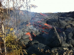
This photo taken 12/19/14 is of a small breakout from the edge of the inflated flow several hundred yards back from the active front. HVO photo.
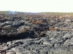
This photo taken 12/19/14 gives the general appearance of the surface of the flow, looking upslope, where the flow is narrower on slightly steeper terrain. HVO photo.
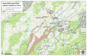
Hawai’i County Civil Defense Lava Flow Maps as of Saturday, 12/20/14 at 7:00 a.m. Civil Defense photo.


