

Swells Fading on All Shores, More Surf Ahead
Alerts
A Small Craft Advisory is posted through 6 a.m. Tuesday for all Big Island waters and channels for rough seas up to 13 feet and winds of 25 to 30 knots. The advisory is posted through 6 p.m. for the Alenuihaha channel and Big Island southeast and leeward waters. Inexperienced mariners should avoid navigating in these conditions.
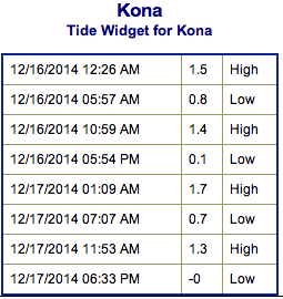
**Click directly on the images below to make them larger. Charts include: Big Island projected winds, tides, swell direction & period and expected wave heights.**
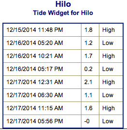 Big Island Surf Forecast, Tuesday, December 16
Hilo side: Choppy trade wind swell still showing a bit. Swell is fading through the day. Early on, best exposures may get sets up to a couple of feet overhead.
Kona side: Surf is expected ankle to possibly shoulder high (for the best exposures) early in the day as the swell continues to slowly fade.
South: Swell is slowly fading but will still offer wave heights up to shoulder high for the best exposures. Some trade swell will trickle in to select spots as well at about head high.
 Wave heights are on a downward trend for all shores. Trade swell will be in the mix for the Hamakua, Puna and Ka’u coastlines.
A small northwest swell is expected to peak late Wednesday and linger through Thursday. This swell is heavily shadowed. A new west-northwest is expected to fill in Thursday evening and peak on Friday morning up to double overhead on the sets at the best breaks. The swell is expected to shift more north so the Kona side is pretty shadowed from this swell but will see a little bit of wrap.
Another west-northwest swell is expected late Sunday depending on how the storm develops.
An out of season south swell that brought a fun little boost the last couple of days will linger but slowly fade through the week. Nothing significant is expected out of the SPAC.
Keep in mind, surf heights are measured on the face of the wave from trough to crest. Heights vary from beach to beach, and at the same beach, from break to break.
**Click here for your detailed Big Island weather report.**
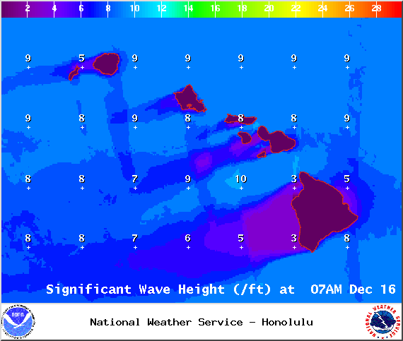
Image: NOAA / NWS
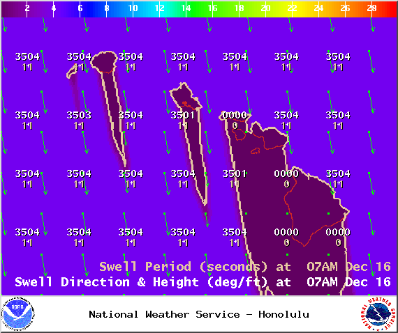
Image: NOAA / NWS
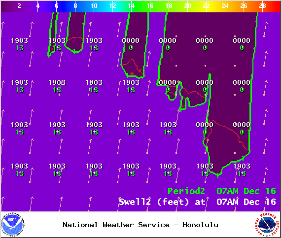
Image: NOAA / NWS
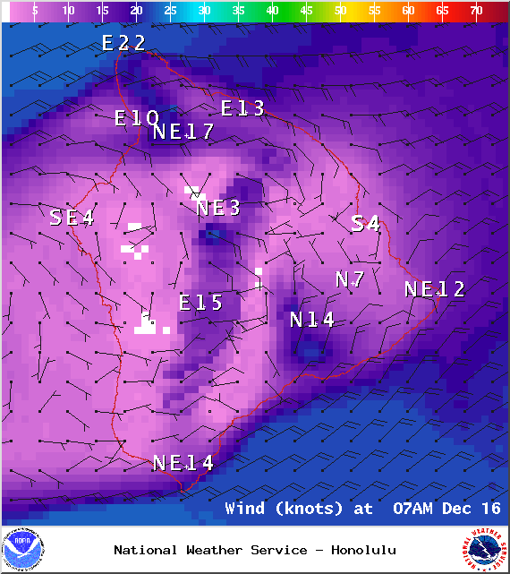
Image: NOAA / NWS
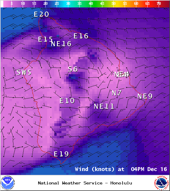
Image: NOAA / NWS
Image: NOAA / NWS
Sponsored Content


