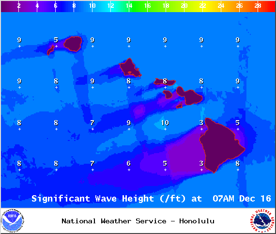
A Small Craft Advisory is posted through 6 a.m. Tuesday for all Big Island waters and channels for rough seas up to 13 feet and winds of 25 to 30 knots. The advisory is posted through 6 p.m. for the Alenuihaha channel and Big Island southeast and leeward waters. Inexperienced mariners should avoid navigating in these conditions.
**Click directly on the images below to make them larger. Charts include: Big Island high/low forecasted temperatures, projected winds, chance of cloud cover, projected localized weather conditions, vog/SO2 forecast and expected wave heights.**
+
SWIPE LEFT OR RIGHT
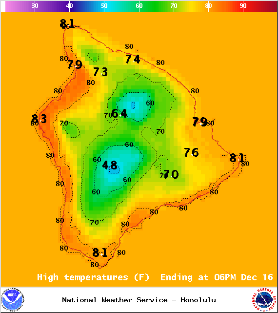
Today, Tuesday, December 16, 2014
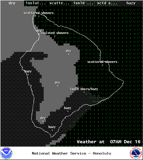
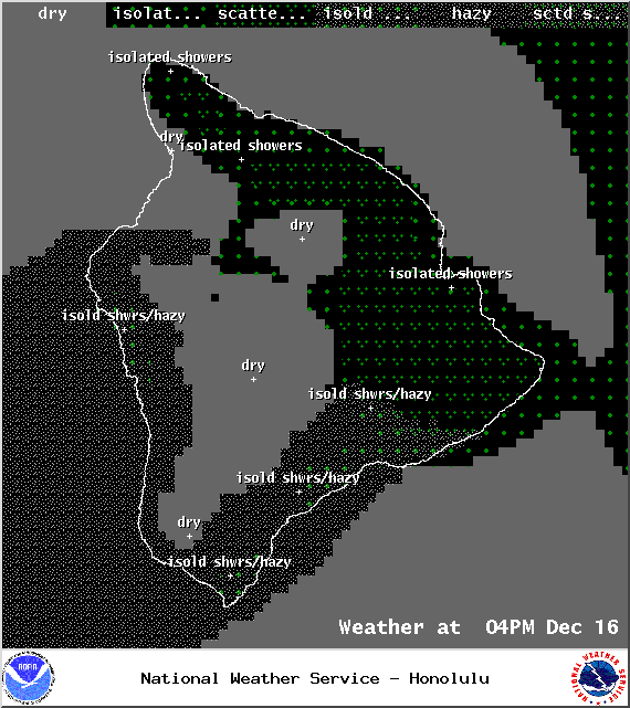
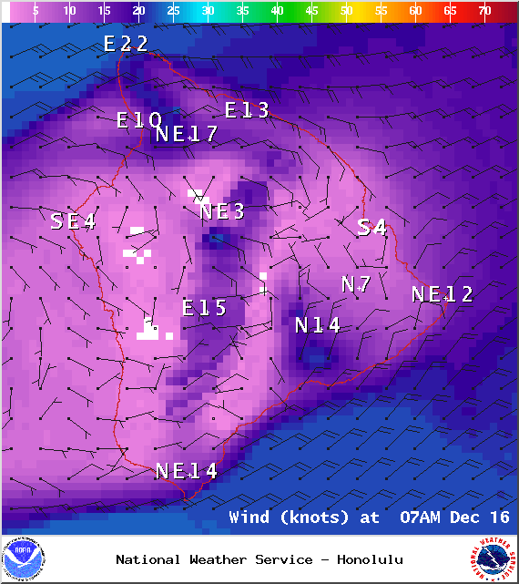
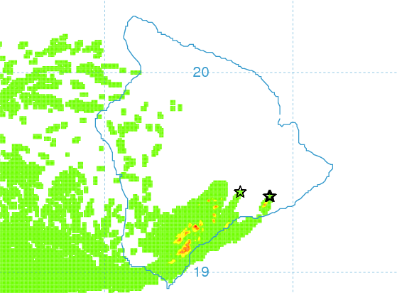
Today is expected to be partly cloudy for windward and mauka areas with scattered showers for windward and mauka areas. For the Kona side mostly clear skies are forecasted in the morning before mostly cloudy skies build in the afternoon possibly bringing an isolated shower or two. Winds are out of the east from 15 to 20 mph with higher gusts. The UHSOEST vog model is forecasting afternoon vog mainly for the Kona side and down south, the morning looks clear for most spots. High temperatures should fall in the range of 81° to 86° and around 70° at 5000 feet.
ARTICLE CONTINUES BELOW AD
ARTICLE CONTINUES BELOW AD
Sunrise: 6:48 a.m.
Sunset: 5:44 p.m.
UV index at 6 (“high” exposure level)
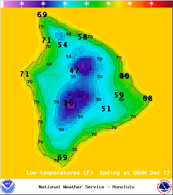
Tonight
ARTICLE CONTINUES BELOW AD
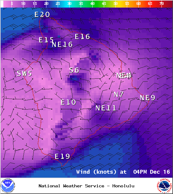
Mostly cloudy skies and scattered showers are expected for windward and mauka areas. After the land breeze takes hold, mostly clear skies are expected on the Kona side with just isolated showers. Winds will be weakening and variable up to 15 mph. Low temperatures from 69° to 74° degrees.
Moonset: 1:49 p.m.
Moonrise: 2:40 a.m. on Dec 17
Next New Moon: Dec. 21 at 3:36 p.m.
Next Full Moon: Jan. 4 at 6:54 p.m.
ARTICLE CONTINUES BELOW AD
The peak nights for the Geminid Meteor Shower have passed but the shower is still active until December 19. Details on timing and viewing tips can be found HERE.
Looking Ahead
High pressure, the weather feature that generates our trade winds, is moving away from the islands and as that happens our winds are expected to weaken. Over the next few days that will be the trend. Another high pressure system will move in by Thursday bringing our winds back up to breezy. Over the weekend we expect winds to shift out of the southeast. A front is expected to impact the state early next week. Will keep an eye on it.
This comments section is a public community forum for the purpose of free expression. Although Big Island Now encourages respectful communication only, some content may be considered offensive. Please view at your own discretion. View Comments