

Gusty Winds, Windward Rain and Clouds Today
Alerts
The National Weather Service has extended the Wind Advisory through Monday at 6 p.m. Northeast winds from 30 to 50 mph with gusts up to 70 mph are expected. The strongest winds on the Big Island are expected on the summits of Mauna Kea and Mauna Loa, in leeward Kohala, the Waimea to Kawaihae corridor and near South Point and Upolu Point. Winds this strong can bring down tree branches and make driving difficult.
A Gale Warning is in effect for Big Island leeward and south waters and the Alenuihaha channel through Monday at 6 p.m. Northeast winds of 30 to 35 knots are expected with higher gusts. Rough seas of 12 to 18 feet are also forecasted. A Gale Warning means that these winds are imminent or occurring. Operating a vessel in gale conditions requires proper experience and equipment. Mariners without these things should remain in port until gale conditions end.
All areas not under the Gale Watch are under a Small Craft Advisory through 6 p.m. Monday. Rough seas of 10 to 17 feet are forecasted along with winds of 30 to 35 knots or more. Inexperienced mariners should avoid navigating in these conditions.
**Click directly on the images below to make them larger. Charts include: Big Island high/low forecasted temperatures, projected winds, chance of cloud cover, projected localized weather conditions, vog/SO2 forecast and expected wave heights.**
Today, Monday December 15, 2014
Today is expected to be mostly cloudy for windward and mauka areas with showers likely along the Hamakua coast and along the windward side to South Point. For the Kona side mostly clear skies are forecasted in the morning before partly cloudy skies build in the afternoon possibly bringing an isolated shower or two. Winds from 15 to 30 mph with higher gusts are expected. The UHSOEST vog model is forecasting afternoon vog mainly for the Kona side and down south, the morning looks clear for most spots. Looks like less vog than previous days. High temperatures should fall in the range of 82° to 87° and around 71° at 5000 feet.
Sunrise: 6:47 a.m.
Sunset: 5:44 p.m.
UV index at 6 (“high” exposure level)
Tonight
Mostly cloudy skies and likely showers are expected for windward and mauka areas. After the land breeze takes hold, mostly clear skies are expected on the Kona side with just isolated showers. Winds will be gusty out of the northeast from 20 – 30 mph, with higher gusts. Low temperatures from 69° to 74° degrees.
Moonset: 1:10 p.m.
Moonrise: 1:49 a.m. on Dec 16
Next New Moon: Dec. 21 at 3:36 p.m.
Next Full Moon: Jan. 4 at 6:54 p.m.
The peak nights for the Geminid Meteor Shower have passed but the shower is still active until December 19. Details on timing and viewing tips can be found HERE.
Looking Ahead
Winds will be strongest where winds funnel, go downslope on the leeward sides and over coastal waters and channels. Gusty winds are expected at least through Monday morning. On Tuesday wind speeds are expected to ease slightly and the weather is forecasted to get back to more normal trade wind conditions. The next cold front should pass north of the state with little effect around midweek, then a new weaker high passing to our north should maintain moderate to locally breezy trades through next Friday. We may get enhanced showers on Wednesday and Thursday.
Almanac for Hilo Airport
Maximum Temperature for today:
Normal 79°
Record 86° / Set in 1979 and tied in 1992
Minimum Temperature for today:
Normal 65°
Record 58° / Set in 1989
**Click here for your detailed Big Island surf report.**
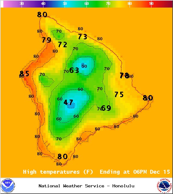
Image: NOAA / NWS
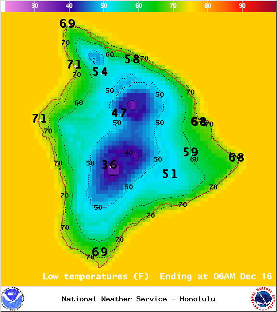
Image: NOAA / NWS
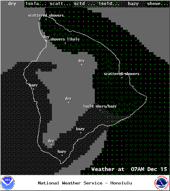
Image: NOAA / NWS
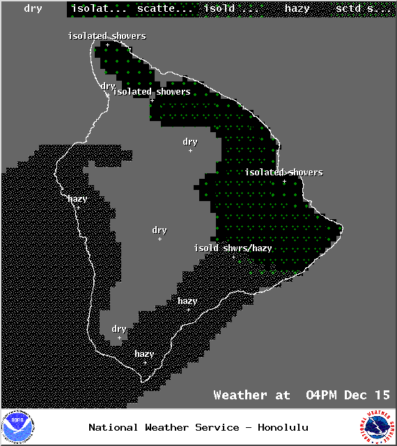
Image: NOAA / NWS
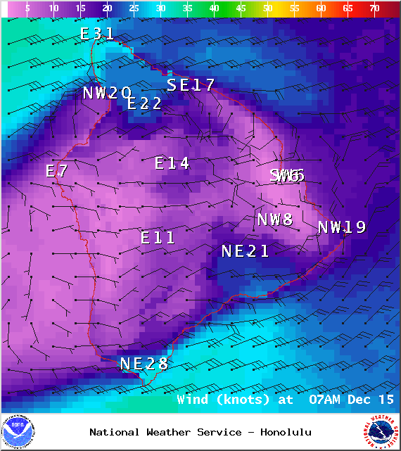
Image: NOAA / NWS
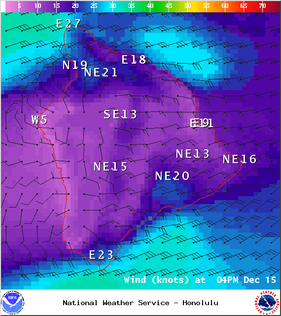
Image: NOAA / NWS
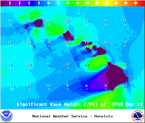
Image: NOAA / NWS
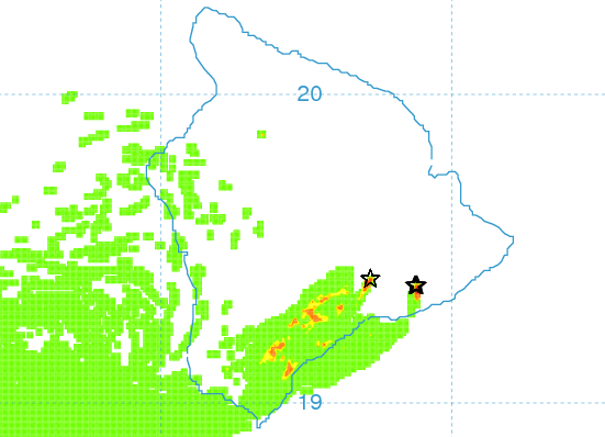
Image: UHSOEST
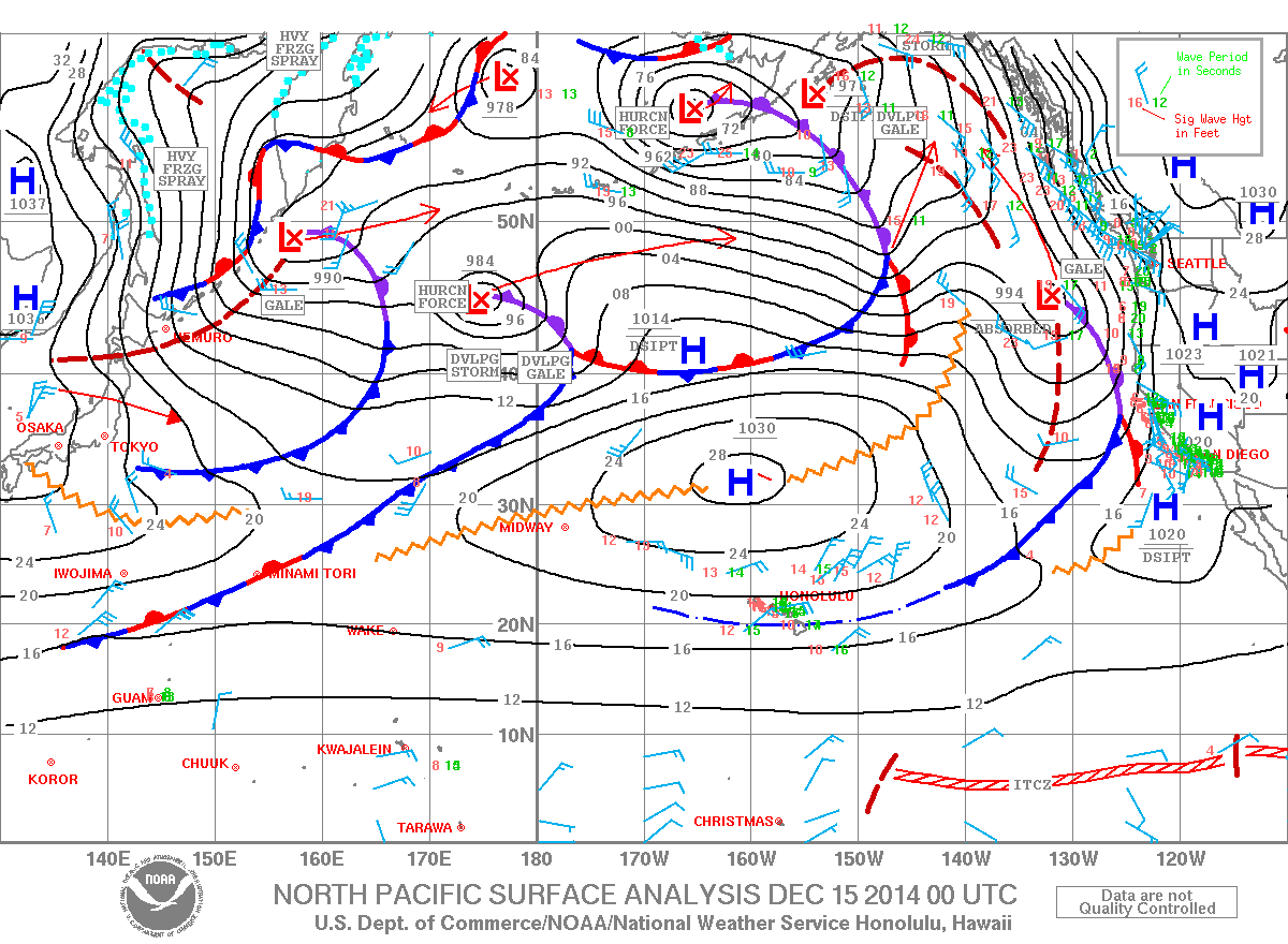
Image: NOAA / NWS
Sponsored Content


