

Weekend Weather: Gusty Winds & Widespread Light Rain
Alerts
- The National Weather Service has issued a Wind Advisory in effect from noon today through Sunday at 6 p.m. Northeast winds from 20 to 40 mph with gusts up to 50 mph are expected. The strongest winds on the Big Island are expected in leeward Kohala, the Waimea to Kawaihae corridor and near South Point and Upolu Point. Winds this strong can bring down tree branches and make driving difficult.
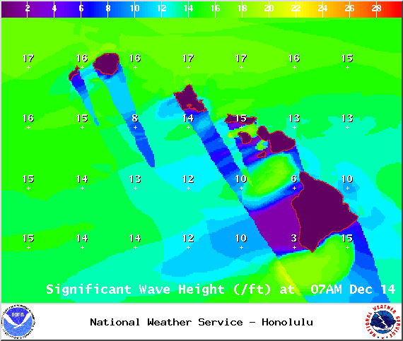
- A Small Craft Advisory has been issued by the National Weather Service from 6 a.m. Saturday through 6 p.m. Monday for all Big Island waters and channels. Rough seas of 11 to 20 feet are forecasted along with winds of 25 to 35 knots or more. Inexperienced mariners should avoid navigating in these conditions.
- The National Weather Service has issued a High Surf Advisory for west shores of the Big Island until 6 p.m. Sunday. Expect strong breaking waves, shore break and strong longshore and rip currents making swimming difficult and dangerous.
- A Gale Warning is in effect for Big Island leeward waters and the Anenuihaha channel through Monday at 6 p.m. Beginning this morning, east winds of 30 to 35 knots are expected with higher gusts. Rough seas of 13 to 21 feet are also forecasted. The largest waves are expected to begin tonight after midnight. A Gale Warning means that these winds are imminent or occurring. Operating a vessel in gale conditions requires proper experience and equipment. Mariners without these things should remain in port until gale conditions end.
**Click directly on the images below to make them larger. Charts include: Big Island high/low forecasted temperatures, projected winds, chance of cloud cover, projected localized weather conditions, vog/SO2 forecast and expected wave heights.**
Today, Saturday December 13, 2014
Today is expected to be sunny and windy. Isolated windward and mauka showers are forecasted in the morning with winds from 15 to 20 mph increasing to 20 to 35 mph with gusts up to 50 mph in the afternoon. The UHSOEST vog model is forecasting afternoon vog mainly for the Kona side and down south. Looks like less vog than previous days. High temperatures should fall in the range of 80° to 85° and around 70° at 5000 feet.
Sunrise: 6:46 a.m.
Sunset: 5:43 p.m.
UV index at 6 (“high” exposure level)
Tonight
Partly cloudy skies and isolated showers are expected for windward and mauka areas with scattered showers in the forecast after midnight. Mostly clear skies are expected on the Kona side with just isolated showers if any. Winds will be gusty out of the northeast from 20 – 35 mph, gusting to 55 mph. Low temperatures from 69° to 74° degrees.
Moonset: 11:56 a.m.
Moonrise: 12:10 a.m. on Dec 14
Next New Moon: Dec. 21 at 3:36 p.m.
Next Full Moon: Jan. 4 at 6:54 p.m.
The Geminid Meteor shower is currently active. Peak nights are Dec. 12-13 and 13-14. Click HERE for viewing tips and details on the shower.
Almanac for Hilo Airport
Maximum Temperature for today:
Normal 79°
Record 87° / Set in 1995
Minimum Temperature for today:
Normal 65°
Record 60° / Set in 1953
Sunday, December 14, 2014
Another windy day with trades expected to blow from 20 to 35 mph with gusts up to 55 mph. Scattered windward and mauka showers are expected through the day then frequent showers at night. Leeward spots are forecasted to get scattered showers at night. Lots of high clouds expected. Highs from 80° to 85° with winds out of the northeast around 15 mph.
Sunrise: 6:47 a.m.
Sunset: 5:44 p.m.
UV index at 6 (“high” exposure level)
Looking Ahead
This weekend is mainly going to be a wind event although we are also expecting widespread light rain. Gale conditions and wind advisories are likely this weekend. Winds will increase especially where winds funnel, go downslope on the leeward sides and over coastal waters and channels. On Tuesday wind speeds are expected to ease and the weather is forecasted to get back to normal trade wind conditions. The next cold front should pass north of the state with little effect around midweek, then a new weaker high passing to our north should maintain moderate to locally breezy trades through next Friday.
**Click here for your detailed Big Island surf report.**

Saturday highs / Image: NOAA / NWS

Saturday lows / Image: NOAA / NWS

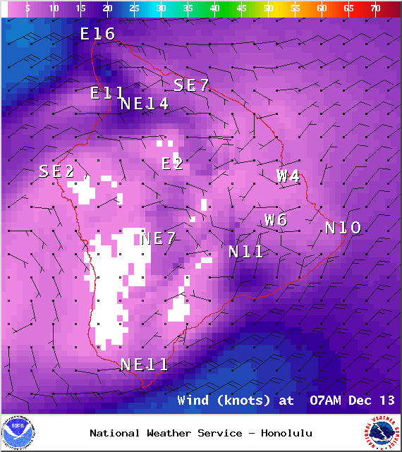
Saturday 7a.m. / Image: NOAA / NWS

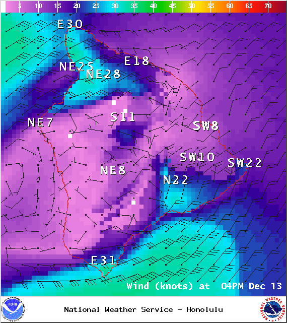
Saturday 4p.m. / Image: NOAA / NWS
Saturday 7a.m. / Image: NOAA / NWS
Saturday 4p.m. / Image: NOAA / NWS

Saturday 7 a.m. / Image: NOAA / NWS

Sunday highs / Image: NOAA / NWS

Sunday lows / Image: NOAA / NWS

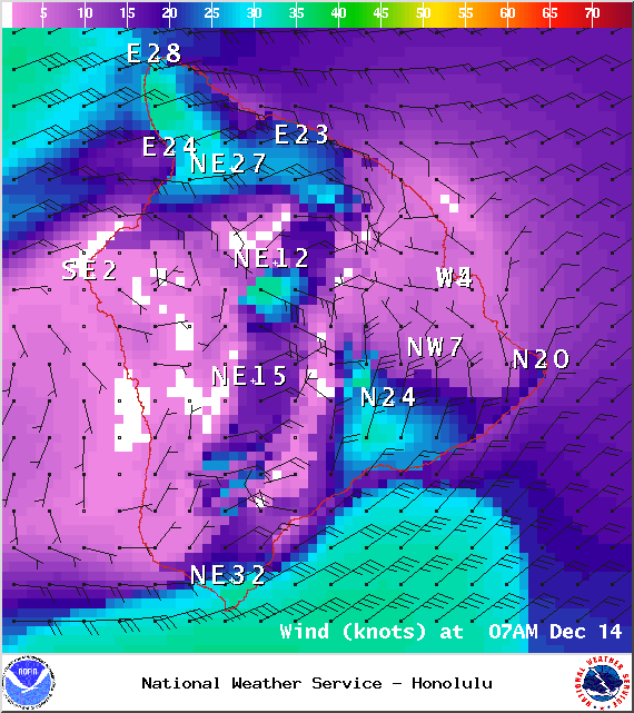
Sunday 7 a.m. / Image: NOAA / NWS

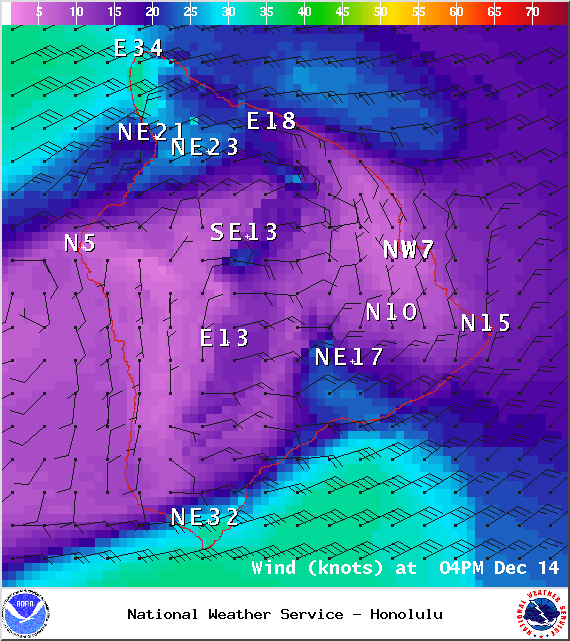
Sunday 4pm / Image: NOAA / NWS
Sunday 7am / Image: NOAA / NWS
Sunday 4pm / Image: NOAA / NWS
Sunday 7 a.m. / Image: NOAA / NWS

Image: UHSOEST
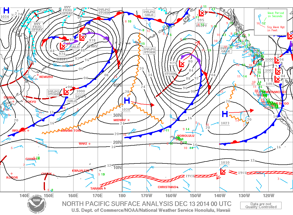
Image: NOAA / NWS
Sponsored Content


