

Double Overhead Surf Expected Today
Alerts
A Small Craft Advisory has been issued by the National Weather Service for Big Island windward waters and the Alenuihaha channel through 6 a.m. Monday for rough seas of 8 to 12 feet. This advisory may need to be extended as another large NW swell is expected to build late in the day.
**Click directly on the images below to make them larger. Charts include: Big Island projected winds, tides, swell direction & period and expected wave heights.**
 Big Island Surf Forecast, Monday December 8, 2014
Hilo side: Surf is expected well overhead to possibly double overhead or more at the best breaks, early in the day. Swell fades through the day. Another builds late in the day keeping wave heights elevated.
Kona side: Surf is expected ankle to waist high for the best exposures.
South: Southeast shores open to the trade swell could see waves knee to chest high, though sloppy and choppy conditions are expected. Minimal surf out of the southern hemisphere – knee high or less.
 Our current north-northwest swell is expected to fade today still offering solid surf expected well overhead + in the morning on the Hilo side. Kona side is heavily shadowed from this swell.
A new, very large, north-northwest swell is expected to build through Monday afternoon and peak Tuesday morning. An overlapping swell is forecasted to help increase surf heights on Wednesday at possibly double to triple overhead or more at the best exposures. This swell will bring us waves for exposed shores through the work week. The situation is still developing.
A series of swells are expected over the weekend and into next week as well.
Super small trace amounts of swell expected out of the SPAC. Not much to get excited about.
Keep in mind, surf heights are measured on the face of the wave from trough to crest. Heights vary from beach to beach, and at the same beach, from break to break.
**Click here for your detailed Big Island weather report.**
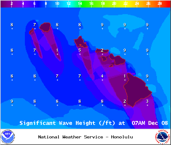
Image: NOAA / NWS

Image: NOAA / NWS

Image: NOAA / NWS
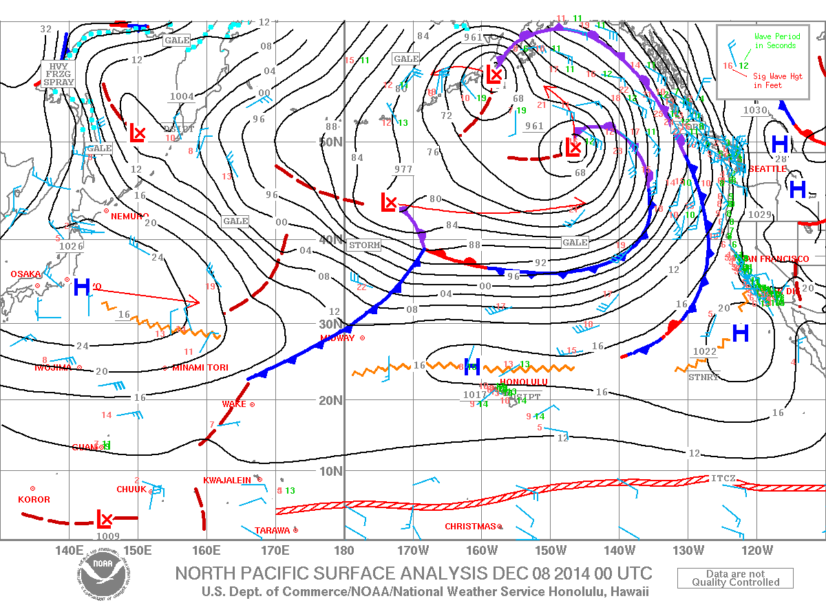
Image: NOAA / NWS
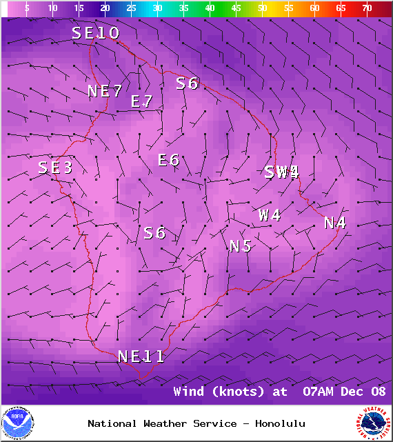
Image: NOAA / NWS
Image: NOAA / NWS
Sponsored Content


