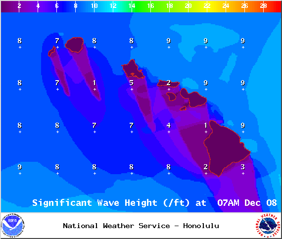
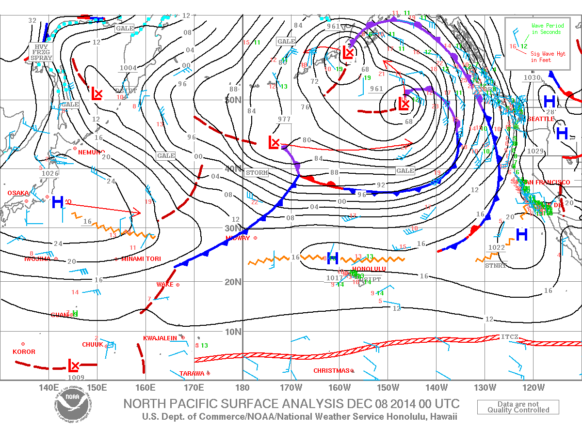
A Small Craft Advisory has been issued by the National Weather Service for Big Island windward waters and the Alenuihaha channel through 6 a.m. Monday for rough seas of 8 to 12 feet. This advisory may need to be extended as another large NW swell is expected to build late in the day.
**Click directly on the images below to make them larger. Charts include: Big Island high/low forecasted temperatures, projected winds, chance of cloud cover, projected localized weather conditions, vog/SO2 forecast and expected wave heights.**
+
SWIPE LEFT OR RIGHT
Today, Monday December 8, 2014
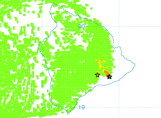
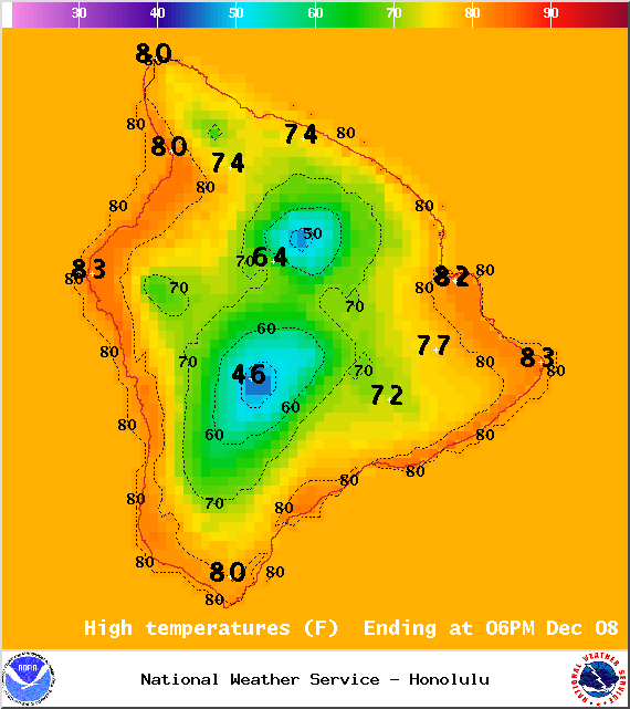
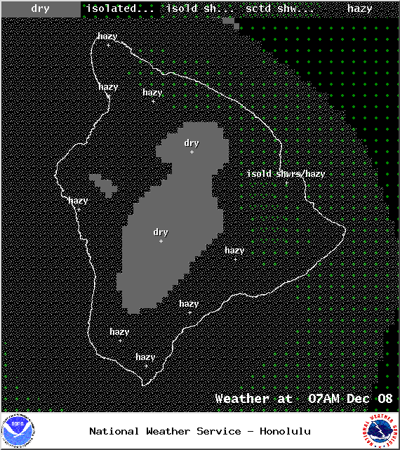
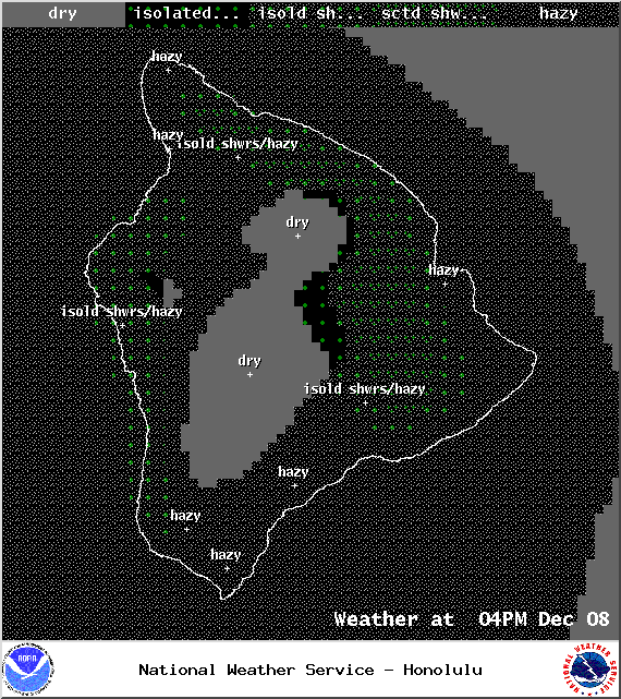
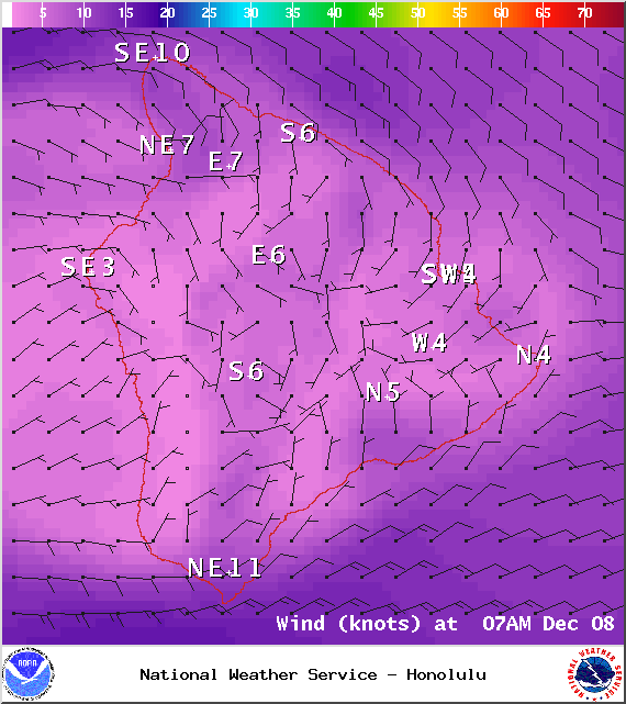
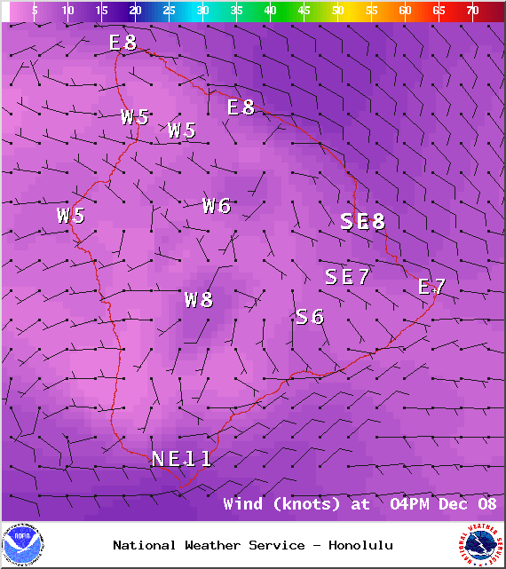
More widespread haze is expected today with our variable wind conditions. Winds are expected up to 15 mph. Mostly clear skies are forecasted in the morning with partly to mostly cloudy conditions in the afternoon as the sea breeze kicks in contributes to local convection. We could see some scattered showers in the afternoon as well. High temperatures should fall in the range of 80° to 85° and around 70° at 5000 feet.
ARTICLE CONTINUES BELOW AD
ARTICLE CONTINUES BELOW AD
Sunrise: 6:43 a.m.
Sunset: 5:42 p.m.
UV index at 6 (“high” exposure level)
Tonight
ARTICLE CONTINUES BELOW AD
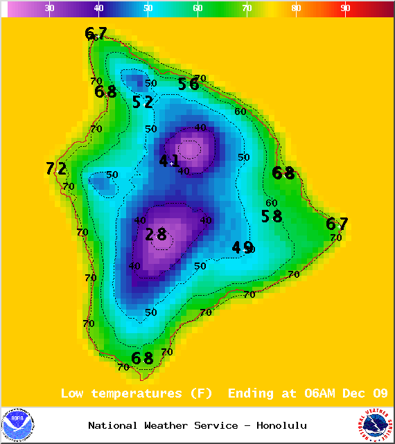
Mostly clear skies are expected tonight with variable winds up to 15 mph. Low temperatures are expected in the range of 68° to 73° with a low of about 50° at 5000 feet.
Moonrise: 8:04 p.m.
Moonset: 9:18 a.m. on Dec 9
Next New Moon: Dec. 21 at 3:36 p.m.
Next Full Moon: Jan. 4 at 6:54 p.m.
ARTICLE CONTINUES BELOW AD
Looking Ahead
The trade winds are expected to remain light and variable through tomorrow. This will allow for local land and sea breezes to develop during that time. Afternoon interior and leeward showers are possible with the sea breezes, but rainfall accumulations should remain light. Winds are forecasted to increase Wednesday and Thursday as a front moves across the islands. A second stronger front expected next weekend will bring strong and gusty winds in its wake.
This comments section is a public community forum for the purpose of free expression. Although Big Island Now encourages respectful communication only, some content may be considered offensive. Please view at your own discretion. View Comments