

Breezy Thanksgiving Forecast
Alerts
A Wind Advisory is in effect until 6 p.m. this evening for winds out of the northeast from 20 to 35 mph, gusting to 50 mph across the Kohala and Kamuela areas on the north end of the Big Island, south of Volcano along the Kau coast and near South Point. The advisory may need to be extended if strong winds persist. Winds this strong can bring down tree branches and make driving difficult, especially for high profile vehicles.
A Small Craft Advisory is posted for all Hawaii County waters until 6 p.m. today. Winds of 20 to 25 knots are expected and rough seas from 10 to 15 feet. Inexperienced mariners should avoid navigating in these conditions.
A Marine Weather Statement has been issued by the National Weather Service for north facing harbors, including Kahului harbor. A large north-northeast swell will continue to affect these areas producing moderate surges and large breaking waves. Mariners should exercise caution when operating vessels inside harbors or near harbor entrances.
A High Surf Advisory is in effect for the north and east facing shores of the Big Island for a larger than expected north-northeast swell. Surf along north facing shores could reach heights of 12 to 15 feet. Surf along east facing shores could reach heights of 8 to 12 feet. The advisory is set to expire at 6 p.m. on Thursday.
**Click directly on the images below to make them larger. Charts include: Big Island high/low forecasted temperatures, projected winds, chance of cloud cover, projected localized weather conditions, vog/SO2 forecast and expected wave heights.**
Today, Thursday November 27, 2014
Partly sunny skies are expected today for the Big Island. Windward and mauka areas are forecasted to get morning scattered showers then isolated showers in the afternoon. The Kona side is expected to get sunshine early on before some clouds begin to build in the afternoon. The UHSOEST vog model (pictured above) shows hazy conditions on the leeward side this afternoon, especially from Kona and to the south. Winds are expected out of the northeast from 15 to 25 mph with higher gusts. High temperatures should fall in the range of 80° to 85° and around 70° at 5000 feet.
Sunrise: 6:35 a.m.
Sunset: 5:40 p.m.
UV index at 6 (“high” exposure level)
Tonight
Mostly cloudy skies are expected in windward and mauka areas tonight with scattered showers in the forecast. Leeward areas should be partly cloudy. Winds are out of the east from 15 to 25 mph. Low temperatures fare expected in the range of 70° to 75° with a low of about 51° at 5000 feet.
Moonrise: 11:17 a.m.
Moonset: 11:10 p.m.
Next Full Moon: Dec. 6 at 2:27 a.m.
Next New Moon: Dec. 21 at 3:36 p.m.
Looking Ahead to the Thankgiving Holiday Weekend
Your Thanksgiving forecast calls for trade wind weather with showers focusing in windward and mauka areas in the morning and evening hours and leeward spots getting lots of morning sunshine. Winds will be breezy through the weekend. Winds may approach or reach advisory criteria in some areas such as Kohala Thursday through Friday. A wetter trade wind day may come Friday when the remnants of an old front reach us. Otherwise, we are looking at a relatively dry trade wind weather regime for the rest of this week and the weekend. The forecast will be updated daily and as necessary so check back for any changes.
Almanac for Hilo Airport
Maximum Temperature for today:
Normal 80°
Record 88° / Set in 2013
Minimum Temperature for today:
Normal 67°
Record 59° / Set in 1985
**Click here for your detailed Big Island surf report.**
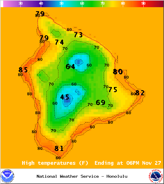
Image: NOAA / NWS
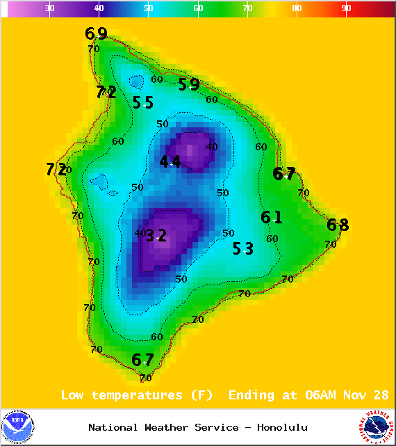
Image: NOAA / NWS
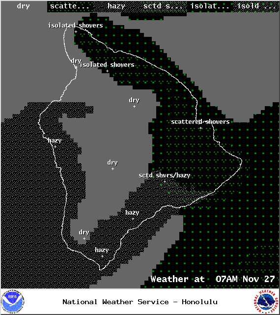
Image: NOAA / NWS
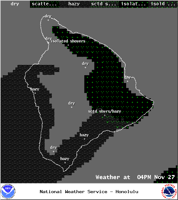
Image: NOAA / NWS
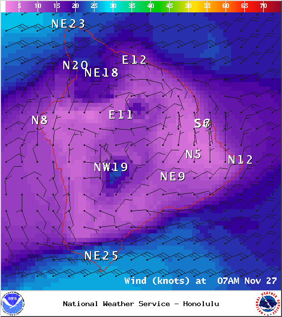
Image: NOAA / NWS
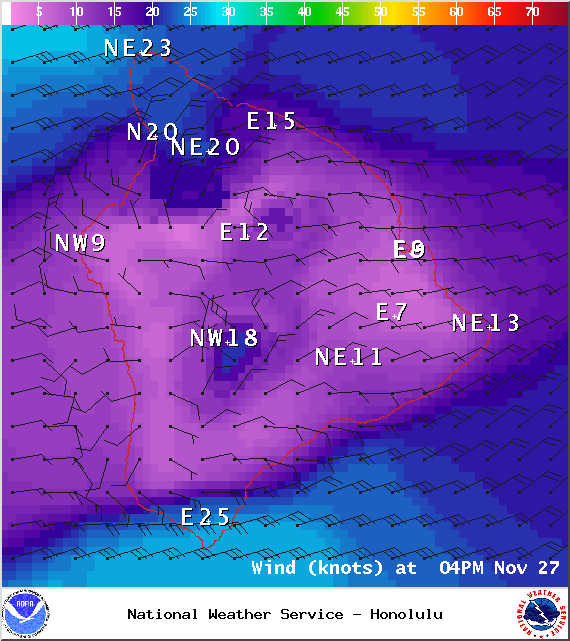
Image: NOAA / NWS
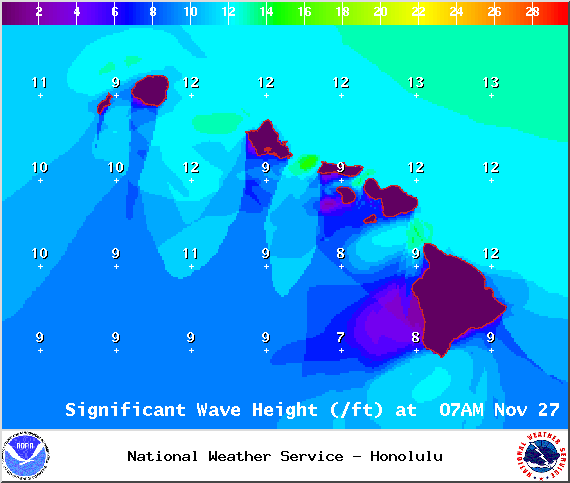
Image: NOAA / NWS
Image: NOAA / NWS
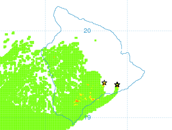
Image: UHSOEST
Sponsored Content


