

Muggy Day Today, Cool and Dry Conditions Ahead
Alerts
There are no weather alerts posted at this time.
**Click directly on the images below to make them larger. Charts include: Big Island high/low forecasted temperatures, projected winds, chance of cloud cover, projected localized weather conditions, vog/SO2 forecast and expected wave heights.**
Today, Sunday November 23, 2014
Today windward and mauka areas can expect partly sunny skies with isolated showers. Meanwhile, the leeward side and coastline can expect a mostly clear morning before clouds begin to build in the afternoon as the sea breeze develops due to daytime heating. Isolated showers are possible in the afternoon and evening as well. High temperatures should fall in the range of 81° to 86° and around 71° at 5000 feet. Winds are expected to be variable from 5 to 15 mph.
Sunrise: 6:34 a.m.
Sunset: 5:40 p.m.
UV index at 6 (“high” exposure level)
Tonight
We expect partly cloudy skies tonight with isolated showers in the evening then clearing after midnight. There will be areas of haze. Light and variable winds are expected. Low temperatures should fall in the range of 69° to 74° with a low of about 56° at 5000 feet.
Moonrise: 7:42 a.m.
Moonset: 7:12 p.m.
Next Full Moon: Dec. 6 at 2:27 a.m.
Next New Moon: Dec. 21 at 3:36 p.m.
Looking Ahead
Winds ahead of an approaching front will become light and variable and a diurnal land / sea breeze weather pattern will set up.. Moderate rainfall and stiff north winds are expected as the front pushes down the island chain. The front is now expected to move quicker, therefore arrival time for the Big Island has been moved up to Monday night. By the time the front reaches Hawaii County it will likely be disorganized and mainly composed of frontal remnants. Best chances for rainfall will be along windward and mauka areas on Monday. Behind the front, cooler temperatures and dry conditions are forecasted. By Wednesday we expect a return to more typical trade wind weather.
Almanac for Hilo Airport
Maximum Temperature for today:
Normal 80°
Record 86° / Set in 1964 and tied in 1977
Minimum Temperature for today:
Normal 67°
Record 62° / Set in 1975
**Click here for your detailed Big Island surf report.**
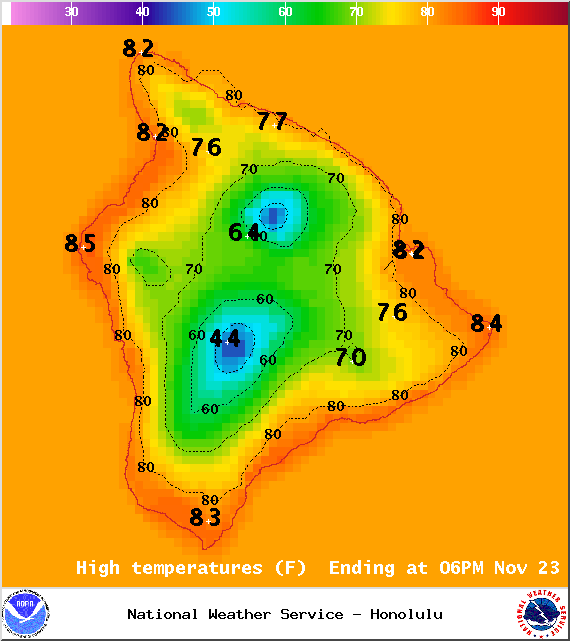
Image: NOAA / NWS
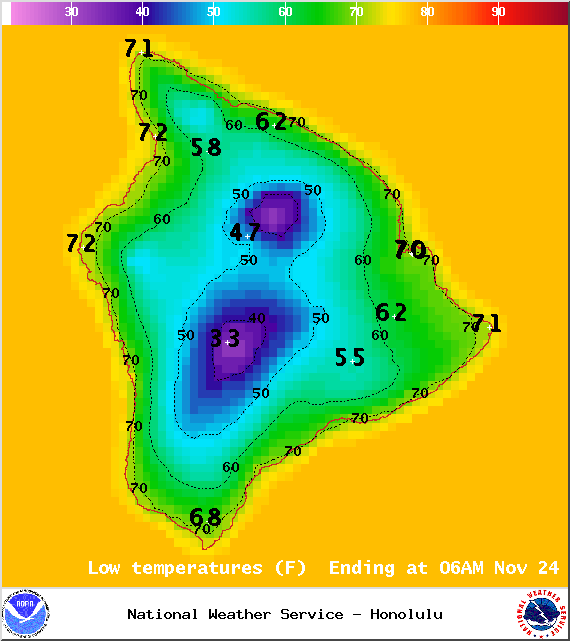
Image: NOAA / NWS
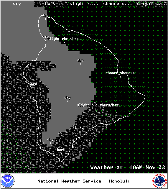
Image: NOAA / NWS
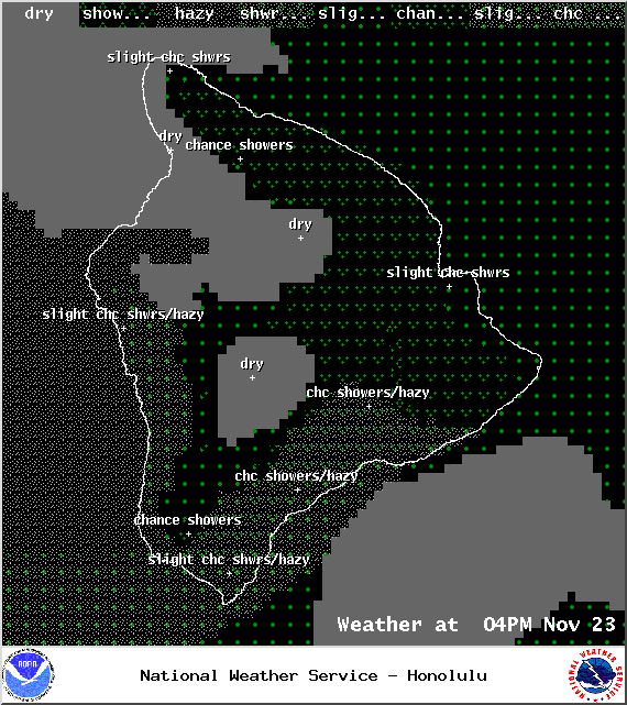
Image: NOAA / NWS
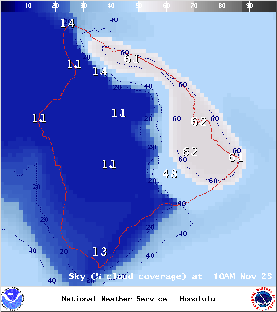
Image: NOAA / NWS
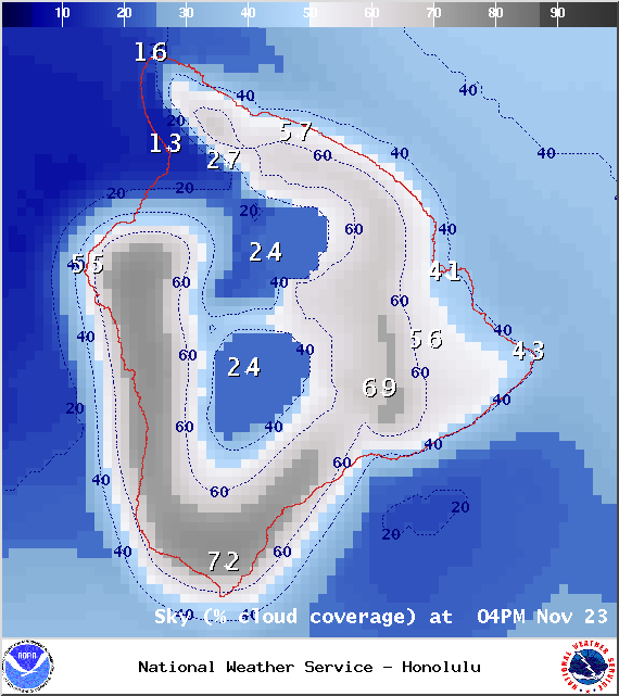
Image: NOAA / NWS
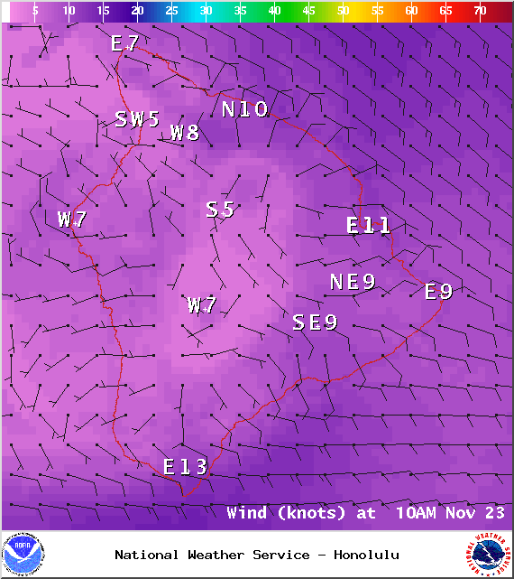
Image: NOAA / NWS

Image: NOAA / NWS
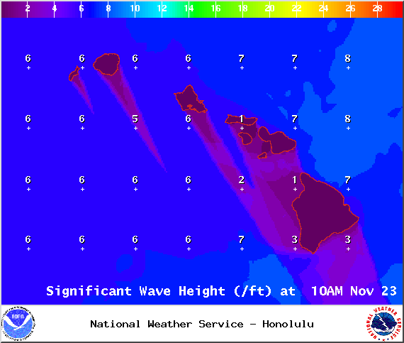
Image: NOAA / NWS
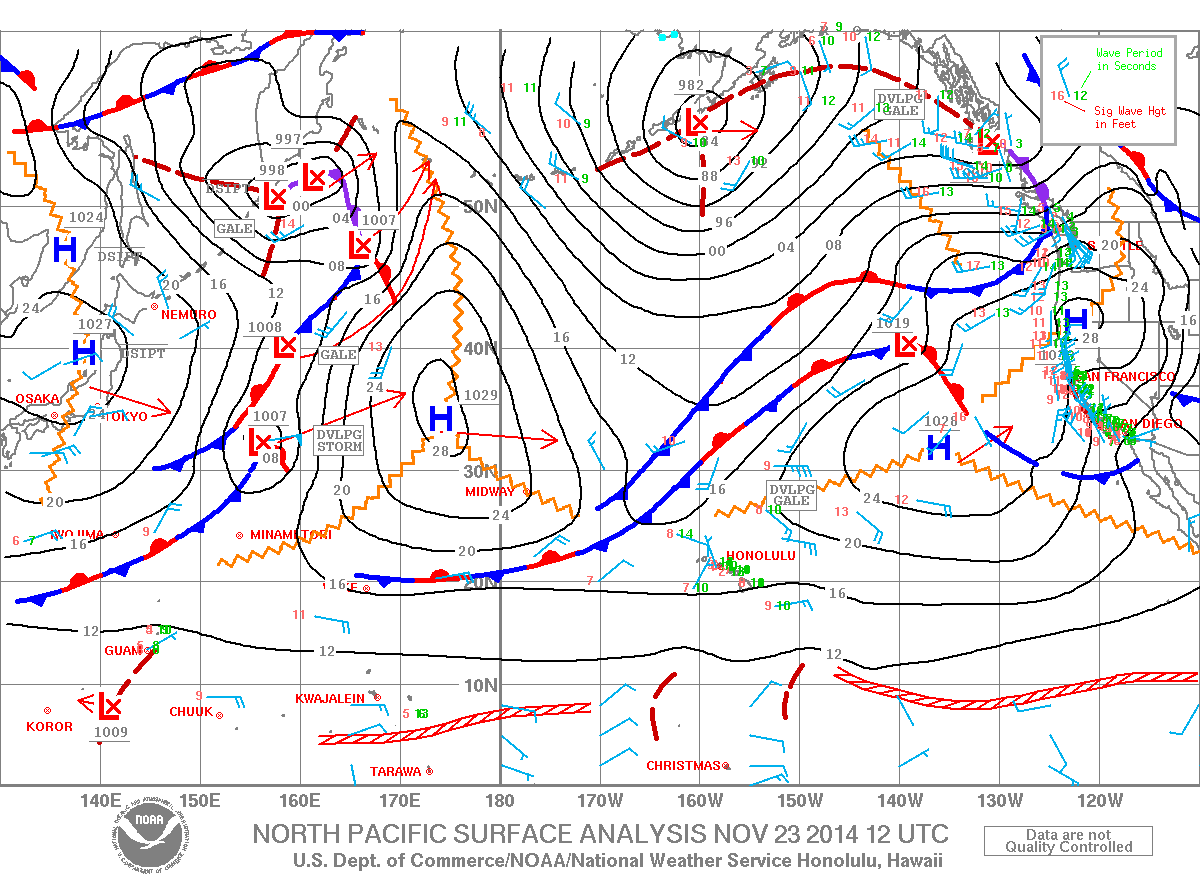
Image: NOAA / NWS
Sponsored Content


