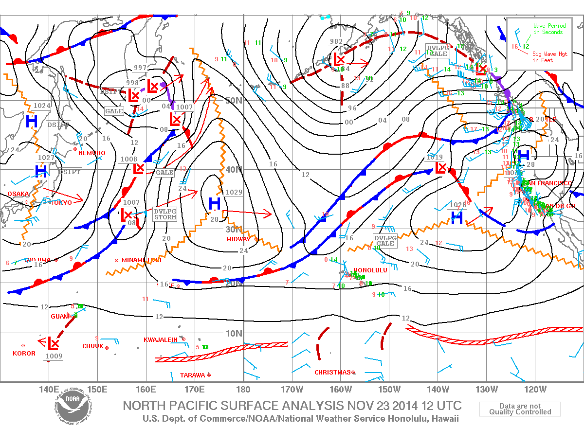
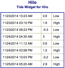
**Click directly on the images below to make them larger. Charts include: Big Island projected winds, tides, swell direction & period and expected wave heights.**
+
SWIPE LEFT OR RIGHT
ARTICLE CONTINUES BELOW AD
ARTICLE CONTINUES BELOW AD
Big Island Surf Forecast, Sunday November 23, 2014
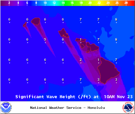
Hilo side: Surf is expected head high at the best breaks due to the tradeswell.
Kona side: Spots that catch some of the wrap could see a slight bump in wave heights, thigh high or less. Breaks not exposed to the swells will be flat today.
ARTICLE CONTINUES BELOW AD
South: Southeast shores open to the trade swell could see waves up to head high or more, though sloppy and choppy conditions are expected. Waves expected thigh high at best for spots catching the fading small southwest.
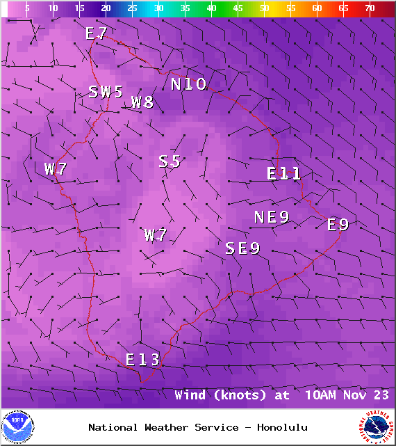
Trade winds are gradually on the decline but still generating a bit of swell for the Big Island. Conditions will be choppy and sloppy.
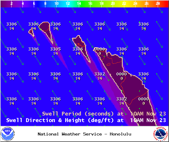
A new northwest swell (305-330°) is expected to build late today. We could see wave heights head high or more with plusses for the Hamakua coast in the afternoon. Kona side will be shadowed but still catch a fraction of the wrap. There’s also the possibility of a north swell for the middle of next week.
ARTICLE CONTINUES BELOW AD
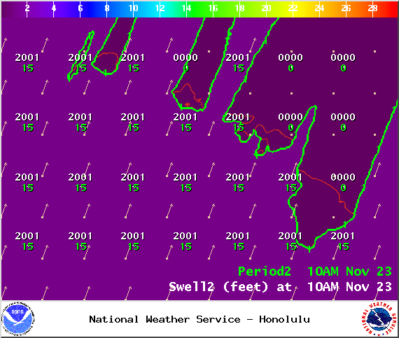
Super small trace amounts of swell expected out of the SPAC. There isn’t much on the horizon to get excited about.
Keep in mind, surf heights are measured on the face of the wave from trough to crest. Heights vary from beach to beach, and at the same beach, from break to break.
This comments section is a public community forum for the purpose of free expression. Although Big Island Now encourages respectful communication only, some content may be considered offensive. Please view at your own discretion. View Comments


 Big Island Surf Forecast, Sunday November 23, 2014
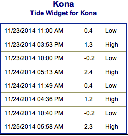 Trade winds are gradually on the decline but still generating a bit of swell for the Big Island. Conditions will be choppy and sloppy.