

Frontal Passage to Bring Increased Rainfall
Alerts
A Wind Advisory is posted for Mauna Kea and Mauna Loa through 6 p.m. today. Winds out of the west from 35 to 50 mph are expected with gusts up to 60 mph. Winds this strong can make driving difficult especially for high profile vehicles.
A Small Craft Advisory is posted for theʻAlenuihāhā channel and Big Island windward waters until 6 a.m. Tuesday. Winds from 25 knots to 30 knots are expected out of the north and rough seas of 8 to 15 feet. The Small Craft Advisory for Big Island southeast waters will be posted at 6 p.m. this evening for northeast winds up to 20 knots and rough seas from 7 to 10 feet. Largest waves are expected tonight and after midnight. Inexperienced mariners should avoid navigating in these conditions.
**Click directly on the images below to make them larger. Charts include: Big Island high/low forecasted temperatures, projected winds, chance of cloud cover, projected localized weather conditions, vog/SO2 forecast and expected wave heights.**
Today, Monday November 24, 2014
Today winds will be light and variable to start and shift out of the north as a front moves through. Before the front conditions will be hot, muggy and hazy. Leeward spots will see isolated showers while windward and mauka areas are forecasted to get disorganized scattered showers from the frontal remnants. Best chances for rainfall will be along windward and mauka areas today. Mostly cloudy skies are in the forecast. Behind the front cooler, drier conditions will take hold. High temperatures should fall in the range of 83° to 88° and around 71° at 5000 feet.
Sunrise: 6:34 a.m.
Sunset: 5:40 p.m.
UV index at 6 (“high” exposure level)
Tonight
With north winds blowing from 15 to 20 mph, cool temperatures are expected tonight in the wake of a front. We expect mostly cloudy skies for windward and mauka areas with scattered showers. Leeward spots are forecasted to get mostly cloudy skies and showers in the evening before clearing. Low temperatures should fall in the range of 66° to 71° with a low of about 53° at 5000 feet.
Moonrise: 8:39 a.m.
Moonset: 8:10 p.m.
Next Full Moon: Dec. 6 at 2:27 a.m.
Next New Moon: Dec. 21 at 3:36 p.m.
Looking Ahead
A weakening front is pushing through the island chain today. Ahead of the front winds will be southwest and west. Behind the front winds will shift out of the north. Cooler temperatures and dry conditions are forecasted in the wake of the front. By Wednesday we expect a return to more typical trade wind weather with showers again favoring windward and mauka terrain.
Almanac for Hilo Airport
Maximum Temperature for today:
Normal 80°
Record 86° / Set in 1964 and tied in 1977
Minimum Temperature for today:
Normal 67°
Record 62° / Set in 1983
**Click here for your detailed Big Island surf report.**
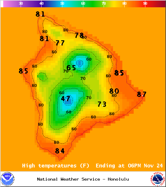
Image: NOAA / NWS

Image: NOAA / NWS
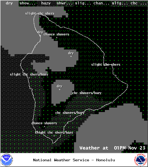
Image: NOAA / NWS
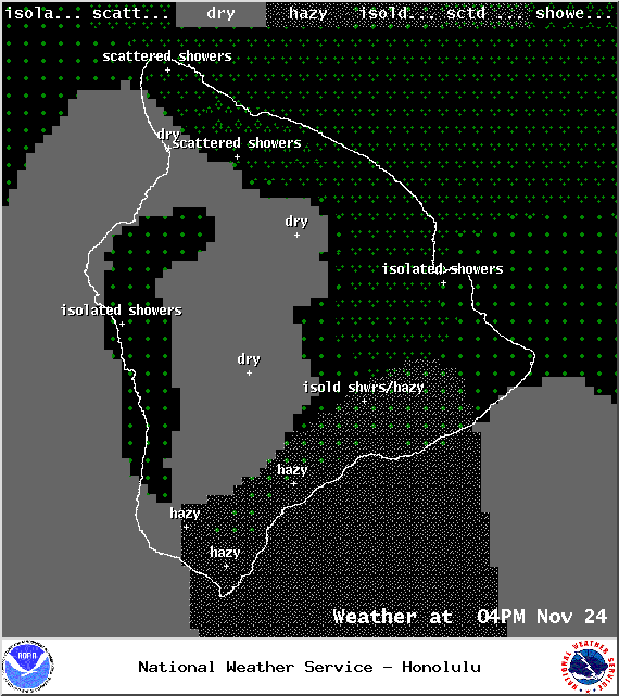
Image: NOAA / NWS
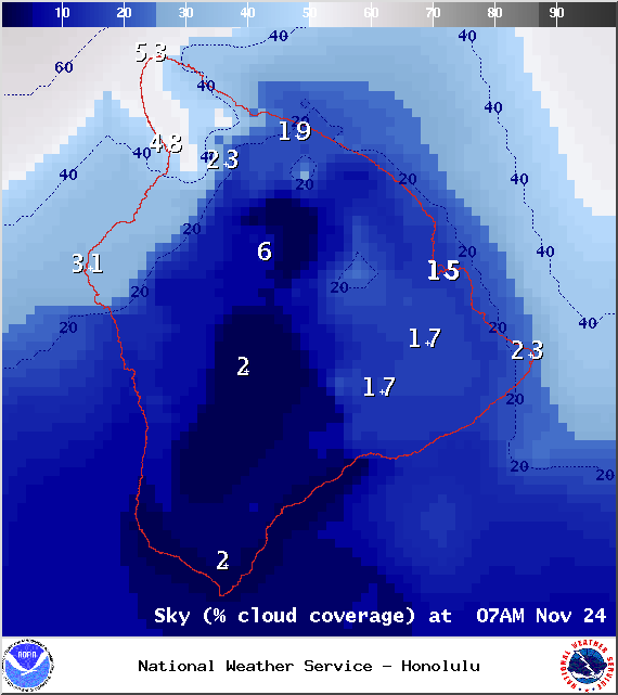
Image: NOAA / NWS
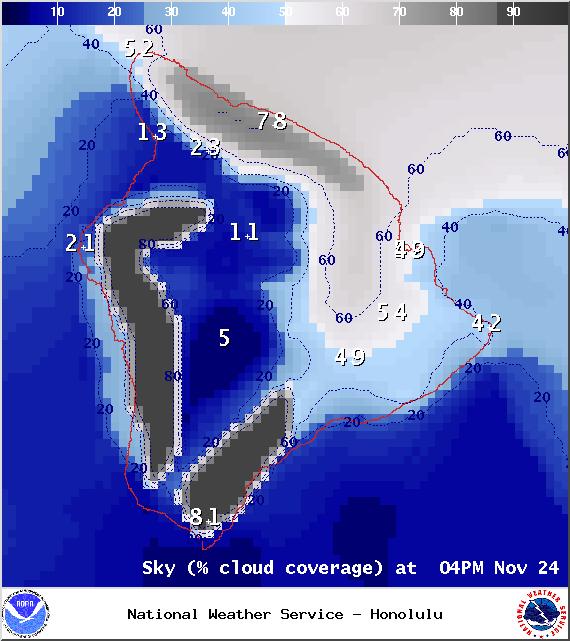
Image: NOAA / NWS
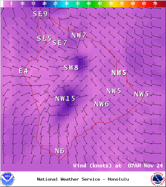
Image: NOAA / NWS
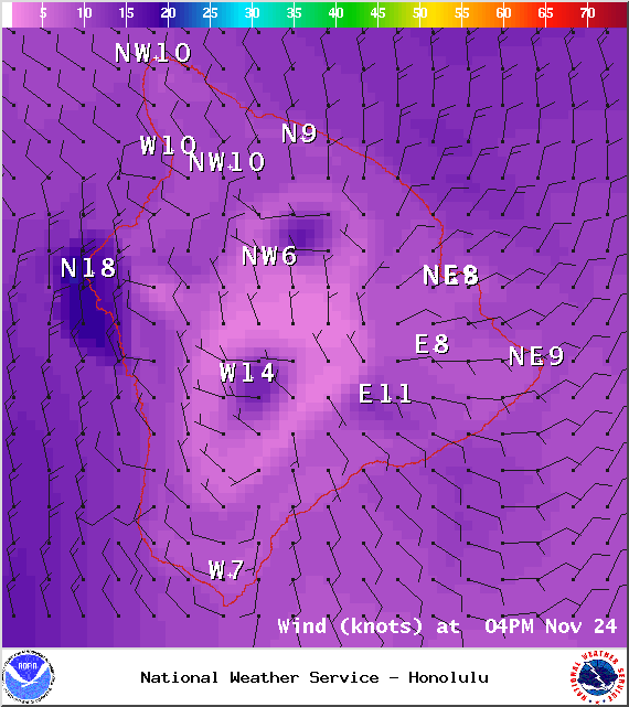
Image: NOAA / NWS
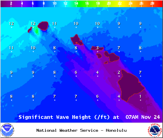
Image: NOAA / NWS
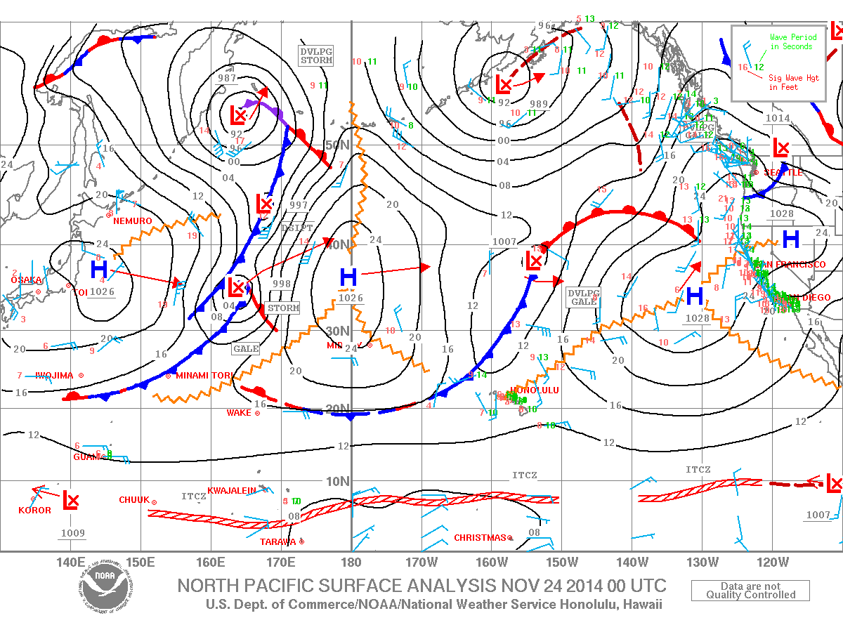
Image: NOAA / NWS
Sponsored Content


