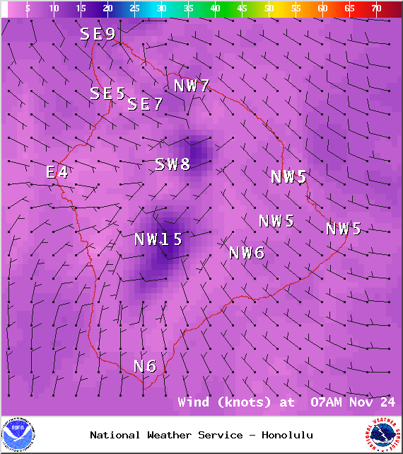
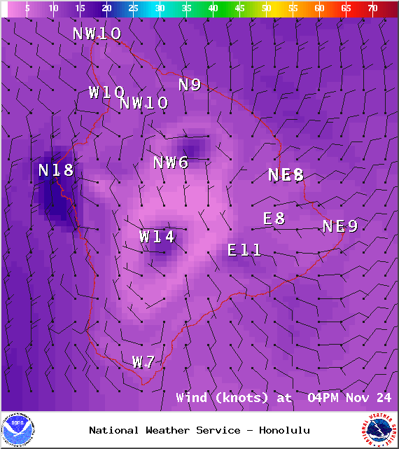
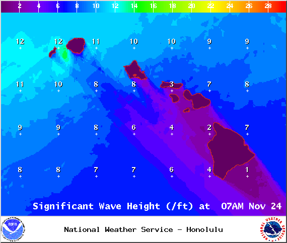
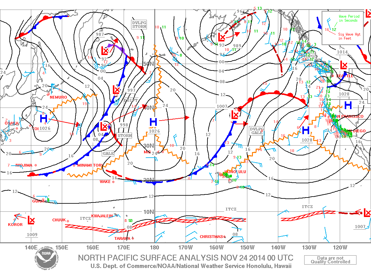
A Small Craft Advisory is posted for theʻAlenuihāhā channel and Big Island windward waters until 6 a.m. Tuesday. Winds from 25 knots to 30 knots are expected out of the north and rough seas of 8 to 15 feet. The Small Craft Advisory for Big Island southeast waters will be posted at 6 p.m. this evening for northeast winds up to 20 knots and rough seas from 7 to 10 feet. Largest waves are expected tonight and after midnight. Inexperienced mariners should avoid navigating in these conditions.
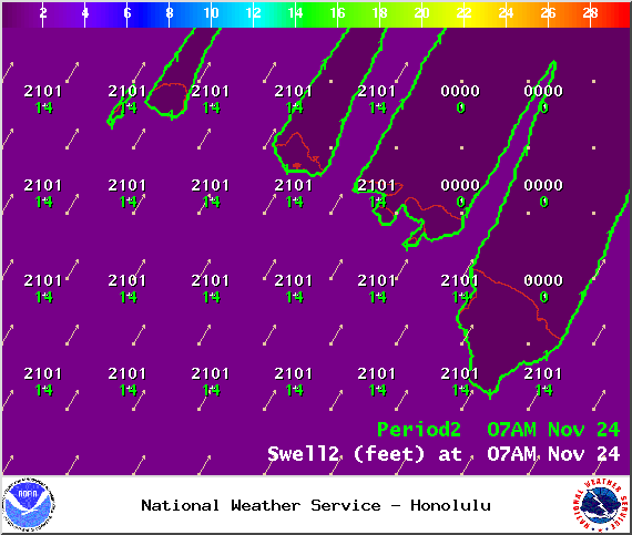
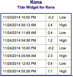
**Click directly on the images below to make them larger. Charts include: Big Island projected winds, tides, swell direction & period and expected wave heights.**
+
SWIPE LEFT OR RIGHT
ARTICLE CONTINUES BELOW AD
ARTICLE CONTINUES BELOW AD
Big Island Surf Forecast, Monday November 24, 2014
Hilo side: Surf is expected head high at the best breaks due to the tradeswell. The northwest swell isn’t at a great angle but it will filter in as well.
Kona side: Spots that catch some of the wrap could see a slight bump in wave heights, waist high or less. Breaks not exposed to the swells will be flat today.
ARTICLE CONTINUES BELOW AD
South: Southeast shores open to the trade swell could see waves up to head high or more, though sloppy and choppy conditions are expected. Waves expected thigh high at best for spots catching the tiny remnants out of the south.
Trade winds are gradually on the decline but still generating a bit of swell for the Big Island. Conditions will be choppy and sloppy.
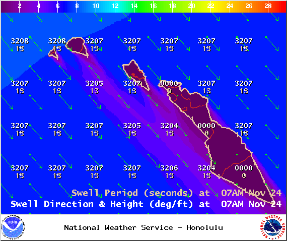
Our current northwest swell (305-330°) peaked last night at buoy 51101. Wave heights are expected overhead to possibly double overhead along the Hamakua coast. By midweek the swell is expected to begin fading. The Kona side will be shadowed but still catch a fraction of the wrap. Keep in mind, weather conditions are expected to be ideal as a front moves through bringing increased showers and shifting winds. A reinforcement to this swell is expected late Monday into Monday night, which may push us above advisory levels.
ARTICLE CONTINUES BELOW AD
Another swell out of the northeast is expected to bring another round of overhead waves late this week. There’s also the possibility of a new northwest swell for the weekend.
Super small trace amounts of swell expected out of the SPAC. There isn’t much on the horizon to get excited about.
Keep in mind, surf heights are measured on the face of the wave from trough to crest. Heights vary from beach to beach, and at the same beach, from break to break.
This comments section is a public community forum for the purpose of free expression. Although Big Island Now encourages respectful communication only, some content may be considered offensive. Please view at your own discretion. View Comments


 Big Island Surf Forecast, Monday November 24, 2014
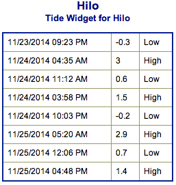 Trade winds are gradually on the decline but still generating a bit of swell for the Big Island. Conditions will be choppy and sloppy.