

Windward Showers, Breezy Winds Today
Alerts
The Small Craft Advisory is posted for all Hawaii County channels as well as Big Island leeward and southeast waters through midnight Friday. Winds of 25 to 30 knots are expected out of the northeast and seas up to 15 feet. Inexperienced mariners should avoid navigating in these conditions.
**Click directly on the images below to make them larger. Charts include: Big Island high/low forecasted temperatures, projected winds, chance of cloud cover, projected localized weather conditions, vog/SO2 forecast and expected wave heights.**
Today, Thursday November 20, 2014
Today windward and mauka areas can expect mostly cloudy skies with showers likely throughout the day. Meanwhile, the leeward side and coastline can expect a mostly clear morning before clouds begin to build in the afternoon. The UHSOEST vog model is predicting less vog than the previous couple of days. High temperatures should fall in the range of 81° to 86° and around 71° at 5000 feet. In general, east winds from 15 to 25 mph are expected.
Sunrise: 6:32 a.m.
Sunset: 5:40 p.m.
UV index at 6 (“high” exposure level)
Tonight
We expect mostly cloudy skies tonight with showers likely for windward and mauka areas and mostly clear skies in leeward spots after the clouds and showers clear from daytime heating in the afternoon and evening. Our natural air conditioning is expected to blow out of the east from 15 to 20 mph. Low temperatures should fall in the range of 70° to 75° with a low of about 55° at 5000 feet.
Moonset: 4:38 p.m.
Moonrise: 5:48 a.m. on Nov. 21
Next New Moon: Nov. 22 at 2:33 a.m.
Next Full Moon: Dec. 6 at 2:27 a.m.
The peak nights of the Leonid meteor shower have passed but the shower is active through tonight. For details on the show in the sky click here.
Looking Ahead
Trade winds are expected to remain breezy through the week with lighter winds currently forecasted for the weekend. A gradual weakening trend is expected to start Thursday night. An area of deep tropical moisture is east-southeast of the state right now and expected to spread across Hawaii & Maui Counties affecting mainly the windward sides. Friday into the weekend we cannot yet rule out the possibility of an isolated thunderstorm or two. A front is expected to reach the islands early next week, pushing down the island chain to Hawaii County sometime late on Monday or early Tuesday. Ahead of the front winds will weaken and a diurnal land / sea breeze weather pattern will set up. That in combination with unstable conditions could spawn heavy showers Sunday afternoon. Will keep an eye on this scenario and bring you the updates.
Almanac for Hilo Airport
Maximum Temperature for today:
Normal 81°
Record 87° / Set in 1992
Minimum Temperature for today:
Normal 67°
Record 61° / Set in 1960
**Click here for your detailed Big Island surf report.**
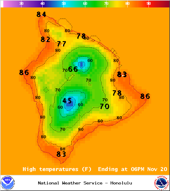
Image: NOAA / NWS
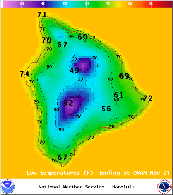
Image: NOAA / NWS
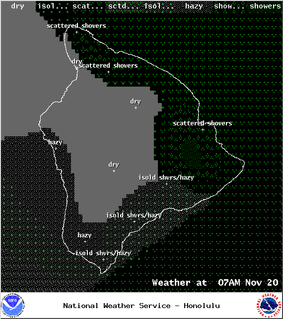
Image: NOAA / NWS
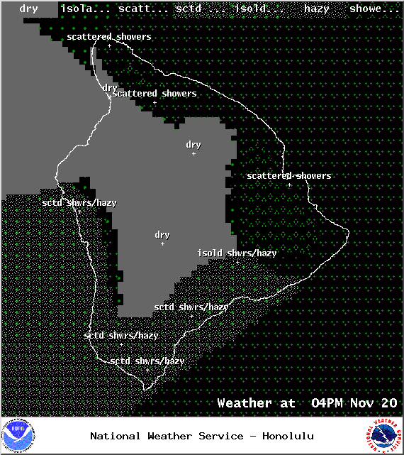
Image: NOAA / NWS
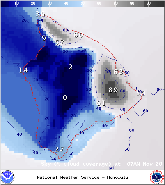
Image: NOAA / NWS
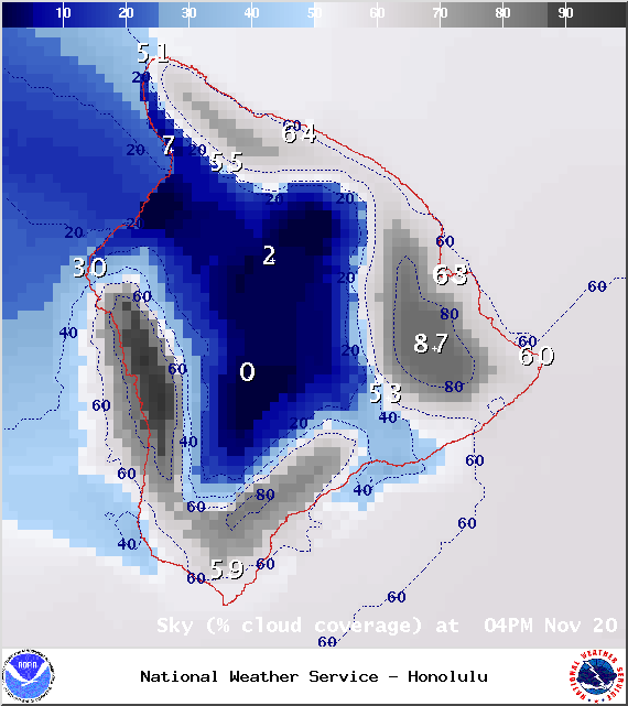
Image: NOAA / NWS
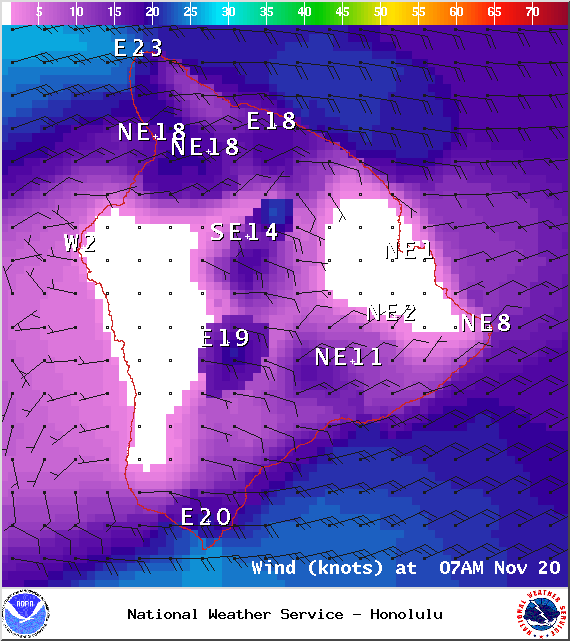
Image: NOAA / NWS
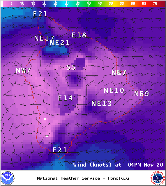
Image: NOAA / NWS
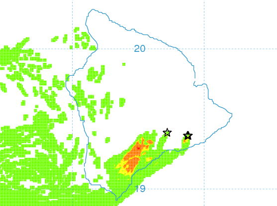
Vog Model – Image: UHSOEST
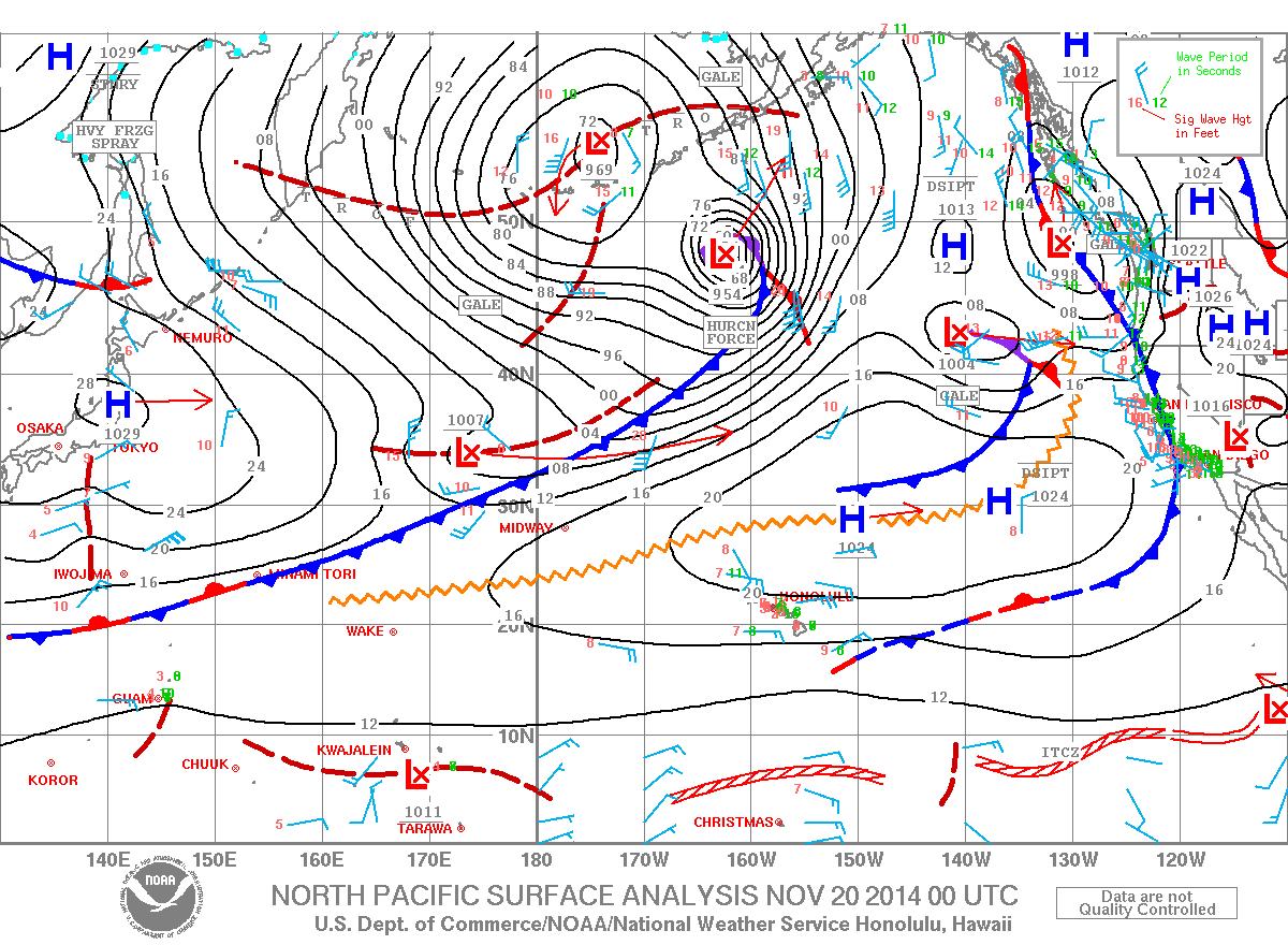
Image: NOAA / NWS
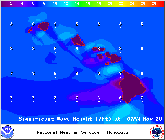
Image: NOAA / NWS
Sponsored Content


