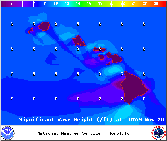
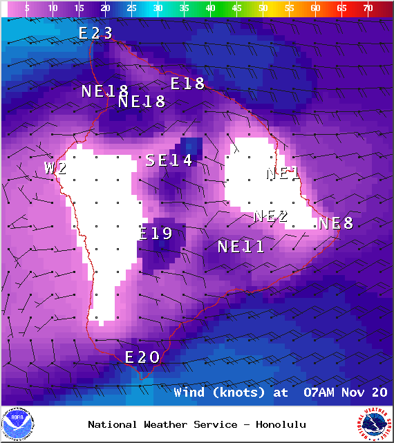
The Small Craft Advisory is posted for all Hawaii County channels as well as Big Island leeward and southeast waters through midnight Friday. Winds of 25 to 30 knots are expected out of the northeast and seas up to 15 feet. Inexperienced mariners should avoid navigating in these conditions.
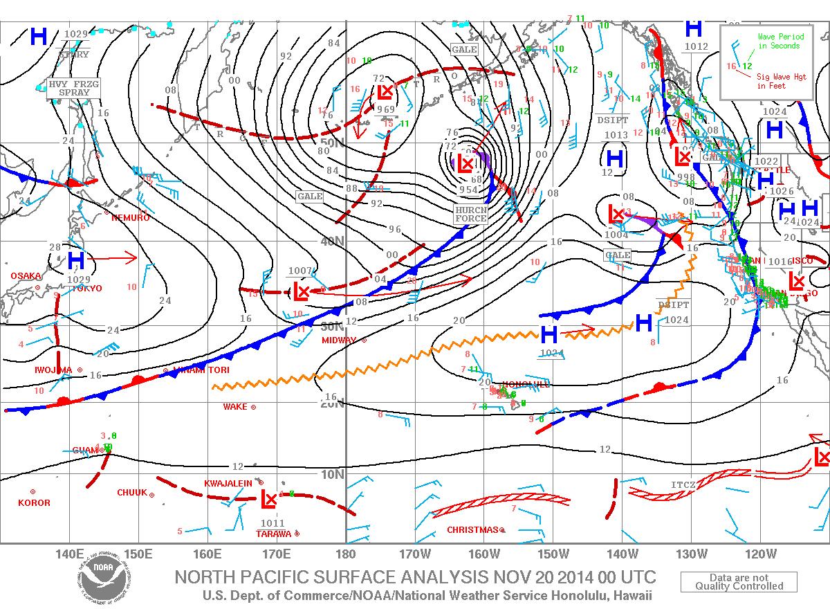
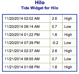
**Click directly on the images below to make them larger. Charts include: Big Island projected winds, tides, swell direction & period and expected wave heights.**
+
SWIPE LEFT OR RIGHT
Big Island Surf Forecast, Thursday November 20, 2014
ARTICLE CONTINUES BELOW AD
ARTICLE CONTINUES BELOW AD
Hilo side: Surf is expected in the head high to possibly even slightly overhead at the best breaks due to the tradeswell. Waist to head high surf due to the northwest wrapping around the island.
Kona side:Breaks not exposed to the swells will be flat today. Spots that catch some of the new northwest wrap could see a slight bump in wave heights possibly up to waist high.
South: Waves expected waist high at best. Southeast shores open to the trade swell could see waves up to head high or more, though sloppy and choppy conditions are expected.
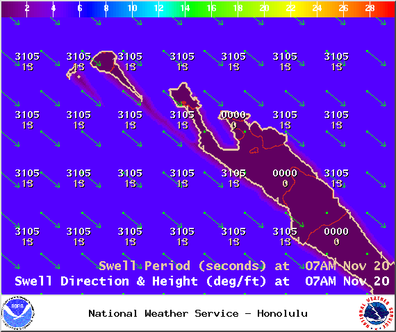
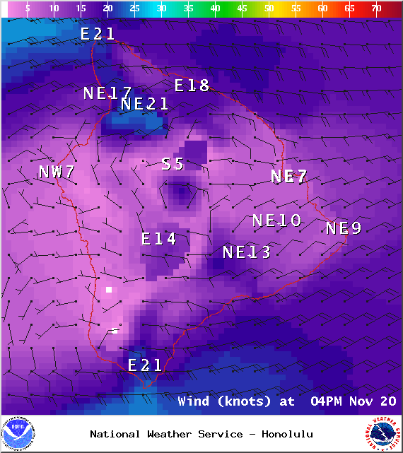
Trade winds are breezy with a slow weakening trend expected. Today through Saturday short-period tradeswell is expected to continue affecting windward shores. Conditions will be choppy and sloppy.
ARTICLE CONTINUES BELOW AD
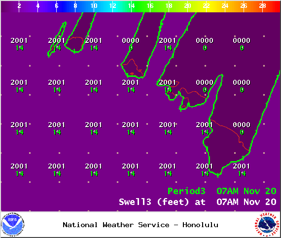
A west-northwest swell (300-330°) is filling in, expected to peak this afternoon and hold for a couple of days. Expected wave heights are up to possibly head high for the Hilo side and waist high for the Kona side.
Another northwest swell (305-330°) is expected to build late Sunday. If the storm develops as the models are indicating right now, we could see wave heights overhead to maybe even a few feet overhead. Will keep an eye on it. There’s also the possibility of a north swell for the middle of next week.
Our current small bump (220-190°) is expected to be waist high or less at the best breaks through Friday. Otherwise, super small trace amounts of swell expected out of the SPAC. There isn’t much on the horizon to get excited about.
Keep in mind, surf heights are measured on the face of the wave from trough to crest. Heights vary from beach to beach, and at the same beach, from break to break.
ARTICLE CONTINUES BELOW AD
**Click here for your detailed Big Island weather report.**
This comments section is a public community forum for the purpose of free expression. Although Big Island Now encourages respectful communication only, some content may be considered offensive. Please view at your own discretion. View Comments


 Big Island Surf Forecast, Thursday November 20, 2014
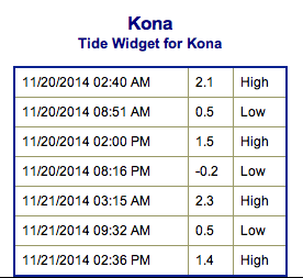 Trade winds are breezy with a slow weakening trend expected. Today through Saturday short-period tradeswell is expected to continue affecting windward shores. Conditions will be choppy and sloppy.