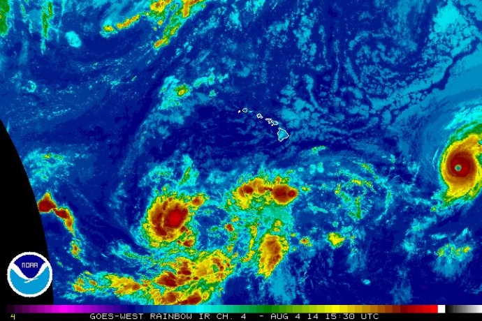
Hurricane Iselle Continues on Track Toward Hawaiʻi
Hurricane Iselle has increased strength and is now listed as a Category 4 hurricane.
The system was located about 1,245 miles east of Hilo, and 1,345 miles ESE of Kahului this morning, and was moving west at 10 mph.
Forecasters with the National Hurricane Center say the system has sustained winds of 140 mph, with hurricane force winds extending outward from the center up to 35 miles, and tropical storm force winds extending outward up to 105 miles.
The system is expected to move into the Central Pacific on Tuesday morning. Forecasters say the system is projected to pass over or near the Big Island of Hawaiʻi as early as Thursday night, with other islands in the state seeing possible impacts by Friday.
Forecasters with the National Hurricane Center say little change is expected in Iselle’s strength today, but gradual weakening is forecast during the next couple of days.

Hurricane Iselle satellite imagery, Monday, Aug. 4, 2014. Image courtesy Central Pacific Hurricane Center/NOAA/NWS.
Forecasters with the National Hurricane Center, Central Pacific Hurricane Center, and the National Weather Service say there is still uncertainty surrounding the exact track of the system and its potential impacts on the state.
Further to the east, forecasters are tracking a separate system, Tropical Storm Julio, which is locate 2,395 miles ESE of Hilo and 2,485 miles ESE of Kahului, Maui. Julio was last located southwest of the southern tip of the Baja California peninsula.
Julio continues to move west at 13 miles per hour with maximum sustained winds of 45 mph. The National Hurricane Center is projecting that Julio will have some strengthening in the next 48 hours, and could be near hurricane strength on Wednesday.
The Hurricane season in Hawaii began on June 1, and runs through Nov. 30.
Sponsored Content
Comments


