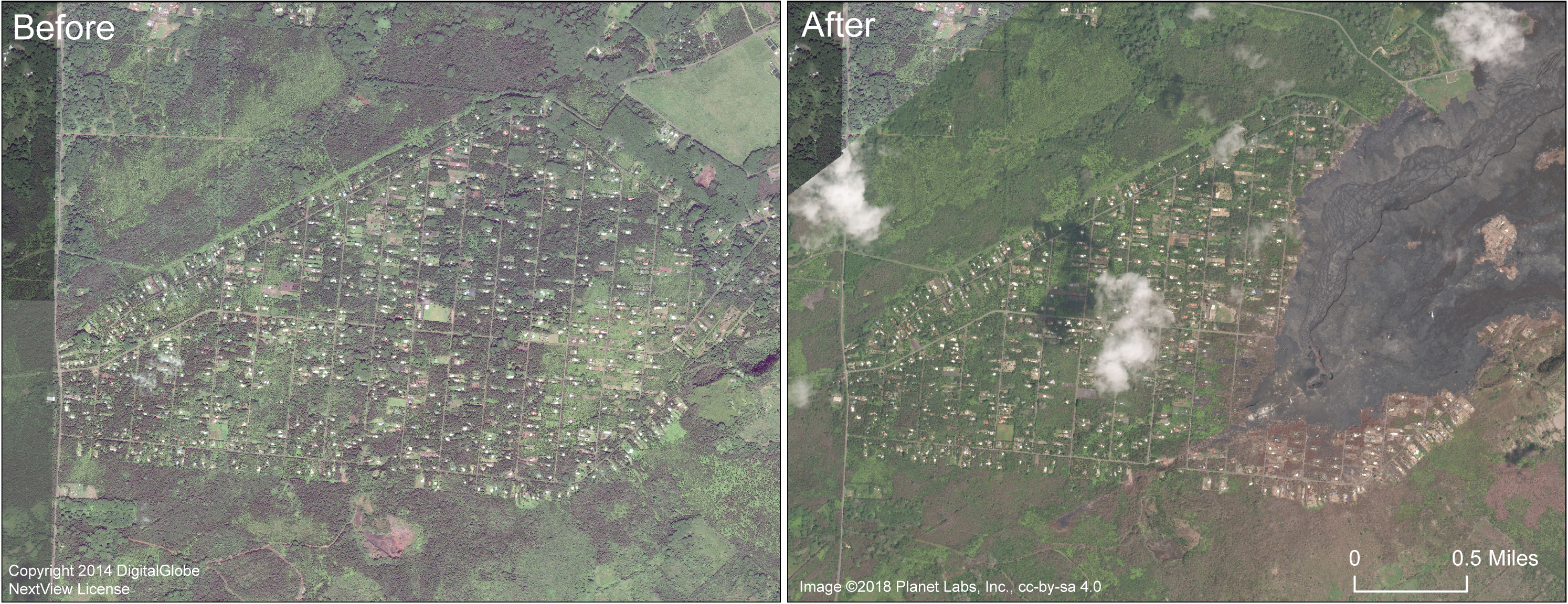
The U.S. Geological Survey released these before and after satellite images of the Leilani Estates subdivision.
This comparison shows satellite images of Leilani Estates subdivision before and after. The image on the right, collected in early September 2018, shows that the eastern portion of the subdivision has been covered by lava.
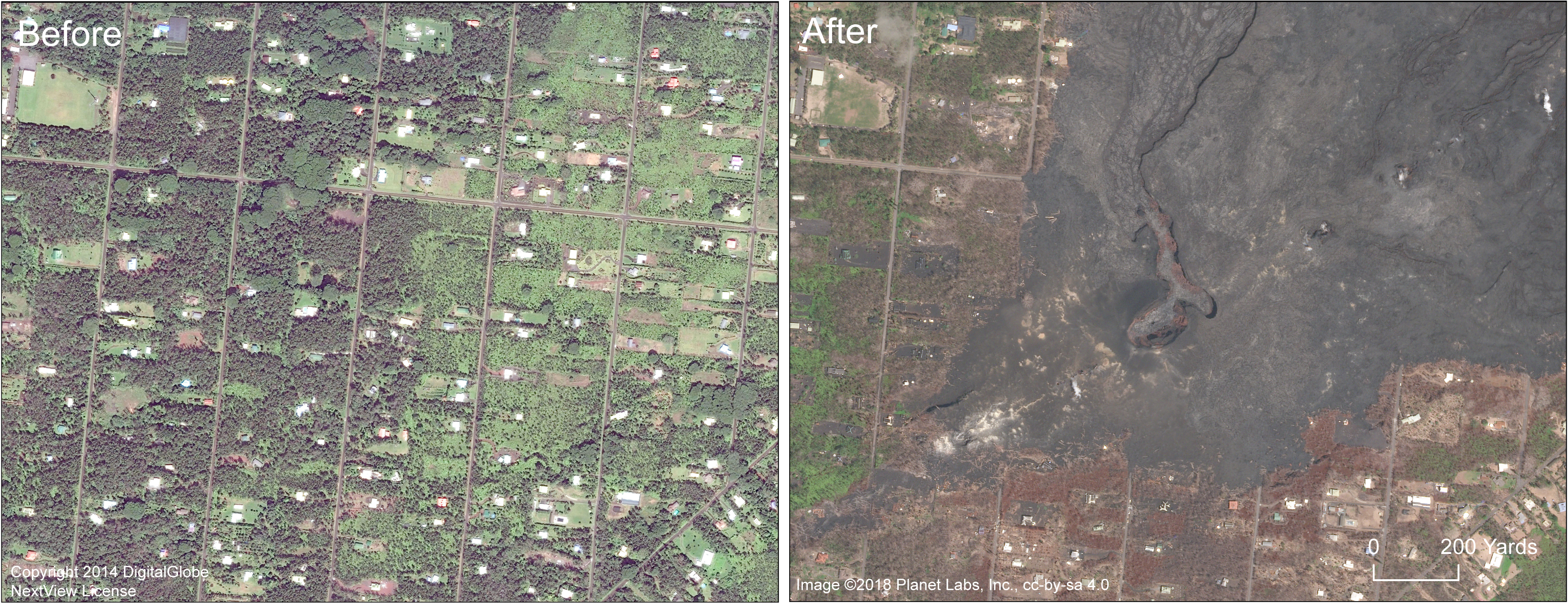
Before and after satellite images of the Fissure 8 area in Leilani Estates. Click to enlarge. PC: USGS
The Fissure 8 lava channel runs northeast from the Fissure 8 cone at the start of the channel. Note also the brown areas of dead vegetation south of the lava flow. Highway 130 runs north-south along the left side of the images.
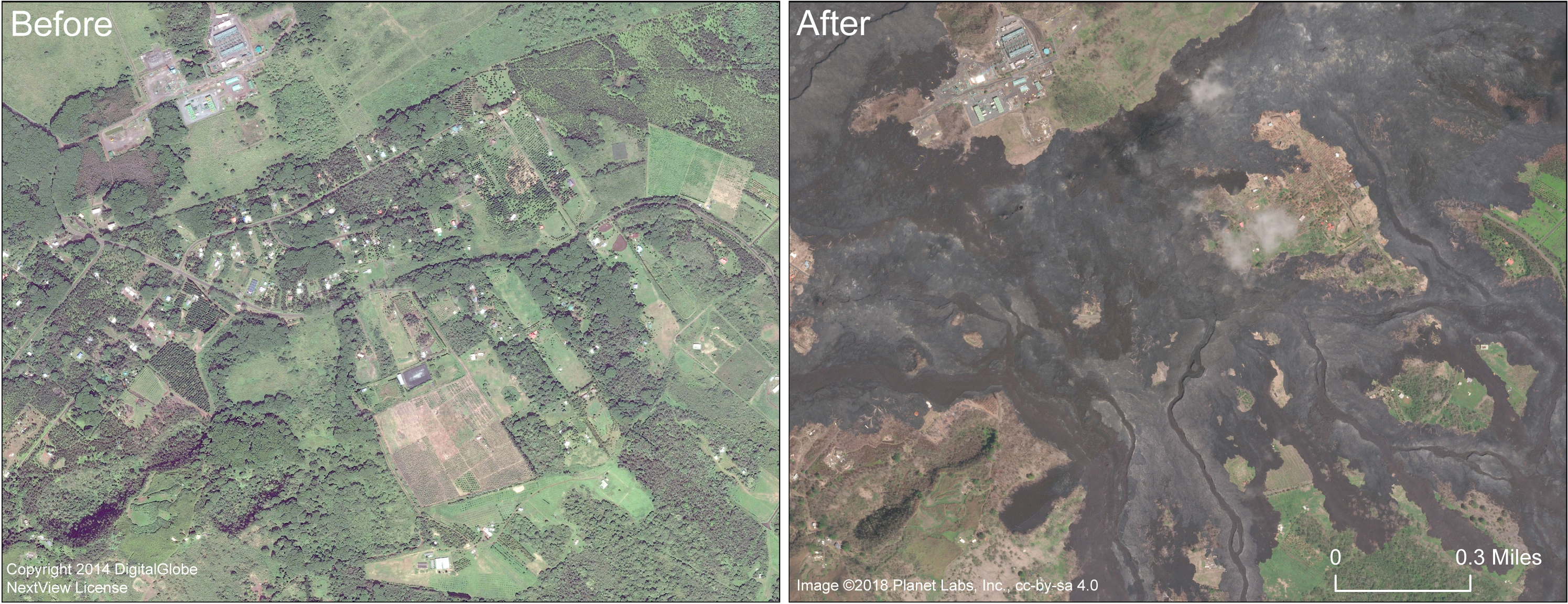
A close up comparison of the Fissure 8 area in Leilani Estates subdivision. Leilani Avenue runs right-left (east-west) through the center of the images.
Before and after satellite images of the Fissure 8 area in Leilani Estates. Click to enlarge. PC: USGS
ARTICLE CONTINUES BELOW AD
ARTICLE CONTINUES BELOW AD
On the right side, the crater within the Fissure 8 cone is visible. The Fissure 8 lava channel extends north from the cone.
For a map of the 2018 lower East Rift Zone eruption fissures and surrounding area, see the HVO web site.
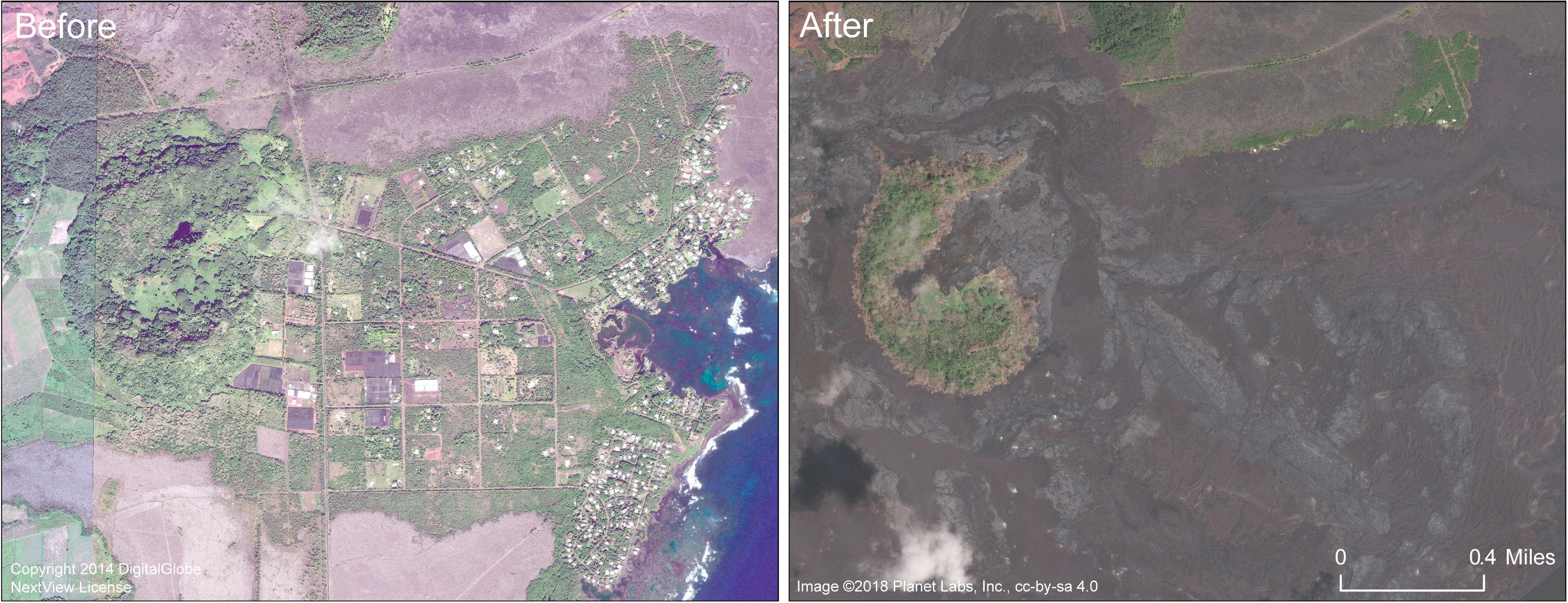
This comparison shows before and after images in the area of Lanipuna Gardens subdivision. Pohoiki Road runs left to right through the center of the image.
Before and after satellite images of Lanipuna Gardens subdivision. Click to enlarge. PC: USGS
ARTICLE CONTINUES BELOW AD
The Puna Geothermal Ventures site is in the upper left portion of the image.
This comparison shows the area of Kapoho before and after. Kapoho Crater is in the left portion of the image. Lava filled much of the crater, including the small nested crater that contained Green Lake. The Kapoho Beach Lots subdivision is in the right side of the image, north of Kapoho Bay, and was completely covered by the Fissure 8 lava flow.
Before and after satellite images of Kapoho. Click to enlarge. PC: USGS
Vacationland Hawai‘i, in the lower right corner of the image, was also completely covered, along with the adjacent tide pools. Kapoho Farm Lots, near the center of the image, is also beneath the flow.
This comments section is a public community forum for the purpose of free expression. Although Big Island Now encourages respectful communication only, some content may be considered offensive. Please view at your own discretion. View Comments