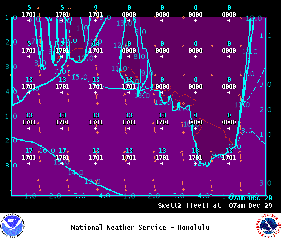
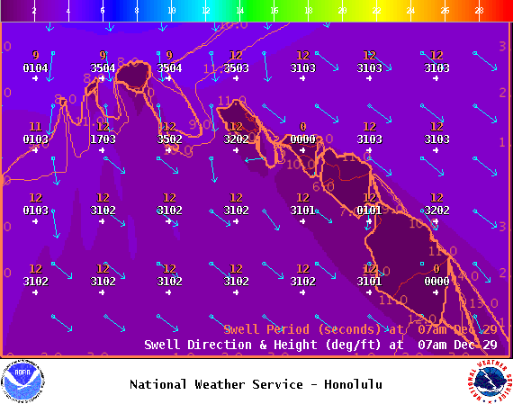
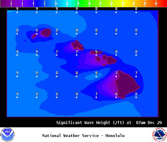
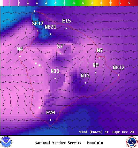
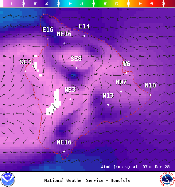
**Click directly on the images below to make them larger. Charts include: Big Island projected winds, tides, swell direction & period and expected wave heights.**
+
SWIPE LEFT OR RIGHT
Big Island Surf Forecast
ARTICLE CONTINUES BELOW AD
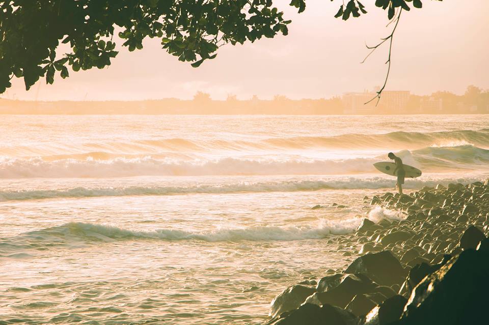
Hilo side: Wave heights are forecast to be head high to possibly overhead today for the best breaks.
Kona side: Wave heights are expected to be down to leftovers today and below waist high. Spots catching the northwest getting up to ankle/waist high on the sets.
South: Wave heights are expected to be down to leftovers today and below waist high. Spots catching the northwest getting up to ankle/waist high on the sets.
Small south-southwest continues Wednesday. Nothing significant is expected out of the SPAC in the near future although a small south swell is forecast for the 31st and 1st with another little bump on the horizon for the 4th.
ARTICLE CONTINUES BELOW AD
Our current northwest swell is forecast to peak Wednesday. This swell is not expected to be quite as big as our Christmas swell. The Kona side will be shadowed.
A trade wind swell will also continue showing today.
Keep in mind, surf heights are measured on the face of the wave from trough to crest. Heights vary from beach to beach, and at the same beach, from break to break.
This comments section is a public community forum for the purpose of free expression. Although Big Island Now encourages respectful communication only, some content may be considered offensive. Please view at your own discretion. View Comments


 Big Island Surf Forecast
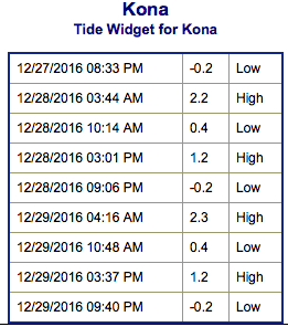 Small south-southwest continues Wednesday. Nothing significant is expected out of the SPAC in the near future although a small south swell is forecast for the 31st and 1st with another little bump on the horizon for the 4th.