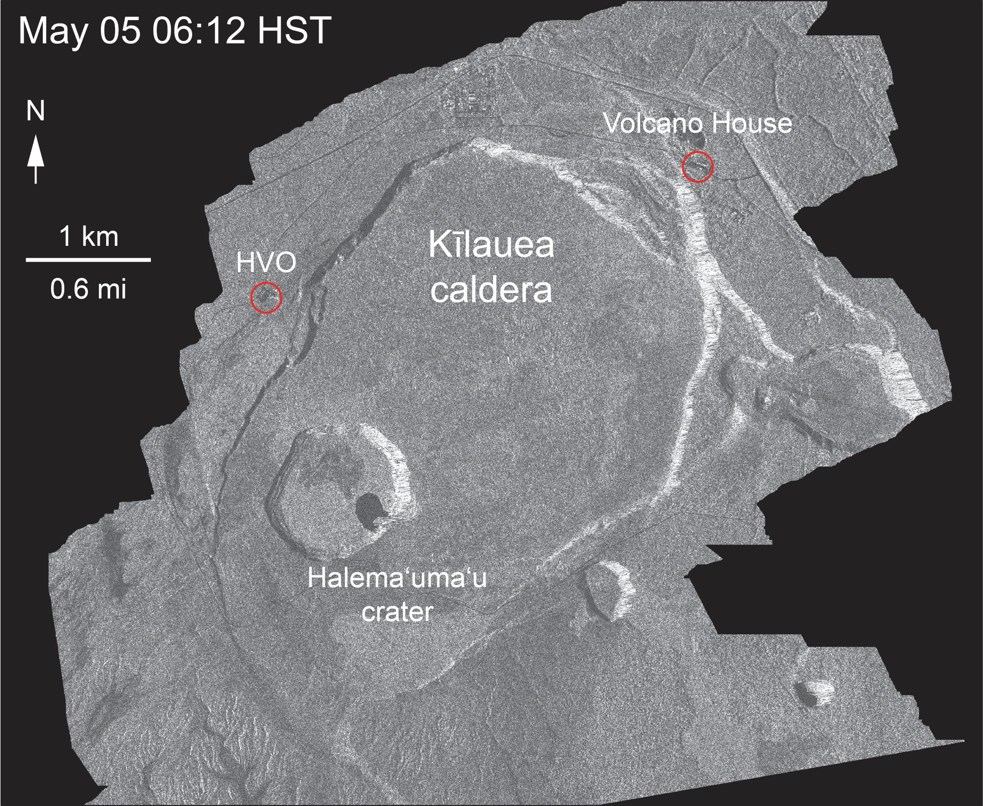
The U.S. Geological Survey released this satellite radar animation that shows continued slumping of Kīlauea caldera on July 16, 2018. This animated GIF shows a sequence of radar amplitude images that were acquired by the Agenzia Spaziale Italiana CosmoSkyMed satellite system.
Satellite radar animation shows continued slumping of Kīlauea caldera. VC: USGS
The images illustrate changes to the caldera area of Kīlauea Volcano that occurred between May 5, and July 16, 2018, at about 6 a.m. The satellite transmits a radar signal at the surface and measures the strength of the return, with bright areas indicating a strong return and dark areas a weak return. Strong returns indicate rough surfaces or slopes that point back at the radar, while weak returns come from smooth surfaces or slopes angled away from the radar.
Over time, expansion of the summit eruptive vent within Halema‘uma‘u crater and the widening of Halema‘uma‘u itself are obvious. Starting in late May, the development of several cracks outside Halema‘uma‘u is clear, and inward slumping of a large portion of the western, southwestern, and northern crater rim begins. Much of this motion appears to be coincident with the small explosions from the summit that have taken place on a near daily basis since early June. The most recent radar scene, from July 16, shows continued motion along cracks over a broader area of the caldera floor, extending east of Halema‘uma‘u. The USGS expects this slumping to continue as long as the collapse events and overall subsidence persist.
Photos of Kīlauea Volcano’s lower East Rift Zone taken by the U.S. Geological survey on Monday, July 16, 2018.
ARTICLE CONTINUES BELOW AD
ARTICLE CONTINUES BELOW AD
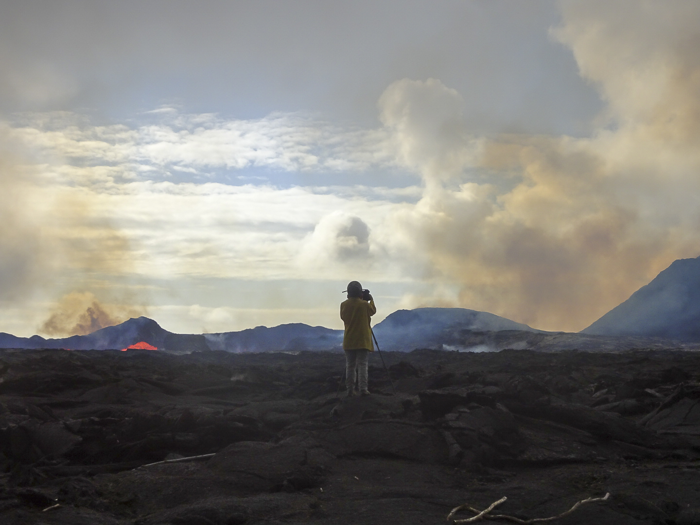
USGS field crews monitor Kīlauea Volcano’s lower East Rift Zone eruption around the clock.
USGS field crews monitor the East Rift Zone on July 16, 2018. Click to enlarge PC: USGS
Here, a scientist takes video of lava as it exits the Fissure 8 cinder cone. The video helps document lava flow behavior, including flow velocity and cooling characteristics, as well as changes to the lava channel.
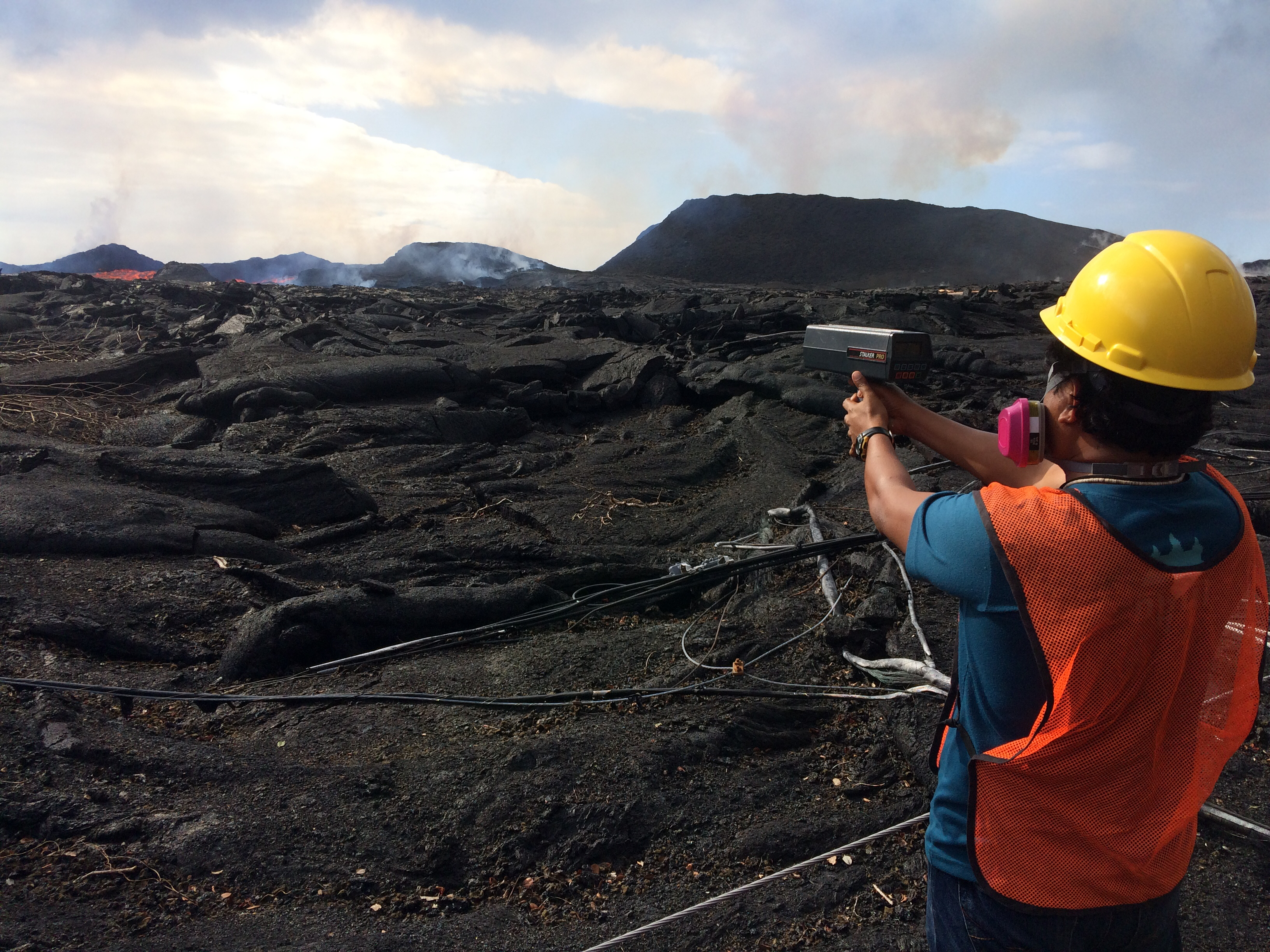
A radar gun, similar to that used in traffic enforcement, is one way that the approximate speed of lava can be measured as it exits the Fissure 8 vent.
USGS Field Staff monitor the East Rift Zone on July 16, 2018. Click to enlarge. PC: USGS
ARTICLE CONTINUES BELOW AD
At the time of this measurement, the flow velocity averaged 18 miles per hour.
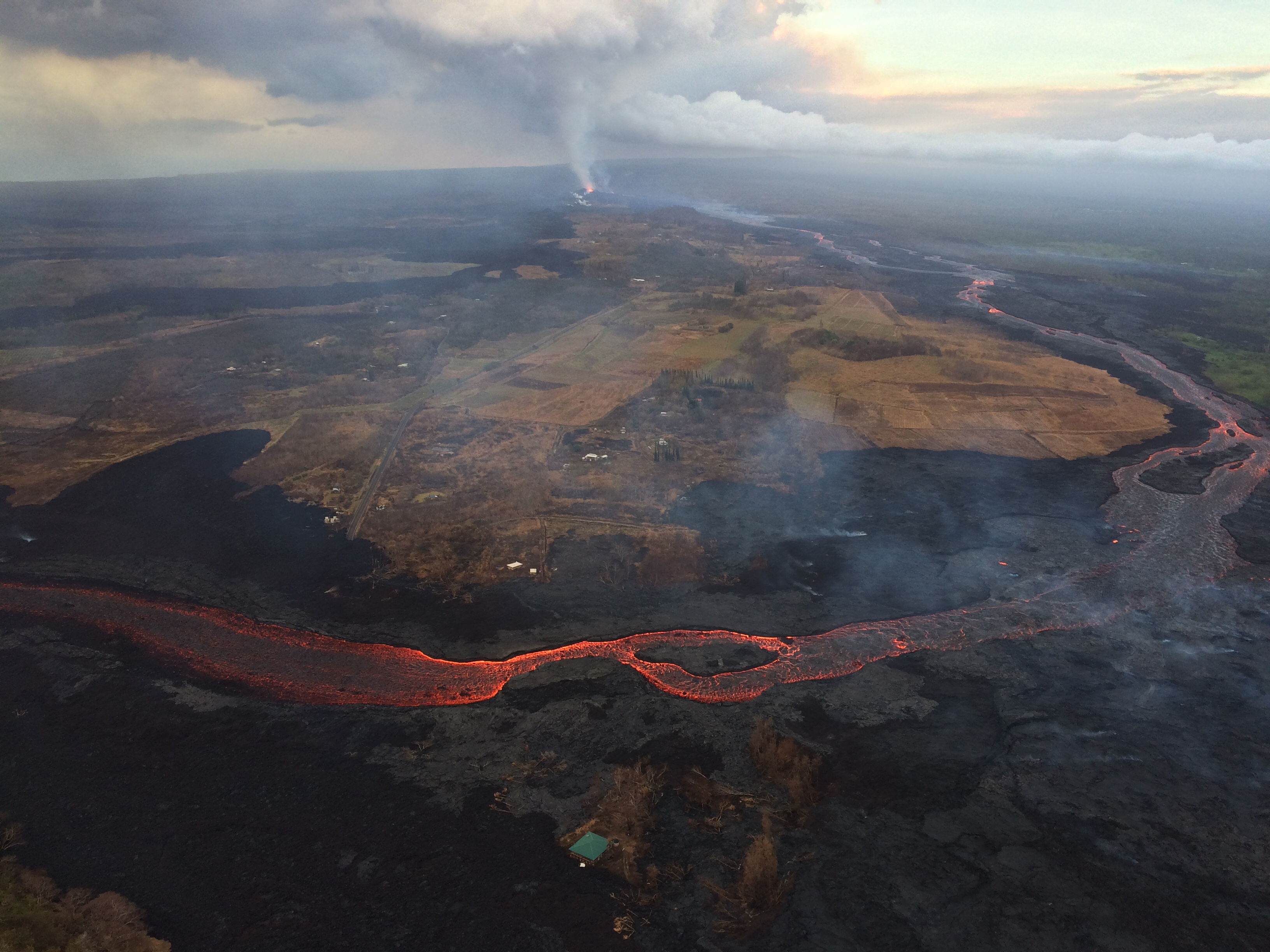
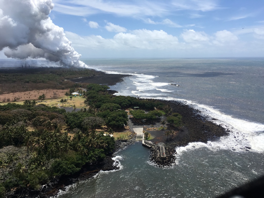
An aerial view of Kīlauea Volcano’s lower East Rift Zone taken during HVO’s early morning overflight July 16, 2018, looking to the west, up the lava channel toward Fissure 8 (center, far distance).
The East Rift Zone on July 16, 2018. PC: USGS
The Fissure 8 channel was full Monday morning, July 16, 2018, but lava was not quite up to the levee rim, so there were no significant overflows.
ARTICLE CONTINUES BELOW AD
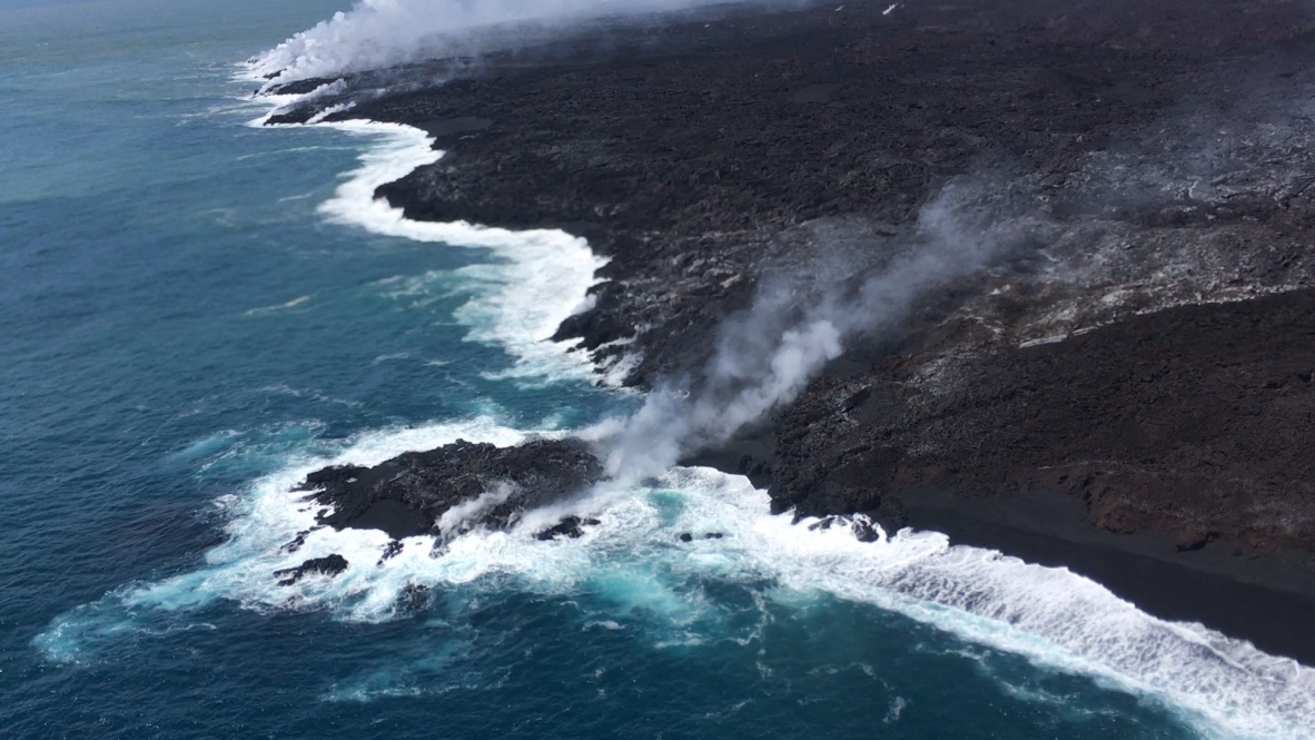
The active ocean entry along the southernmost margin of the Fissure 8 flow is a hazardous area.
Lava enters the ocean on July 16, 2018. PC: USGS
The interaction of lava and seawater creates “laze,” a corrosive steam plume laced with hydrochloric acid and fine volcanic glass particles that is blown downwind and can irritate the skin, eyes, and lungs. Lava flows entering the ocean can also result in explosive interactions, littoral explosions, that can hurl fragments of molten lava and rocky debris hundreds of yards inland and seaward.
The Hawai‘i County Civil Defense released these photos on an overflight on Saturday, July 14, 2018.
The tiny lava island was almost connected to the Big Island. PC: HFD
Pohoiki has not been taken as of Monday, July 16, 2018.
Pohoiki boat harbor on Saturday, July 14, 2018. Click to enlarge. PC: HFD.
This comments section is a public community forum for the purpose of free expression. Although Big Island Now encourages respectful communication only, some content may be considered offensive. Please view at your own discretion. View Comments