The U.S. Geological Survey released these photos of the East Rift Zone on Wednesday, July 4, 2018.
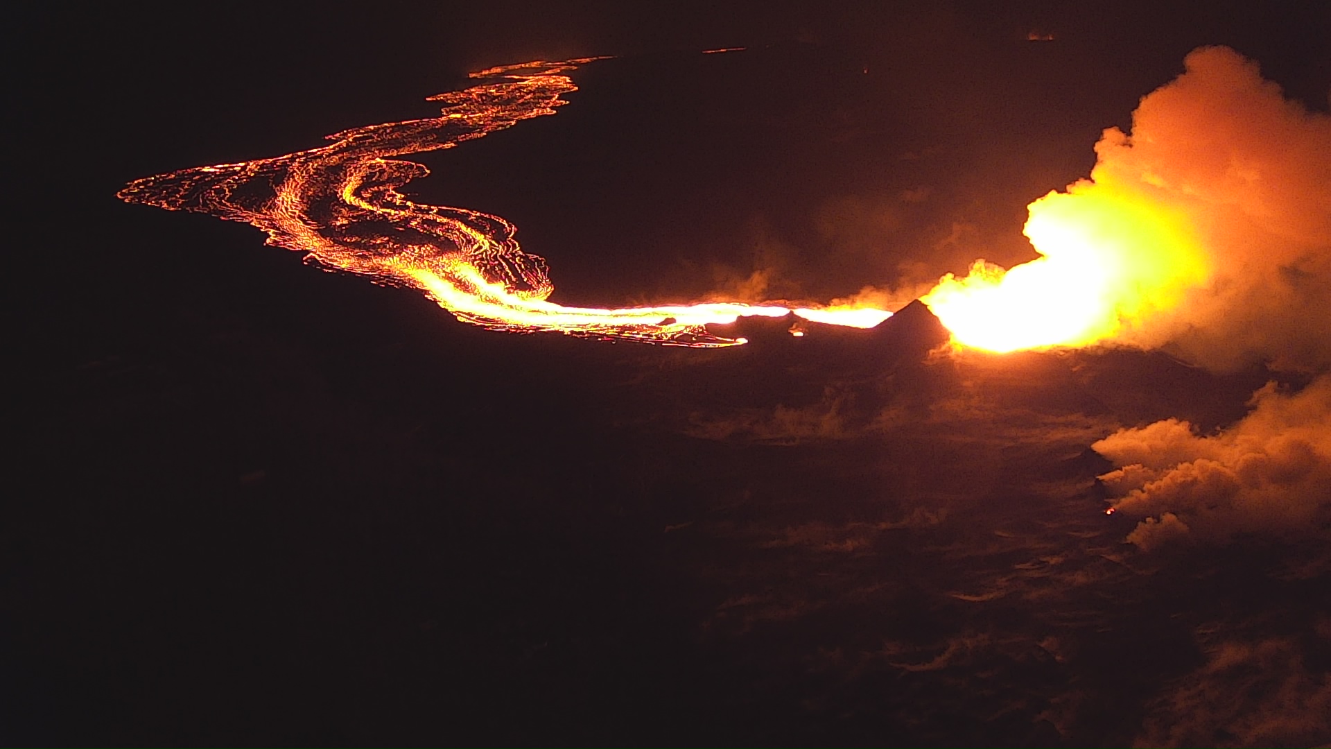
Overnight views show Fissure 8 lava roiling in the vent and feeding a pulsing channel
Fisheye lens photograph of a USGS geologist making observations of the Fissure 8 lava channel at sunset July 3, 2018.
The glow of the Fissure 8 vent is the bright spot in the center of a different cone, Halekamahina. July 4, 2018. PC: USGS
The field crew is at a high point overlooking the channel near where it makes a 90 degree turn around Kapoho Crater and flows south.
USGS scientist observes the glow of Fissure 8 fountain and channel within Leilani Estates.
Steam rises from cracks and hot spots within the tephra deposit surrounding the cone. July 4, 2018. PC: USGS
ARTICLE CONTINUES BELOW AD
ARTICLE CONTINUES BELOW AD
Frequent observations of the cone and channel are made throughout the day and night to track changes that could lead to signfiicant breakouts beyond the current flow field.
USGS Unmanned Aircraft Systems image of Fissure 8 looking east.
Below the prominent Fissure 8 cone, smaller vents above the original fissure emit volcanic gas. July 4, 2018. PC: USGS
Lava has a brighter glow near the vent exit where it is more turbulent than in the downstream channel, which has portions of darker, cooled crust on its surface.
Lava within the Fissure 8 cone roils and churns where it eupts from the vent and flows rapidly down the well-established channel.
Mavic Pro drone photo taken on July 4, 2018. PC: USGS
ARTICLE CONTINUES BELOW AD
This image was captured via a Mavic Pro drone courtesy of the DOI/USGS Unmanned Aircraft Systems team.
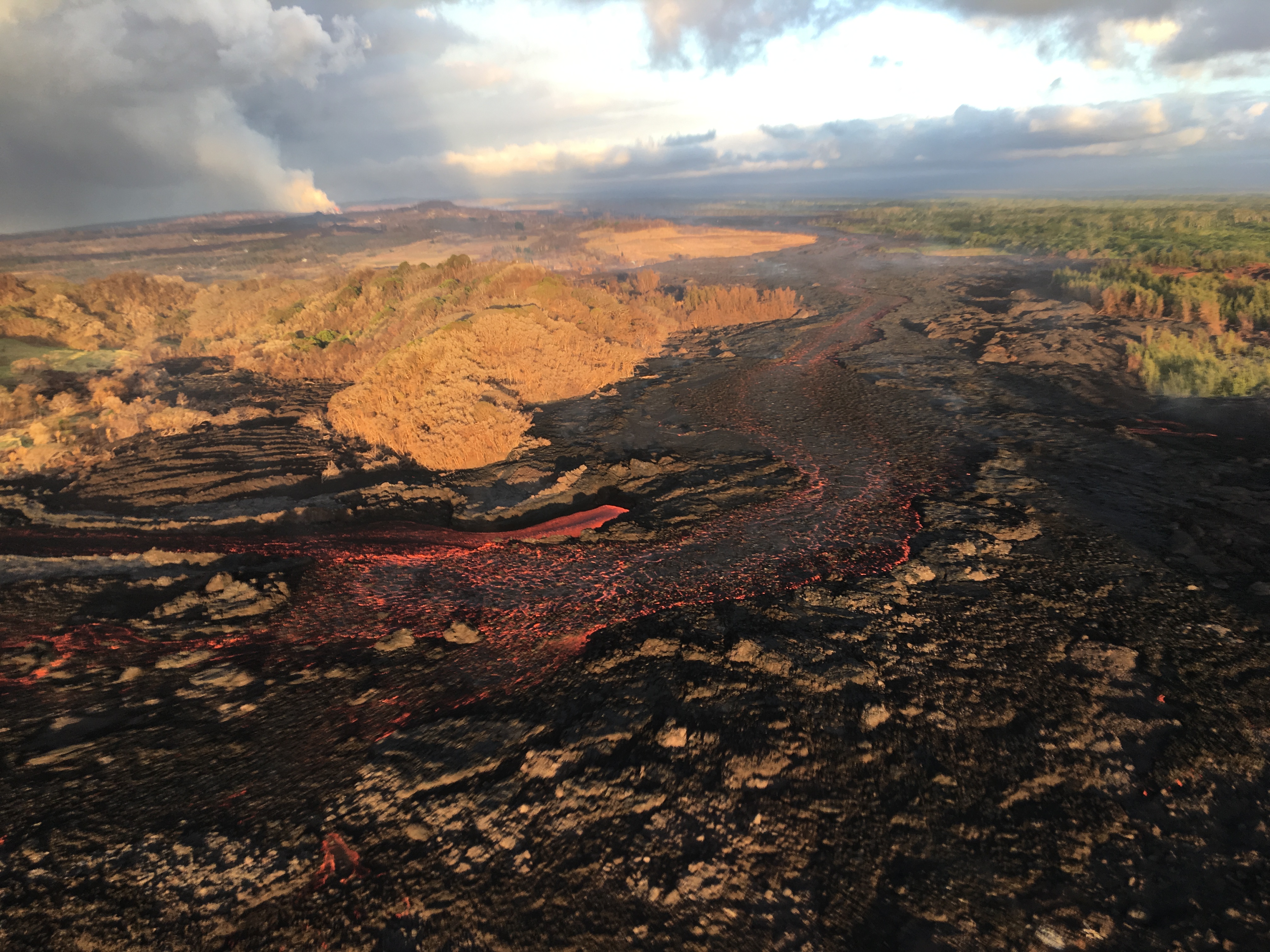
The lava channel from Fissure 8 jumped its banks near Kapoho Crater where the channel makes a 90 degree bend.
Flow within the channel on July 4, 2018. PC: USGS
The flow within the channel was diverted around a constricted area and joined the channel again “downstream” to the south (left).
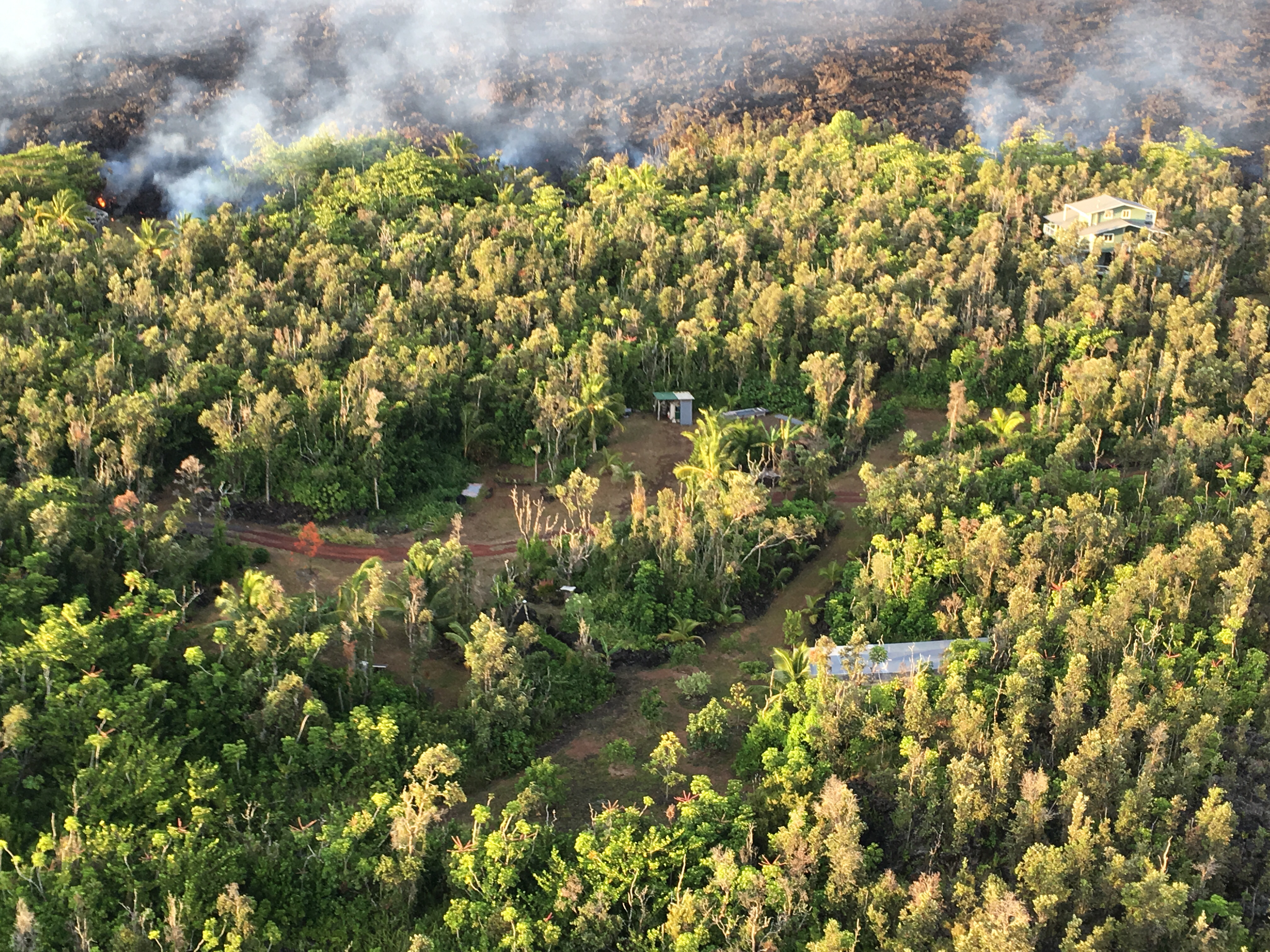
Near the coast, the northern margin of the flow field is still oozing pasty lava at several points in the area of Kapoho Agricultural and Beach Lots.
Near the coast on July 4, 2018. PC: USGS
ARTICLE CONTINUES BELOW AD
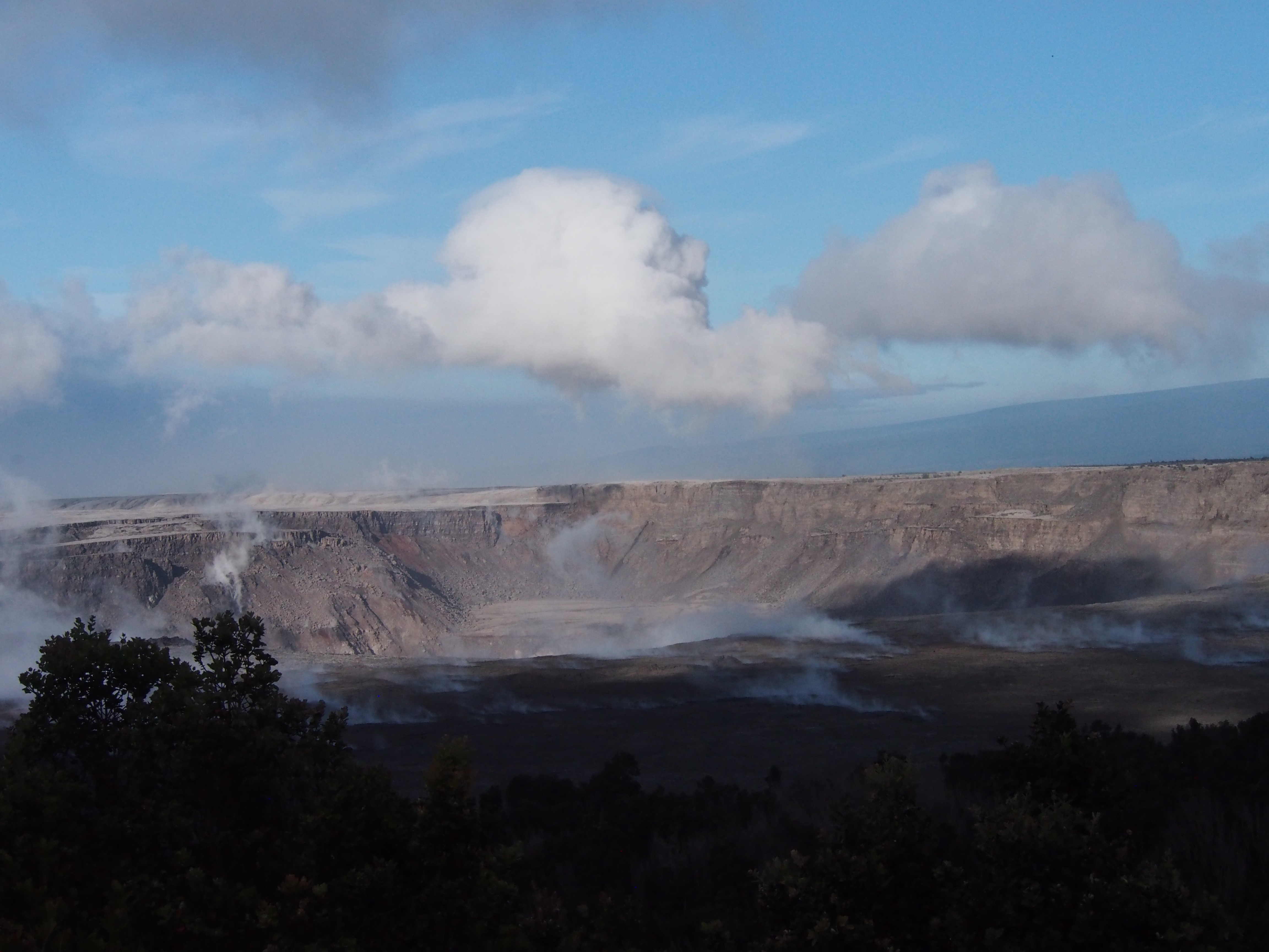
Sunrise at Kīlauea Volcano’s summit shows an enlarged Halema‘uma‘u crater
Sunrise view of Halema‘uma‘u crater as seen from the USGS observation point from Volcano House in Hawai‘i Volcanoes National Park.
Sunrise view of Halema‘uma‘u crater on July 4, 2018. PC: USGS
This comments section is a public community forum for the purpose of free expression. Although Big Island Now encourages respectful communication only, some content may be considered offensive. Please view at your own discretion. View Comments