

New NW Fills in, High Surf Advisory Posted

Image: James Grenz
Alerts (as of 1:00 a.m.)
A High Surf Advisory is posted for the north shore of the Big Island from 6 a.m. Friday through 6 a.m. Saturday.
A Small Craft Advisory is posted for our usual windiest Hawaii County waters through 6 p.m. Sunday.
**Click directly on the images below to make them larger. Charts include: Big Island projected winds, tides, swell direction & period and expected wave heights.**
 Big Island Surf Forecast
Hilo side: Wave heights are forecast from head high to overhead today for the best breaks.
Kona side: Wave heights are expected to be pretty flat today in the morning. As a shadowed northwest fills in, we’ll see inconsistent knee/waist high waves in the afternoon.
South: Wave heights are expected to be pretty flat today in the morning. As a shadowed northwest fills in, we’ll see inconsistent knee/waist high waves in the afternoon. Spots that are more open to the wrap will be bigger.
 A new northwest swell is expected to build Friday and hold into Saturday before fading out. Another modest dose of north-northeast is forecast for the 20th through 22nd.
Nothing significant is expected out of the SPAC with minimal leftovers expected this week.
Keep in mind, surf heights are measured on the face of the wave from trough to crest. Heights vary from beach to beach, and at the same beach, from break to break.
**Click here for your detailed Big Island weather report.**

Image: NOAA

Image: NOAA
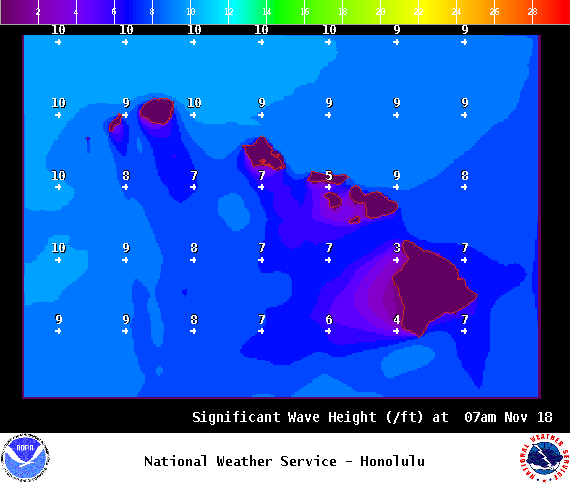
Image: NOAA
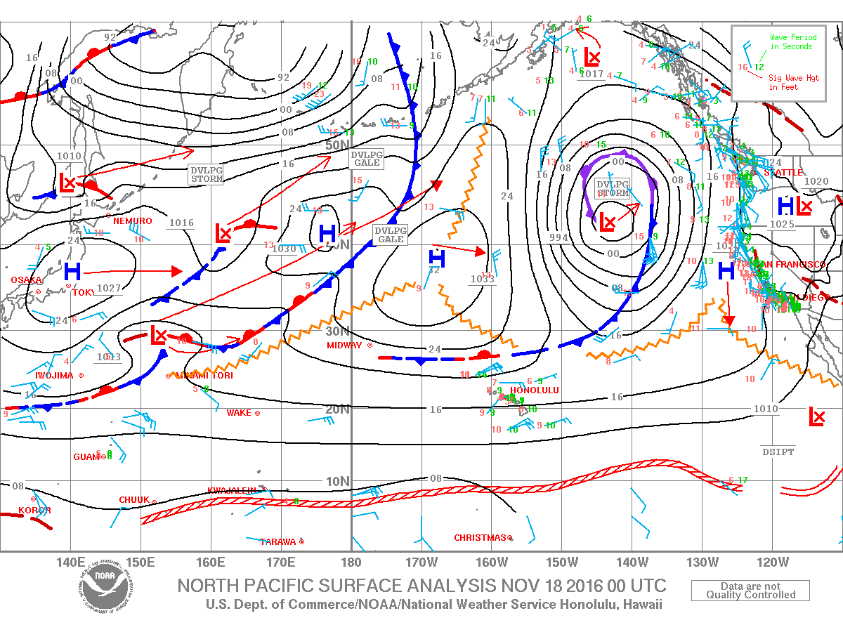
Image: NOAA
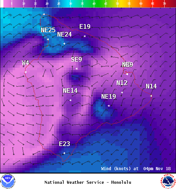
Image: NOAA
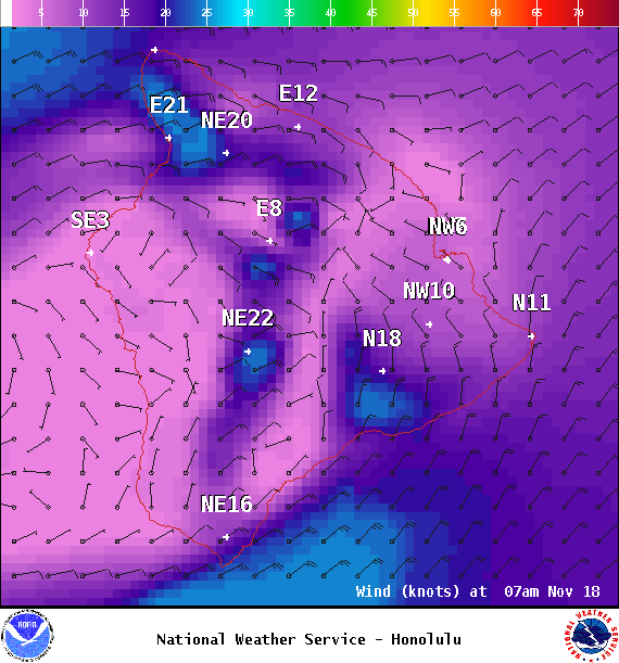
Image: NOAA
Sponsored Content


