Weather

Numerous Hurricane Alerts Posted as Madeline Approaches

Play
Listen to this Article
2 minutes
Loading Audio... Article will play after ad...
Playing in :00
A
A
A

no slideshow

Image: James Grenz

Alerts (as of 1:00 a.m.)

A Tropical Storm Warning is posted for the island of Hawaii. Tropical Storm conditions are likely within 36 hours.

A Hurricane Warning is posted for all offshore waters in the Hawaiian Islands.

A High Surf Warning is posted from 6 a.m. Tuesday through 6 a.m. Thursday for east facing shores.

A Flash Flood Watch is posted from Wednesday morning through late Thursday night.

ARTICLE CONTINUES BELOW AD

A Hurricane Watch is posted for waters around the Big Island.

Click HERE for Meteorologist Malika Dudley’s LIVE 5 a.m. video “Category 3 Hurricane Madeline Update”.

Hurricane Madeline updates can found at this link throughout this event. 

Check our breaking news section for any urgent weather alerts or updates to the weather alerts listed above.

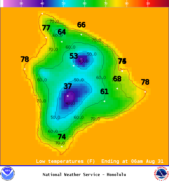
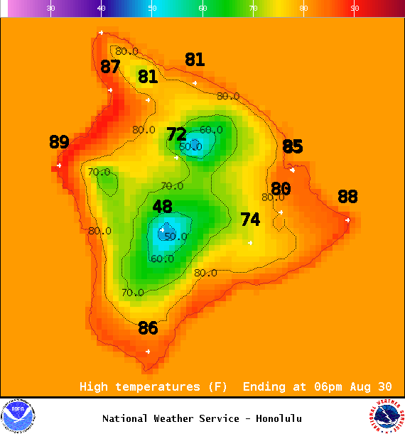
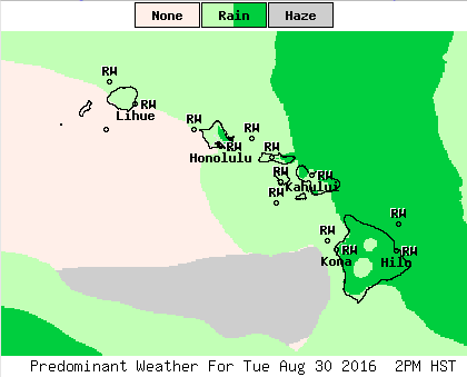
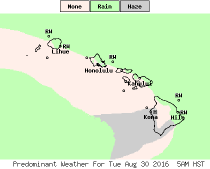
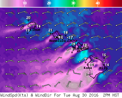
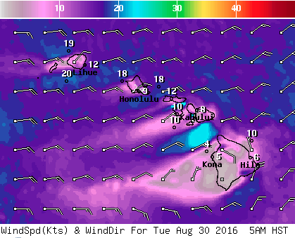
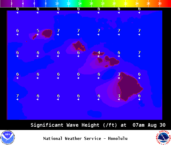
**Click directly on the images below to make them larger. Charts include: Big Island high/low forecasted temperatures, projected winds, chance of cloud cover, projected localized weather conditions, vog/SO2 forecast and expected wave heights.**

    +
    SWIPE LEFT OR RIGHT
ARTICLE CONTINUES BELOW AD


Looking Ahead

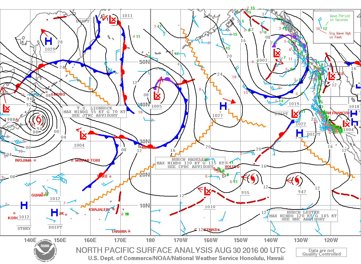
Moderate trade winds are forecast to continue through Tuesday with an increase in moisture. Uncertainty is still high when it comes to the forecast track for Hurricane Madeline, however direct impacts, including damaging winds, flooding rain, and high surf, are likely over portions of the state during the Wednesday through Thursday time frame. After a brief return of stable trade wind weather, Hurricane Lester may affect the islands over the upcoming Labor Day weekend. Will keep an eye on it.


Today 

ARTICLE CONTINUES BELOW AD

Mostly cloudy skies today with occasional windward showers. Mostly clear for the Kona side in the morning with clouds building in the afternoon and scattered showers. Haze is expected. High temperatures from 85° to 90°. Winds will be northeasterly around 15 to 20 mph with higher gusts.

UV index at 12 (“extreme” exposure level)


Tonight 

Winds will be northeasterly around 15 to 25 mph. Mostly cloudy with windward showers likely and clearing through the night for lee spots. Low temperatures from 73° to 78°.


Our Big Island Now Weather homepage always includes daily: Sunrise | Sunset | Moonrise | Moonset | Moon Phase | Live Weather Cams | 5-day Forecast | Current Temperature & Conditions

**Click here for your detailed Big Island surf report.**


Image: NOAA

Image: NOAA

Image: NOAA

Image: NOAA

Image: NOAA

Image: NOAA

Image: NOAA

Image: NOAA

Image: NOAA

Image: NOAA

Image: NOAA

Image: NOAA

Image: NOAA

Image: NOAA

Image: NOAA

Image: NOAA

Sponsored Content

Subscribe to our Newsletter

Stay in-the-know with daily or weekly
headlines delivered straight to your inbox.
Cancel
×

Comments

This comments section is a public community forum for the purpose of free expression. Although Big Island Now encourages respectful communication only, some content may be considered offensive. Please view at your own discretion. View Comments